Monday, December 31, 2018

W1/MV-004 Joe English Hill

After getting North Uncanoonuc we drove over to the end of Summit Drive in New Boston, the starting point for Joe English Hill. There is a small cul-de-sac at the end, and we parked across from the driveway.
Small beaver pond at the start.
The road was very icy, but there were enough rocks sticking through we didn't need the micro spikes. The road goes up the hill, then turns to the right. At this turn, step off the road into the stream bed clearing and follow it up. It turned back into a road after a short distance.
Turn.
Turn left at the intersection. At this point we started seeing a lot more abandoned equipment and junk. The road got a bit steeper, and much icier. When it got too much, we just stepped into the woods and followed the road through the trees. Where the summit flattens out we got back on the trail and followed it to the high point.
First view, near the summit.
There is no marker or view at the high point, but after exploring down a few trail we found some stone benches, where we stopped and I got setup. There were decent views, but lots of trees. I started on 20, and soon had a large pileup. I tried to work through it quickly, but everyone had zero beat me very well which made it hard to pick out calls.
Some mountain. Monadnock maybe?
After I had worked everyone, I was going to go do 40, but people were getting cold, so I packed up. We took the same route down, more or less. We found a trail, and started following it, but it was heading in the wrong direction, so we cut back through the woods to the road we took up. With the micro spikes on it was easy to get back to the car.
Nothing like hiking on a sheet of ice.
Trailhead: End of Summit Drive, New Boston.
Website: SOTA Site.
Route: Follow the road across the pond. Where it turns, go up the stream bed, straight uphill. Follow the road and trails up to the top.
Red Tape: This is private land, but is not signed and appears to be friendly to hikers. The cliff side of the mountain is on an Air Force Base, so don't trespass there.

W1/MV-003 North Uncanoonuc

My parents wanted to come out an a hike, and my Mom said she hadn't been to this peak or Joe English Hill, so we decided to head out. I chose the White Dot Trail, because it seemed like it would be the easiest. There is a small pullout on Mountain Road with enough space for 3 cars. We got the last spot, then crossed the road and headed up.
Start of the trail.
True to the name, it is blazed with white dots. Many are old can ends painted white and nailed to trees. This trail is the most direct way up to the summit. We made good time, taking about 30 minutes to get to the top. There wasn't much ice on the way up, which was nice.
Open forest most of the way up.
The top is fairly open, with some ledges to the east. There were great views of the other Uncanoonuc, and we could see downtown Manchester. I setup at the top of the ledge so I wouldn't block the view and got on the air. It was nice and warm, the warmest summit I've been on this week.
South Uncanoonuc. Manchester is to the left.
Twenty meters was open to Europe, and I got Czech and Irish stations. I filled the rest of the log with the usual chasers. After working everyone on 40, my Mom said she was starting to get cold, so I packed up and we headed down. Back at the car we drove over to the base of Joe English Hill.
Summit sign.
Trailhead: White Dot Trail, on Mountain Road.
Website: SOTA SiteTrail map, downloadable pdf too.
Route: White Dot Trail, or one of the other ones.
Red Tape: None. 

Friday, December 28, 2018

W1/MV-007 Dunbarton High Point

This was the fourth and final summit of the day. After activating Clark Summit in Deering I drove over to this easy summit. Route 13 goes through the activation zone, and there are some residential side streets that are in the activation zone of this broad summit.
Parked at the forest sign.
However, the summit appears to be in the Natalie and Wilcox Brown Forest, and is open to the public. Just north of the high point there is a pullout by a sign on Rt 13 south, just before you drive by the small ponds. I parked here and decided to walk up to the top.
Bench at the second pond. This would be a good place to operate from too, as it is in the AZ.
There is a small trail that goes across the north side of the first pond to a bench at the second. This area is all in the activation zone, and setting up here would make this an even easier summit. There is a marshy area between them, and in the dry season it might be passable. I decided not to risk crossing the ice, and just went around the second pond. The woods were fairly open, and there is not much slope, so I just went uphill. There are some old stone walls that criss-cross the summit.
Lots of small puddles had frozen through.
I found a reasonable open area, and set up the antenna. There was plenty of cell service on top, and I could hear the cars zooming by on the highway a short distance away. The sun was setting, so I didn't stay long on top. To get back, I tried going around the highway side of the pond, but the steep terrain and dense forest forced me onto the shoulder for a few yards.
No view from the top.
Trailhead: Natalie and Wilcox Brown Forest sign, Rt 13 south.
Website: SOTA SiteForest website
Route: Set up at the ponds, or bushwhack up to the high point.
Red Tape: None. 

W1/HA-219 Clark Summit

This was the third summit of the day, after Rose Mountain and Crotched Mountain. The trailhead for this peak is at the His Mansion Ministries, which is some sort of treatment or rehab center. I parked in the small lot across from the office and set off down the road. I wasn't paying attention, and went down the wrong one, but it was easy to cut through the woods to the power lines and back to the one I wanted.
Clear cut under the power lines.
I went around the gate and up towards Wolf Summit. The road makes a turn to the right, and there is a faint trail that leaves to the left. I followed the trail as best I could. I found blazes, but only on my way down.
Clark Summit through the woods.
At this time of year it was easy to see the peak through the forest. I followed what seemed to be an old jeep trail down to the col, crossed the small stream, then followed it a little ways up the other side. It didn't seem to be going in the right direction, so I left it and headed straight up the hill.
View from the summit.
Near the top I came across what appeared to be a summit trail, so I followed it. This took me right to the summit. The top is fairly open with ledges, and has a large plaque set in the rock. I set up and decided to try 20 first, in case it was still open to Europe. It wasn't, but I got most of the American chasers I usually get.
Antenna at the summit.
On the way down I followed the white dot blazes. However, at the col I lost them and just went straight up to the jeep trail, then back to the service road. Back at the car I decided there was still enough time to get one more summit, so I headed over to the Dumbarton High Point.

Trailhead: End of Wolf Hill Road, at the gate. 
Website: SOTA Site. Deering Town Hiking Map showing trail to summit. 
Route: Follow the white dot trail as best you can.
Red Tape: None. I did feel weird parking by the office, but I didn't see any signs forbidding it, and no one said anything.
A quick selfie before heading down.

W1/HA-047 Crotched Mountain

After activating Rose Mountain I drove a few minutes down the road to the trailhead for this peak. I decided to use the Gregg Trail and approach the summit from the south. There is a dirt parking lot near the top of Crotched Mountain Road in Greenville. There was a port-a-potty, but it was locked. I set off up the trail.
Joe English Hill on the left, Rose Mountain in the middle.
This trail is marked as accessible, and it is wide and low gradient for the first section. This part also goes through some open meadows with great views to the south and east.
The Uncanoonucs and Joe English Hill to the East.
The trail turns into single track and climbs at a low rate along a fairly flat ridge. After crossing a small stream, it gets steeper. At a junction I turned and took the Shannons Trail, which climbed up some small ledges on the way to the summit. From the ledges there were great views of Grand Monadnock and the Wapack Range.
Wapack Range: North Pack, Pack Monadnock, Temple Mountain, Mt Watatic.
Above the last ledge, with the picnic table, the trail became very hard to follow. I did my best, and ended up at the summit. There is a cell tower here, and I could hear the ski lifts running a short distance away. I set up and sat on an old foundation block.
Crotched Mountain.
Like on Rose Mountain, I got some nice DX on 20 meters. This time it was Spain and two French stations. Everyone else was just the usual chasers. I didn't linger because it was cold and there were two more summits I wanted to get in. I took the same trails back down, passing a group on their way up. It is nice to have the mountain to yourself.
Trail on the way up.
Back at the car I drove up to Deering to get Clark Summit.

Trailhead: Gregg Trail on Crotched Mountain Road in Greenville. Other trailheads possible.
Website: SOTA Site
Route: Gregg Trail to Shannons Trail.
Red Tape: None.
Grand Monadnock.

W1/HA-084 Rose Mountain

I had a car for a full day, so I decided to make the most of it and get four summits. This was the first of the day. I drove to The Pinnacle Trailhead on Mountain Road in Lyndeborough. This is the spot that most people on peakbagger seem to use. There isn't much room to park here, and I was barely able to get the car off the road. It might be better in the summer.
Parking was a tiny pullout on the side of the road.
The trail starts out as an old jeep trail, but quickly turns into single track. A short distance up I found a map on a tree, which implies that this entire hike is on land open to the public, however I'm still not sure who owns all of it.
The best trail map I found.
I made good time up, but missed the turnoff for Rose Mountain and ended up on top of the Pinnacle. After wandering around a bit looking for the trail, I realized that it had turned off below the summit. I headed back down and got on the proper trail. The ridge was fairly flat. There was a small bump to go over Lyndeborough Mountain, then the climb up to the summit of Rose.
Forest below the summit.
On the ridge I passed a sign for the Piscataquod Land Conservancy, who appear to own the land around the summit. The trail takes a very large switchback to get up to the summit. I got bored, so decided to just go straight up through the forest. The woods are open here, and it is not very steep, so it was pretty easy. The summit is fairly open, with limited views. 
View towards the Monadnock Region.
I setup the antenna and got on the air. I got a few contacts on 40, then went up to 20. Here I managed to work Spain and Sweden. There was a good breeze on top, so I got cold quickly. I packed up and retraced my steps back down. I decided to take the small spur to the summit of Lyndeborough Mtn since I was already up there. There weren't any views from the top. Back at the car I headed up to the trailhead for Crotched Mountain, the next summit of the day.

Trailhead: Pinnacle Trailhead, Mountain Road, Lyndeborough. Other trailheads available.
Website: SOTA SitePiscataquog Land Conservancy. PLC Map of Rose Mtn
Route: Take Helens Trail to the Summit Trail.
Red Tape: None.
This appeared to be the highest point on the mountain.

Wednesday, December 26, 2018

W1/HA-165 Skatutakee Mountain

My family would come here every summer when I was growing up to pick the wild blueberries growing on top. I always knew this peak as Blueberry Mountain. It was fun coming again as an adult to do a SOTA activation.
Trailhead next to the kiosk.
The trailhead is at the Harris Center. This is down a dirt road, but no problems in the sedan I had. There is a small lot, with room for a dozen or so cars. From the parking lot take the Harriskat Trail. This goes right to the summit. There is a junction before the climb starts where you can make a loop and go over Thumb Mountain as well, but it isn't a SOTA peak.
The only junction on the trail.
Unlike North Pack Monadnock, there was more snow and ice at the bottom of the mountain. I took off the micro spikes as I climbed higher. At the top there is a small clearing and cairn. There were some views to the south, but it was cloudy and started snowing as I arrived on the top. I set up on the edge of the clearing, in case anyone else came up.
View.
There was cell service all the way from the parking lot to the summit, so no problems spotting. I started on 40 and went to 20 like previous summits, and got plenty of contacts on each. Its interesting being on the other side of the country. Some people come in very strong who I'm used to hearing weakly.
Summit snowfall.
The sun went behind the clouds and I started getting cold, so I packed up. It was a quick trip back to the car, only 45 minutes. There was still plenty of daylight left, so I headed a few minutes down the road to get nearby Bald Mountain.

Trailhead: Harris Center, Kings Highway, Hancock.
Website: SOTA Site.
Route: Take the Harriskat Trail. 
Red Tape: None.
Skatutakee Mountain summit.

W1/HA-203 North Pack Monadnock

I was back in New Hampshire for the Christmas holiday, and I had one goal: Activate seven more summits so I could do more summits than last year. I started this with an easy nearby summit, North Pack Monadnock. I had done Pack Monadnock earlier this year, or I would have combined the two in one hike.
Sun shining through the forest at the parking lot.
I decided to go up the short way, up the north side of the mountain. The Wapack Trail parking lot was easy to find, and had some spaces left. It was around 30 degrees when I set off, much colder than I'm used to in California. I quickly warmed up as I headed up the trail. The Wapack Trail is blazed with yellow triangles, and is a popular hiking trail.
The distinctive Wapack Trail blazes.
Despite the popularity and a well defined trail, I managed to wander off the trail pretty quickly. After nearly hitting my head on a few low branches I started to wonder why such a popular trail needed so much maintenance. I then realized there weren't any blazes, so I backtracked and found the real trail.
Snow and ice higher up the trail.
 The trail got much more icy once I got to the ledgy section. There was enough bare rock I didn't need to put on the micro spikes. I passed a number of people coming back down. Once I got to the top I put on all my jackets then looked for a place to set up. I found one in the sun and out of the wind near the summit cairn.
Looking at the antenna.
I started on 40 after putting out a spot. There was good cell service on top. After working everyone, I went up to 20. Here I had an unruly pileup, which made me think that the band might be open to Europe, but it was mostly Americans. I did get G4OBK though. Once the pileup was done, I was getting cold, so I packed up.
Summit of North Pack Monadnock.
Before heading down I put on the micro spikes. I was glad I had them. I managed to get down without falling. Back at the car I put on the heat and enjoyed a warm drive home.

Trailhead: Wapack Trail northern terminus, on Mountain Road in Greenfield.
Website: SOTA Site.
Route: Hike up the Wapack Trail.
Red Tape: None. Entire route is in the Wapack NWR.
One chilly activator.

Monday, December 24, 2018

W1/HA-109 Bald Mountain

After activating Skatutakee Mountain I came over to get this Bald Mountain. This peak is on Audubon Socienty land, and open to the public during daylight. The parking lot on Willard Pond Road was partially plowed, but there was enough space for half a dozen cars.
Parking lot. Trail leaves behind the car. 
I took the Tamposi Trail to the summit. It was hard to follow in places, the tread was not well defined. There were enough blazes that I didn't get lost, though. Partway up the trail squeezed through a small space between two rocks. About halfway up is a trail junction. It was obvious there was a junction, but the signs were missing.
Hope you're skinny enough to fit through!
I continued up the Potosi Trail, which was much easier to follow above the junction. It started snowing harder, but the trail didn't get too slippery, at least until it covered the icy rocks. I slipped on one, and had to be more careful after that. Luckily I was near the summit.
Bald Mountain summit.
There were a lot of trees on top, and no view. It is the hairiest Bald Mountain I've ever been on. I set up in a clearing at the top. There was good service on top. I did 40 and 20 again, making contacts on each. I had sweat a bit going up, so I got cold after about 30 minutes.
Near the summit.
There was no reason to stay on top, so I went back down. I passed a woman heading up, and when I got back to the trailhead there were a bunch of cars. Not sure where they were in the woods.

Trailhead: Potosi Trailhead, Willard Pond Road, Antrim
Website: SOTA Site.
Route: I took the Potosi Trail. 
Red Tape: Trails open sunrise to sunset.

Sunday, December 23, 2018

W6/NC-434 Bay Hill

After activating Pole Mountain, I stopped by Bay Hill on my way home. This is an easy drive up peak. There is a long pullout just before the high point if you're heading east on the road. I parked here, walked a short distance from my car, and set up.
Setup an the side of Bay Hill Road.
I still didn't know why my wire antennas weren't working, so I just put up the whip. After putting out a spot I got three contacts on 20. After calling a while on 30 I got number four. I tried 2m for a few minutes, and had a quick qso with a PG&E worker who was about to start his shift.
Not much of a view in the fog.
Only one car drove by while I was on top. Definitely not busy midweek. There was no reason to hang out on the side of the road on a foggy day, so I packed up and made my way through the traffic back home.

Trailhead: Pullout on Bay Hill Road.
Website: SOTA Site.
Maps: AA6XA SOTA Hikes map.
Route: Find somewhere safe to setup, off the road.
Red Tape: None.

W6/NC-242 Pole Mountain

Pole Mountain was recently opened to the public, earlier this year. It is a long hike up though. The trailhead is at the Jenner Headlands preserve parking area off of route 1, a few miles north of where it crosses the Russian River. Since it opened so recently, everything there is shiny and new.
The hobbit hole bathrooms near the parking lot.
There were some paper maps, and I took one. The route up is simple, just stay on the Sea to Sky Trail until you reach the summit. The first part of the trail climbs up through open grazing land. There were excellent views of the coast and the Russian River outlet. There were a few viewpoints marked on the map, and the first even had some binoculars on a post.
Outlet of the Russian River.
This part was also very wet and muddy, and the new trails seemed like they could use some drainage work. There were a lot of cows that looked like pandas from far away. At the top of the hill the trail turns into the trees, and begins a descent down to a river.
The panda cows.
The descent wasn't hard, but I lost almost all the elevation I had just climbed. At the bottom was a fast flowing river. I found a stick and was able to rock hop across with dry feet. On the other side I had a nearly 2000' climb back up to the summit.
Across the river.
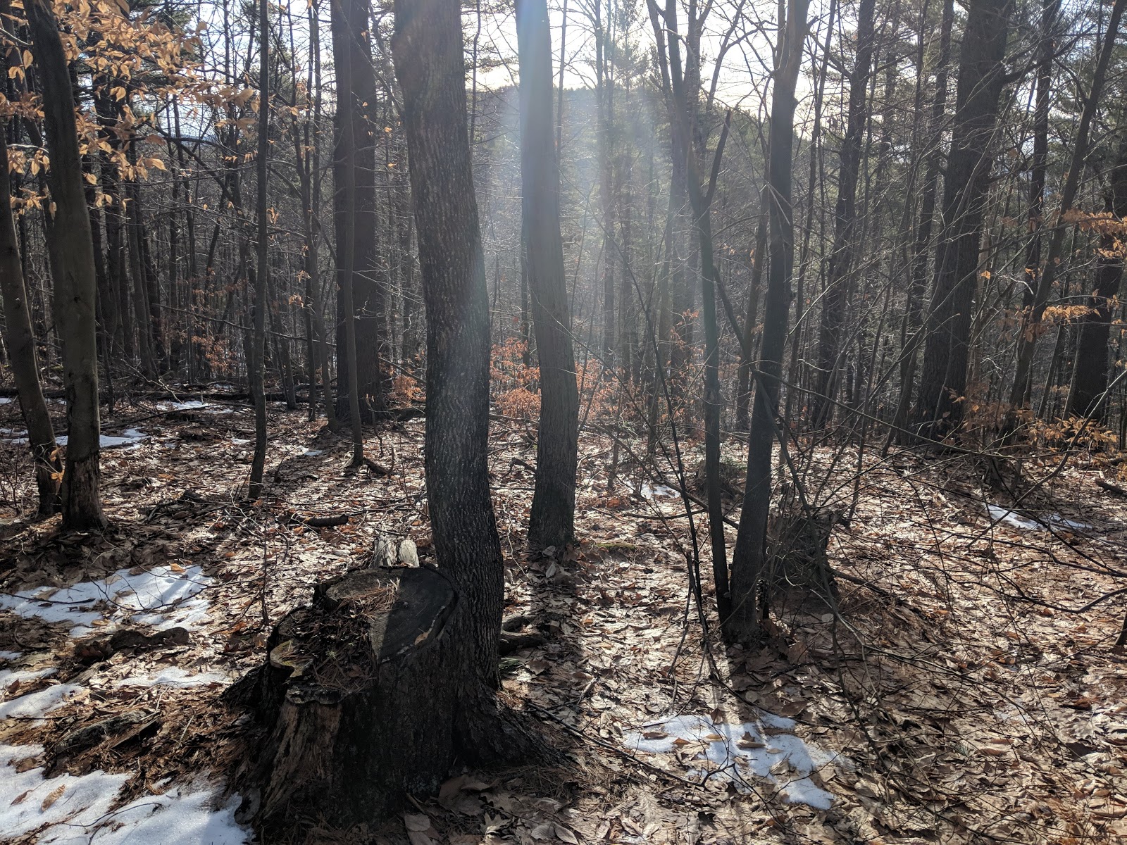
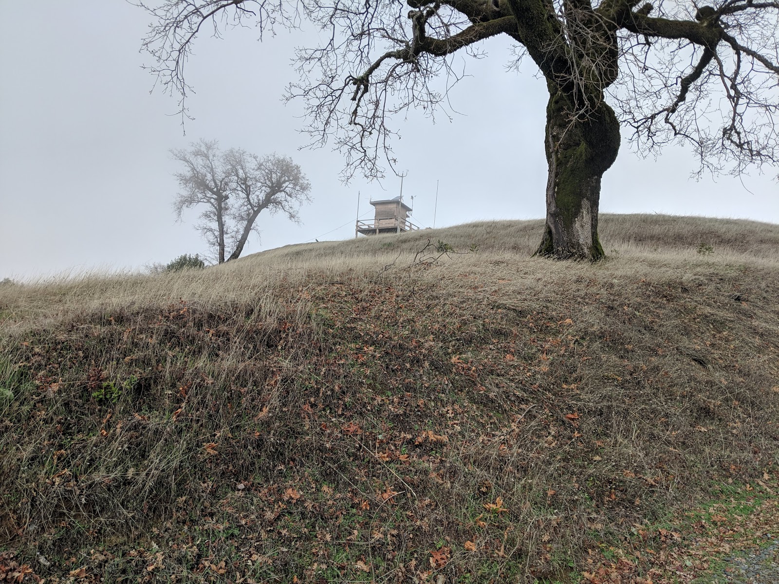
As I climbed up the other side the forest thinned out, but the fog didn't lessen. I got to the top, but it was socked in and there was no view. I went around to the picnic tables and got set up.
Almost at the top.
After putting up the antenna, I found that it wouldn't tune on any bands. Luckily I had my MFJ whip, which I hooked up. There was good cell service everywhere in the summit area. However, there was S7 noise, and I couldn't hear any chasers. This wouldn't work, so I packed up and hiked down to the bottom of the activation zone and set up again on the side of the road. There was no noise here, and I quickly got a small pileup.
Where I had set up.
I didn't linger, since I had a long hike back to the car, and they said the gate was closed promptly at sunset. It was the day before the shortest day of the year, so sunset was at 4:45. On the way back I passed some workers in a side-by-side. I caught up to them a few minutes later where I saw them reassembling a gate. Apparently their key didn't work, so they took the gate off its hinges, drove through, then put it back together.
One of the best views I had.
I made it back to the car in plenty of time, and headed back down the coast to get Bay Hill on my way home.

Trailhead: Jenner Headlands Preserve, CA 1.
Website: SOTA Site.
Maps: AA6XA SOTA Hikes map.
Route: Take the Sea to Sky Trail. 15 miles round trip.
Red Tape: None. Gate closes at sunset.
Dramatic coastal scene.