Thursday, December 29, 2022

W6/CT-218 Temescal Ridge


 It was a warmer than expected day as I drove up Reseda Blvd. At the end is Topanga State Park, with Temescal Ridge my goal. At the end of the road there is paid parking, but if you're willing to walk a little farther you can park for free below. I was feeling cheap, so I used the free parking, then set off up the hill.
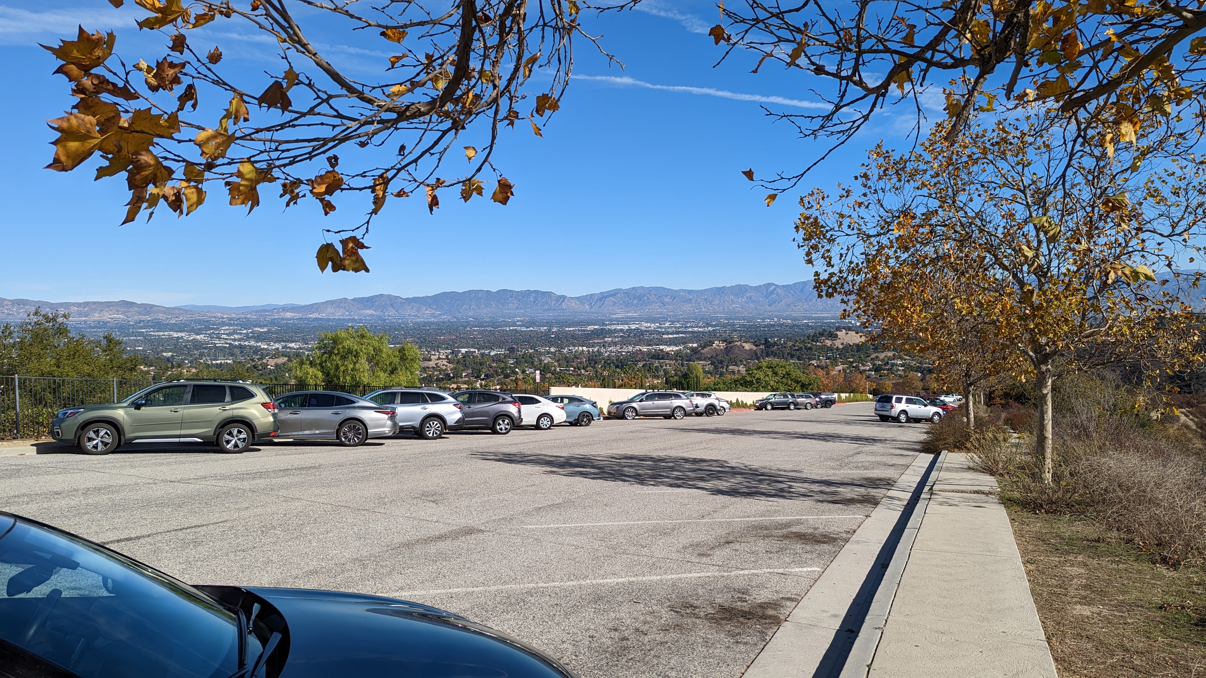
Top of the free parking lot.

There are a lot of trails in the park, so bring a map. I didn't see any paper ones available for taking at any of the kiosks. I took a fire road that seemed to be going in the right direction. It was, but it would've been more direct to take a single track trail at the start.

Looking back at Oat Mountain.

The fire road trail winds its way up nearly to the summit. About 3/4 of a mile before the summit the road reaches a col with a pit toilet and bench. After a quick pit stop I continued up to the top. Just before the summit a trail reaches the road. Take this single track up to the high point.

Pacific Ocean

The very top of the mountain is pretty small, so I went down a few feet to set up near some bushes. I didn't have cell service where I was sitting, but RBNhole spotted me no problem. Once I was done on HF I went to the top for some VHF and made a few more contacts.

Summit just behind my pole and antenna.

I took the same route down, mostly. I did take a little single track that went over one of the bumps. It added some variety, though there were some steep parts. Back at the car I put on some clean clothes before heading to the airport to go home.

Trailhead: End of Reseda Blvd. There is both free and paid parking.
Website: SOTA Site.
Maps: AA6XA SOTA Hikes map.
Route:  Take the fire road to just below the summit, then take the Backbone Trail up to the top.
Red Tape: None. 
Video: ham_bitious YouTube

Friday, December 2, 2022

W6/CT-032 Oat Mountain


 It was a windy day as I arrived at the trailhead in Michael D. Antonovich park. This park is at the end of Brows Canyon Road. The road has a number of "no trespassing" signs along the way, but it seems you are allowed to drive up, since there's the park entrance. I paid my $5 and drove to the upper dirt lot.

Parking area.

The entrance to the lot is a bit rough, but I was able to get in without bottoming out the sedan I had. The path to the top is a paved road. A short distance up it passes the site of a Nike Missile base, back when the missiles were needed to defend against Soviet bombers. There isn't much left but graffiti in the area.

Views of the destination.

The road continues up at a pretty good grade. There are some flatter sections, but the climb is fairly constant. Shortly below the summit there was a signed gate. I didn't want to go through it, so here I turned and went straight up the hill. It was rather steep, but I was quickly at the top.

Summit ahead!

I tagged the summit, then set up a little below it under some trees. It was out of the wind, which was nice. I had almost lost my hat a few times. I didn't have cell service where I was sitting, but I had had it for most of the hike up. I think if I had walked around a bit I would've found somewhere that had service.

Looking over at the Santa Monica Mountains.

I had limited time, so I only did 20m and 40m, with a few calls on 2m at the end. I didn't get a lot of contacts, but there was no problem activating the summit. Once I was done I took the road back down. I didn't feel like going down the steep grass, so I took it from the summit. It probably would've been smarter to go up that way.

Trailhead: End of Browns Canyon Road in Michael D Antonovich Park
Website: SOTA Site.
Maps: AA6XA SOTA Hikes map.
Route:  Follow the paved road to the summit.
Red Tape: None. 
Video: ham_bitious Youtube


Wednesday, November 30, 2022

W6/CT-163 Yerba Buena Ridge


 Yerba Buena Ridge is in Angeles National Forest, on the LA side. The trailhead is pretty easy to get to, on road 3N41 off of Little Tujunga Canyon Road. There is a parking lot with what looked like a toilet, but it was behind a locked gate. So I drove just up the road where there is a large pull out across from the trailhead. 

Trailhead parking was plentiful.

There are a number of switchbacks to climb up the steep part out of the canyon, then the trail starts a constant climb up to the ridge. It was a cool morning, and the hiking was quite pleasant. There seems to be some sort of private ranch below the trail. The Oak Spring Trail eventually reaches what is probably Oak Spring, where it drops a short distance into a forested area before resuming the climb.

Summit views.

Eventually you get to the ridge road, 3N30. There are some metal posts to keep vehicles off the single track trail. Turn left here and follow the road for about two miles up to the high point. There is a small cairn at the high point just off the road. I backtracked a little to a clearing with a covered cistern to set up.

MTR on the summit.

There are some bushes here to stick your pole in, but they're low enough you still have great views over to the rest of the San Gabriel mountains. I had enough cell service to send out some spots, so I sent one for SOTA and POTA. I was hoping I'd get a lot of contacts like on Bare Mountain, but since it was a weekday there just weren't as many chasers out. It was still a good activation.

Once I was done, I retraced my steps back to the car. It was a bit faster going down, as you'd expect. 

Trailhead: Road 3N41, just past the parking lot.
Website: SOTA Site.
Maps: AA6XA SOTA Hikes map.
Route:  Take the Oak Spring Trail up to the ridge road, then turn left and take it to the summit.
Red Tape: None. 
Video: ham_bitious YouTube


Thursday, November 24, 2022

W6/CT-082 Bare Mountain


 This mountain feels like it is deep in the San Gabriel Mountains even though it is fairly close to the desert. The trailhead is along road 5N04.4 south of the summit, near the Pinyon Flats shooting area. The day I went all the gates were open and I was able to drive right to the fire break, where I parked on the side of the road. Note that the dirt road section is somewhat rough, and you may not want to go down it in a regular sedan.

Heading up the fire break.

The fire break that you follow to the summit starts at a culvert. There was lots of evidence of shooting in the area, so be careful if you head there. I had passed one parked car on my drive in, so I wasn't worried. The fire break is generally wide and easy to follow. The climb up to the ridge isn't particularly steep, and I was soon enjoying the views.

Excellent Halloween views.

After you get to the ridge, there is a bit of a drop, then a steep climb up to a sub-peak. It was slow going, with loose sand and no switchbacks. However, like most hikes, if you persevere you'll get to the top. After the sub-peak there is a shallow col then the climb up to the summit. I found the firebreak became indistinct and hard to follow at the sub-peak, but there is not much brush, so it wasn't an issue.

Summit and register.

I found the summit register in a cairn on top. The notebook was wet, so I left it out to dry some while I was activating. It seemed drier when I packed it back up, and I tried to leave the opening at the bottom, so hopefully it won't be so wet for the next person. It was great at the summit, all I needed was a windbreaker while I operated.

Views to the Antelope Valley.

I had good service on top, and was able to spot for SOTA and WWFF/POTA. This resulted in a pretty good size pileup, and I got around 40 contacts total. Once I had worked everyone, I packed up and headed back down. The steep bits were a somewhat treacherous with my road running shoes, but I made it down without falling. Then it was just a long drive all the way back to the Angeles Crest Highway and back down to Palmdale.

Trailhead: Road 5N04.4 at the Pinyon Flats shooting area. The Forest Service map shows a trail here.
Website: SOTA Site.
Maps: AA6XA SOTA Hikes map.
Route:  Follow the fire break trail to the ridge and summit.
Red Tape: None. 
Video: ham_bitious YouTube

Saturday, November 12, 2022

W6/CT-169 Bee Benchmark


 This peak is in the hills near Bouquet Canyon Road. I parked at the Bouquet Crossing trailhead, which has some parking on both sides of the road. I then took forest road 6N19 up the hill.

Parking area.

This road seems fairly well graded, but it would probably be too rough for a regular sedan. If you had a bit more clearance though, you could probably drive up to the ridge without much issue. Since I had a sedan, I walked.

Heading up the road.

Eventually, you'll reach an intersection on the ridge. Turn right here. There are two decent paths, either will work. One sidehills around the little bumps, the other goes over them all. This area seemed to be a favorite place for dirt bikes and ATVs, and I saw some bikers while I was out.

Better views, so I must be getting close.

This road runs along the ridge, but doesn't go over the summit. At some point you'll see a well defined motorcycle trail that runs directly up the hill to the top. This is what you want to take. I thought I might have to bushwhack to it, but there were some easy paths over to it. This track is much steeper than the climb to the ridge, so be prepared. After a left turn, you're almost at the top.

Ready to go!

I signed the register, then set up off the side of the road. The cell service was somewhat marginal, but enough I was able to spot without too much issue. I thought I might get some people on 2m, but I only got one summit to summit contact. Since I had to get back to the airport I didn't linger too long on top. 

I took the same route back down, where I changed and drove the rest of the way through Bouquet Canyon to Santa Clarita and the airport.


Trailhead: Bouquet Crossing, Bouquet Canyon Road.
Website: SOTA Site.
Maps: AA6XA SOTA Hikes map.
Route:  Take road 6N19 to the ridge, then turn right. Follow one of the paths until you see the motorcycle trail to the summit, then follow that.
Red Tape: None. 
Video: ham_bitious YouTube