Tuesday, January 29, 2019

W6/NC-464

After activating Mt St Helena, I decided to try and get this unnamed peak. One of the maps I saw online showed a trail running along the ridge connecting the two, but no official map did. I figured I try, and if it got too hard I'd turn around and find a better way for a future trip.
3431 is the high point above the cliffs.
The ridge leaves the access road where the turn off for East Peak is. I started this direction, and quickly found that there was indeed an unmaintained trail like I had seen on the map. It was reasonable easy to follow. It is quite overgrown in places, requiring ducking to get through some of the brush. Most of the time the plants  were rubbing against my shoulders as I walked.
Looking back at the St Helena.
The trail goes over a few bumps on the ridge, dropping slowly, then drops very steeply. I slipped a few places in the loose dirt, but made it to the col without any incidents. In a few of the clearings it was hard to tell where the trail re-entered the woods, but I managed not to get lost. In the col it crosses a few streams, then joins an abandoned jeep trail to begin climbing.
Col between 3431 and Goat Roost Rock.
The jeep trail was a pleasant walk, despite all the blow downs. When I reached the col between 3431 and Goat Roost Rock I turned off and started bushwhacking. There were two parts to the bushwhack, a steep climb through open forest, and a fight on the flat section through dense brush. I discovered on the way down that the left side of the ridge (North/West) was a bit more open and much easier going.
Almost at the top!
I found a small clearing near the summit and set up there. There was sort of enough room to string out the antenna, but I made contacts with it anyway. I had good cell service. After working everyone, I packed up for the slog back to St Helena. I cut down the side of the ridge back to the jeep trail, then followed it back. The steep climb back up was tiring.
View down the valley to the west.
Back on the main road, I took a break, then headed down. There were some climbers on some of the cliffs lower down, and I watched them for a few minutes. Back at the car I headed down the hill and joined the traffic heading home from Napa Valley.

Trailhead: Robert Louis Stevenson SP.
Website: SOTA Site.
Maps: AA6XA SOTA Hikes map.
Route: Hike up to the turn off for Mt St Helena East Peak. Turn right and follow the faint trail along the ridge, down, across, then up the abandoned jeep trail to the col. Bushwhack up to the summit. Might be easier to come in from the west if there's parking on Ida Clayton Road.
Red Tape: None.

W6/NC-030 Mt St Helena

This peak had been on my radar for a long time, and I finally picked a weekend to come up and do it. I left home early and beat the traffic in Napa Valley. The road up to the pass had quite a few switchbacks, and I was surprised how many cars there were on it. At the top there is a small parking lot, where I parked. I was there at 8, and it was already getting tight. I'm glad I got there when I did.
Up the trail in the forest.
The first mile or so is on single track through the woods. At a small flat area there is a marker where Robert Louis Stevenson spent his honeymoon. The cabin is long gone. A short distance above that the trail ends and joins the access road for the towers on top. It also comes out of the forest and enters an area that was burned in the 2017 North Bay fires.
Looking down at Calistoga. Mt Diablo in the distance.
Coming out of the trees, the wind picked up quit a bit. Hiking up hill I had no problem staying warm, but I did have to tighten the straps to keep my had from blowing away. The access road was used as a fire break during the fires, and it is interesting to see one side burnt and the other untouched.
Mt Tam in the distance, from the summit.
Eventually the road switchbacks up to the summit plateau. There are turn-offs for each of the sub-peaks that have towers. I went up to the East Peak because it is the highest point in Napa County. Another high point checked off! After a quick final climb, I was then on the summit. I took some photos, then quickly retreated down a little ways on the lee side of the hill.
RADAR installation on the top of East Peak. Lake Berryessa in the valley behind.
Here, out of the worst of the wind, I set up. I had good cell service, and had no trouble spotting. I worked people on all three bands I had, including a few summit to summits. I tried VHF, but only got a few people in Santa Rosa. I had been eyeing a nearby peak, 3431, and decided to try and hike over before heading down.
Not blown away yet.
Trailhead: Robert Louis Stevenson SP.
Website: SOTA Site.
Maps: AA6XA SOTA Hikes map.
Route: Take the trail up the switchbacks to the road, then follow road to summit.
Red Tape: None.

Monday, January 21, 2019

W6/NC-350 Loma Alta January VHF Contest

I did pretty well in the 2018 contest from Loma Alta, so I decided to head up again for this year's contest. The peak is in CM88qa, very close to the south border of the grid. This year I had my transverter for 222MHz, so I was all mode there. I also made an extended double zepp for 6m, to go with the one I have for 2m.
View down Lucas Valley.
It had been rainy all week, but thankfully the storm blew out on Friday. It was cloudy and overcast, but the rain held off while I was on the summit. I parked at the Big Rock trailhead. It was a quick hike up despite the heavy pack. Nothing like 100' of coax to slow you down.
A brief break in the clouds mid afternoon.
I set up in the same place as last year. I think I've finally figured out the best way to set up the pole with all the yagis. I have to stake it out while its empty, then take it down, add the antennas, then put it back up. The other pole I just strapped to the fence and strung out the zepps.
My portable antenna farm. Arrow 146/437 on top, Arrow 222 on bottom. 6M EDZ in an inverted-V on the other pole, with a 2m vertical EDZ below it.
I had some time before the contest, so I put up my MFJ whip and worked some of the regular chasers on 20. Later in the afternoon I did some more CW on 30 using the 6m EDZ antenna. The tuner in the KX3 will match anything. I had a brief scare when it looked like my big battery wasn't providing any power. I quickly found I had connected the voltage-reducing diodes the wrong way.
So much stuff.
I also forgot to bring a pen or pencil, so I had to do all the logging on my phone. This was annoying, but didn't stop my fun. As expected, I got lots of contacts on 2m. This seems to be the money band. I was surprised how many contacts I got on 222, and I was even more surprised that I worked some people first on that band. In the past I've gotten two or three contacts on 222. Over half my contacts on 222 were mults, and nearly half on 6m were.
Looking up the "tower".
There were a few people I could hear in the central valley, and I got three grids there. K6MYC in DM07 worked hard to get me on three bands, but I was too weak for him to hear me on 432. WE6C was up in CM99, but he only had 2 meters. It would have been nice to get more mults from him. And AE6GE was in DM06, but could only hear me on 6.
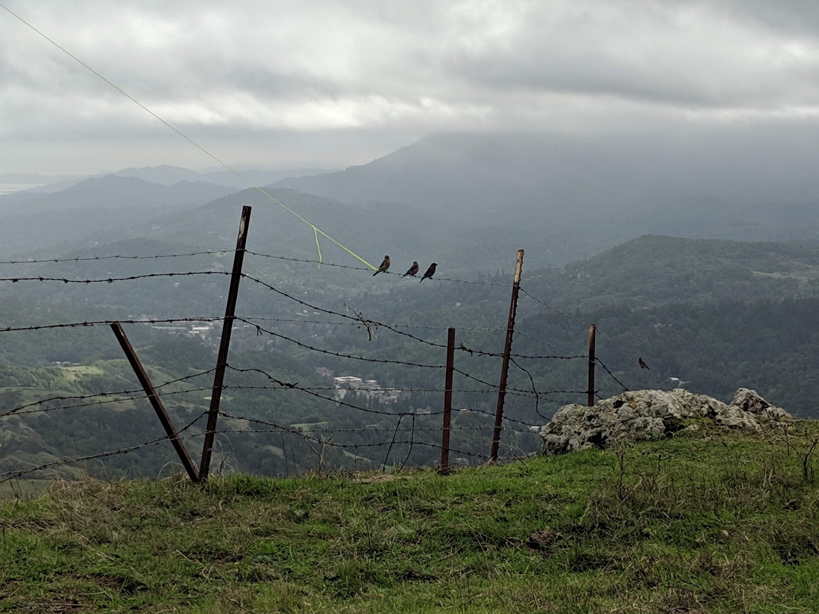
Some birds checking out the end of my 6m EDZ. Mt Tam was in the clouds all day.
Shortly before I had to pack up there was an opening on 6. All of a sudden I could hear some stations in the LA area, then XE2JS started booming in. I tried to work him, but he couldn't get my complete call. I should have tried CW but didn't think of it at the time. I looked it up, he was about 1100 miles away in DL68.
Sunset over the Marin hills.
 The hike down was pretty dark, but it was easy to follow the wide fire road back to the car. I was able to make it back without needing my headlamp.
The lights come on in San Rafael.
For the next contest there are some changes I hope to have done. I want separate antennas for 144 and 432. I also need some antenna switches to switch the IF signal between transverters. Maybe a little Arduino controller can read the band data from the KX3 and do the switching automatically. I'm  hoping to have a 1296 setup, and maybe even something on 902. I also think I should find an antenna for 223 and 446 vertical polarization. Maybe a tri-band j-pole will work? Maybe a dual band (146/446) antenna will be enough since 222 is not very popular. I worked people on FM with horizontal polarization, but maybe I could have worked more if I had a different antenna.
A stretch goal is to have a setup to run FT8 and MSK144. I think I could get a lot more mults on 6, and maybe even on 2 if I had FT8 running in the background. I have a Raspberry Pi, and I've seen people running WSJT on them, so I'd just have to make it portable.
Looking towards Mt Tam.

Wednesday, January 9, 2019

W1/CR-009 Mt Watatic

After hiking up Temple Mountain I drove around to the sound end of the Wapack Trail to hike Mt Watatic. There were a bunch of cars parked along the side of the road, but there were still a few spots free in the dirt lot. It seems like it is a popular spot for hiking.
The marsh wasn't totally frozen yet.
From the parking lot the trail is initially flat, passing through some marshy area on bog bridges. They were mostly frozen, but there was still some running water and I was glad to have the bridges. At the trail junction turn right to stay on the Wapack Trail. This will take you right to the summit.
Viewpoint on the way up.
About 2/3 of the way up the trail passes a small viewpoint. The summit is fairly open, with decent views in all directions. On clear days Boston is visible in the distance. It was cold and windy when I was on top, and the city was definitely not visible. After tagging the summit I descended a short distance to some bushes to setup out of the wind.
Summit cairn.
On the air I had no trouble getting enough stations to fill the log. I tried to get a summit to summit with K6ARK in California, but he couldn't hear me. I had sweat a bit on the way up, so sitting in the breeze got cold quickly. I made very good time on the way down, trying to warm up again.
The tread was not well defined on parts of the trail.
This was the 126th and final summit I had done in 2018. This was a record year for me, getting 5 more summits than in 2017. However I got fewer points in 2018 than 2017, likely due to more 1-point summits. I finished the year with 706 points. If I can keep up the same rate, I should get Mountain Goat in 2019!

Trailhead: Trailhead on MA 119. It was well signed.
Website: SOTA Site.
Route: Take the Wapack Trail north to the summit. Possible to make a loop using the Midstate Trail.
Red Tape: None. 

W1/HA-181 Temple Mountain

It was the last day of the year, and there was time to get in two more peaks. I wanted to get Temple Mountain and Mt Watatic because they were the last two peaks on the Wapack trail I hadn't done yet. The other peaks are Pack Monadnock and North Pack Monadnock. The easiest access to Temple Mountain seemed to be from the large parking lot on 101, across from the Pack Monadnock road.
Plenty of parking, and Pack Monadnock wasn't in the clouds yet.
I took the short trail over to the Wapack Trail, then started heading south. The first part of the hike is up the access road for the communication tower on the side of the mountain. This section was very icy, and I was grateful to have the microspikes with me. At the tower the trail turns into a single track trail and heads into the woods.
In the cold woods.
It was a very gray day. The forecast was for rain and snow in the evening, and the clouds were getting ready. The maps I had looked at before I left showed the trail going around the side of the peak, meaning a bushwhack would be required. Lucky for me, they were wrong and the Wapack Trail goes directly over the summit. There was a small sign and small rocky clearing at the top. No views.
A rather underwhelming peak.
There was enough space for me to put up the pole and wire without it getting tangled in the trees, which made my life easier. My verizon phone had good service. On the air I started on 20 meters, quickly getting a bunch of European DX in the log, including my first German station. After a few minutes on 40 I started getting cold, so I packed up and retraced my steps.
The top of Pack Monadnock in the clouds as I descend down the sheets of ice.
 The walk back was quick, and back at the car I turned on the heat and drove down to the trailhead for Mt Watatic.

Trailhead: Temple Mountain Reservation parking lot, at the height of land on 101. 
Website: SOTA Site.
Route: Take the Wapack Trail south to the summit.
Red Tape: None.