Tuesday, January 30, 2018

W6/NC-367

I decided to activate this peak as I was already in the park for an orienteering meet. After having a good run on the course, I took a short break to eat some food, and then drove to the end of the road and parked by the dam. The lake seemed to be lower than when I was there in November activating Nesbit Ridge. I finish putting my things in the bag, then set off up the trail.
Getting close to peak green, the prettiest time of the year.
The wide trail climbs up a short distance in the trees, then breaks out into a wide open meadow. There were still a few orienteers running their courses as I headed up the hill. I took the wide trail up to the col, then turned right onto a faint trail that made its way up to the summit. There were plenty of switchbacks, so the climb was pleasant, even on my tired legs. There was also much less mud than last time, which made the walking easier.
View to the south. Fremont Peak on the left. Peaks on the right are the north end of the Santa Lucia Range. Gilroy BM out of view on the right.
At the summit I decided to take the easy setup route and just strap my pole to the fence on the north side. This is also the park boundary. The hills around me blocked most of the views while I operated, but there were still good views to the west. As I was operating a few people walked by, but no one stopped or said anything.
View of Nesbit Ridge. The trail across the meadow by the river is clearly visible, as are some of the switchbacks farther up.
I had brought my KX3, so I started on 60 meters and worked my way up the bands. I made contacts on each band I tried except 17. Thirty meters was surprisingly full of signals, and I had to tune around a bit to find an open frequency. After working the bands, and trying VHF, I decided to go back to 30 and answer some CQs. I had a nice conversation with a portable station in San Francisco, near the bay.
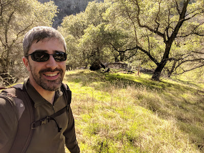
Taking a break from calling CQ.
By this point I was getting cool and tired, so I packed up. To get down I continued around on the same trail, making a loop. My legs and feet were tired, and I had twisted my ankle, so the descent took longer than the ascent. There were a few muddy patches on the shaded, east-facing slope, and I saw a herd of deer. Back at the car I got as much mud as I could off my boots and drove home.

Black Tailed Deer.
Trailhead: Dam parking lot, north end of Coyote Lake Harvey Bear Ranch Park. (what a mouthful)
Website: SOTA Site. Park Site.
Maps: AA6XA SOTA Hikes map
Route: Take the Harvey Bear trail to the Ed Wilson Trail.
Red Tape: None.
Loma Prieta and Mt Um.

Monday, January 29, 2018

W6/NC-343 Wragg Ridge

Wragg Ridge is a relatively low mountain south of Lake Berryessa. It was the third peak I climbed that day, after Peak 1972 and Junior Benchmark. I started at the same place as Junior BM, a pullout on the side of CA 128. From here it is a very steep 250 foot climb, followed by a pleasant ridge walk.
Almost at the top of the steep section.
Across the street from the pullout I found a gap in the fence. Above this is a gully that is fairly open. I climbed up the side of the erosion gully. It was steep, like the final push up Junior Benchmark, but not as long. At the top of the ridge the terrain levels off. Here there are some old roads from when there was talk of building houses up here. There are lots of markers along the way.
Lot number 15.
The trees are sparse enough that there were views as I climbed up. There are a few paths running along the top of the ridge. I took the left fork at every intersection I came to. From the satellite view, it appears either direction would be fine. The summit was a short distance above the road.
Mt Vaca (I think).
On top I put my pole against a tree branch, then strung out the antenna and got on the air. There was decent cell service, not as strong as on the other two peaks, but I had no problem filling the log. Around the time I got to the summit, the sun came out. This made it more pleasant to sit on top and play radio. The hike back was quick, since I no long had to fight gravity.
On the way back down the steep section. 
Trailhead: Pullout on CA 128.
Website: SOTA Site
Maps: AA6XA SOTA Hikes map
Route: Cross the road and fence, and find a way up the steep slope to the top of the ridge. Follow one of the old roads up to the summit.
Red Tape: None.
Following the road down the ridge.

W6/NC-254 Junior Benchmark

The hike up to Junior Benchmark was interesting. I came here after climbing Peak 1972, a few miles north. I started from a pullout along CA 128, just before it makes a U-turn around the end of Wragg Ridge. From here it was a short walk to the start of the ranch road. The road climbs over a small hill, then descends at a gentle grade through a picturesque valley.
Top of the valley. Mt Diablo to the left of the tree.
 The road was quite muddy after the recent rains, and the proximity to a stream did not help. There were a number of cows, but they ran of as I approached. I continued down the road until I found a ridge that looked like it would offer good access to the summit.
Walking through the muddy valley.
I started up the ridge. It was a pleasant walk, through open forest with lots of green grass. Partway up I found what looked like a very faint ranch road, and started to follow it. It turns out, there is an abandoned road that runs all the way up to the col north of the summit.
Abandoned ranch road.
In a few places I did see signs that it had been driven recently, but I didn't see or hear any other humans while I was out. The road continued up, past some small ponds that seemed to be man-made. Shortly after the last pond, the road crossed a fence on a ridge coming down from the summit. Here I turned and started to follow the fence up the hill. Eventually I found the road again on the other side of the fence.
It is hard to capture how unpleasantly steep this part was.
This was also the start of the steep section. The road went straight up the hill. From the contour lines, I could see that this was the least steep part of the summit cone, but it was still steep. It was the sort of climb that makes you question why you are out doing this. It does, however, get to the summit eventually.
Panorama, near the summit. Mt Vaca in the center. Summit on the right. The trail comes up the center.
I found a convenient tree to put my antenna in, and got on the air. There was good cell coverage on the top part of the mountain. Like usual, 30 meters got the most contacts. They were coming in fast enough that I had trouble keeping up at points. Twenty and 40 meters were not as busy. After I had finished operating, I packed up and went up to the highest point to take a look around. The views were even better up there.
Looking south to Mt Diablo. I believe that is Marsh BM to the left.
The hike down was much quicker. The rains had softened the ground enough that the footing on the steep sections was very secure. It had gotten very overcast on the way down, and I was concerned it might rain, but a quick check of the weather said there was a 0% chance, so back at the road I continued up to Wragg Ridge.

Trailhead: Pullout on CA 128.
Website: SOTA Site
Maps: AA6XA SOTA Hikes map
Route: Follow the road down to the ridge, then follow the old ranch road and go cross country up to the summit. Road is not visible in satellite imagery.
Forest near the top.

W6/NC-279

This peak is at the south end of Lake Berryessa, and provides great views of the entire Berryessa area. The best trailhead seems to be on Steele Canyon Road, at a pullout at the south end of the lake. From the pullout, cross the road and climb down the embankment to the stream. Cross the stream, and find a way up the embankment on the other side. This was the hardest part of the hike, getting across the deep gully.
Halfway down the embankment, looking back at the road.
On the other side is an old ranch road which goes all the way to the top. It first climbs over a smill ridge and into Negro Canyon. Near the head of the canyon it turns right and crosses the stream. There is quite a bit of discarded junk in this area. This is where the climb starts. The road climbs steeply up to the summit. It seems like it was used as a fire break, or access to a fire break, in the recent Napa fires. There were a lot of fresh tracks.
Summit still in the clouds.
It was cloudy and overcast when I started, but the clouds lifted at about the same rate as I climbed, so I was never socked in. The recent rains also made the hike more pleasant, softening the ground and making the footing better on the steep sections. This was particularly nice during the descent. After about an hour of hiking, I made it to the summit. There is a wide road running over the high point, and the fires had burned the area.
Burned area at the summit.
I strapped my pole to a burned bush, and got on the air. There was good service at the top, so no problem spotting. I made contacts on the usual bands, and didn't make any notable contacts. Since I had two other summits planned for the day, I didn't linger.
Berryessa Peak across the lake.
The hike down was fine, except I missed a turn and didn't realized it until I had descended a few hundred feet. The mountain is covered in dense chapparal, so the easiest way to get back on track was to hike up to the junction, then down the correct path. This mountain would be very difficult to hike if the fire breaks and ranch roads weren't there.
Cedar Roughs on the left, with some abandoned equipment. 
Back at the car I drove over to the trailhead for Junior Benchmark, my next peak of the day.

Trailhead: Pullout on Steele Canyon Road, near south end of the lake.
Website: SOTA Site
Maps: AA6XA SOTA Hikes map
Route: Cross the stream, down then up the embankment, then follow the ranch road on the other side up to the summit.
Red Tape: None. Summit appears to be on BLM land.
Looking South. Mt Vaca on the left. Mt Diablo was visible in the distance.

Monday, January 22, 2018

W6/NC-350 Loma Alta

This weekend was the January VHF contest, and I was eager to participate. I decided I could kill two birds with one stone by operating from a SOTA summit. The first challenge was finding a suitable summit. I was looking for a peak with good line of sight to the Bay Area and Central Valley, and one that didn't have any towers on the summit. I've found that the best VHF summits already have towers on top, and there is generally too much RF for my radios. Eventually I decided on Loma Alta in Marin County.
View down Lucas Valley, from near the trailhead. San Pedro Mtn to the right of center.
This summit is bare on top, except for a fence to keep the cows in the correct pasture. I was, however, concerned that Mt Tam would block my signals to the south and I wouldn't be able to reach anyone on the peninsula. It turns out the map in my head was slightly off, and I had clear views of San Francisco and points south. The areas blocked by Mt Tam are sparsely populated.
Mt Diablo and North Peak is the double summit on the left.
I decided to hike up from the Big Rock Trailhead, unlike last time. My impression was that this trail is less steep and a more pleasant hike. This could be because last time I hiked up in the mid afternoon in June, and it was very hot then. The trail to the top is part of the Bay Area Ridge Trail, and crosses an easement. The rancher passed me a few times riding up and down on his four-wheeler. When I got near the top, the wind really started to pick up, and didn't relent until I descended later.
Almost at the top.
At the summit I wasted no time in putting on warmer clothes and jackets. Having done this, I began to set up my antennas. I had my trusty doublet for 6m, an Arrow 2/70 satellite antenna for 2m and 70cm, and a new Arrow yagi for 220. I had ordered a Ukrainian transverter for 220, but it didn't arrive in time (and hasn't arrived at the time of writing). I brought up both of my fishing poles. I used the shorter, thinner one to hold up the doublet, strapping it to the fence.
Setup, looking to the north-east. Big Rock Ridge on the left. Maybe Berryessa Peak in the center?
I guyed out my other pole, then had to figure out how to attach the yagis. I had one mounting bracket, but the pole was to skinny except at the bottom section to attach it, so I used it for the 220 antenna. I only had to disassemble the yagi twice in order to get the bracket on the pole and in the proper polarisation. For the 2/70 yagi, I used some giant twist-ties I got from REI. This works, but is not a good solution. In June, I'll have more mounting brackets. Somehow, one of the element-center screws had gotten lost, so I only had a 6 element yagi on 70.
Mid afternoon, some cows came over to say hi.
By the time I had finished putting up the antennas and connecting all the rigs and transverters, it was 10:57. Just enough time to rest for a moment before the contest started. I had assumed that there would be a lot of activity on 6 meters, but I didn't hear anyone there at the start. It turns out that 2m sideband was the place to be. After moving up, I began making contacts. For the next five hours I switched modes and bands, trying to get as many contacts as I could.
Sunset, just before starting my hike down.
In the end I made 75 contacts with 15 multipliers for a claimed score of 1425. My antennas almost blew over once, but I was able to catch the mast and avoid any catasrophies. Partway through I decided to take a break from all the SSB, so I went down to 30 meters and put out a spot. This brought in contacts at a faster rate than in the contest, at least for a few minutes. At the UTC day rollover I decided that I was getting cold and I wanted to be down before dark, so I went QRT and packed up.
The big rock at the trailhead.
I was surprised to pass a few groups heading up so late in the day. After dropping below the ridge, the wind was dramatically reduced, and I began to warm up quickly. At home, I started the tedious process of typing in all the contacts so I could submit my score. Overall, I think the contest went well for me. Next time I think I will try to find a mountain with a better view of the central valley. I also hope to have one antenna and feedline per band, as it will make QSYing much easier. I will also fix the mounting brackets so I can use them higher up on the mast.

Trailhead: Big Rock Trailhead, height of land on Lucas Valley Road.
Website: SOTA Site
Maps: AA6XA SOTA Hikes map
Route: Take the trail to the summit. There is only one from this side, and all junctions are onto private land, and clearly signed.
Red Tape: Stay on the trail, it passes through an easement.
Sunset is the best time to be outside in California. Mt Diablo in the distance.

W6/SC-458 Loma Alta (Jack's Peak)

Nobody can seem to agree on the name of this peak. Whether it is Loma Alta or Jack's Peak, it is a low hill outside of Monterey and Carmel. It is almost a drive up, the parking lot is a few feet too low to be in the activation zone. I came over after activating Pinyon Peak. To get here, drive up Jack's Peak Road, pay the entrance fee at the booth, then follow the road to the right to its end.
Kiosk at the trailhead.
From here it is about a quarter mile with less than 100' to get to the summit. I took the Jacks Peak Trail, but there were many unsigned trails in the area. After a few minutes walk, I was at the high point. There were many trees and no view. I found a branch, and threw my rope over it. However, I hadn't let out enough slack, so the weight couldn't pull the rope down. I tried pulling it back over, but I snapped my rope. Luckily I had my pole with me, and I was able to poke the weight out of the tree.
Antenna in a tree.
A second attempt was successful, and I proceded to string up the legs of the dipole. However, I put too much tension on one side, and broke the wire. After tying a quick sheet bend, the antenna was up and I was on the air. I made a number of contacts on 30 and 20. After a CQ on 40, W6JL answered me, and we had a long talk. He was sending right at the limit of what I can head copy, so it was a challenge to keep up. He is definetely a great CW op. After having my brain melted, I tried VHF. Not receiving any answers, and getting cold, I packed up and headed home.
Compact setup. The pine needles were very comfortable for sitting.
Trailhead: End of Jacks Peak Road.
Website: SOTA Site
Maps: AA6XA SOTA Hikes mapJacks Peak Park
Route: Pick a trail. They all go through the AZ.
Red Tape: None.

W6/SC-261 Pinyon Peak

Pinyon Peak is one of the peak lining the Carmel River Valley, and a nice hike. KE6MT had attempted to activate this peak last year, but was unable to with only an HT. I brought up my usual setup, and had no problems with the activation.
I followed Rex's route, since it seemed like a good one. The attendant at the Carmel Valley Ranch gate let me through when I told him I was there for a hike. I parked at the end of Oak Place Lane, then walked up the stairs between two of the buildings. At the top is the Huff-n-Puff Trail. There are signs warning you that it is very steep, but it is no worse than any other trail.
It was foggy and overcast as I left the trailhead.
The trail climbs up to a corral. There was construction going on, so I took the marked detour around to the Mucklehead Trail. This climbs along a fence line, the other side clearly marked as private. The trail makes a sharp bend to the left at a junction, with the other option signed "Trail Closed".
Getting more views as I climb.
The Snively's Ridge Trail climbs up the north and east side of the ridge, with views of the Carmel Valley. I was surprised how noisy it was, with traffic noise all the way to the summit. The trail is well graded, and seems to be maintained. At the top of the ridge, the trail levels out for a short distance as it passes an unnamed peak. Near a second peak there is a narrow path that heads off to the right. Take this, and follow the narrower ridge up to the summit. There is a small, rocky bump along the way. There is a trail that goes around each side of the peak. I recommend taking the one that goes around the north side, as it is better graded and easier to follow.
Tower on the summit.
 The final climb up the summit cone is the steepest part of the trail. On top there is a tower and two picnic tables. The second peak, withouth the tower, is slightly higher, and there are herd paths that lead over to it. Between the peaks is an old outhouse. There is no door, but other than that it seemed usuable. Certainly has one of the best views while doing your business.
Outhouse looking east.
I setup at one of the picnic tables, putting my pole in a bush. There were no trees on top, so bring your own support. It was cool and windy, but pleasant when the sun was out. I worked the bands in my usual order, 30, 20, 40, and made contacts on each. I had a strong LTE signal on my Verizon phone. There are some repeaters on the tower, and all the rf was causing interference on 2 meters for me. 70 cms was quiet, and I had a long qso with a fellow down in Seaside. If the other antennas weren't there, it would make a decent VHF peak, with line of sight to Monterey, Santa Cruz, and Salinas.
Me and my setup.
After spending over an hour on the summit, I was getting cold, so I said 73 and packed up. The return trip was better than I had feared, the mud was not slippery. Back at the car, I drove over to Jacks Peak to get in a second activation.
Fremont Peak to the left of the antenna, summit in the clouds.

Trailhead: Top of Oak Place Lane, Carmel Valley Ranch. Also approaches from the north (Garland Ranch Regional Park).
Website: SOTA Site
Maps: AA6XA SOTA Hikes map. Carmel Valley Ranch site
Route: Huff-n-Puff to Mucklehead to Sniveley's Ridge Trails.
Red Tape: Trail on the ridge is on easment. Stay on the trail.
Small cave near the summit.

Monday, January 15, 2018

W6/NC-399 Coyote Peak

This was my second time up to Coyote Peak. I took the same route up as last time. However, at the top, I setup on the other summit, just to the east. I got the idea after watching KE6MT's video report, when he mentioned trying to set up farther east to help with propagation.
Interesting rock on the way up. Looks like it eroded after a storm.
The east peak is a few feet lower, but still in the activation zone. I setup my doublet using one of the bushes on top for support. I sat on the ground in front of a rock, which made a decent chair.
Mt Hamilton with Mt Isabel to the right. Mt Misery is directly in front of Mt Hamilton, but very hard to see from this angle.
I was not in a hurry, so I spent over two hours on the summit. I made contacts on most of the bands I tried. I also spent some time on SSB, something I rarely do. This peak is in a good place for VHF, and I did make three contacts on 6 meters. Surprisingly, I didn't get anyone on 2 meters, but there was some intereference from the nearby tower. 220 didn't have anyone listening, but I did manage one contact on 440.
My setup. Coyote Peak summit behind the tower. Loma Prieta on the left, Mt Um between my pole and the tower.
Towards the end of my time up on the summit, the temperature started to drop and the wind picked up. Since I had been up there so long, I finished up my conversation and packed up. The hike down seemed steeper than it had on the way up.

Trailhead: Pueblo Day Use Area. There are a number of small parking lots along the road. I parked at the one where the road makes a U-turn, across the street from the Hidden Springs Trail.
Website: SOTA Site
Maps: https://www.sccgov.org/sites/parks/parkfinder/Documents/Santa-Teresa-map.pdf. AA6XA SOTA Hikes map
Route: Hidden Springs Trail is the shortest, other trails also go to the summit. Also possible to start at the base of the mountain.
Red Tape: Don't cut switchbacks. Don't ignore signs saying the area is closed.
Other: Bring a pair of binoculars for the summit, if it is a clear day.
Looking south, through some power lines. El Toro on the left, Twin Peaks on the right.

W6/NC-288 Scarper Peak

Scarper Peak, or Scarpet Peak in some sources, is a prominent mountain in the Santa Cruz Mountains along the peninsula. It is also one of three SOTA peaks in San Mateo County, the other two being San Bruno Mountain and Sierra Morena. The peak is in the Rancho Corral de Tierra section of the Golder Gate National Recreation Area. As far as I can tell, the best trailhead is at the top of Coral Reef Ave. There is space here for a number of cars, and street parking if the area is full.
Trailhead.
Almost immediately the trail starts climbing up a ridge. The maps show a number of trails, but there are no signs or names that I saw. I took the trail that goes up the closest ridge to the trailhead. The trail climbs up, steeply in sections, and joins with another trail higher on the ridge. The new trail continues up the same ridge.
First view of the air force station, the harbor, and Mavericks Beach.
The trail reaches a paved road, where I turned left and continued up the hill. There was a gate just after the intersection on the road, but it looks like it hasn't been used in a long time, and some serious work would be required for it to close again. The pavement ends, and it turns into a dirt road. The rest of the hike is much less steep than the first part.
The trail intersection is just beyond the sign.
Enjoy the ridge walk, with great views up and down the coast. Take the right path at the next two intersections. The second right is under some power lines, and it looks like it is possible to get to the summit via the left fork. From here you begin to hike in the trees and forest more, and there are not as many views. When I got close to the summit I could see the road above me after it had switched back, so I took a shortcut through the brush in one of the less steep sections.
FAA facility on the summit.
The summit is fenced off and has an active FAA station. I walked around part of the fence, and it doesn't seem like the area inside is any higher than at the border. I didn't see a good place to set up at the summit, so I hiked down a little ways. Following the road from the summit down, I took the first left onto a road that is being retaken by nature. Here there were a lot of trees with branches at an ideal height and position for holding an antenna.
Setup on the overgrown road. 
I got my line over a branch after a few tries, and set up. The branch I had chosen was almost too high, I only had an extra foot or two of feedline. Since I wasn't in a rush, I decided to start on 5 MHz and work my way up the bands. I made at least two contacts on each band, 60 through 12 meters. I tried calling on 6m ssb, but didn't get anyone. Surprisingly, I got one contact on 440 but none on 2 meters. After doing all the bands in CW, I decided to get some voice contacts. However, the wind was really blowing and I was getting cold, so after a few QSOs on 20 I packed up.
Cold and windy activation.
I retraced my steps on the way down. There was less wind on the other side of the peak, but I didn't take off all my warm gear until I had hiked over a mile. I passed a few people heading up, including a biker. The fire roads are probably great for biking. In one of the eucalyptus trees at the parking lot I saw a hawk. I tried to get a picture, but it took off right as I got the camera up. Back at the car I drove home, getting home. before the traffic got too bad.
Looking south on the way down. 
Trailhead: Top of Coral Reef Ave, in El Granada.
Website: SOTA Site. NPS Site. The NPS maps are terrible.
Maps: AA6XA SOTA Hikes map.
Route: Take one of the trail up the ridge. At the paved road, head left and follow it as it becomes dirt. At the next two intersections, take the road to the right. Continue up to the summit.
Red Tape: None.