Tuesday, January 24, 2023

January VHF Contest 2023


 It was a beautiful day as I hiked up to Loma Alta (W6/NC-350), my usual VHF contest spot. I was worried it would be very muddy after all the recent rains, but the trail seems to have mostly dried out. The was water running in the trail, but it was in little erosion channels. The flat areas a little below the summit were more muddy, but my socks stayed dry.

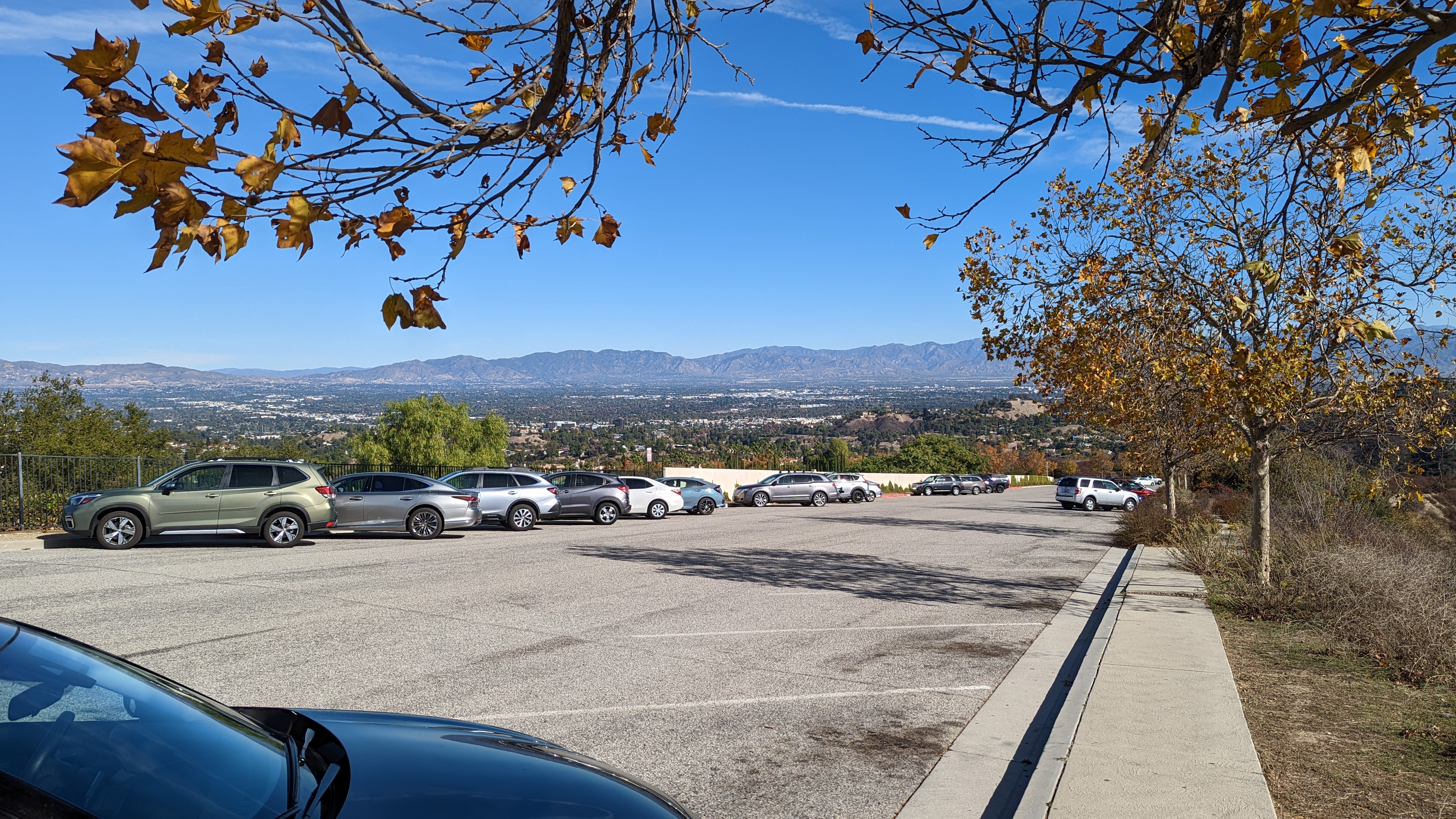
Looking down Lucas Valley.

I was a bit worried it would be really busy since the parking area was totally full, but I didn't see that many people on the trail. Maybe everyone was going to Big Rock Ridge instead. It seemed like a long two miles to the summit, but I was carrying a lot of stuff.
Two of the antennas.

I brought my usual six-band setup. This includes yagis for 144, 222, 432, 920, 1296, and EDZs for 6m and 2m. Four radios, four transverters, and lots of connectors and coax. I'd bring 10GHz, but no one from the local microwave club ever seems to get on for this contest, so its not worth it. I've gotten good at setting it up, so I had some spare time before the start, which I used to make some 10m SOTA contacts. 
Extended Double Zepp pole.

The first hour of the contest was action packed, and I made lots of QSOs, particularly on 6m and 2m. After that it slowed down a lot. I'm not sure why activity was so slow this year. My best guess is that it was the first nice weekend of the year, and people were tired of being cooped up inside. So they went out instead of sitting at their radios.
As expected, 223 and 902 were not very active. Two meters provided the most contacts. It will be interesting to see how the scoring works out this year now that there are "all mode" and "analog only" subcategories. My guess is that single operator portable stations don't do much FT8, so the competition will be similar.
So much stuff to carry.

I took a break part way through to try out 12m. I did get a Japanese station, but there weren't many other takers. After some more calling on the VHF bands I eventually decided to pack it up. As I was taking down the 6m EDZ, on leg came off. It was nice of the antenna to break at the end of the day instead of during setup. I made it back to the car before sunset, which is unusual for me. 
I had plenty of time to let my mind wander since it was so slow. I definitely need to finish my Mountain Top VHF presentation and give it to the area clubs to try and drum up more activity. More QSOs means more fun for everyone! Overall, I'm claiming a score of 1,820, 63 QSOs and 20 mults. 
Here's hoping June will be better! 

Monday, January 9, 2023

W6/ND-144 Dante Benchmark

After exploring Joshua Tree National Park, we got up early and drove over to Death Valley. This huge park is a few hours drive through the desert. Our first stop was Dante's View, on the east side of the valley. Just above the parking lot is a SOTA summit, and that was our destination.
Operating from the summit.

There is a short trail that leaves from the far side of the parking lot. Watch out for cars while walking over. We were soon at the top, where we found a spot out of the wind to set up. I was worried there wouldn't be any cell service, and KN6REU wouldn't be able to get any contacts. It turns out there was decent service (Verizon) at the peak, and spotting was no problem. Naina got more contacts on 10m than she wanted, then headed back to the car. I stayed up to work a big pileup on 20m before heading back down.
Mosaic Canyon

From the viewpoint we drove down to the Furnace Creek visitor center to get a map and see if there were any souvenirs we needed, then continued around to Stovepipe Wells and Mosaic Canyon. This was a fun hike, up the canyon. We turned around before there were any difficult parts, but it is a hike we'd recommend.
Lowest people in the Western Hemisphere.

Next we made a brief stop at the Mesquite Sand Dunes on our way to Badwater Basin. This is the lowest point in the western hemisphere at -282 feet. A sign high up on the cliff above the road really drives home how low you are. A short distance back up the road we stopped again, this time at Devil's Golf Course. 
Only the devil could play golf here.

I think this is one of the neatest areas, with rough salt formations in the middle of the valley. Worth a stop if you're in the area. Finally, on our way out of the park we stopped at Zabrisky point for a quick sunset. The dunes and rocks in this area are excellent, and I can see why it is featured on postcards.
Sunset at Zabrisky Point.

This is one of the largest national parks in the USA, and I wish we had more time to explore. We only hit the highlights, and it feels like we barely scratched the surface. 

Trailhead: Dante's View.
Website: SOTA Site.
Maps: AA6XA SOTA Hikes map.
Route: Follow the trail up to the summit. 
Red Tape: None. Just the standard national park rules. 
Video: ham_bitious YouTube

Thursday, January 5, 2023

W6/SD-037 Inspiration Benchmark

Since we had a 12-month national park pass, we decided to go down to the desert during Christmas break to check out Joshua Tree and Death Valley National Parks. We left San Jose early, and after a long drive down California, we reached Joshua Tree. We went straight to Keys View in the park, where we planned to activate Inspiration Benchmark, then enjoy the sunset from the viewpoint.
View across to San Jacinto.

There is no official trail up to the summit, but enough people go up that way that there is a use trail. It is hard to follow in places, but the way you should go is obvious. There are two false summits on the way to the high point. 
Joshua tree on the first summit.

We made good time up the hill, and were soon in the activation zone.  We found some comfortable rocks, and got set up. KN6REU went first on 10m, but there were no contacts. It appears that the antenna was somehow broken, so we put up the other one and tried again. She soon had a few contacts in the log, including one to Chile.
Calling on 10m.

AA6XA then worked a small pileup on 20m before we packed up and headed back. It was a quick hike down, and we were both surprised to see a dog on the trail. We both thought they weren't allowed off the pavement in the national park.
Sunset.

Back at the lot we joined the small crowd watching the sunset. It was quite spectacular, and I'd recommend going to the desert for excellent lighting. As it got dark we left the park to find some food and rest for another day of exploring the park.
Joshua Tree at sunset.

The next day we drove around and saw a lot of the sights in the park. The area is definitely worth a visit! 

Trailhead: Keys View.
Website: SOTA Site.
Maps: AA6XA SOTA Hikes map.
Route: Take one of the use trails up to the first peak. From there the trail becomes more defined as is drops the col then climbs up to the true summit.
Red Tape: None. Just the standard national park rules. 
Video: ham_bitious YouTube

Thursday, December 29, 2022

W6/CT-218 Temescal Ridge


 It was a warmer than expected day as I drove up Reseda Blvd. At the end is Topanga State Park, with Temescal Ridge my goal. At the end of the road there is paid parking, but if you're willing to walk a little farther you can park for free below. I was feeling cheap, so I used the free parking, then set off up the hill.

Top of the free parking lot.

There are a lot of trails in the park, so bring a map. I didn't see any paper ones available for taking at any of the kiosks. I took a fire road that seemed to be going in the right direction. It was, but it would've been more direct to take a single track trail at the start.

Looking back at Oat Mountain.

The fire road trail winds its way up nearly to the summit. About 3/4 of a mile before the summit the road reaches a col with a pit toilet and bench. After a quick pit stop I continued up to the top. Just before the summit a trail reaches the road. Take this single track up to the high point.

Pacific Ocean

The very top of the mountain is pretty small, so I went down a few feet to set up near some bushes. I didn't have cell service where I was sitting, but RBNhole spotted me no problem. Once I was done on HF I went to the top for some VHF and made a few more contacts.

Summit just behind my pole and antenna.

I took the same route down, mostly. I did take a little single track that went over one of the bumps. It added some variety, though there were some steep parts. Back at the car I put on some clean clothes before heading to the airport to go home.

Trailhead: End of Reseda Blvd. There is both free and paid parking.
Website: SOTA Site.
Maps: AA6XA SOTA Hikes map.
Route:  Take the fire road to just below the summit, then take the Backbone Trail up to the top.
Red Tape: None. 
Video: ham_bitious YouTube

Friday, December 2, 2022

W6/CT-032 Oat Mountain


 It was a windy day as I arrived at the trailhead in Michael D. Antonovich park. This park is at the end of Brows Canyon Road. The road has a number of "no trespassing" signs along the way, but it seems you are allowed to drive up, since there's the park entrance. I paid my $5 and drove to the upper dirt lot.

Parking area.

The entrance to the lot is a bit rough, but I was able to get in without bottoming out the sedan I had. The path to the top is a paved road. A short distance up it passes the site of a Nike Missile base, back when the missiles were needed to defend against Soviet bombers. There isn't much left but graffiti in the area.

Views of the destination.

The road continues up at a pretty good grade. There are some flatter sections, but the climb is fairly constant. Shortly below the summit there was a signed gate. I didn't want to go through it, so here I turned and went straight up the hill. It was rather steep, but I was quickly at the top.

Summit ahead!

I tagged the summit, then set up a little below it under some trees. It was out of the wind, which was nice. I had almost lost my hat a few times. I didn't have cell service where I was sitting, but I had had it for most of the hike up. I think if I had walked around a bit I would've found somewhere that had service.

Looking over at the Santa Monica Mountains.

I had limited time, so I only did 20m and 40m, with a few calls on 2m at the end. I didn't get a lot of contacts, but there was no problem activating the summit. Once I was done I took the road back down. I didn't feel like going down the steep grass, so I took it from the summit. It probably would've been smarter to go up that way.

Trailhead: End of Browns Canyon Road in Michael D Antonovich Park
Website: SOTA Site.
Maps: AA6XA SOTA Hikes map.
Route:  Follow the paved road to the summit.
Red Tape: None. 
Video: ham_bitious Youtube