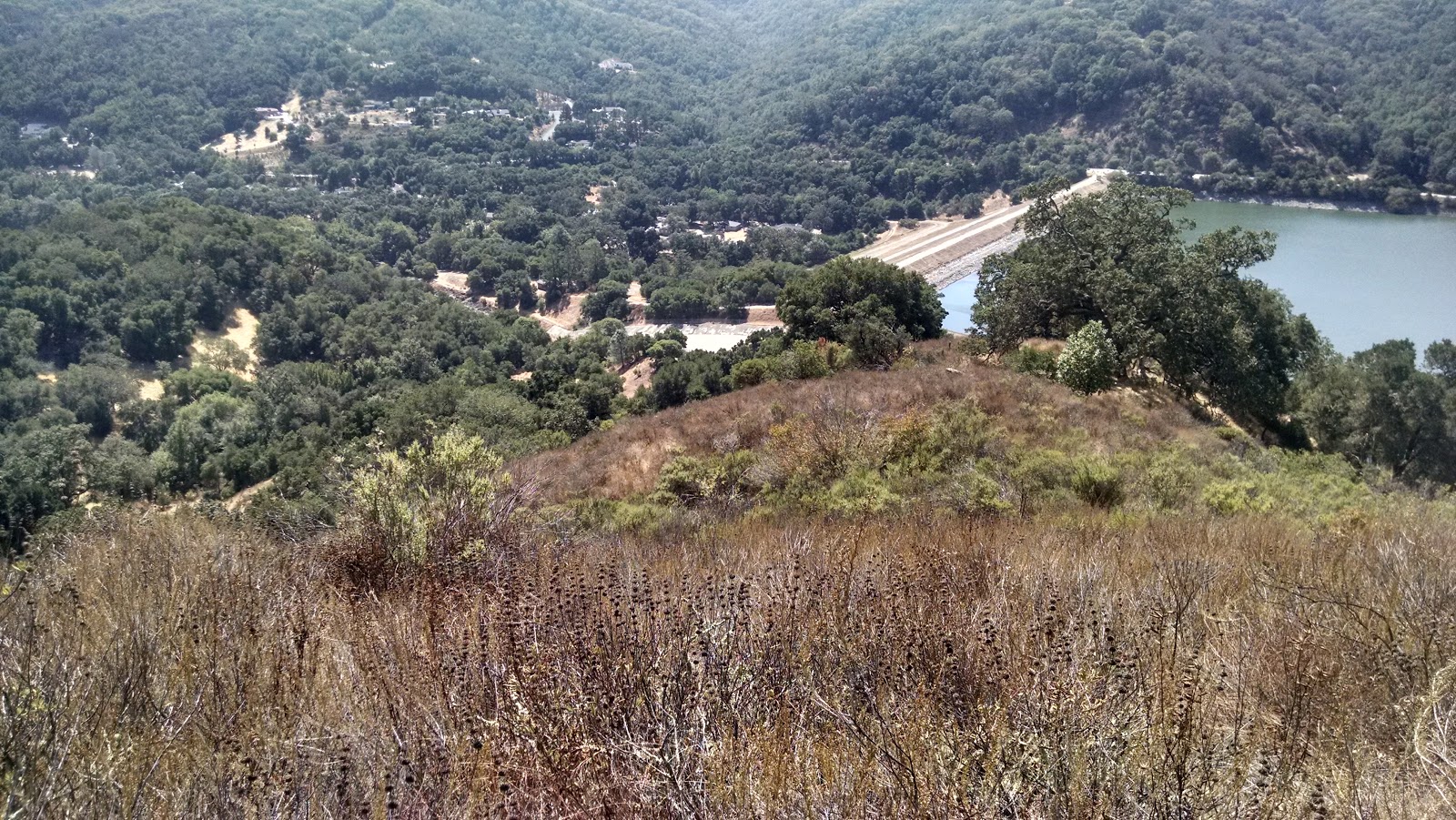
West Twin Peaks is a mountain at the south end of the Santa Cruz Mountain range, west of Morgan Hill. Most of the mountain is private property, but the face above Uvas Reservoir is public, and this is the side I climbed up. I parked in a large pullout across the street from the dam, then walked across it. It is possible to go around the fences at the spillway if the water is low enough. If there is high water, it would be dangerous or impossible to get across the spillway.
 |
| Dam, with ridge I climbed on the left. |
Once on the other side, I started uphill. There were some old animal paths that I was able to follow, which made it much easier to push through the brush. The sections of trees were a nice break from pushing through the brush. Partway up I found and old road bed that is not on any of the maps. This appeared to contour around the hill, and rejoin the ridge on the other side of the sub-peak. I started to take it. However, a short distance down it, I came around a bend to find a skunk with its tail up, standing in the middle of the path. I quickly backed up, and gave it a few minutes to clear out of the area.
 |
| This is as close as I was willing to get to the skunk with my camera. |
I then cautiously started up the old road again, only to find the skunk still standing in the middle. Not willing to risk being sprayed, I decided to follow the crest of the ridge, which had been my original plan. I made it past the sub-peak, marked 1257 on the USGS quad, and started the final push up to the summit.
 |
| This sort of brush is not fun to push through. |
The summit cone was covered in a taller, denser brush, and it was slow going if I didn't have a herd path to follow. I would recommend wearing long sleeves and gloves if you come up this route, my arms got cut up. Eventually I made it to the summit. There was a small clear area, with views to the north and east where I set up to operate. I made eight contacts on 30, 20, and 17 meters. My calls on VHF were fruitless. I had a good 4G signal at the top.
 |
| El Toro, my next SOTA peak for the day. |
After I had finished operating, I packed up for the slog back down. I think it took the same amount of time to get back down as it did to get up, the brush was so dense. It was a relief to break out of the brush at the bottom and walk across the dam. I then drove over to
El Toro, for a second SOTA activation. I had been worried that it would be too steep to get up or down, but the grades were reasonable the entire way. There were a few cliffs and other really steep sections, so some planning is required to avoid these areas.
 |
| Part way down, looking back at the summit. |
Trailhead: Pullout across the street from Uvas Reservoir Dam.
Website: SOTA Site.
County Park site.
Maps: AA6XA SOTA Hikes map.
County park map. Shows public land boundaries.
Route: Cross the dam. Bushwhack up your selected ridge to the summit.
Red Tape: None. May be impossible to cross spillway during high water.
 |
| Dam and spillway. |


Interesting hike and I'm not too surprised to see that much of that side above Uvas is public. We used to climb this peak (and the east summit) as night hikes back in the 70s. Not to avoid property owners, but just because it was so eerie and mysterious. I remember a well defined use trail that went straight up to the summit from the dam- no significant bush whacking. Amazing the changes 40 years can bring.
ReplyDelete-Gordon Jacobs
Thanks for showing the way. I made it up here yesterday with about the same amount of bushwhacking. Pretty nice views from the top. I found an article implying that perhaps the entire route up is public now: http://www.mercurynews.com/2013/03/01/land-deal-doubles-size-of-protected-open-space-around-uvas-reservoir-south-of-san-jose/
ReplyDeleteContact me via Peakbagger if you're interested in some more Bay Area peaks sometime.
-Andrew Kirmse