Eagle Peak is the high point of Modoc County, the South Warner Wilderness, and the Warner Mountains. Because it is a county high point, it is fairly frequently climbed. The
Peakbagger page has a number of other trip reports. I had camped the night before at Patterson Campground, which is at the south trailhead of the Summit Trail. I had an ambitious three-peak day planned, so I woke up and left early.
 |
| Me and my destination. Most of the trail hike was in the shade, because of the peaks to the east. |
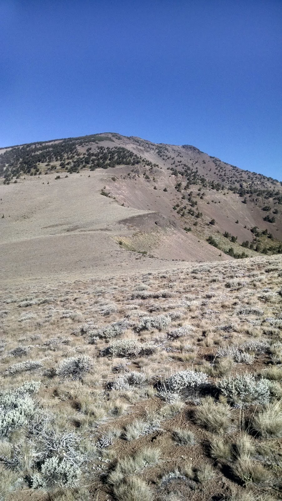
Once I had climbed up to the ridge, I started to get views of the peak. It is very large, and very impressive looking. It took me about two hours to get to the junction with the unmaintained trail that goes over the saddle. From here, I found a good point to leave the trail and start the ascent.
 |
| Ready to go up. |
The bottom section is open, with small scrub that is difficult to push through. Luckily it is fairly low, so one can step over it. The really steep part doesn't start until the trees in the above picture. That is also the section where the loose gravel starts. I was glad I had brought my hiking poles. There were a few sections that were steeper and more exposed than I would have liked, but I got past them. Eventually, I made it to the top. I found the register, and signed it.
 |
| Partially set up antenna. Lots of smoke in the distance. |
There are lots of low trees on the west side of the hill, and I used one to support my pole and antenna. After having a snack, I got on 20 meters. There was a very good 4G signal (Verizon) on the summit. I quickly got nine contacts in the log. I thought I'd try VHF since I was so high, but the only contact I made was when someone re-transmitted my signal on 446 through a local repeater. I still wanted to get
Cole Peak and Emerson Peak, so I didn't hang around on the summit too long.
On my way down I took a more westerly route, staying in the trees for longer. This felt safer, probably because I couldn't see so far down the slope. At the bottom I passed two guys who were about to head up. I gave them my thoughts, then continued around to
Cole Peak.
Trailhead: Patterson Campground/Guard Station. There are pit toilets, but no water.
Website: SOTA Site.
Patterson CG Site
Maps: AA6XA SOTA Hikes map.
Route: Summit Trail, to unmaintained trail at col. Cross-country uphill to the summit. Cross-country section very steep.
Red Tape: None.
 |
| Looking North. I think that is Warren Peak in the far distance. |


No comments:
Post a Comment