Friday, August 7, 2020

Marin Headlands: Richardson East, 1041, Wolf Ridge, Hawk Hill, Slacker Hill

The Marin Headlands are one of the nicest places for a hike or run in the Bay Area. I decided to head back to get some more Nifty Ninety peaks. Today it was Wolf Ridge, Hawk Hill, and Slacker Hill from the list, plus Peak 1041 a P300 peak and Richardson East Benchmark, a SOTA peak.
Heading up the trail.
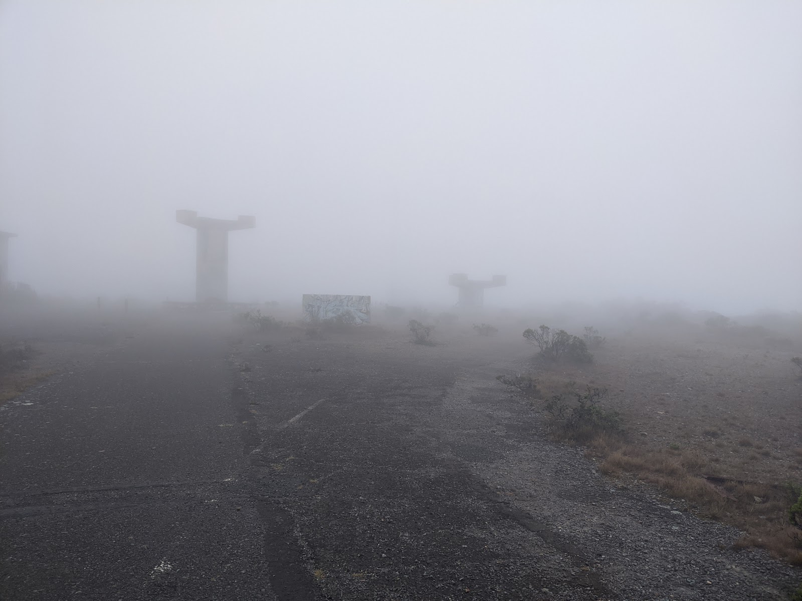
 It was cool and overcast at the trailhead, and I assumed that the fog would lift in an hour or so so there'd be views by the time I got around to Hawk Hill and Slacker Hill. It was great running weather as I headed up to Richardson East, the first peak of the day. It was extremely foggy, I couldn't see the towers on top until I was quite close.
I could barely see the towers in the fog.
 On the summit I set up my radio to try and make a few contacts. Despite spotting myself and trying multiple bands I only got two contacts. I'll have to go back to get the points for this year. It was pretty chilly, and I was getting damp in the cloud, so I didn't linger.
The FAA installation on top of 1041.
 It was an easy run around to Peak 1041, one of the P300's in the headlands. I'm pretty sure I went over the high point, but I couldn't really see anything. At least it wasn't so wet my glasses got drops on them, that would have made the run much more challenging.
The abandoned military stuff on top of Wolf Ridge.
 To get over to Wolf Ridge required some time on single track, which was a nice break from all the fire roads. The final climb up to the summit is paved, and there are lots of ruins on top from when it was a military installation. I assume there are good views too, but I didn't see them.
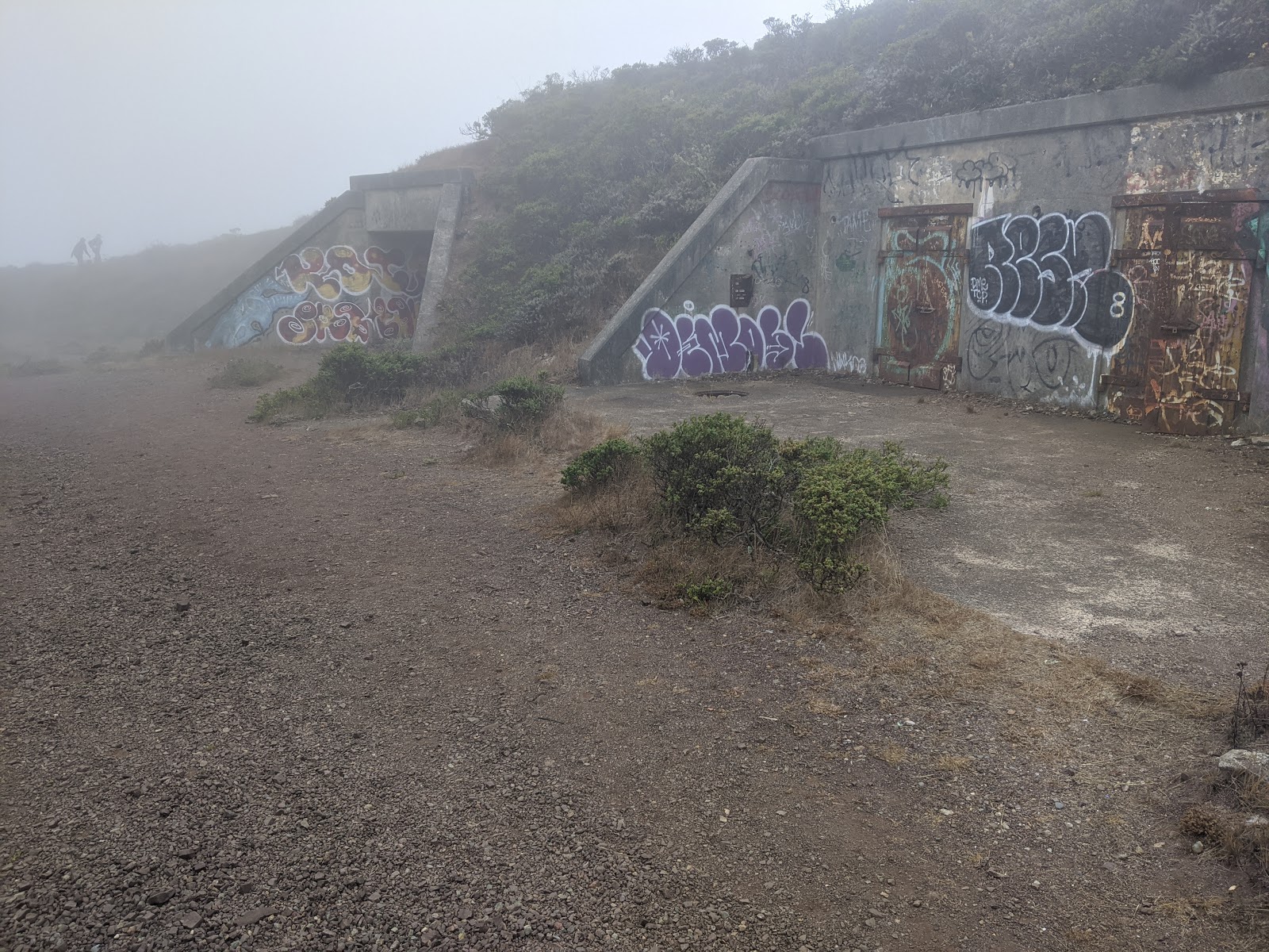
Some bunkers below West Wolf Ridge.
 I decided to go over Wolf Ridge, West Peak since I was there. Nothing on that summit, but there were some old bunkers in the hill on the west side. I had a bit of trouble picking the right trail to take down towards Rodeo Lagoon, but I figured it out eventually. After I mix of road and trails, I was soon on the other side of the valley and starting my climb up to Hawk Hill.
Looking across at Lands End and the Presidio in SF.
 Most of that climb is on a small trail right next to the road. Not the nicest place for a hike, but the views over the ocean were excellent. There are lots of small trails on the summit of Hawk, around an old installation, but I found my way to the high point pretty easily.
Golden Gate Bridge.
 The descent to the col between it and Slacker had some excellent views of the Golden Gate Bridge and SF. I can only imagine what it would be like on a sunny, fog-free day. Up on Slacker Hill I stopped briefly to take some pics of the excellent view before getting out of the wind.
The Golden Gate Bridge is behind me.
 From here it was a pleasant run along the ridge at the east end of the Headlands. There were quite a few people and groups out, but nothing too bad. Back at the fire road I took the short spur trail back down to the parking lot and my car.
Looking down the valley towards Rodeo Lagoon.
Despite not having any views, it was a fun loop. I'll probably go back in a few months when it is less foggy to get those views.

Wednesday, August 5, 2020

Mindego Hill, Borel Hill

After roasting in the East Bay, I decided to get some peaks on the peninsula in the hopes they'd be cooler for exercise. I found a nice loop over two Nifty Ninety summits, Mindego Hill and Borel Hill. I started at the parking lot on Alpine Road, just after the intersection with Skyline Blvd. The gate was closed when I arrived, but as I was getting ready the ranger arrived and opened it, so I was the first car in the lot!
Trail along Alpine Road.
 I started by running by the small pond, then up the hill. Near the top I found a locked gate with a sign indicating private property. Not sure why the trail there exists, but I just bushwhacked around it up to Alpine Road, then back to the trail. This is where the views started getting good.
Fog rolling in off the ocean.
 There were excellent views to the west, and I could see up and down the ridge, especially once I got farther out.
Mindego Hill on the right.
 The approach to Mindego Hill is quite nice. You drop down the hill to a ridge, then traverse across and up. Mindego is one of the nicest peaks I've gone to while doing this list. I passed a few hikers also heading out to the summit, where I stopped for some pictures.
Borel Hill in the background.
 I then retraced my steps back along the ridge to the next trail that would take me around to Borel Hill.
Lots of fog rolling in.
 Walking up the hill I saw a rabbit, which was nice enough to stay still long enough for me to get some pictures.
 There were then some nice shady climbs back up towards Borel Hill. This section of the preserve appeared much more popular, as I started passing lots of groups. The summit of the hill is fairly close to the highway, and it doesn't have the same remote feeling that Mindego did, but the views were 360.
Summit of Borel Hill.
 After weaving my way through all the bikers and hikers, I stopped for some pictures at the top before heading the last short bit to the car.
Loma Prieta and Mt Umunhum in the distance.
Overall this was a very nice loop, and I would recommend both summits to anyone looking for a nice hike.

Monday, August 3, 2020

Vail Peak, Eagle Peak, Las Trampas Peak

Another long run, and another few peaks off the Nifty Ninety list. This time it was to the Las Trampas wilderness area in the east bay for three peaks, Vail, Eagle, and Las Trampas. I arrived early, and the gate was still locked, so I parked on the side of the road and walked up.
Early morning light hitting a peak.
 As I climbed up to Vail Peak I could feel it getting hotter. I just hoped it wouldn't get too warm before I finished. The views were decent once I got up on the ridge, but nothing spectacular. There is a use trail that goes to the high point of Vail Peak, and it had lots of poison oak. I seem to have managed to get through without touching any, which is nice.
Summit of Vail Peak. Not very interesting.
 From here it was a short run along the ridge to Eagle Peak. There is a short spur trail to the high point were there is a bench, and spectacular views across the valley to Mt Diablo.
Looking down a canyon between Vail and Eagle Peaks.
 I stopped for a few minutes to take some pictures and enjoy the view of Diablo. It was awesome in the early morning light.
Mt Diablo.
 From here I dropped down off the ridge on some steep trails and started to wind my way over to Las Trampas Peak. I wasn't paying attention, and missed the trail I intended to take up to the summit. Luckily there was another trail that I was able to use that didn't add much distance to the loop.
Looking back towards Eagle and Vail.
 Climbing up the hill I started to see a lot more people, and the temperature started getting higher. I was hot when I got up to the summit of Las Trampas, and stopped a minute in the shade to cool off some before going down.
Las Trampas peak, looking north.
 It was a quick run down to the main parking lot area, where I turned right and headed up to Rocky Ridge to do a quick SOTA activation. Climbing up the road in the sun wasn't much fun, but I made it, and even made some contacts with my 5watter homebrew rig.
Some shade on Rocky Ridge.
As I started heading down I finished the last of my water. This made the descent a lot more miserable than it needed to be, but I made it back to the road for the walk back to the car. I sucked down some water before heading back with the AC on full blast. This is a nice area, but July was probably not the best time to go.