Rainbow Braid posted an entry on her blog about Pivot Dude and myself, if you want to read someone else's view on the end of the hike.
http://www.loveandlegwork.blogspot.com/2013/11/a-wiff-of-hiker-funk-makes-medicine-go.html
In other exciting news, my 2000-miler patch and certificate arrived from the ATC yesterday.
Tuesday, December 3, 2013
Monday, November 11, 2013


Day 142, 11-7
--> Springer Mountain, 21.0 miles
Sleeping on the picnic table bench may not have been the best idea. It was pretty narrow. I did, however, choose the side of the table that stayed dry under the tarp in the rain. After people had gotten up we made pancakes, or rather we tried and Pancake and Rooster made them. It had stopped raining but was pretty foggy when I left. Rainbow Braid was kind enough to slackpack us to Big Stamp Gap, so it was a fast hike. I stopped at the Hawk Mountain Shelter for lunch and a short break. There was a guy there drying out his gear. It was an easy seven miles to the road from there. I met Pivot Dude and Rainbow Braid there, and we reloaded our packs and all headed up the last mile together. The sun was out and it had turned into a beautiful day. At the top we signed the register and took lots of pictures. We each had a bottle of champagne to celebrate. It was then a quick return down to the car at the road, where Rainbow Braid gave us a ride to her apartment for the night. It is weird to be done. So much time spent walking and living in the woods. It seems like yesterday I was in Maine, slogging through the 100-mile wilderness.
Sleeping on the picnic table bench may not have been the best idea. It was pretty narrow. I did, however, choose the side of the table that stayed dry under the tarp in the rain. After people had gotten up we made pancakes, or rather we tried and Pancake and Rooster made them. It had stopped raining but was pretty foggy when I left. Rainbow Braid was kind enough to slackpack us to Big Stamp Gap, so it was a fast hike. I stopped at the Hawk Mountain Shelter for lunch and a short break. There was a guy there drying out his gear. It was an easy seven miles to the road from there. I met Pivot Dude and Rainbow Braid there, and we reloaded our packs and all headed up the last mile together. The sun was out and it had turned into a beautiful day. At the top we signed the register and took lots of pictures. We each had a bottle of champagne to celebrate. It was then a quick return down to the car at the road, where Rainbow Braid gave us a ride to her apartment for the night. It is weird to be done. So much time spent walking and living in the woods. It seems like yesterday I was in Maine, slogging through the 100-mile wilderness.
Day 141, 11-6
--> Woody Gap, 10.7 miles
We took our time getting ready because it was very foggy out. The climb up Blood Mountain was shorter and easier than I thought it would be. It was still foggy at the top, so no views. There was a long slow descent. At Woody Gap Fresh Grounds was set up and cooking food for hikers. I had been told before that there was food there, so I nearly ran there. Upon my arrival, Rooster and Pancake started making me some eggs, and shortly later Bison, Chickadee, and Rainbow Braid arrived. Pivot Dude got here, and they started cooking more food. We decided to stay and spend the afternoon and night here, and it was a lot of fun hanging out with other hikers. Fresh Grounds and Chickadee made a resupply run and brought back a cake, beer, and wine. We played ninja, and did a tequila shot every few rounds. I even managed to win a few rounds. Rainbow Braid made an Indian dish for dinner, which was really good. We stayed up very late talking, then eventually went to sleep.
We took our time getting ready because it was very foggy out. The climb up Blood Mountain was shorter and easier than I thought it would be. It was still foggy at the top, so no views. There was a long slow descent. At Woody Gap Fresh Grounds was set up and cooking food for hikers. I had been told before that there was food there, so I nearly ran there. Upon my arrival, Rooster and Pancake started making me some eggs, and shortly later Bison, Chickadee, and Rainbow Braid arrived. Pivot Dude got here, and they started cooking more food. We decided to stay and spend the afternoon and night here, and it was a lot of fun hanging out with other hikers. Fresh Grounds and Chickadee made a resupply run and brought back a cake, beer, and wine. We played ninja, and did a tequila shot every few rounds. I even managed to win a few rounds. Rainbow Braid made an Indian dish for dinner, which was really good. We stayed up very late talking, then eventually went to sleep.
Day 140, 11-5
--> Neels Gap, 18.8 miles
Today was a pretty easy hike. It was downhill to the first shelter, where we filled up and had a snack. At Hogpen Gap we met a lady who asked us if there was anything she could do for us. We mentioned that we were looking for some champagne for Springer, but everything was closed in Hiawassee on Sunday. We sad bye and continued on our way. We ate at an overlook, then pushed into Neels Gap. At the hostel the lady had left not only a bottle of champagne, but salad, bread, chicken, and a cake. We took showers then sat around eating and watching movies (on VHS). It was great.
Today was a pretty easy hike. It was downhill to the first shelter, where we filled up and had a snack. At Hogpen Gap we met a lady who asked us if there was anything she could do for us. We mentioned that we were looking for some champagne for Springer, but everything was closed in Hiawassee on Sunday. We sad bye and continued on our way. We ate at an overlook, then pushed into Neels Gap. At the hostel the lady had left not only a bottle of champagne, but salad, bread, chicken, and a cake. We took showers then sat around eating and watching movies (on VHS). It was great.
Day 139, 11-4
--> Blue Mountain Shelter, 19.1 miles
Pivot Dude was still asleep when I was ready to go so I left and hitched back to the trail. It was very windy until around lunch, but I stayed warm while moving. I passed a lot of section hikers and day hikers. The views from Tray Mountain were great. All day there were views through the leafless branches of the trees. Georgia is quite pretty. I go to the shelter, and Pivot Dude got here about an hour later. It is quite breezy, and I think it is going to be a chilly night. Tomorrow we'll go to Neels Gap and stay at the hostel at the outfitters there. One less night in the cold. Only three days left, 50.5 miles.
Pivot Dude was still asleep when I was ready to go so I left and hitched back to the trail. It was very windy until around lunch, but I stayed warm while moving. I passed a lot of section hikers and day hikers. The views from Tray Mountain were great. All day there were views through the leafless branches of the trees. Georgia is quite pretty. I go to the shelter, and Pivot Dude got here about an hour later. It is quite breezy, and I think it is going to be a chilly night. Tomorrow we'll go to Neels Gap and stay at the hostel at the outfitters there. One less night in the cold. Only three days left, 50.5 miles.
Day 138, 11-3
--> Dicks Creek Gap, 11.8 miles
We got going in the cold weather, an hour earlier because of the time change. At Bly Gap, the NC/GA border, a NOBO passed us with a dog following her. She said it was lost. We volunteered to take it into Hiawassee with us. The dog followed us for a while., and right after we called the number on the collar it ran into the woods. A mile or so later it came back and we tied a leash onto it. The owner was at the road, and we returned the dog and got a ride into town. The first order of business was food, so we went to the all you can eat buffet. Back at the motel we took showers and laid around watching TV. I resupplied and spent the evening watching more.
We got going in the cold weather, an hour earlier because of the time change. At Bly Gap, the NC/GA border, a NOBO passed us with a dog following her. She said it was lost. We volunteered to take it into Hiawassee with us. The dog followed us for a while., and right after we called the number on the collar it ran into the woods. A mile or so later it came back and we tied a leash onto it. The owner was at the road, and we returned the dog and got a ride into town. The first order of business was food, so we went to the all you can eat buffet. Back at the motel we took showers and laid around watching TV. I resupplied and spent the evening watching more.
Day 137, 11-2
--> Muskrat Creek Shelter, 21.1 miles
We got up and got out by 8. It was a nice morning, but not as warm as yesterday. We passed a lot of people out for the weekend. Right as we got to the Standing Indian Shelter a dark cloud moved in and it started to hail. We sat in the shelter until it had blown over. On our way out of Deep Gap another cloud moved in and it hailed on us again. We made it here without further incident. There is a section hiker here, and a lot of mice in the shelter. It will be an interesting night. Hiawassee tomorrow, with warm showers and town food.
We got up and got out by 8. It was a nice morning, but not as warm as yesterday. We passed a lot of people out for the weekend. Right as we got to the Standing Indian Shelter a dark cloud moved in and it started to hail. We sat in the shelter until it had blown over. On our way out of Deep Gap another cloud moved in and it hailed on us again. We made it here without further incident. There is a section hiker here, and a lot of mice in the shelter. It will be an interesting night. Hiawassee tomorrow, with warm showers and town food.
Day 136, 11-1
--> Long Branch Shelter, 17.4 miles
We had a slow morning in the motel. We called the chamber of commerce and they found a driver who would take us back up to the summit. By the time we left it was a beautiful sunny day. I went back up to the tower to get a better view than yesterday, then started down the mountain. It was mostly downhill. It was also a warm, sunny day, perfect hiking weather. This shelter is new, it was built last year. A bunch of section hikers got to the shelter after dark, and took their time cooking and setting up and eating. It is amazing how much more efficiently I can do camp chores since I've been doing them for so long. A few of them were mechanical engineers, and reminded me that "you can't spell 'geek' without the double 'e'." Tomorrow looks like it will be a good day. We'll pass the NOBO 100 mile mark and the 2100 mile mark. We'll also go over our last 5000' peak. It will be our last full day in North Carolina.
We had a slow morning in the motel. We called the chamber of commerce and they found a driver who would take us back up to the summit. By the time we left it was a beautiful sunny day. I went back up to the tower to get a better view than yesterday, then started down the mountain. It was mostly downhill. It was also a warm, sunny day, perfect hiking weather. This shelter is new, it was built last year. A bunch of section hikers got to the shelter after dark, and took their time cooking and setting up and eating. It is amazing how much more efficiently I can do camp chores since I've been doing them for so long. A few of them were mechanical engineers, and reminded me that "you can't spell 'geek' without the double 'e'." Tomorrow looks like it will be a good day. We'll pass the NOBO 100 mile mark and the 2100 mile mark. We'll also go over our last 5000' peak. It will be our last full day in North Carolina.
Day 135, 10-31
--> Wayah Bald, 16.4 miles
It was a relatively uneventful morning. The climb up to the ridge was not hard. Wesser Bald has a tower on it so you could see above the trees. It wasn't bald at all. I took the side trail to Rocky Bald and had lunch at the top. Its not bald either. Pivot Dude caught up there and we hiked the rest of the day together. We could see and feel the rain clouds blowing in, so we decided to try and go into Franklin for the night. Two ladies from the chamber of commerce picked us up at the summit of Wayah Bald, brought us into town, and got us some fast food. They were awesome. We spent the rest of the evening watching TV, only venturing out for pizza and beer. Hopefully the rain will stop by tomorrow morning.
It was a relatively uneventful morning. The climb up to the ridge was not hard. Wesser Bald has a tower on it so you could see above the trees. It wasn't bald at all. I took the side trail to Rocky Bald and had lunch at the top. Its not bald either. Pivot Dude caught up there and we hiked the rest of the day together. We could see and feel the rain clouds blowing in, so we decided to try and go into Franklin for the night. Two ladies from the chamber of commerce picked us up at the summit of Wayah Bald, brought us into town, and got us some fast food. They were awesome. We spent the rest of the evening watching TV, only venturing out for pizza and beer. Hopefully the rain will stop by tomorrow morning.
Day 134, 10-30
--> A Rufus Morgan Shelter, 7.7 miles
An 'easy' day today. It was a nice night at the shelter, despite the mice. There was a pretty sunrise. A section hiker came down around breakfast time and we talked for a while. I only did one faceplant on the way down. It was a long way down. At the NOC I did laundry and had lunch. Pivot Dude got there in the early afternoon and we spent the afternoon drinking beer and talking. We went to the restaurant for dinner and split a pizza. Pivot Dude tried to yogi a stay with one of the waitresses, or at the staff housing, but it didn't work out, so we're at the shelter. Tomorrow is 15.5, mostly uphill, but over a few balds. Hopefully they aren't too hairy.
An 'easy' day today. It was a nice night at the shelter, despite the mice. There was a pretty sunrise. A section hiker came down around breakfast time and we talked for a while. I only did one faceplant on the way down. It was a long way down. At the NOC I did laundry and had lunch. Pivot Dude got there in the early afternoon and we spent the afternoon drinking beer and talking. We went to the restaurant for dinner and split a pizza. Pivot Dude tried to yogi a stay with one of the waitresses, or at the staff housing, but it didn't work out, so we're at the shelter. Tomorrow is 15.5, mostly uphill, but over a few balds. Hopefully they aren't too hairy.
Day 133, 10-29
--> Sassafras Gap Shelter, 21.8 miles
This morning was overcast but relatively warm. I ate and packed up, used the flush toilet, then headed out. As I was leaving Walker Gap the sun started to show through the fog. It was a good day after that. Cable Gap Shelter still had the register from early this year and it was fn to flip through it to see the people I had met up north. After the next shelter we went down Jacob's ladder. It was New England steep. Pivot Dude then decided he didn't want to do such a long day so he stopped at Stecoah Gap and went to a hostel. I'll meet him at the NOC tomorrow. From there it was a long uphill to Cheoah Bald. Its a very hairy bald. There were some guys camped at the top. I then dropped down to the gap here, and have the shelter to myself. Today was my fourth 20 in a row. Tomorrow is seven downhill to the Nantahala Outdoor Center, where showers, laundry, food, and beer are waiting. Only 144 miles left!
This morning was overcast but relatively warm. I ate and packed up, used the flush toilet, then headed out. As I was leaving Walker Gap the sun started to show through the fog. It was a good day after that. Cable Gap Shelter still had the register from early this year and it was fn to flip through it to see the people I had met up north. After the next shelter we went down Jacob's ladder. It was New England steep. Pivot Dude then decided he didn't want to do such a long day so he stopped at Stecoah Gap and went to a hostel. I'll meet him at the NOC tomorrow. From there it was a long uphill to Cheoah Bald. Its a very hairy bald. There were some guys camped at the top. I then dropped down to the gap here, and have the shelter to myself. Today was my fourth 20 in a row. Tomorrow is seven downhill to the Nantahala Outdoor Center, where showers, laundry, food, and beer are waiting. Only 144 miles left!
Day 132, 10-28
--> Fontana Dam Shelter, 23.0 miles
I'm at the Fontana Hilton. It's not as nice as I thought it would be, but there are flush toilets. About 9 AM I passed the 2000 mile mark. That's a lot of miles to walk. It wasn't so cold this morning, which was nice. The mice were very active last night. The first climb was steep and felt tough but the views at the top were good. I stopped at the first shelter to use the last privy in the park. It was then mostly down, a few thousand feet. About two miles from the park boundary we saw four bears, a mother and three cubs. We could have watched them for hours. The smallest ones were hiding partway up trees and such. We roadwalked across the dam, which is the highest dam in the East. The snack bar at the visitors center was closed, and the coke machine out of order. So sad. We got to the shelter, then got a ride into town. We did a small resupply then got dinner. After we finished eating we just sat on the couch with our beers and watched TV until closing time. Back at the shelter it feels really warm, but its probably only in the 50's. Tomorrow is 21 miles uphill. What fun.
I'm at the Fontana Hilton. It's not as nice as I thought it would be, but there are flush toilets. About 9 AM I passed the 2000 mile mark. That's a lot of miles to walk. It wasn't so cold this morning, which was nice. The mice were very active last night. The first climb was steep and felt tough but the views at the top were good. I stopped at the first shelter to use the last privy in the park. It was then mostly down, a few thousand feet. About two miles from the park boundary we saw four bears, a mother and three cubs. We could have watched them for hours. The smallest ones were hiding partway up trees and such. We roadwalked across the dam, which is the highest dam in the East. The snack bar at the visitors center was closed, and the coke machine out of order. So sad. We got to the shelter, then got a ride into town. We did a small resupply then got dinner. After we finished eating we just sat on the couch with our beers and watched TV until closing time. Back at the shelter it feels really warm, but its probably only in the 50's. Tomorrow is 21 miles uphill. What fun.
Day 131, 10-27
--> Derrick Knob Shelter, 21.0 miles
It rained a bit last night which melted the snow and ice. I packed up quickly and headed out. It was all downhill to Newfound Gap. Lots of people there. The climb up to Clingmans Dome felt really long. The top was socked in, visibility was only a few hundred feet. I waited at the tower a while for Pivot Dude, but left when I got cold. At the next shelter I met JJ, a fellow SOBO. There were also two people out for the day who quizzed me on hiking and gear choices and such, because they want to do it next year. It was then an easy seven miles to here. No one else is here which is nice. Just us and the mice. Tomorrow we're exiting the park. Only 11 more hiking days left.
It rained a bit last night which melted the snow and ice. I packed up quickly and headed out. It was all downhill to Newfound Gap. Lots of people there. The climb up to Clingmans Dome felt really long. The top was socked in, visibility was only a few hundred feet. I waited at the tower a while for Pivot Dude, but left when I got cold. At the next shelter I met JJ, a fellow SOBO. There were also two people out for the day who quizzed me on hiking and gear choices and such, because they want to do it next year. It was then an easy seven miles to here. No one else is here which is nice. Just us and the mice. Tomorrow we're exiting the park. Only 11 more hiking days left.
Day 129, 10-25
--> Mt. Cammerer, 7.9 miles
It was nice and warm in the bunkroom. This morning was cold and gray, so we sat around until 1. We then left. There was a cooler with a beer on the other side of the highway. The climb was long but not bad. There was snow in the shade. When we got to the lookout on top of Mt Cammerer we decided not to go the extra three miles to the shelter. Bernie and Biner are here as well. Pivot Dude, Bernie, and I learned "Lean On Me" in three part harmony with a ukulele. The sunset was gorgeous, and we'll get up to see the sunrise tomorrow morning. Its cold out, but the lookout is fully enclosed and it is a bit warmer in here. Tomorrow Pivot Dude and I are doing 23, and the other two may try. I hope they do, its a fun group. The shelter tomorrow should have a view, and I'll walk past the 90% mark.
It was nice and warm in the bunkroom. This morning was cold and gray, so we sat around until 1. We then left. There was a cooler with a beer on the other side of the highway. The climb was long but not bad. There was snow in the shade. When we got to the lookout on top of Mt Cammerer we decided not to go the extra three miles to the shelter. Bernie and Biner are here as well. Pivot Dude, Bernie, and I learned "Lean On Me" in three part harmony with a ukulele. The sunset was gorgeous, and we'll get up to see the sunrise tomorrow morning. Its cold out, but the lookout is fully enclosed and it is a bit warmer in here. Tomorrow Pivot Dude and I are doing 23, and the other two may try. I hope they do, its a fun group. The shelter tomorrow should have a view, and I'll walk past the 90% mark.
Day 130, 10-26
--> Icewater Spring Shelter, 23.1 miles
It wasn't too bad in the enclosed lookout last night. The sunrise wasn't as nice as the sunset. It was cold hiking this morning. especially around Mt. Guyot. Lots of stow up high. Bernie and Biner both made it to the Tricorner Shelter, and we said goodbye before heading out. We're too fast for them. There were a lot more views this afternoon. There was some color, ut a lot of the trees have already lost their leaves. There are a whole lot of weekenders here. They started a fire and the shelter is quite worm. It would be great if Bernie had come with his ukulele. Its also surprising how many people are breaking the rules and camping. The park could make a lot of money in fines if a ranger came by. Tomorrow is Clingmans Dome, and the last night in the park.
It wasn't too bad in the enclosed lookout last night. The sunrise wasn't as nice as the sunset. It was cold hiking this morning. especially around Mt. Guyot. Lots of stow up high. Bernie and Biner both made it to the Tricorner Shelter, and we said goodbye before heading out. We're too fast for them. There were a lot more views this afternoon. There was some color, ut a lot of the trees have already lost their leaves. There are a whole lot of weekenders here. They started a fire and the shelter is quite worm. It would be great if Bernie had come with his ukulele. Its also surprising how many people are breaking the rules and camping. The park could make a lot of money in fines if a ranger came by. Tomorrow is Clingmans Dome, and the last night in the park.
Day 128, 10-24
--> Green Corner Read, 20 miles
It was cold this morning. I left wearing a lot of clothes. I caught Biner at the next shelter, then went up Max Patch Bald. The view was awesome, but it was too cold to stay and enjoy it. I ran down to the trees, then had a view-less ridge walk. The next mountain had some views and an FAA tower on the top. There was a long descent to the read, then a quick road walk to the Standing Bear Hostel here. The bunk room has a wood stove and is the greatest thing ever. I hear its going to be 27 degrees in Gatlinburg tomorrow, which means it will bu much colder up in the mountains, maybe in the single digits. I hope I don't freeze too much.
It was cold this morning. I left wearing a lot of clothes. I caught Biner at the next shelter, then went up Max Patch Bald. The view was awesome, but it was too cold to stay and enjoy it. I ran down to the trees, then had a view-less ridge walk. The next mountain had some views and an FAA tower on the top. There was a long descent to the read, then a quick road walk to the Standing Bear Hostel here. The bunk room has a wood stove and is the greatest thing ever. I hear its going to be 27 degrees in Gatlinburg tomorrow, which means it will bu much colder up in the mountains, maybe in the single digits. I hope I don't freeze too much.
Day 127, 10-23
-->Walnut Mountain Shelter, 13.1 miles
Its really nice to sleep in a warm house on a real mattress. I got up at 7:30 and the delicious breakfast was at 8:30. We had a relaxing morning, and got lunch at the diner again. I hit the trail around 2. It was cold. I didn't step because it was so cold. I got to the shelter, got water, then put on all of my warm and dry clothes. My fingers are a bit cool. If it stays this cold we might change our plans and stay at more hostels and less time in the Smokies. Cold.
Its really nice to sleep in a warm house on a real mattress. I got up at 7:30 and the delicious breakfast was at 8:30. We had a relaxing morning, and got lunch at the diner again. I hit the trail around 2. It was cold. I didn't step because it was so cold. I got to the shelter, got water, then put on all of my warm and dry clothes. My fingers are a bit cool. If it stays this cold we might change our plans and stay at more hostels and less time in the Smokies. Cold.
Day 126, 10-22
--> Elmer's Sunnybank Inn, Hot Springs, NC, 11.0 miles
That mouse last night was terrible. None of ups got much sleep. We got up early and all left by 7:20. It was a lot of downhill to Hot Springs. I had trouble finding the hostel because it didn't have a sign or anything out front. I got here, took a shower, then Pivot Dude and I got lunch at the diner across the street. When Biner got here we did laundry. I bought my Smokies permit, then went to the library. We had dinner at a tavern with 50 varieties of beer. (No, I didn't try them all, or attempt to) We then went to the Iron Horse Station to see some of the live music. I played piano back at the hostel for a while, then went to bed.
That mouse last night was terrible. None of ups got much sleep. We got up early and all left by 7:20. It was a lot of downhill to Hot Springs. I had trouble finding the hostel because it didn't have a sign or anything out front. I got here, took a shower, then Pivot Dude and I got lunch at the diner across the street. When Biner got here we did laundry. I bought my Smokies permit, then went to the library. We had dinner at a tavern with 50 varieties of beer. (No, I didn't try them all, or attempt to) We then went to the Iron Horse Station to see some of the live music. I played piano back at the hostel for a while, then went to bed.
Day 125, 10-21
--> Spring Mountain Shelter, 21.3 miles
Its nice having a climb first thing to warm up. The morning was a cool but pleasant ridge walk. We stopped a the second shelter fro lunch, and caught up to Biner. A weekender arrived with a tea kettle he found on the trail, so we named him Genie. We went down the hill singing Disney. There was a small store at the gap where we got sodas. I ran up the last 3.7 miles in 1.1 hours. Its a party with Biner and Pivot Dude here. There are some very noisy mice in the roof, and we can't get them out. It really sucks. Hot Springs in the morning!
Its nice having a climb first thing to warm up. The morning was a cool but pleasant ridge walk. We stopped a the second shelter fro lunch, and caught up to Biner. A weekender arrived with a tea kettle he found on the trail, so we named him Genie. We went down the hill singing Disney. There was a small store at the gap where we got sodas. I ran up the last 3.7 miles in 1.1 hours. Its a party with Biner and Pivot Dude here. There are some very noisy mice in the roof, and we can't get them out. It really sucks. Hot Springs in the morning!
Sunday, November 10, 2013
Day 124, 10-20
--> Flint Mountain Shleter, 18.9 miles
It was quite cold this morning. I didn't hang around once I got out of my bag. It was a quick climb up to Big Bald, where it was nice and warm with the sun shining down on me. There was then a long, cold descent to Sams Gap. We got a ride from some trail runners to a nearby diner, but it was closed so we went to a gas station for some snacks instead. While we were munching a couple offered us a ride back to the trail. They were '07 thru hikers. It was then a pleasant walk in the woods to the shelter. No one else is here, and it isn't as cold as last night. Both are good signs.
It was quite cold this morning. I didn't hang around once I got out of my bag. It was a quick climb up to Big Bald, where it was nice and warm with the sun shining down on me. There was then a long, cold descent to Sams Gap. We got a ride from some trail runners to a nearby diner, but it was closed so we went to a gas station for some snacks instead. While we were munching a couple offered us a ride back to the trail. They were '07 thru hikers. It was then a pleasant walk in the woods to the shelter. No one else is here, and it isn't as cold as last night. Both are good signs.
Day 123, 10-19
--> Bald Mountain Shelter, 21.1 miles
It was overcast and not too cool this morning. It was quick five miles into Erwin where I stopped at Uncle Johnny's and got a few 40 cent snickers. From there it was mostly uphill. There were a few views along the way. Little Bald Mountain was disappointing- its not bald on top. The High Rocks were nice. There are two weekenders and a section hiker (and former thru-hiker) here. Its windy, and will probably be around freezing tonight. I'm comfortable with all of my clothes on. Hope it doesn't get much cooler.
It was overcast and not too cool this morning. It was quick five miles into Erwin where I stopped at Uncle Johnny's and got a few 40 cent snickers. From there it was mostly uphill. There were a few views along the way. Little Bald Mountain was disappointing- its not bald on top. The High Rocks were nice. There are two weekenders and a section hiker (and former thru-hiker) here. Its windy, and will probably be around freezing tonight. I'm comfortable with all of my clothes on. Hope it doesn't get much cooler.
Day 122, 10-18
--> Curly Maple Gap Shelter, 20.1 miles
I got up and packed up, then went over to the house. Pivot Dude and I got breakfast then headed back up to the trail. The AT goes along the ridges to Cherry Gap Shelter, then climbs up Unaka (pronounced 'you-nake-a') Mountain. It was a 1300' climb, but pretty easy. On the other side are some open fields, and two day hikers pointed out where the trail goes the next few days. From there it was an easy walk to the shelter. Tomorrow we'll stop by Uncle Johnny's outfitters and hostel so Pivot Dude can pick up his new shoes. His are literally falling apart as he walks. Then it is a climb back to the border, and we'll end the privy-less section of the trail. Very exciting.
I got up and packed up, then went over to the house. Pivot Dude and I got breakfast then headed back up to the trail. The AT goes along the ridges to Cherry Gap Shelter, then climbs up Unaka (pronounced 'you-nake-a') Mountain. It was a 1300' climb, but pretty easy. On the other side are some open fields, and two day hikers pointed out where the trail goes the next few days. From there it was an easy walk to the shelter. Tomorrow we'll stop by Uncle Johnny's outfitters and hostel so Pivot Dude can pick up his new shoes. His are literally falling apart as he walks. Then it is a climb back to the border, and we'll end the privy-less section of the trail. Very exciting.
Day 121, 10-17
@ Greasy Creek Friendly, 0 miles
I ended up zeroing again. It was raining when I woke up, and the forecast was for rain all day, so there was very little motivation to get out. I typed up a bunch of blog stuff, and watched a bunch of movies. I am going to leave tomorrow, even if its a blizzard. I can't take another day on the couch. I think the government is back in business, so I should be able to go through the Smokies legally. :)
I ended up zeroing again. It was raining when I woke up, and the forecast was for rain all day, so there was very little motivation to get out. I typed up a bunch of blog stuff, and watched a bunch of movies. I am going to leave tomorrow, even if its a blizzard. I can't take another day on the couch. I think the government is back in business, so I should be able to go through the Smokies legally. :)
Day 120, 10-16
@ Greasy Creek Friendly, 0 miles
I hadn't planned to, but I took a zero. I went back to the house from the bunkroom at 8 and got some eggs and grits for breakfast. Connie said she was going into town, so I decided it would be easier to hang out for a day than to try and hitch into Erwin. We watched Django Unchained, then went into town. On the way to Wal-mart we went to a buffet. After resupplying we came back and watched movies until wayyyy past my bedtime. I'm hoping its nice tomorrow or I may get sucked further into the Greasy Creek black hole. The forecast is for rain. I now understand the signs that say "Hiking is getting in the way of my trail experience." Could be worse places for a double zero.
I hadn't planned to, but I took a zero. I went back to the house from the bunkroom at 8 and got some eggs and grits for breakfast. Connie said she was going into town, so I decided it would be easier to hang out for a day than to try and hitch into Erwin. We watched Django Unchained, then went into town. On the way to Wal-mart we went to a buffet. After resupplying we came back and watched movies until wayyyy past my bedtime. I'm hoping its nice tomorrow or I may get sucked further into the Greasy Creek black hole. The forecast is for rain. I now understand the signs that say "Hiking is getting in the way of my trail experience." Could be worse places for a double zero.
Day 119, 10-15
--> Greasy Creek Gap, 16.6 miles
There was a beautiful sunrise. I enjoyed it while eating breakfast and using the open air privy, the first one since Damascus. I left before Pivot Dude and quickly got up to the first bald. It was beautiful on the balds. There were about three miles all out of the trees. Just as pretty as the Grayson Highlands. I got to Carvers Gap, then ran up Roan Mountain. I stopped by the shelter on top, the highest on the AT. It was then a pleasant walk through the woods to the Gap. I followed the side trail down to the friendly (hostel). CeeCee, the owner, likes to talk, and is probably the friendliest hostel so far. Pivot Dude Showed up later. We both got dinner and watched movies all evening. A nice way to end the day.
There was a beautiful sunrise. I enjoyed it while eating breakfast and using the open air privy, the first one since Damascus. I left before Pivot Dude and quickly got up to the first bald. It was beautiful on the balds. There were about three miles all out of the trees. Just as pretty as the Grayson Highlands. I got to Carvers Gap, then ran up Roan Mountain. I stopped by the shelter on top, the highest on the AT. It was then a pleasant walk through the woods to the Gap. I followed the side trail down to the friendly (hostel). CeeCee, the owner, likes to talk, and is probably the friendliest hostel so far. Pivot Dude Showed up later. We both got dinner and watched movies all evening. A nice way to end the day.
Day 118, 10-14
--> Overmountain Shelter, 18.0 miles
We left the shelter and got to the road around noon. At the road we walked to a restaurant, but it was closed. Just down the road we yogied a ride to a different place. It was a nice little diner, and we both ate our fill. We sat around for a while, and got a ride back to the trail from one of the waitresses. It was a nice climb up to the top of Hump Mountain. The Roan Highlands are beautiful, even if it was a bit foggy. I got to the shelter just as it was too dark to see. I ate dinner, the Pivot Dude and I talked to the weekenders and told them our best trail stories. Its fun having an audience. Tomorrow we're going to a hostel for a shower and some real food.
We left the shelter and got to the road around noon. At the road we walked to a restaurant, but it was closed. Just down the road we yogied a ride to a different place. It was a nice little diner, and we both ate our fill. We sat around for a while, and got a ride back to the trail from one of the waitresses. It was a nice climb up to the top of Hump Mountain. The Roan Highlands are beautiful, even if it was a bit foggy. I got to the shelter just as it was too dark to see. I ate dinner, the Pivot Dude and I talked to the weekenders and told them our best trail stories. Its fun having an audience. Tomorrow we're going to a hostel for a shower and some real food.
Day 117, 10-13
--> Mountaineer Shelter, 15.6 miles
We slept in, then decided to have a leisurely morning and to not leave until noon. I finished the Crichton book I started last night, then looked through the PCT guide at the hostel. At noon we saddled up and left. It was overcast, and a few miles in it started to rain. There were scattered showers all afternoon. It was nice to got to the shelter and put on dry clothes. Tomorrow we plan to go to a restaurant near the trail for lunch, then up to the Overmountain Shelter. We will cross the TN/NC border, and will follow it for the next 200 miles or so. Roan High Knob the day after is the first bald, I believe.
We slept in, then decided to have a leisurely morning and to not leave until noon. I finished the Crichton book I started last night, then looked through the PCT guide at the hostel. At noon we saddled up and left. It was overcast, and a few miles in it started to rain. There were scattered showers all afternoon. It was nice to got to the shelter and put on dry clothes. Tomorrow we plan to go to a restaurant near the trail for lunch, then up to the Overmountain Shelter. We will cross the TN/NC border, and will follow it for the next 200 miles or so. Roan High Knob the day after is the first bald, I believe.
Day 116, 10-12
--> Dennis Cove Road, 28.9 miles
Seiko gave us a ride back to TN 91, and we started walking at 8. Hiking with a day pack is much easier than with a full load. We got to Vandeventer Shelter at 11:30, our original destination for yesterday. We enjoyed the view and the Bob Peoples graffiti, the headed downhill. At the bottom is a dam where we had the second half of lunch. The afternoon was a 1700' climb then descent over a viewless mountain. Laurel Falls and gorge were very pretty, but there were a lot of people around. As we were coming down the mountain Pivot Dude's shoe broke. He stopped for a while while he had cell service to try and sort it out. As I was climbing out of the gorge it started to sprinkle. I flew past the day hikers and got to the read and hostel before the rain really started. Trashcan was here, cleaning out the fridge and hiker box of all their food. I cooked the spaghetti we got yesterday, and Pivot Dude got back just before it was ready. We demolished the 2 lbs of pasta and a jar of sauce. Trashcan headed back out into the rain while we took warm showers and did laundry. It looks like it will be another quiet evening. Hopefully the weather will be better tomorrow morning.
Seiko gave us a ride back to TN 91, and we started walking at 8. Hiking with a day pack is much easier than with a full load. We got to Vandeventer Shelter at 11:30, our original destination for yesterday. We enjoyed the view and the Bob Peoples graffiti, the headed downhill. At the bottom is a dam where we had the second half of lunch. The afternoon was a 1700' climb then descent over a viewless mountain. Laurel Falls and gorge were very pretty, but there were a lot of people around. As we were coming down the mountain Pivot Dude's shoe broke. He stopped for a while while he had cell service to try and sort it out. As I was climbing out of the gorge it started to sprinkle. I flew past the day hikers and got to the read and hostel before the rain really started. Trashcan was here, cleaning out the fridge and hiker box of all their food. I cooked the spaghetti we got yesterday, and Pivot Dude got back just before it was ready. We demolished the 2 lbs of pasta and a jar of sauce. Trashcan headed back out into the rain while we took warm showers and did laundry. It looks like it will be another quiet evening. Hopefully the weather will be better tomorrow morning.
Friday, November 8, 2013
The End
I summited Springer Mountain yesterday afternoon. We got lots of pictures and drank the champagne we carried up. Its hard to believe I'm done after so long. Two thousand miles is a long way to walk, and a long time to live in the woods.
Tomorrow I fly back to NH, and will type up the rest of the entries, so you all can find out what happened the past few weeks.
Tomorrow I fly back to NH, and will type up the rest of the entries, so you all can find out what happened the past few weeks.
Sunday, November 3, 2013

Saturday, October 26, 2013
Day 115, 10-11
--> TN 91, 11.3 miles
We killed the other mouse, but there was a third one we didn't get. All of our food stayed uneaten, however. Pivot Dude and I packed up and said bye to Biner, then headed out. We made good time to the Double Springs Shelter, where we had lunch. We walked through a field that included ~1 mile of handicap-accessible trail. We got to TN 91, and on the other side of the read was a sign saying the area was closed to camping because of bears. We talked, and decided that this would be a good rule not to break. We called Kincora to try and get picked up, but they couldn't. Using his charm, Pivot Dude yogied a ride from the first car that went by. She was willing to take us all the way to the hostel, ~40 minutes. When we got to Kincora we found that the legendary Bob Peoples was not in town. Seiko, the caretaker, gave us a ride into town to buy some food. The ride down was scary, the Seiko roller coaster. Lots of tight switchbacks taken at high speed in a Jeep. Back up the mountain I made myself some tacos for dinner, then lounged around reading all evening.
We killed the other mouse, but there was a third one we didn't get. All of our food stayed uneaten, however. Pivot Dude and I packed up and said bye to Biner, then headed out. We made good time to the Double Springs Shelter, where we had lunch. We walked through a field that included ~1 mile of handicap-accessible trail. We got to TN 91, and on the other side of the read was a sign saying the area was closed to camping because of bears. We talked, and decided that this would be a good rule not to break. We called Kincora to try and get picked up, but they couldn't. Using his charm, Pivot Dude yogied a ride from the first car that went by. She was willing to take us all the way to the hostel, ~40 minutes. When we got to Kincora we found that the legendary Bob Peoples was not in town. Seiko, the caretaker, gave us a ride into town to buy some food. The ride down was scary, the Seiko roller coaster. Lots of tight switchbacks taken at high speed in a Jeep. Back up the mountain I made myself some tacos for dinner, then lounged around reading all evening.
Friday, October 25, 2013
Day 114, 10-10
--> Abingdon Gap Shelter, 10.4 miles
It was a bit chilly this morning when I woke up. Smiles got up early and got out. Pivot Dude and I went to Dairy King for breakfast. It was a good little diner. We then sat around waiting for the library to open at 11. We went there to go online, then wet to Hey Joe for some burritos. Thus fed we headed uphill. A few miles in we crossed into Tennessee. Goodbye Virginia, I'll miss you. It was a nice trail to the shelter. Biner is here and we spent the evening talking about all sorts of things. There are two mice here, and we've killed one and we're sitting up waiting for the other one to come back so we can get it. We are determined to have a mouse-free night.
It was a bit chilly this morning when I woke up. Smiles got up early and got out. Pivot Dude and I went to Dairy King for breakfast. It was a good little diner. We then sat around waiting for the library to open at 11. We went there to go online, then wet to Hey Joe for some burritos. Thus fed we headed uphill. A few miles in we crossed into Tennessee. Goodbye Virginia, I'll miss you. It was a nice trail to the shelter. Biner is here and we spent the evening talking about all sorts of things. There are two mice here, and we've killed one and we're sitting up waiting for the other one to come back so we can get it. We are determined to have a mouse-free night.
Thursday, October 24, 2013
Day 113, 10-9
--> The Place, Damascus, VA, 15.6 miles
It was another chilly morning. Pivot Dude and I got out and moving to warm up. We got to Damascus in 4.5 hours, and only one break. It was drawing us in like a magnet. We stopped at Subway for lunch, then talked to Crazy Larry for a minute. We then got to The Place, a hostel run by the Methodist Church. We resupplied at the Dollar General, then took showers and went to happy hour at the Blue Blaze Cafe. Killer and Smiles got there a bit later. Worldwide and Yogi (of the PCT guidebook) were there and I talked about hiking with them. Pivot Dude and I ordered burgers for dinner, but they made a mistake putting in the order and we each got 2 burgers. We left at 8 to go get some laundry done, then played a few rounds of Rummikube. I won two out of three. Its now quite late, and time for bed.
It was another chilly morning. Pivot Dude and I got out and moving to warm up. We got to Damascus in 4.5 hours, and only one break. It was drawing us in like a magnet. We stopped at Subway for lunch, then talked to Crazy Larry for a minute. We then got to The Place, a hostel run by the Methodist Church. We resupplied at the Dollar General, then took showers and went to happy hour at the Blue Blaze Cafe. Killer and Smiles got there a bit later. Worldwide and Yogi (of the PCT guidebook) were there and I talked about hiking with them. Pivot Dude and I ordered burgers for dinner, but they made a mistake putting in the order and we each got 2 burgers. We left at 8 to go get some laundry done, then played a few rounds of Rummikube. I won two out of three. Its now quite late, and time for bed.
Day 112, 10-8
--> Lost Mountain Shelter, 17.3 miles
It was COLD this morning when I woke up. I stayed in the bag as long as possible, but eventually I had to get out. I warmed up once I started moving. Pivot Dude caught up to me after about 30 minutes and we hiked the rest of the day together. The Grayson Highlands were beautiful. Absolutely gorgeous. Probably the prettiest part of the trail so far. I didn't see any ponies, but it was still great. As we were walking we could see Mt. Rogers, and decided not to go up because there would've been no view. We ate lunch on Whitetop Mountain, which had another large open area. From Buzzard Rock we could see into NC/TN and VA. The scenery was different enough it was easy to tell which was which. After taking a bunch of pictures we reluctantly headed back into the trees. From there it was as easy downhill to the shelter. We tried to get a fire going, but wet rhododendron does not burn well. Tomorrow we're heading to Damascus for showers, laundry, and some tasty food. Tonight looks like it will be chilly, but we're 1000 feet lower so it might not be as bad.
P.S.: Smiles and Killer showed up around dark, and most of The Lorax is written on the walls of the privy.
Wednesday, October 23, 2013
Day 111, 10-7
--> Wise Shelter, 10.9 miles
It was quite windy last night as I was going to bed, then it started to rain around 1:30. As I was eating breakfast the rain started to taper off, so I waited for it to stop before leaving. It was a quick hike to the next shelter, then up. When I got to the Scales, it as still cloudy. The Scales was the place where the ranchers and farmers would gather and weigh their cattle before bringing them down the hill to the market. It was like walking out west, with the grasses and not very many trees. There were some cattle sitting near the trail, including a few bulls. Right when I got to the shelter the sun came out. I had a pleasant but cool afternoon here. Two section hikers, Pivot Dude, and another section hiker also showed up. I haven't been with this many people in a shelter for a long time. Everyone is nice enough. Tomorrow is supposed to be good weather, and that's where the ponies are. There should be some views, and I'll probably go up to Mt. Rogers, the high point of Virginia. Damascus the day after.
It was quite windy last night as I was going to bed, then it started to rain around 1:30. As I was eating breakfast the rain started to taper off, so I waited for it to stop before leaving. It was a quick hike to the next shelter, then up. When I got to the Scales, it as still cloudy. The Scales was the place where the ranchers and farmers would gather and weigh their cattle before bringing them down the hill to the market. It was like walking out west, with the grasses and not very many trees. There were some cattle sitting near the trail, including a few bulls. Right when I got to the shelter the sun came out. I had a pleasant but cool afternoon here. Two section hikers, Pivot Dude, and another section hiker also showed up. I haven't been with this many people in a shelter for a long time. Everyone is nice enough. Tomorrow is supposed to be good weather, and that's where the ponies are. There should be some views, and I'll probably go up to Mt. Rogers, the high point of Virginia. Damascus the day after.
Day 110, 10-6
--> Hurricane Mountain Shelter, 19.7 miles
Trashcan got up and left around 3:30 this morning. I got up at the more reasonable hour of 6:45. Despite a full pack today as not a hard day. As I was eating lunch Pivot Dude caught up and we walked down to the road together. He's going to a hostel tonight, and we'll meet up at the Wise Shelter tomorrow. Tomorrow I enter the Grayson Highlands, which has wild ponies. I bought an extra apple for them. Hopefully the rain will hold off so there will be some good views. It will be a short day. Only 48 miles left in Virginia.
Trashcan got up and left around 3:30 this morning. I got up at the more reasonable hour of 6:45. Despite a full pack today as not a hard day. As I was eating lunch Pivot Dude caught up and we walked down to the road together. He's going to a hostel tonight, and we'll meet up at the Wise Shelter tomorrow. Tomorrow I enter the Grayson Highlands, which has wild ponies. I bought an extra apple for them. Hopefully the rain will hold off so there will be some good views. It will be a short day. Only 48 miles left in Virginia.
Day 109, 10-5
--> Partnership Shelter, 7.1 miles
Today was a short and easy hike. There was a climb in the morning, then a few smaller peaks. I got to the road, and the visitors center was closed because of the government shutdown. I eventually got a hitch into town, and went to the library. The computers there forced you to use an old version of Internet Explorer, and wouldn't let me log onto Blogger. I wouldn't recommend the library to anyone. I went to a Japanese place for lunch, which was very mediocre. I walked to the grocery store and resupplied. I sat outside and charged stuff while eating some ice cream then calling home. As I was walking back to the road to hitch back a truck pulled over and offered me a ride. I then spent the rest of the afternoon relaxing here. I got pizza for dinner. Pivot Dude caught up, and it was fun to catch up with him. Another SOBO, Trashcan, also got here. He has been doing some big days, he started July 31.
Today was a short and easy hike. There was a climb in the morning, then a few smaller peaks. I got to the road, and the visitors center was closed because of the government shutdown. I eventually got a hitch into town, and went to the library. The computers there forced you to use an old version of Internet Explorer, and wouldn't let me log onto Blogger. I wouldn't recommend the library to anyone. I went to a Japanese place for lunch, which was very mediocre. I walked to the grocery store and resupplied. I sat outside and charged stuff while eating some ice cream then calling home. As I was walking back to the road to hitch back a truck pulled over and offered me a ride. I then spent the rest of the afternoon relaxing here. I got pizza for dinner. Pivot Dude caught up, and it was fun to catch up with him. Another SOBO, Trashcan, also got here. He has been doing some big days, he started July 31.
Tuesday, October 22, 2013
Hot Springs, NC
I'm at the library in Hot Springs. Fewer than 300 miles left. Over 1900 miles walked. That's a long way to walk.
Some more thoughts:
-You might be a thru-hiker if you are looking forward to clean socks more than a shower.
-You can tell what kind of privy it is from a distance away, through the woods.
-You have a sixth sense as to where the privy is, if there's no sign.
-Walking around town in nothing but rain pants and a rain coat seems normal.
-A pint of Ben & Jerry's is a normal serving of ice cream.
Monday, October 21, 2013
Day 108, 10-4
--> Chatfield Shelter, 18.4 miles
Today was warm, warmer than it should be in October. At the first read crossing this morning there was some trail magic. The first since Vermont. I walked through a lot of fields today, which was a nice change from the forest but not so nice in the sun. I passed the 75% mark, then had lunch at what looked like an old shelter. There was a picnic table, privy, and a set of old steps. I got to I-81 and crossed it for the fourth and final time. As I was crossing the road on the other side a guy in a pickup asked if I saw the coolers a few miles back. It turns out he was the person who put them there. I thanked him, finished crossing the road, then went to the gas station to get a soda and snack. I sat there for a while then headed out. I was going to stop at the Settlers Museum, but it was closed, and the note said something about government funding. Does this mean the government has actually shut down? This shelter is right by a stream, and I was able to soak my feet for a while. Its been a long time since I've been able to do that. Tomorrow is a short day to the Partnership Shelter and Marion, for resupply and takeout pizza.
Today was warm, warmer than it should be in October. At the first read crossing this morning there was some trail magic. The first since Vermont. I walked through a lot of fields today, which was a nice change from the forest but not so nice in the sun. I passed the 75% mark, then had lunch at what looked like an old shelter. There was a picnic table, privy, and a set of old steps. I got to I-81 and crossed it for the fourth and final time. As I was crossing the road on the other side a guy in a pickup asked if I saw the coolers a few miles back. It turns out he was the person who put them there. I thanked him, finished crossing the road, then went to the gas station to get a soda and snack. I sat there for a while then headed out. I was going to stop at the Settlers Museum, but it was closed, and the note said something about government funding. Does this mean the government has actually shut down? This shelter is right by a stream, and I was able to soak my feet for a while. Its been a long time since I've been able to do that. Tomorrow is a short day to the Partnership Shelter and Marion, for resupply and takeout pizza.
Day 107, 10-3
--> Knot Maul Branch Shelter, 19.1 miles
I didn't see any bears last night despite all the sign warning of bear activity. This morning started with a 1600' climb up to a view-less ridge. I walked along to Chestnut Knob, which had a few views and a shelter on top. The shelters on top of mountains always seem to be nice. There was an open field on the ridge on the way down. It was quite nice. There were then a few more smaller mountains to go over before the shelter here. The water wasn't too far away which was nice. Tomorrow doesn't look like it will be too bad, and my pack will be lighter with less food, so it should be good. I'll also go by the 75% mark.
I didn't see any bears last night despite all the sign warning of bear activity. This morning started with a 1600' climb up to a view-less ridge. I walked along to Chestnut Knob, which had a few views and a shelter on top. The shelters on top of mountains always seem to be nice. There was an open field on the ridge on the way down. It was quite nice. There were then a few more smaller mountains to go over before the shelter here. The water wasn't too far away which was nice. Tomorrow doesn't look like it will be too bad, and my pack will be lighter with less food, so it should be good. I'll also go by the 75% mark.
Sunday, October 20, 2013
Day 106, 10-2
--> Jenkins Shelter, 23.8 miles
Today was long but not hard. It was relatively warm when I woke up, which made packing a bit more pleasant. This morning was on a bumpy ridge. I ran into Dad (the section hiker) partway through. I met him at the Peru Peak Shelter in Vermont. He was doing a section from TN to Pearisburg. I didn't expect to see him ever again and it was a nice surprise. At the bottom of the hill someone had left some bottles of water, where I filled up and had lunch. I then Crossed I-77 on a road walk. Haven't had one of those in a while. The afternoon was on another ridge, which had a few views.
There are a number of signs up warning of bear encounters near this shelter. Hopefully they'll stay away this evening, along with the mice and other annoying animals. Also, the end of Virginia is in sight, only another 100 miles. And less than 600 miles to Springer!
Day 105, 10-1
--> Jenny Knob Shelter, 21.4 miles
Today was a good day. I felt a lot better this morning than the day before. There was a tasty creme brulee French Toast dish for breakfast. I packed up and paid, then walked back to the trail. There was a pleasant ridge walk this morning with some great views. I then descended to the valley where there were some flat miles. I took a side trail to Dismal Falls, which were very underwhelming. I crossed a road, went up, over, and down a ridge then got to the shelter. I was able to find some water closer than I thought it would be. The NOBOs I passed said it was far away. It doesn't look like there is a lot of water tomorrow, hopefully I can get by with 2 liters at a time. There won't be a lot of vertical, so I'm hopeful.
Today was a good day. I felt a lot better this morning than the day before. There was a tasty creme brulee French Toast dish for breakfast. I packed up and paid, then walked back to the trail. There was a pleasant ridge walk this morning with some great views. I then descended to the valley where there were some flat miles. I took a side trail to Dismal Falls, which were very underwhelming. I crossed a road, went up, over, and down a ridge then got to the shelter. I was able to find some water closer than I thought it would be. The NOBOs I passed said it was far away. It doesn't look like there is a lot of water tomorrow, hopefully I can get by with 2 liters at a time. There won't be a lot of vertical, so I'm hopeful.
Day 104, 9-30
@ Woods Hole Hostel, 0 miles
Its always nice to sleep on a real mattress. I got up at 7:15, and went in at 8 for breakfast. It was just as good as dinner last night, and their zucchini bread was awesome. I helped with the dishes afterwards, then sat around on the porch reading and relaxing. After a while I went down to help move some cows from one pasture to another. We then went to take care of some goats, then had lunch. After lunch I helped repair an electric fence. I knew my degree would come in use somewhere. There was then some downtime before dinner, then a great Mexican lasagna. Now its dark and time for bed. I feel much more rested, physically and mentally, and ready to hit the trail again tomorrow.
Its always nice to sleep on a real mattress. I got up at 7:15, and went in at 8 for breakfast. It was just as good as dinner last night, and their zucchini bread was awesome. I helped with the dishes afterwards, then sat around on the porch reading and relaxing. After a while I went down to help move some cows from one pasture to another. We then went to take care of some goats, then had lunch. After lunch I helped repair an electric fence. I knew my degree would come in use somewhere. There was then some downtime before dinner, then a great Mexican lasagna. Now its dark and time for bed. I feel much more rested, physically and mentally, and ready to hit the trail again tomorrow.
Saturday, October 19, 2013
Day 103, 9-29
--> Sugar Run Gap, 9.7 miles
My campsite wasn't as flat as it looked, but I had a good nights sleep anyway. After packing up I climbed up to Angel's Landing and enjoyed the view. The trail then goes along the ridge, and through tunnels of rhododendron. It would be beautiful to see when they're in bloom. It took me a long time to do the miles today, I was pretty tired. Eventually I got to the read and walked down to Woods Hole. This is a nice place. The bunkhouse looks like it was a barn at one point, and it has outdoor showers and an outhouse. It was nice to sit around for a few hours. I got dinner here, and it was delicious Mexican, family style. There are three cats, and one seems to enjoy sitting in my lap. Very relaxing.
My campsite wasn't as flat as it looked, but I had a good nights sleep anyway. After packing up I climbed up to Angel's Landing and enjoyed the view. The trail then goes along the ridge, and through tunnels of rhododendron. It would be beautiful to see when they're in bloom. It took me a long time to do the miles today, I was pretty tired. Eventually I got to the read and walked down to Woods Hole. This is a nice place. The bunkhouse looks like it was a barn at one point, and it has outdoor showers and an outhouse. It was nice to sit around for a few hours. I got dinner here, and it was delicious Mexican, family style. There are three cats, and one seems to enjoy sitting in my lap. Very relaxing.
Day 102, 9-28
--> Stealth Campsite, 20 miles
I woke up and got going this morning. I climbed up to the ridge and walked along the border for most oft he morning. The section on the ridge really needed some maintenance, mostly with a weed-whacker. I stopped at the Rice Field shelter for lunch. There is a nice view from the field in front of it. I then dropped down to the New River. One spot was so badly marked I couldn't find the trail for at least 30 minutes. The Outdoor Club of Virginia Tech really needs to come out more. I finally made it to Pearisburg where I had an early dinner at a mexican restaurant, did a resupply, and had a pint of Ben & Jerry's. I got back ot the trail and walked until I found a campsite, then stopped and set up. Tomorrow I'm going to the Woods Hole Hostel, and I'll very likely take a zero there.
I woke up and got going this morning. I climbed up to the ridge and walked along the border for most oft he morning. The section on the ridge really needed some maintenance, mostly with a weed-whacker. I stopped at the Rice Field shelter for lunch. There is a nice view from the field in front of it. I then dropped down to the New River. One spot was so badly marked I couldn't find the trail for at least 30 minutes. The Outdoor Club of Virginia Tech really needs to come out more. I finally made it to Pearisburg where I had an early dinner at a mexican restaurant, did a resupply, and had a pint of Ben & Jerry's. I got back ot the trail and walked until I found a campsite, then stopped and set up. Tomorrow I'm going to the Woods Hole Hostel, and I'll very likely take a zero there.
Friday, October 18, 2013
Day 101, 9-27
--> Pine Swamp Branch Shelter, 18.5 miles
Last night there was some unearthly howling for a while. It sounded like a high-pitched dog. The hike today was uneventful. I didn't see anyone else on the trail, which surprised me since it is Friday. Looks like I'll get he shelter to myself again. Tomorrow I'll walk along the VA/WV border for a while, then drop into Pearisburg to resupply. Hopefully I'll find somewhere near town to stay, because I don't want to walk all the way to the next shelter after town. That would be a 30 miler.
Last night there was some unearthly howling for a while. It sounded like a high-pitched dog. The hike today was uneventful. I didn't see anyone else on the trail, which surprised me since it is Friday. Looks like I'll get he shelter to myself again. Tomorrow I'll walk along the VA/WV border for a while, then drop into Pearisburg to resupply. Hopefully I'll find somewhere near town to stay, because I don't want to walk all the way to the next shelter after town. That would be a 30 miler.
Day 100, 9-26
--> Laurel Creek Shelter, 21.2 miles
One hundred days. Wow. Time flies when you're having fun. We woke up at 6:15 then got breakfast. Shortly after we headed back to the read crossing where I finished yesterday, and said goodbye. I started the day with a long climb. By the time I got down the other side of the mountain the fog had burned off. I climbed up the next ridge, and walked along it for a while. At the bottom is the largest Oak on the AT in the South. The one in NY is bigger. I walked through some fields and over a million fence stiles, then made it to the shelter. Just below are large stands of Rhododendron. It would be nice in the spring. Over the past 100 days my average miles per day is 15.2. Tomorrow I'll pass the 70% mark.
One hundred days. Wow. Time flies when you're having fun. We woke up at 6:15 then got breakfast. Shortly after we headed back to the read crossing where I finished yesterday, and said goodbye. I started the day with a long climb. By the time I got down the other side of the mountain the fog had burned off. I climbed up the next ridge, and walked along it for a while. At the bottom is the largest Oak on the AT in the South. The one in NY is bigger. I walked through some fields and over a million fence stiles, then made it to the shelter. Just below are large stands of Rhododendron. It would be nice in the spring. Over the past 100 days my average miles per day is 15.2. Tomorrow I'll pass the 70% mark.
Thursday, October 17, 2013
Day 99, 9-25
--> VA 620, 13.9 miles
We woke up and got breakfast at the hotel. We drove to the Dragon's Tooth parking area then got shuttled back to the other parking lot. It was nice hiking without a pack. We walked along a ridge, then through some fields, which was a new experience for my parents. We made it up to the Dragons Tooth around lunchtime. After lunch my parents went straight down to the car and I continued another 5.5 miles to the road where they picked me up. It sprinkled a little but I didn't get too wet. Back at the hotel I took a shower. We went out for dinner then watched TV the rest of the evening. Tomorrow will be a slightly earlier start so they can get back to the airport in time.
We woke up and got breakfast at the hotel. We drove to the Dragon's Tooth parking area then got shuttled back to the other parking lot. It was nice hiking without a pack. We walked along a ridge, then through some fields, which was a new experience for my parents. We made it up to the Dragons Tooth around lunchtime. After lunch my parents went straight down to the car and I continued another 5.5 miles to the road where they picked me up. It sprinkled a little but I didn't get too wet. Back at the hotel I took a shower. We went out for dinner then watched TV the rest of the evening. Tomorrow will be a slightly earlier start so they can get back to the airport in time.
Day 98, 9-24
--> VA 311, 10.4 miles
I woke up and killed as much time as I could bear to. I didn't leave until around 8. I quickly got up to Tinker Cliffs and hung out there for a while. When I got cold I moved on. I stopped at a viewpoint on the ridge and was able to look back at what I walked yesterday. At the Campbell shelter I found a new log book, and had the privilege of writing the first entry. A highlight of the day. I got to McAfee Knob and waited for my parents in a swarm of gnats. We eventually found each other, and took a lot of pictures. It was a quick walk down to the car, then into Roanoke for the Hotel and dinner. We resupplied afterwards then set up a shuttle for tomorrow. We're going to hike up to the Devil's Seat and the Dragons Tooth. With names like those they must be good.
I woke up and killed as much time as I could bear to. I didn't leave until around 8. I quickly got up to Tinker Cliffs and hung out there for a while. When I got cold I moved on. I stopped at a viewpoint on the ridge and was able to look back at what I walked yesterday. At the Campbell shelter I found a new log book, and had the privilege of writing the first entry. A highlight of the day. I got to McAfee Knob and waited for my parents in a swarm of gnats. We eventually found each other, and took a lot of pictures. It was a quick walk down to the car, then into Roanoke for the Hotel and dinner. We resupplied afterwards then set up a shuttle for tomorrow. We're going to hike up to the Devil's Seat and the Dragons Tooth. With names like those they must be good.
Monday, October 14, 2013
Day 97, 9-23
--> Lamberts Meadow Shelter, 14.4 miles
For whatever reason, today I was dragging. It was another cool morning and I took a while to warm up since the trail was downhill the first three miles. At the bottom I crossed I-81 again then went to the outfitter in Daleville. I got more denatured alcohol, and exchanged my worn-out socks for a brand new pair. Darn Tough is great. I then climbed back up onto the ridge for the rest of the day.
At the viewpoint where I had lunch I watched more hawks flying around. A few times they flew pretty close. At a different overlook there was a Black Vulture on the edge. I got some great pictures of it. I also saw a small bear this morning, and another fearless deer.
Sunday, October 13, 2013
Day 96, 9-22
--> Fullhardt Knob Shelter, 16.6 miles
We woke up then went down to the diner for breakfast. On the way back to the trail we stopped at an old suspension bridge that was built during the civil war so troops could get across the James River. By the time we got back to the trailhead the fog had burned off. Today was a beautiful day. It was not hazy at any of the BRP overlooks. At one of them there were a bunch of people watching raptors, particularly migrating hawks. At the next overlook I stopped for lunch and watched a hawk soaring around very close to the ground. I'm hoping to see an osprey before Georgia. After Blackhorse Gap I was back in the trees so I sped up to my normal pace. This shelter is on top of the knob, and it will probably be chilly tonight. Tomorrow I'll go through Daleville and cross I-81 again.
We woke up then went down to the diner for breakfast. On the way back to the trail we stopped at an old suspension bridge that was built during the civil war so troops could get across the James River. By the time we got back to the trailhead the fog had burned off. Today was a beautiful day. It was not hazy at any of the BRP overlooks. At one of them there were a bunch of people watching raptors, particularly migrating hawks. At the next overlook I stopped for lunch and watched a hawk soaring around very close to the ground. I'm hoping to see an osprey before Georgia. After Blackhorse Gap I was back in the trees so I sped up to my normal pace. This shelter is on top of the knob, and it will probably be chilly tonight. Tomorrow I'll go through Daleville and cross I-81 again.
Day 95, 9-21
--> Bearwallow Gap, 10.4 miles
The mice were rather active last night, but they didn't chew through anything of mine. It was overcast as I left and there weren't many views. Up around 2500' I entered the cloud and stayed in it. It is sometimes neat to walk on a ridge like that, but I prefer the views. I got to the road a few minutes before 11 and waited for my aunt and uncle to arrive. Around 11:20 they drove by. It turns out that they were waiting in a parking lot close by that wasn't in my guide. If it hadn't been so foggy we would have been able to see each other. We drove down to Buchannon and got a room at the Wattstull Inn and I took a shower. We drove into Roanoke to a Thai place for lunch, then went to the Taubman Art Museum. They had Yoko Ono's Imagine Peace exhibit, and an excellent one on Civil Rights photography. We went to Indian for dinner then returned to the hotel.
The mice were rather active last night, but they didn't chew through anything of mine. It was overcast as I left and there weren't many views. Up around 2500' I entered the cloud and stayed in it. It is sometimes neat to walk on a ridge like that, but I prefer the views. I got to the road a few minutes before 11 and waited for my aunt and uncle to arrive. Around 11:20 they drove by. It turns out that they were waiting in a parking lot close by that wasn't in my guide. If it hadn't been so foggy we would have been able to see each other. We drove down to Buchannon and got a room at the Wattstull Inn and I took a shower. We drove into Roanoke to a Thai place for lunch, then went to the Taubman Art Museum. They had Yoko Ono's Imagine Peace exhibit, and an excellent one on Civil Rights photography. We went to Indian for dinner then returned to the hotel.
Saturday, October 12, 2013
Day 94, 9-20
--> Bryant Ridge Shelter, 24.8 miles
I had breakfast and packed up, then hitched back to the trail. Te guy who gave me a ride was a talker. The hike today was like an inverted "V". The James River is at 860', Apple Orchard Mountain at 4200', and the shelter at 1300'. The climb up was uneventful, but the top was all in the clouds. No views today. The last descent was long because it wasn't steep. I'm not convinced that having switchbacks makes the trail any easier on the knees; mine were still tired when I got here. A section hiker is here and he was interesting to talk to. He was amazed I did 25 miles today, but it doesn't feel like it was that hard. I guess my perspective is a bit warped now that I have trail legs. Tomorrow the trail to the road doesn't look too bad, and hopefully the rain will hold off until the afternoon.
I had breakfast and packed up, then hitched back to the trail. Te guy who gave me a ride was a talker. The hike today was like an inverted "V". The James River is at 860', Apple Orchard Mountain at 4200', and the shelter at 1300'. The climb up was uneventful, but the top was all in the clouds. No views today. The last descent was long because it wasn't steep. I'm not convinced that having switchbacks makes the trail any easier on the knees; mine were still tired when I got here. A section hiker is here and he was interesting to talk to. He was amazed I did 25 miles today, but it doesn't feel like it was that hard. I guess my perspective is a bit warped now that I have trail legs. Tomorrow the trail to the road doesn't look too bad, and hopefully the rain will hold off until the afternoon.
Friday, October 11, 2013
Day 93, 9-19
--> Glasgow, VA
Last night it didn't get to cold and was pleasant. As I was eating breakfast it started to rain, but stopped a few minutes later. It was overcast all morning. I stopped at a cliff with a view for a break until it started sprinkling. It never really rained. I got to the Johns Hollow Shelter around 10:30, and to the road by 11. It took about 15 minutes to get a hitch into town. Glasgow is a small little town, but pretty nice.
I went to the library and updated the blog and charged my stuff, then resupplied. I spent the afternoon at the hiker shelter in town. I got pizza for dinner. I'm gong to meet my aunt and uncle in 2 days in Buchannon. I haven't seen them for a while, so it should be fun. Hopefully it doesn't rain too much.
Thursday, October 10, 2013
Damascus, VA
I got into Damascus yesterday at lunchtime. Only a few more miles of Virginia left. Tonight I'll be sleeping in Tennessee.
Monday, September 30, 2013
Woods Hole
I'm taking a zero today at Woods Hole hostel. There is a time limit on the computer, and the internet is pretty slow so I won't be uploading any posts from here, but when I get into town again I type up a bunch.
Friday, September 27, 2013
Day 92, 9-18
--> Punchbowl Shelter, 25.3 miles
It turns out the group is from an NYC high school that does a 2-week intensive course at the beginning of the semester. They were nice, and gave me all of their leftover rice and lentils. Second dinner was great. The night was pretty cold- any colder and I would have needed more clothes.
I took my time this morning and stayed in my bag as long as possible. It was cold enough to start with my fleece on. I warmed up fairly quickly, and enjoyed the ridge walk. There were a few open areas with views. There was a long descent to US 60, the down some more to the Brown Mountain Creek shelter. That area used to be the homes and farms of a bunch of freed slaves. You could see some of the ruins in the forest.
It was fairly flat for the next five miles around a reservoir, then a climb back up to the mountains. I crossed the BRP again, then got here. Its nice that the trail and parkway don't follow each other as closely as Skyline Drive did. Who wants to constantly hear cars while they're hiking? Tomorrow I have a 10.5 mile day into Glasgow for some real food. Yum!
Thursday, September 26, 2013
Day 91, 9-17
--> Seely Woodworth Shelter, 14.2 miles
It was cool this morning so once I got up I got moving. I walked down to the Tye River, crossed the suspension bridge, then started up the Priest. This is a 4.3 mile, 3100' climb. It was long but not particularly tough. That seems to be the new norm, lots of switchbacks. I sat awhile at a viewpoint near the top then went down to the shelter. There was a group just leaving as I got there. They interviewed me for a few minutes then headed off. I hung out at the shelter until I started to get cold then headed out. I quickly passed the group, then went to sop rock. It was the first natural 360 degree view in quite some time. I sat around and enjoyed it for over an hour then came here. After a quick food inventory I decided to stay. I'm going to skip Buena Vista and go straight to Glasgow, which I hear is much more hiker friendly. It also looks like I'll have no problem meeting my parents at McAfee's Knob next week. The group hasn't arrived yet, but I've only been here an hour. It will be fun to watch them when they do. Hopefully they'll have extra food and shore it with me.
It was cool this morning so once I got up I got moving. I walked down to the Tye River, crossed the suspension bridge, then started up the Priest. This is a 4.3 mile, 3100' climb. It was long but not particularly tough. That seems to be the new norm, lots of switchbacks. I sat awhile at a viewpoint near the top then went down to the shelter. There was a group just leaving as I got there. They interviewed me for a few minutes then headed off. I hung out at the shelter until I started to get cold then headed out. I quickly passed the group, then went to sop rock. It was the first natural 360 degree view in quite some time. I sat around and enjoyed it for over an hour then came here. After a quick food inventory I decided to stay. I'm going to skip Buena Vista and go straight to Glasgow, which I hear is much more hiker friendly. It also looks like I'll have no problem meeting my parents at McAfee's Knob next week. The group hasn't arrived yet, but I've only been here an hour. It will be fun to watch them when they do. Hopefully they'll have extra food and shore it with me.
Day 90, 9-16
--> Harpers Creek Shelter, 22.0 miles
I feel like a real thru hiker again after doing some real miles. The day started with a climb up to Humpback Mountain, which didn't really have any views. I then walked along the side of a ridge because the BRP took the more scenic route from the trail. There were a few overlooks, which was nice. Shortly after I got to the top of Humpback it started to rain. There were scattered showers all morning. I stopped by the Maupin Field Shelter for a break and talked with section hiker Poet for a while. Apparently Salesman told him about the free Southern Comfort, so I shared some. He was a nice guy. I then run up Three Ridges Mountain, then down to a viewpoint. I could see The Priest which I'll climb tomorrow morning. It doesn't look too bad, I hope. No one is here, and I doubt I'll see too many people on trail until Friday.
I feel like a real thru hiker again after doing some real miles. The day started with a climb up to Humpback Mountain, which didn't really have any views. I then walked along the side of a ridge because the BRP took the more scenic route from the trail. There were a few overlooks, which was nice. Shortly after I got to the top of Humpback it started to rain. There were scattered showers all morning. I stopped by the Maupin Field Shelter for a break and talked with section hiker Poet for a while. Apparently Salesman told him about the free Southern Comfort, so I shared some. He was a nice guy. I then run up Three Ridges Mountain, then down to a viewpoint. I could see The Priest which I'll climb tomorrow morning. It doesn't look too bad, I hope. No one is here, and I doubt I'll see too many people on trail until Friday.
Wednesday, September 25, 2013
Day 89, 9-15
--> Paul C Wolfe Shelter, 5.2 miles
I woke up and both sides of my tarp were covered with dew. One reason camping in fields is no fun. I packed up then went to Weasie's for breakfast. It was a tasty little diner. I hitched back to the trail, and the 1st car that went by picked me up. The trail was flat, then dropped down to the shelter. I thing the switch backs were a quarter mile long. I hope the rest of the trail is a bit steeper and shorter. I've set all my west stuff out to dray, and am enjoying sitting around. A nero today instead of a zero in Waynesboro.
I woke up and both sides of my tarp were covered with dew. One reason camping in fields is no fun. I packed up then went to Weasie's for breakfast. It was a tasty little diner. I hitched back to the trail, and the 1st car that went by picked me up. The trail was flat, then dropped down to the shelter. I thing the switch backs were a quarter mile long. I hope the rest of the trail is a bit steeper and shorter. I've set all my west stuff out to dray, and am enjoying sitting around. A nero today instead of a zero in Waynesboro.
Tuesday, September 24, 2013
Day 88, 9-14
--> Rockfish Gap, 7.5 miles
It was pretty chilly when I woke up, so I ate in my bag then packed up quickly. The short climb to the top of Calf Mountain warmed me up. There were views on top of Little Calf Mountain. The trail is then mostly downhill to Rockfish Gap, the south end of SNP and the north end of the Blue Ridge Parkway. I walked up to the visitors center and found that there is a hostel in Waynesboro. I called, but they had closed for the season.I called a different person and got a ride into town. I got a free shower at the YMCA, then went to the library for the computer. I then went to Ming Gardens Buffet for lunch. After lunch I did some laundry then got a hair cut. I went to Walmart to get some orange, then to the grocery store. After all of these errands I went back to the hiker campsite in town and had some dinner.
It was pretty chilly when I woke up, so I ate in my bag then packed up quickly. The short climb to the top of Calf Mountain warmed me up. There were views on top of Little Calf Mountain. The trail is then mostly downhill to Rockfish Gap, the south end of SNP and the north end of the Blue Ridge Parkway. I walked up to the visitors center and found that there is a hostel in Waynesboro. I called, but they had closed for the season.I called a different person and got a ride into town. I got a free shower at the YMCA, then went to the library for the computer. I then went to Ming Gardens Buffet for lunch. After lunch I did some laundry then got a hair cut. I went to Walmart to get some orange, then to the grocery store. After all of these errands I went back to the hiker campsite in town and had some dinner.
Day 87, 9-13
--> Calf Mountain Shelter, 13 miles
I saw four bears today. I wonder if I'll see any tomorrow on my way out. Last night as I was eating dinner a doe and her fawn walked up to the hut to eat. I managed to get some pictures. A cold front also moved in last night, so today was munch more pleasant walking. It will probably be cold tonight. Nothing of note, besides the bears, happened on the walk over. At times it seemed like I would get over a hill, and there would be an identical one on the other side waiting to be climbed. Tomorrow I'll head into Waynesboro for resupply, shower and laundry. And a hair cut. I'm thinking of zeroing there, we'll see how I feel tomorrow.
I saw four bears today. I wonder if I'll see any tomorrow on my way out. Last night as I was eating dinner a doe and her fawn walked up to the hut to eat. I managed to get some pictures. A cold front also moved in last night, so today was munch more pleasant walking. It will probably be cold tonight. Nothing of note, besides the bears, happened on the walk over. At times it seemed like I would get over a hill, and there would be an identical one on the other side waiting to be climbed. Tomorrow I'll head into Waynesboro for resupply, shower and laundry. And a hair cut. I'm thinking of zeroing there, we'll see how I feel tomorrow.
Monday, September 23, 2013
Day 86, 9-12
--> Blackrock Hut, 21.4 miles
I left the shelter and had a pleasant walk to Simmons Gap where I went to the ranger station to fill up. The sun came out shortly after I got back on the trail and it got very humid. The trail bumps along until the side trail to the Loft Mountain Wayside. I walked half a mile downhill to get some food. A file further along the trail is the Loft Mountain Camp store which I visited for a soda and ice cream. Shortly after I got back on the trail I heard some thunder. I thought it would rain, but it just sprinkled. As I approached the top of Blackrock Mountain, which has great views, it started to thunder again. I decided it wouldn't be safe up on top when I could see lightning so I went down to the hut. Shortly before dark a bunch of section hikers and flip-flopper Busch showed up. They had quite an assortment of alcohol, so everyone had a good time.
I left the shelter and had a pleasant walk to Simmons Gap where I went to the ranger station to fill up. The sun came out shortly after I got back on the trail and it got very humid. The trail bumps along until the side trail to the Loft Mountain Wayside. I walked half a mile downhill to get some food. A file further along the trail is the Loft Mountain Camp store which I visited for a soda and ice cream. Shortly after I got back on the trail I heard some thunder. I thought it would rain, but it just sprinkled. As I approached the top of Blackrock Mountain, which has great views, it started to thunder again. I decided it wouldn't be safe up on top when I could see lightning so I went down to the hut. Shortly before dark a bunch of section hikers and flip-flopper Busch showed up. They had quite an assortment of alcohol, so everyone had a good time.
Sunday, September 22, 2013
Day 85, 9-11
--> Hightop Hut, 23.9 miles
I saw six bears today. As I was walking, shortly after leaving the shelter, I heard a rustling in a tree nearby. I assumed it was just a squirrel until I heard a branch break. Squirrels don't break branches. There was a bear up in a tree. I watched him until he climbed down and ambled away. The second bear was also up in a tree. Three and four were on the ground. One was a small cub, and I tried to get a good picture. Wildlife photography is hard. Number five was running away as I saw it. This was all in the first hour of me leaving the shelter. I finally got to Big Meadows Wayside where I had some pancakes for a second breakfast. On my way up Hazeltop I saw bear number 6. I stopped at the South Mountain Picnic area for lunch.
I filled up my water in Swift Run Gap then climbed up Hightop Mountain. These 1000' climbs keep getting easier to do. There was an overlook at the summit, then I dropped down to the hut. No one else is here, and I hope no one shows up. I like having the shelters to myself. I imagine the trail will get more lonely once I get south of Waynesboro. It will be great.
Saturday, September 21, 2013
Day 84, 9-10
--> Rock Spring Hut, 15.3 miles
Some mice chewed through the lid of my pack and nibbled on a granola bar I forgot I had left there. I'll have to get a sewing kit to fix it, but duck tape will work for now. Everyone in the shelter was up pretty early. Sunny Days said he had some extra denatured alcohol in his car, so I met him at the parking lot in Thornton Gap. It will be nice to have hot food this week. The trail then climbed up to Mary's Rock which had excellent views. I could see everything I just hiked over. There were also a bunch of good views from the ridge today.
I got to the Pinnacle Picnic Area at 11, but there was nobody picnicking there to try and yogi some food from. I passed over the highest point of the AT in the park on the side of Stonyman Mountain, then headed down to the hut here. There is a cabin just below the shelter with a view, but none from here. As I arrived a doe was browsing, and didn't run away as I approached. The deer in this park are fearless. Still no bear sightings yet.
Day 83, 9-9
--> Pass Mountain Hut, 23.6 miles
The sun doesn't come up early anymore so I didn't get up until 6:30. I was on the trail by 7:15 and quickly got to the SNP permit station. I filled it out and was on my way. There was a lot of up and down today, but a lot of the ups had views at the end. The trail also crosses Skyline Drive a lot, and parallels the road a bunch. I got to the Elkwallow Wayside around 2 and got a burger and fries for a second lunch. They didn't fill me up as much as I thought they would. A ranger gave a short talk on bears. The rest of the trail wasn't hard. At the top of the last hill I took a break, and a 6-point buck came out of the woods. We stared at each other, then he went on eating. The Vacationers are here at the shelter, an older couple who are doing their very last section, and another guy, Sunny Days, who thrued in 1986 and now goes around and does trail magic.
The sun doesn't come up early anymore so I didn't get up until 6:30. I was on the trail by 7:15 and quickly got to the SNP permit station. I filled it out and was on my way. There was a lot of up and down today, but a lot of the ups had views at the end. The trail also crosses Skyline Drive a lot, and parallels the road a bunch. I got to the Elkwallow Wayside around 2 and got a burger and fries for a second lunch. They didn't fill me up as much as I thought they would. A ranger gave a short talk on bears. The rest of the trail wasn't hard. At the top of the last hill I took a break, and a 6-point buck came out of the woods. We stared at each other, then he went on eating. The Vacationers are here at the shelter, an older couple who are doing their very last section, and another guy, Sunny Days, who thrued in 1986 and now goes around and does trail magic.
Friday, September 20, 2013
Day 82, 9-8
--> Tom Floyd Shelter, 8.1 miles
I woke up and lay around for a while. When I got hungry I ate then sat around some more. I left at 8:15 and got to the road by 9:45. I hitched into town and resupplied at the Food Lion. I walked to the Visitors Center, and hung out there to recharge. The lady at the counter gave me a goodie bag and told me the best Mexican place in town. I walked over and had a great burrito. I sat in the VC a while to let everything digest. I stopped by the ABC store, then hitched out of town. It was uphill to the shelter. Sawyer was here, and he likes to talk. He's a LASHer. Two other guys arrived as well. Tomorrow I'll do 23 miles, and ~15 from here is a wayside where I'll get some lunch.
I woke up and lay around for a while. When I got hungry I ate then sat around some more. I left at 8:15 and got to the road by 9:45. I hitched into town and resupplied at the Food Lion. I walked to the Visitors Center, and hung out there to recharge. The lady at the counter gave me a goodie bag and told me the best Mexican place in town. I walked over and had a great burrito. I sat in the VC a while to let everything digest. I stopped by the ABC store, then hitched out of town. It was uphill to the shelter. Sawyer was here, and he likes to talk. He's a LASHer. Two other guys arrived as well. Tomorrow I'll do 23 miles, and ~15 from here is a wayside where I'll get some lunch.
Day 81, 9-7
--> Denton Shelter, 10.0 miles
Today was pretty short and easy. I took my time this morning and left late, but still got to the shelter at 12:30. About a mile before there is a big meadow which had a bunch. I took a long break there. Two weekenders showed up. The guy is very loud and seems to be trying to impress his girl. Its fun to watch him strut around. Tomorrow I'm going into Front Royal to resupply. Depending on how quickly I get there I'll have brunch and/or lunch there as well. Then into SNP. I don't think I've been there before, so it should be fun. Lots of Waysides and picnic areas to get food.
Two more guys, then three ladies showed up. Lots of people here now. Someone also left a bit of Jim Bean in the cooking shelter, so I took care of it. Wouldn't want it to go to waste. The three ladies got a fire going, so I went over and talked to them for a while. They seemed like nice people.
Thursday, September 19, 2013
Day 80, 9-6
--> Dicks Dome Shelter, 18.3 miles
There were make your own pancakes this morning and they were good. I hit the trail at 8 and enjoyed the rest of the Roller Coaster. I only missed one turn and had an exciting half mile adventure. Last night some law enforcement people showed up at the hostel to see if we'd seen a missing hiker. Today I passed 2 groups looking for him, one with a dog. I hope they find the guy.
In Sky Meadows State Park the trail is up on top of a grassy hill. Probably like the balds down south, except for the trees at the top. A weekender hiked with me for a little while and asked a bunch about thru hiking. This shelter is built as a geodesic dome. It is pretty cool, but not the most efficient use of space. But that shouldn't be a problem, I don't think there will be anyone else here this evening. Tomorrow I think I'll do a short 10 to what the guide says is an "Excellent Shelter." That will also put me only five miles out of Front Royal, so I can take my time on Sunday. Hopefully the weather stays, its been beautiful out. Shenandoah National Park is probably better in the sun.
Three Months In
Today it has been three months since I summited Katahdin. I walked past the 1400 mile mark this morning, and am in Glasgow, VA. I don't have any pearls of wisdom, so instead I'll list all of the blaze colors and their meanings that I can remember.
White: following the white blazes of the AT
Blue: taking blue-blazed shortcuts and such
Yellow: hitchhiking instead of hiking
Aqua: canoeing down a section (common on the Shenandoah River for NOBOs)
Pink: changing your hiking speed to stay with a girl
Brown: hiking privy to privy
Green: hiking high
Black: walking on roads instead of the trail
Neon: going from motel to motel
Ghost: following the old AT instead of the current one
Tuesday, September 17, 2013
Day 79, 9-5
--> Bears Den Hostel, 16.3 miles
Sleep never felt so good. Standing up was a chore this morning, one I did not enjoy. I packed up and headed out. At the first road crossing I walked .25 to a convinience store to get a few things. Thus resupplied I headed out. I went to Bezzard Rocks which advertized a view, but it was very restricted. There was a better view a few miles dow. I went to the Blackburn AT Center for some water and a break. It seemed like a nice place. I also decided there to push on to the hostel here. I entered the Roller Coaster, described in the guide as "13.5 miles of tightly packed ascents and descents." An apt description. I also passed the NOBO 1000 mile mark.
I spent around an hour helping a section hiker understand how to read the guide. I thought it was pretty obvious. At 5 the upstairs opened and I got the thru-hiker special: bunk, shower, laundry, pizza, pint of B&J, and a soda. I put the pizza in the oven and started a wash. I ate while watching Pirates of the Caribbean 2, but the disk was scratched. Instead I watched Back to the Future with dessert. It was good to sit and do nothing. At 9 I crawled into bed and went to sleep.
Monday, September 16, 2013
Day 78, 9-4
--> Campsite, 49.7 miles
It's been done. A 50 mile day. I left at midnight and headed down the trail by headlamp. Around 1:30 I got to Maryland. I missed the Mason-Dixon sign, but it was pretty dark so I'm not surprised. Maryland had a few rocky sections, but was generally good walking. At the Ensign Cowall Shelter I missed a turn and when I got back tho the trail I went the wrong way. Easy to do at night. After 0.2 I realized my mistake and turned around. It was light enough to see by the time I got to the Pogo Memorial Campsite. I stopped at Washington Monument State Park for a break and second breakfast. I stopped again at Gathland State Park, which is an interesting place. The war correspondents arch is there. It was then relatively flat, then down to the C&O canal towpath. Unlike the Erie Canal, the C&O is not maintained for boats and it looked pretty disgusting. I crossed the Potomac River and was in Harpers Ferry, WV. I made my way to the ATC headquaters and had my picture taken. I'm SOBO #40 this year. Globe was there, I haven't seen him since Rutland. After hanging out for an hour I went to the store to get a few more supplies then headed out. At the top of Loudoun Heights I crossed into Virginia. I was planning to go to the next shelter, but when I got herer I decided I had had enough. Overall it only took me 19 hours, and my average pace was about 2.6 mph.
I think the hardest part was from ~3-5 am. I was tired and just felt like quitting. The last descent to the towpath was also rough, but by that point my legs were on automatic. I'm also surprised I only saw 1 biker on the towpath. At least the Potomac river was interesting to look at.
Sunday, September 15, 2013
Day 77, 9-3
--> Deer Lick Shelters, 15.8 miles
A whole bunch of birds have just flown into the area, and I've had to go sit under the shelter roof to avoid being hit by falling tree pieces. Today was a pretty easy day, and I got to the shelter shortly after 1. I spent the afternoon sitting around and reading and resting for tomorrow. I've decided to attempt the 4 state challenge. I'll leave here at midnight and try to got to somewhere in Virginia before midnight tomorrow. It will be a challenge. The birds seem to be on their way out. It is surprising how noisy they are, chirping and all taking off at once. A section hiker stopped by a while ago and gave me some extra food. I might see him again, but I'll be walking past his campsite rather early in the morning. Off to be to try and get a few hours of sleep in.
A whole bunch of birds have just flown into the area, and I've had to go sit under the shelter roof to avoid being hit by falling tree pieces. Today was a pretty easy day, and I got to the shelter shortly after 1. I spent the afternoon sitting around and reading and resting for tomorrow. I've decided to attempt the 4 state challenge. I'll leave here at midnight and try to got to somewhere in Virginia before midnight tomorrow. It will be a challenge. The birds seem to be on their way out. It is surprising how noisy they are, chirping and all taking off at once. A section hiker stopped by a while ago and gave me some extra food. I might see him again, but I'll be walking past his campsite rather early in the morning. Off to be to try and get a few hours of sleep in.
Day 76, 9-2 (Labor Day)
--> Quarry Gap Shelter, 16.9 miles
It was great to sleep in the air conditioning last night. Breakfast was two waffles and some cereal. I left around 8:30, after reading the pamphlet on how to make iron. Interesting stuff, and now I know why everything is called 'furnace' around here. A few miles from the park I passed the halfway sign. I took some pictures and wrote in the register. A bit over a mile later I passed the actual halfway point, which is unmarked and at the top of a hill. The rest of the day was fairly flat and uninteresting. This shelter is really really nice. Probably the nicest on the AT. There are hanging plants and small stones were carried in to 'pave' the front of the shelter. And the privy has a book about outhouses in it. The maintainer came up to water the plats and pick up4 trash. He is pround of his shelter, and rightly so. He said he volunteers with kids who have to do community service, and gets them to help do trail work and maintenance.
Tomorrow I'm going to probably go to a campsite 0.6 from the Maryland border, then attempt the Maryland Challenge on Wednesday. The challenge is to walk the entire state of MD in one day, about 41 miles. Or, if I'm feeling good, I'll do the 4 state challenge, starting in PA, going through MD and WV and ending in VA, about 50 miles. We'll see. I also heard that Mom got to the top of Mt. Isolation in NH and finished her 4000 footers. Congratulations!
Saturday, September 14, 2013
Day 75, 9-1
--> Ironmasters Mansion Hostel, 15.7 miles
Today was still very hot and humid. I was tired from yesterday, so I took my time this morning. I was also very hungry and ate an entire box of Life cereal. At the top of the hill at noon it started to rain. It down poured for a while and the trail turned into a river. I got to Pine Grove Furnace State Park around 1 and made my way to the general store. The tradition is to eat a half gallon of ice cream here, and I did. The first 1.5 quarts took me half an hour, and the last pint another half hour. It was a lot of ice cream. While it digested I went to the AT museum and looked around. It was small but nice. I then sat on the porch and waited for the hostel to open. At 5they let me in and I showered and did laundry and had dinner. The room has air conditioning, and it is the greatest. Worth every penny on these humid days. Tomorrow I'll get breakfast then head out. Its supposed to be hot and humid tomorrow , so I mad do a short day. Tuesday should be better, according to the internet.
Today was still very hot and humid. I was tired from yesterday, so I took my time this morning. I was also very hungry and ate an entire box of Life cereal. At the top of the hill at noon it started to rain. It down poured for a while and the trail turned into a river. I got to Pine Grove Furnace State Park around 1 and made my way to the general store. The tradition is to eat a half gallon of ice cream here, and I did. The first 1.5 quarts took me half an hour, and the last pint another half hour. It was a lot of ice cream. While it digested I went to the AT museum and looked around. It was small but nice. I then sat on the porch and waited for the hostel to open. At 5they let me in and I showered and did laundry and had dinner. The room has air conditioning, and it is the greatest. Worth every penny on these humid days. Tomorrow I'll get breakfast then head out. Its supposed to be hot and humid tomorrow , so I mad do a short day. Tuesday should be better, according to the internet.
Some More Virginia
I made it through Shenandoah National Park and got into Waynesboro this morning. I'll spend the night here then get back on the trail tomorrow morning.
Saturday, September 7, 2013
Day 74, 8-31
--> Alec Kennedy Shelter, 29.5 miles
I woke up at the usual time, and packet up all of my stuff. I had some pie, grapes, peanut butter, and a hard boiled egg for breakfast, then headed out. The trail was rocky the first few miles until the bottom of the hill after the pipeline south of Duncannon. Then they stopped. I had lunch at the Darlington Shelter, but it was so hot and humid I wasn't very hungry. From there the AT drops into the Cumberland Valley for ~18 miles. This section was very flat and hot. A few miles out of Boiling Springs it started to raid and there were a few rumbles of thunder. I got to the ATC mid-Atlantic office in Boiling Springs and took a break on their porch. There were some Christians there, and one was arguing that humility was more important than love. I don't buy it.
I at some mashed potatoes I found in the hiker box, then decided I didn't want to camp when everything was all wet, so I pushed on to the shelter. I made it just before dark. There are a bunch of weekenders here, and one other SOBO I haven't met yet. Tomorrow I plan to go to the Ironmaster's Mansion Hostel for a shower and some laundry. Hopefully the storms will cool everything off a bit.
Friday, September 6, 2013
Day 73, 8-30
--> Duncannon, PA, 11.3 miles
I got up and headed out. It was pretty foggy, and made the walk almost eerie. I took a break at the Clarks Ferry Shelter, then got to the road. There is a very long road walk over the Susquehanna River then through Duncannon. As I got the our agreed-upon meeting place, Grandma and Grandpa pulled up. What great timing. We went into Harrisburg to a nice Indian place, then to the grocery store. We ate some pie at The Doyle, then they headed home. I sat around with Chipmunk (formerly Transition) and Bag of Tricks all afternoon. Tricks likes to talk, and he had stories of all the silly things he'l done on the trail and at trail festivals. Around dinner time we went into the bar and ate and drank until they closed. It was a lot of fun. Tomorrow I should hit the end of the PA rocks, or so I'm told. Fingers crossed.
I got up and headed out. It was pretty foggy, and made the walk almost eerie. I took a break at the Clarks Ferry Shelter, then got to the road. There is a very long road walk over the Susquehanna River then through Duncannon. As I got the our agreed-upon meeting place, Grandma and Grandpa pulled up. What great timing. We went into Harrisburg to a nice Indian place, then to the grocery store. We ate some pie at The Doyle, then they headed home. I sat around with Chipmunk (formerly Transition) and Bag of Tricks all afternoon. Tricks likes to talk, and he had stories of all the silly things he'l done on the trail and at trail festivals. Around dinner time we went into the bar and ate and drank until they closed. It was a lot of fun. Tomorrow I should hit the end of the PA rocks, or so I'm told. Fingers crossed.
Thursday, September 5, 2013
Day 72, 8-29
--> Peters Mountain Shelter, 18 miles
Today was a lot nicer than yesterday. I slept in a bet, then hit the trail. It was much less rocky than yesterday, so there was less cursing. I passed a few abandoned coal mining town sites. At the spring just before the road I filled up and took an extra liter in case the water here was dry. The ridge on the other side of the road had a lot more spider webs, but the sun came out. This shelter is large and nice, but the water is steeply downhill. I'm hoping I'll have enough to get to the next shelter tomorrow. Grandma and Grandpa are coming out to meet me for lunch. It should be good, and it will be nice to see them.
Today was a lot nicer than yesterday. I slept in a bet, then hit the trail. It was much less rocky than yesterday, so there was less cursing. I passed a few abandoned coal mining town sites. At the spring just before the road I filled up and took an extra liter in case the water here was dry. The ridge on the other side of the road had a lot more spider webs, but the sun came out. This shelter is large and nice, but the water is steeply downhill. I'm hoping I'll have enough to get to the next shelter tomorrow. Grandma and Grandpa are coming out to meet me for lunch. It should be good, and it will be nice to see them.
Day 71, 8-28
--> Rausch Gap Shelter, 17.5 miles
I wake up a bit later than my usual time. I was still ready to go at 7 however. But it was raining, so I waited until it stopped at 8 before leaving. It was a quick four miles to the William Penn Shelter, and I passed the 1000 mile mark. That is a long way to walk. There was a weekender at the shelter who I tried to ignore but he insisted on talking to me. I took a shorter break there. There was a nice rock seat at the abandoned power line where I ate my leftover pizza. On the way to I-81 it rained. There was a bench under the highway where I stopped for another break.I was tired all day. Transition caught up to me there, and we hiked the last 6.5 miles through scattered showers. I definitely got here faster with her following me.
Rausch Gap Shelter is a nice shelter, though there aren't a lot of nails to hang stuff on. My guess is that it was a railroad building, because there is the old track bod as the approach trail. I hope tomorrow is sunnier, being damp is no fun. I also hope the spring is running at the shelter tomorrow, or I'll be very thirsty.
Welcome to Virginia
Well, I did 50 miles yesterday and completed the 4 state challenge (PA, MD, WV, VA). I'm now in the Bears Den Hostel, a few miles into the "Roller Coaster" of northern Virginia. I should be in Front Royal in 2-3 days, then Shenandoah National Park. Less than 1000 to go!
Wednesday, September 4, 2013
Day 70, 8-27
--> 501 Shelter, 29.8 miles
Thirty miles is a long way to walk, especially on the PA rocks. I did it though, and had some wonderful fries and pizza for dinner. I left at 6:45 this morning and got to Port Clinton around 8:30. If I had planned a bit better I could have hitched up to the Yuengling Brewery and gotter a tour. Next time... It was a steep climb out of the Gap, but after that it was relatively flat for the next 24 miles. I stopped by the Eagles Nest Shelter for lunch and a water refill. It got warmer at this point, bit still not bad hiking weather. I got to a campsite 5.5 miles from the shelter at 4:15 and decided to get here by 6:15. I beat it by 7 minutes. The last three miles were probably the fastest of the day. I'm not sure where all the eneryg came from, but it was probably the promise of pizza.
Transition and Nightwalker are here, and some guy I've never seen before. A quiet night. There are 2 cats and a kitten wandering around the shelter and outside. They are very cute, and I think all shelters should have cats. I call my grandparents to finalize plans for Friday since there was a better signal here, and called home while I had the phone out. I think my headlamp is about to die, it keeps flashing brighter. I can't remember the last time I changed the batteries, so tomorrow, when its light. Tomorrow is a nice, short, 17.5 miler. But first, sleep.
Tuesday, September 3, 2013
Day 69, 8-26
--> Windsor Furnace Shelter, 22.5 miles.
I left at 7. The trail was flat and rocky for the six miles to the Allentown shelter. It was then flat and rocky until it dropped down to Hawk Mountain Road. I had lunch at the road crossing. Ther ewas a long climb on cakcy dict roads to the next ridge. At the Pinnacle I stopped for a break. It as an overlook. A northbound hiker I passed said it was one of the best views on the trail. I was disappointed. I called my grandparents to meet up with them. The call dropped partway though, so I have to tray again tomorrow some time.
There is a small camp group here. They built a large fire and it is now uncomfortably warm noar the shelter. They say they'll keep it going all night (and they did). I hope they're quiet. Tomorrow I'm doing 30 miles (hopefully) to the 501 shelter. Pizza is delivered there.. After that it will be some 18s to get to Duncannon and meet everyone. Watch out rocks, here I come!
Monday, September 2, 2013
Day 68, 8-25
--> New Tripoli Campsite, 11.8 miles
I slept well in a real bed again last night. We had a somewhat slow morning, but the pancakes and fresh strawberries were an excellent breakfast. Aunt Priscilla made up some egg salad for lunch, then everybody got ready to go. On the way to the trail we had to find some denatured alcohol for my stove. It was surprisingly hard to find, but Home Depot had some. We got back to Lehigh Gap and were on the trail shortly after noon.
Hiking with the Gee's was a bit slower than I usually go, but it was nice. The ridgerunner was at the shelter so we said hi, then ate lunch at a campsite just beyond it. The egg salad was good for a change from peanut butter and Nutella. After hiking a bit farther the Gee's had to turn around, and I sped up. I got to the Bake Oven Knob Shelter at 4, and decided to keep going a bit. Ten miles to the next shelter was too much so I stopped after four at this campsite. Its a nice little site, bu I can hear the read. I hope the shelters are farther from the road down south. Tomorrow I have to call my grandparents so I can meet up with them. There is no signal here where I'm set up. I plan to do a bunch of miles tomorrow, so on one of the ridges there'll be a good and strong signal. The temperature seems to have cooled down some, so tonight and tomorrow will hopefully be more pleasant walking, if the rocks go away.
Day 67, 8-24
@Gladwyne, PA, 0 miles
After everyone had woken up and gotten ready we went into Philadelphia for Federal Donuts. They were very tasty. There was a farmers market a few blocks away and we stocked up for lunch. There were black bean burritos for lunch. I had a very relaxing afternoon sitting around. The Gee's were invited to their neighbor's for a dinner party this evening, so we walked next door for dinner. It was good food and great people. Its now past my bedtime. Tomorrow the Goo's will come up and hike a while with me, then return home as I continue on. But first will be chocolate chip pancakes for breakfast.
After everyone had woken up and gotten ready we went into Philadelphia for Federal Donuts. They were very tasty. There was a farmers market a few blocks away and we stocked up for lunch. There were black bean burritos for lunch. I had a very relaxing afternoon sitting around. The Gee's were invited to their neighbor's for a dinner party this evening, so we walked next door for dinner. It was good food and great people. Its now past my bedtime. Tomorrow the Goo's will come up and hike a while with me, then return home as I continue on. But first will be chocolate chip pancakes for breakfast.
Sunday, September 1, 2013
Day 66, 8-23
--> PA 248/145, 15.7 miles
A NOBO was at the shelter last night. Its hard to believe. He said he thought he was the last on, and I believe him. He has to do 20 mile days to got to Katahdin before it closes. I packed up and hit the trail. It was flat and rocky most of the day. On the south side of Little Gap is the Superfund detour. The climb up was rocky, but then the rocks stopped and it was pleasant walking along a ridge with views of Palmerton. It was great. At the end the trail drops steeply down into Lehigh Gap. The grade and rocks reminded me of NH.
I got to the parking lot and found a comfortable rock to sit on. I watched the other people setting out to hike and read a few chapters. Eventually Aunt Priscilla and I found each other and she took me home. On the way we picked up some Indian food for dinner. I'm not sure Ailey recognized me when she got home. Taking a shower felt great.
Living on a Prayer
I'm at the Ironmaster's Mansion Hostel in Pine Grove Furnace State Park in PA. I am a few miles north of the halfway point and I'll pass it tomorrow. To celebrate I'll leave this video. I don't think I could say or do anything more awesome. Watch it, it's one of my favorites, and made by a southbounder. https://www.youtube.com/watch?v=OnFMQ2NAgyk The weather has been very hot and humid the past few days, and I hope it cools off soon. I really don't like hiking in such humidity.
Some other thoughts I've had while hiking:
-Why is Nutella so good? Probably because the first ingredient is sugar.
-Have you ever read the ingredients list of a package of Goldfish? The very first one, before the flour, is my favorite.
-"Potable Water" is quickly becoming one of my favorite things to see.
-You know you need to do laundry when someone standing on the other side of the site (~20 feet away) comments on how bad your socks smell.
-Cold instant mashed potatoes is an excellent dinner or snack.
Fewer than 1100 miles to go!
Thursday, August 29, 2013
Day 65, 8-22
--> Leroy A Smith Shelter, 20.2 miles
I slept well in the hostel. I woke up late, at 6:30, and had some granola that was left by previous hikers. I got back on the trail at 7:30. It was very humid this morning as I climbed out of Delaware Water Gap, and it was unpleasant. It was the kind of humidity that just sucks away all of your energy. Once I got up, though, it was flat. The infamous Pennsylvania rocks started a few miles in. They are no fun to walk on, especially with worn out shoes. I felt like I wasn't getting anywhere so I put on some music after lunch. It really helped the miles go by.
The trail then dropped into Wind Gap, then climbed to the ridge on the other side. There were more rocks, then the shelter. As I was making dinner a thunderstorm rolled through. It is now cooler and less humid, and much more pleasant. I'm hoping it will cool off more as the sun goes down. Hot nights are not fun for sleeping. There were a lot fewer people on the trail. School is starting up, and I've passed all of the NOBOs so I think there will be fewer people out in general.
Wednesday, August 28, 2013
Day 64, 8-21
--> Delaware Water Gap, 24.8 miles
Ranger Bob snored and the group of campers didn't go to bed until late, so I got less sleep than I would have liked. The trail today was on very flat ridges. They could have been railroad beds. At the first view this morning I stopped and looked out over the clouds. It was like the ocean. Fourteen miles in was the AMC's Mohican Outdoor Center. I stopped by hoping to get an ice cream, but they had none and a terrible selection of soda. I ate lunch, filled my water, and threw my trash away there. It was then back to the ridges.
There was a family I passed who said they were lost. I really had no idea where I was, but I tried to hlp them. There were a lot of camp groups on the trail. On the way down I flew by many day hikers. People seem to walk so slowly. New Jersey said goodbye with a long roadwalk, first parallel to I-80, then on a sidewalk right next to it. Right on the other side of the bridge is DWG, PA. I'n in The Church of the Mountain Hostel. It's in the basement of a Presbyterian church, and is pretty nice. There is a section hiker here who likes to complain. I think I'll go to bed soon so I don't have to talk to him anymore.
Tuesday, August 27, 2013
Day 63, 8-20
--> Brink Road Shelter, 19.6 miles
I was the only one at the shelter again last night. Nice and quiet. I left early and missed the unmarked trail to the highest point of NJ. If I ever decide to collect high points I'll have to go back. There was a wooden tower where I got a view however. At the Mashipacong Shelter I took a break. I figured I'd eat half of my goldfish and save the other half for tomorrow. This plan was going well until section hiker Ranger Bob showed up. He liked to talk, so I listened until the Goldfish were gone. At the pavillion on time of Sunrise Mountain I called home to find out where my boots were. I'll get a pair this weekend when I visit my cousins. These ones only have to last 60 more miles.
I met some dayhikers on top of Culver Mountain. One of them asked me if I had seen any bears, and I replied "Not since Connecticut." This set off a lot of questions which I answered patiently. They gave me some food. I bought a soda at Culvers Gap then went to the shelter. It looks like a nicer shelter is being built on the other side of the road. Next year's thru hikers will be lucky. I think I'll be alone tonight unless Ranger Bob shows up. Tomorrow is a big day into Delaware Water Gap, PA. When I get there I'll have finished half of the states and 41% of the miles.
Monday, August 26, 2013
Day 62, 8-19
--> High Point Shelter, 23.9 miles
There was no one else at the shelter last night. It was nice and quiet and I slept great. There were some good views on top of Wawayanda Mountain this morning. The trail then went don to a long swampy section. There was nearly a mile of boardwalk, and lots of bog bridges. I had lunch at a viewpoint on Pochuck Mountain. The trail went around the perimeter of the Wallkill Reserve. It looked like a swamp to me. I went into Unionville to get a few things and take a break. They have a nice little general store. From there it was uphill seven miles to the shelter. Tomorrow morning I'll go by the high point of NJ. If the tower is open I may go up. If not I'll continue on towards Georgia.
There was no one else at the shelter last night. It was nice and quiet and I slept great. There were some good views on top of Wawayanda Mountain this morning. The trail then went don to a long swampy section. There was nearly a mile of boardwalk, and lots of bog bridges. I had lunch at a viewpoint on Pochuck Mountain. The trail went around the perimeter of the Wallkill Reserve. It looked like a swamp to me. I went into Unionville to get a few things and take a break. They have a nice little general store. From there it was uphill seven miles to the shelter. Tomorrow morning I'll go by the high point of NJ. If the tower is open I may go up. If not I'll continue on towards Georgia.
Day 61, 8-18
--> Wawayanda Shelter, 12.1 miles
The other guy at the shelter last night, Bald Eagle, was pretty interesting. He was a pastor in the Moravian Church and now works for the denomination. As I was falling asleep, Stinky Jesus and Nightwalker arrived.
I left around 7 and quickly got to the Village Vista Trail. I got into town around 9 and did my resupply at the Country Grocery. The guy there gave me a free drink. I went to The Grill for brunch and got a tasty breakfast wrap. I then went to the library to charge my electronics and use the computers. It was a pretty steep climb back to the AT with a full load of food and water.
The trail went aloung a ridge to the AT high point of NY. There was a flag there. The NY-NJ border was half a mile past. State number seven. This shelter, with a fun name to say, is in Wawayanda State Park. I filled up my water at the visitors center half a mile before the shelter. There are a lot of bears in New Jersey, so I expect I'll see some over the next few days. The shelters have bear boxes, so my food should be safe.
Sunday, August 25, 2013
Day 60, 8-17
--> Wildcat Shelter, 19.6 miles
Pivot Dude and his family, as well as Booby Trap and Transition showed up later last night. We had a small fire. Their dog Suki is very needy- whining whenever they walked away. The first few miles this morning were pretty easy, and I quickly got to Lake Tiorati. I used the flush toilets and threw away my trash. There were a lot of people on the trail, but it is a Saturday. I went through the Lemon Squeezer, a narrow split boulder. My pack had to come off to get through.
The trail bumped along, and I crossed another interstate. Most of the road crossings had water caches, and I didn't have to worry about running out on this surprisingly dry section. This shelter is very buggy, and trashy. The NY-NJ Trail Conference seems to be terrible at maintaining shelters. I don't know why, because the trail was fine for the most part. Tomorrow I'm going into Greenwood Lake to resupply, then onto New Jersey.
Saturday, August 24, 2013
Day 59, 8-16
--> William Brien Memorial Shelter, 16.5 miles
I packed up very quickly and got to the convenience store/deli. I had french toast and did a small resupply. From there it was quick to get to the Hudson River. I went across the Bear Mountain Bridge, then walked to Fort Montgomery. At the post office they didn't have my box. I called home to get the tracking number, and the guy printed out the tracking history. My shoes are getting a tour of New England. It turns out Mom wrote the wrong zip code on the box. I tried to get it sorted out, then headed back to the trail.
The AT goes through a zoo, and the bear cage is the low point of the trail, 124 feet above sea level. The animals didn't look very happy being cooped up in the cages. The climb up Bear Mountain was easy and I blew by the tourists going up. The top has a view of the NYC skyline. I got a shin splint in my right leg, so the rest of the day was hot and painful. There were some nice views, however. There is now water at this shelter so I had to carry some two miles in from the Palisades Parkway visitor center. It was heavy.
This shelter looks nice from the outside, but is very trashy. It's too bad because everything else about the location is great. Tomorrow I need to do 19.6 so I'm close to a resupply, then I think I'll slow down for a day or two to let my leg rest some.
Half Way Done?
On Wednesday I crossed into Pennsylvania, and have now completed half of the states. However I am still about 100 miles north of the half way point.
Friday, August 23, 2013
Day 58, 8-15
--> Graymoor Ballfield, 18.8 miles
The NOBOs stayed up really late and talked loudly near the shelter. Once they left I was able to get some sloop. I hope the NOBOs tonight aren't partyers. Today felt like a long day. At the top of the first hill there was a 9-11 memorial flag painted on the rock and a view. The rest of the day was in the trees. My ankles started to hurt about 10 miles in. I made it, though. I'm at a ball field at the Graymoor Spiritual Life Center. The friars let hikers sleep in the field and pavilion. There is also an outlet and some electric lights, a very fancy shelter. Tomorrow I get my tew shoes. The last 780 miles have don a nimber on them. The thicker soles will be nice. There is also a deli one mile south where I'll get breakfast. Tomorrow will be good.
Most of the SOBOs from yesterday arrived, and Stinky Jesus and Nightwalker got in late. A fire was built, and a good time had by all.
Thursday, August 22, 2013
Day 57, 8-14
--> RPH Shelter, 16.8 miles
I left this morning and quickly got to Nuclear Lake. Apparently there was a reactor there that had a meltdown, and now it is a lake. I got to NY 55 and walked to the market. I got there and it wasn't there, so I had to resupply at a gas station. When I got to NY 52 I went to the pizza place by the trail. After letting my calzone digest a bit I went to the shelter. There were a bunch of NOBOs, and some SOBOs got here eventually. One of the NOOBs knows someone from around here who brought some pizza and beer. It was really good. The NOBOs went off on their own and we SOBOs hung out and talked and drank. It was fun.
I left this morning and quickly got to Nuclear Lake. Apparently there was a reactor there that had a meltdown, and now it is a lake. I got to NY 55 and walked to the market. I got there and it wasn't there, so I had to resupply at a gas station. When I got to NY 52 I went to the pizza place by the trail. After letting my calzone digest a bit I went to the shelter. There were a bunch of NOBOs, and some SOBOs got here eventually. One of the NOOBs knows someone from around here who brought some pizza and beer. It was really good. The NOBOs went off on their own and we SOBOs hung out and talked and drank. It was fun.
Wednesday, August 21, 2013
Day 56, 8-13
--> Telephone Pioneers Shelter, 21.2 miles
As I was eating breakfast I saw a bear walking through the woods. My first bear! It started to rain shortly after I left, and rained until I got to the 10 Mile Shelter. I stepped at the next shelter for lunch, even thought there was a terrible smell. A NOBO looked underneath and saw a dead possum. Mystery solved. After lunch I missed a turn and went the wrong way since I wasn't paying attention. I realized my mistake after about half a mile, and had to backtrack.
I stopped at the garden center for a while, and got a Coke and some chips. On the way up here I passed the largest oak on the AT. Dave the Pirate and Smiles are here, so it looks like I'm catching up to some other SOBOs.There are also a few NOBOs so we had fun. Tomorrow I'm going to the RPH Shelter, which I hear is really nice. And you can get pizza delivered there. The weather is also supposed to be nice the next few days, which is good news.
Tuesday, August 20, 2013
Day 55, 8-12
--> Mt Algo Shelter, 17.3 miles
I woke up earlier than usual because the mosquitoes woke up and began to attack. They weren't bad on the trail- I must hike faster than they can fly. There were a bunch of ups and downs this morning, then a few very flat miles along the Housatonic River. The trail goes up St. Johns Ledges, which have a good view, the down to Kent. I got to the road and walked into town, getting there around 2.
I resupplied at the grocery store, then went to the library to use the computer. After my time was up I got some more denatured alcohol, then went to the pizza place to have an early dinner. As I was walking out of town, a van pulled over and the guy offered me a ride. I opened the back door and was about to put my ack in when his foot slipped off the brake and knocked me down onto the sidewalk. I got a few cuts and scrapes. As I was picking myself up a truck pulled over and a guy got out. He started yelling at the van driver. Its nice to know there are random people looking out for my well being. I decided to just walk back to the trailhead. It was then .3 to the shelter.
No one else is here. The NOBOs are probably in Kent instead, and I don't think there are any SOBOs close behind me. The shelter has an open area in front with a stream. There aren't too many bugs which is even better. I'm sitting here munching on starbursts that I carried from town. On to New York tomorrow!
Monday, August 19, 2013
Day 54, 8-11
--> Pine Swamp Brook Shelter, 15.7 miles
I woke up, and shortly after I went upstairs breakfast was served. It was as good as dinner. I packed up and BIG Lu gave me a ride back to the trail. It was an easy eight to Falls Village where I went to the Toymakers Cafe for a second breakfast/ early lunch. The French Toast was tasty. The trail then walks along the Housatonic River for a few miles before going into the hills again. At the top of one hill I called home to get my new boots sent. My current ones only have to last 80 more miles.
The shelter here has quite a few mosquitoes. Hopefully it will be a cool night and they'll go away. Searcher showed up a bit later. I had passed her this morning near Falls Village. She says she was raised Amish in Ohio, but left them and now does other stuff.
Sunday, August 18, 2013
Day 53, 8-10
--> US 44, 14.1 miles
What a beautiful day. I left before the others had packed up, and got up Mt. Everett. There were still a lot of low clouds around the summit, so there was no view. On Mt. Race, however, the view was great. Below the summit the trail walks along a cliff for half a mile, and it was a great day to be up there. Next was Sages Ravine, and the MA-CT border. Last New England state! The ravine was pretty, but the rocks were wet and slippery.
On my way up Bear Mountain I passed a lot of day hikers and weekenders. The summit was pretty busy. There is a "tower", and a nice view. I flew down the mountain and made it to Salisbury in about two hours. I did a resupply and got some ice cream. I called the Bearded Woods hostel, and they had a free bunk. He couldn't pick me up for an hour, so I went to the library to type some blog entries up.
The hostel is really nice. Hudson did all of the interior woodwork and it is beautiful. The attention to detail is incredible. I hung out all afternoon. Four NOBOs got in later. There was a family style dinner with really good food. We sat around talking for a long time afterwards. Its way past hiker midnight, and time for bed.
Post
I'm in the Greenwood Lake, NY, library. I got in earlier and did a resupply and got some lunch. When my hour is up on the computer I'll hike back up to the trail and go into New Jersey. Yesterday I passed the 800 mile mark of the trail. About 1350 miles left.
Saturday, August 17, 2013
Day 52, 8-9
--> The Hemlocks Shelter, 19.7 miles
Well, there were no mosquitoes today. However, there was a lot of rain. It woke me up around 3:30. The rain stopped briefly around 7 when I left. By the time I got to the bottom of the hill it was raining again. It rained hard, it sprinkled, it rained hard again. I was soaked. It was fairly warm so I didn't need a raincoat. There was a long, flat section through fields and pastures. I saw two deer; I won a staring contest with the first one. I took a lunch break during a brief stop in the rain. At the last paved road in Massachusetts there was a monument noting that the last battle of Shay's rebellion took place there.
The climb up to here was pretty steep in the beginning. I did get a bit of a view on a ledge. There are two shelters here 1/10 of a mile apart. This one I'm at is a lot nicer. There are 2 other SOBOs and 2 NOBOs here tonight. It's really dark in the shelter, and it's raining again. I hope it blows over overnight. I don't want to walk to Salisbury in the rain.
We played Texas Hold 'Em, betting with rocks and acorns. It was fun, but kind of cramped in the loft. I was the third person to run out of "money", which is better than I thought I'd do.
Friday, August 16, 2013
Day 51, 8-8
--> Mt. Wilcox South Shelter, 15.8 miles
The pancakes this morning were good. And there were fewer people, so I didn't have to wait in line to get them. I packed up and hit the trail. It was not a great hike. Most of it was in the long green tunnel, with a few fields. Nothing exciting. I was going to go another 5.3 today, but I was tired, and my leg hurt, so I stopped. The water source for the shelter is well hidden. It took me about 20 minutes to find, and I nearly got lost. They should label it better. As I'm writing this the wind is picking up and its getting ominously dark. I think it will rain before I leave tomorrow morning. I also think I need a shower and laundry. Even I think my shirt and socks smell bad.
The pancakes this morning were good. And there were fewer people, so I didn't have to wait in line to get them. I packed up and hit the trail. It was not a great hike. Most of it was in the long green tunnel, with a few fields. Nothing exciting. I was going to go another 5.3 today, but I was tired, and my leg hurt, so I stopped. The water source for the shelter is well hidden. It took me about 20 minutes to find, and I nearly got lost. They should label it better. As I'm writing this the wind is picking up and its getting ominously dark. I think it will rain before I leave tomorrow morning. I also think I need a shower and laundry. Even I think my shirt and socks smell bad.
Thursday, August 15, 2013
Day 50, 8-7
@ Upper Goose Pond Cabin, 0 miles
I got up when my bladder was full. I went downstairs and a few minutes later discovered that the pancakes were ready. If only all shelters had pancakes in the morning. I ate my fill and watched the NOBOs pack up and head out. The caretaker, Pete, found the keys to the canoes, so I went out. I was the only one here for most of the day. The pond is really nice. After canoeing I sat on the porch and read and ate. A very relaxing day.
This afternoon the NOBOs started arriving. Danger Dave got here first. Baloo said that she had started in Damascus, VA, so I might see her again down south. I like this group mare than those last night. One section hiker has a guitar so we had music all evening. It rained a bit, but the cabin is very comfortable. Tomorrow I have to pack up and go. I haven't looked at the guide, but I think I'll do around 20. It will be nice to be moving again. I feel rested after today.
Day 49, 8-6
--> Upper Goose Pond Cabin, 8.8 miles
Mr. Lowrance wasn't getting there until noon, so I took my time. I sat around in my bag for two hours, but it was still cold when I got out. The hike to the road was pretty quick. I got to the road at 11. At 12, he arrived and we drove into Lee. We went to a Peruvian restaurant. I got a rice dish that tasted a lot like fried rice. It was good. After a quick stop at the grocery store so I could resupply I was back on the trail.
Crossing interstate 90 was very exciting. I've driven under the trail enough times on my way to or from Rochester; it was nice to finally be on the bridge. Over a hill and I was at the cabin. I checked in and got a bunk. I spent the afternoon hanging out by the lake and with the NOBOs here. It was fun. When the real caretaker gets here I'll make sure its OK to zero tomorrow. He'll also be able to unlock the canoes so I can go out in those tomorrow.
Wednesday, August 14, 2013
Day 48, 8-5
--> October Mountain Shelter, 25.7 miles
Today was really nice. It was cold this morning as I ate and packed up. The trail down Greylock is very nicely graded and parts seemed almost flat. There is a short roadwalk through Cheshire, which looked like a nice town. There is a monument there for a >1000 pound cheese the town gave to president Jefferson. I guess that's something to be proud of. About one mile south of town is an outlook, where I took a break and admired the view. The trail is on a fairly flat ridge until it drops into Dalton.
Partway along the ridge I realized I'd get to Dalton around noon. This was very exciting. Real food for lunch. In fact, I got to the north end of High Street just before 12. The trail is on that road for a mile to down town Dalton, where I stopped at Angelinas and got 2 veggie burgers and a large fries. The liquor store was next door, so I stopped by. The lady at the counter didn't card me. I must look older with this beard on. On my way out I stopped by Tom Levardi's to fill up my water.
At was a pleasant climb to Kay Wood Shelter. At the side trail I called Mr Lowrance to see what time he thought he'd get there. Since he was planning on being there earlier and today was so nice, I decided to go another 8.8 to here. It wasn't bad, the trail was mostly flat. I sang songs the last 2.5 miles. There was no one here when I arrived just before 6, and only one NOBO is here now. Its going to be a quiet night. Tomorrow I only have to do 7.2 to the road, so there's no rush. It will be night to see Mr Lowrance, and to get rid of all the extra stuff I have. Onward to Georgia!
Day 47, 8-4
--> Mark Noepel Shelter, 16.5 miles
It was a cold night, but I stayed warm enough in my bag. I did pack up and eat breakfast quickly, however. Once I hit the trail I warmed up. The trail was mostly flat to the border and I made good time. After some pictures and sighting the register I was on my way in Massachusetts. There was a descent with some big rocks near the top, to make me feel at home, then a pleasant stream side walk to the road.
At MA 2 I walked half a mile to the Stop & Shop. I got my resupply food, then decided to have an early lunch, so I got some hummus and crackers. I ate them under some trees in the parking lot. Very tasty. I walked back to the trail, walked up the roadwalk, and got back into the woods. It was kind of steep up the first part of Greylock, then there was a long boring ridgewalk, then a final climb to the summit. There are tourists up there. As a thru hiker I was practically a rockstar. It started raining, then hailing while I was inside having a snack. I left once it stopped. About a quarter mile down the trail it started raining and hailing again. What fun. The weather made it a quick three miles to the shelter.There are a bunch of NOBOs here, and they're all nice.
Tuesday, August 13, 2013
Day 46, 8-3
--> Seth Warner Shelter, 13.1 miles
Today was a short day and I didn't get out of my bag until 6:45. I hit the trail by 7:30 and quickly got to the road. The climb up the other side wasn't too steep. I signed the register at the top of the hill and then went to the shelter. Since my parents weren't home yesterday evening I called home and talked for a while. It sounds like everyone is doing well.
From there the trail goes over a couple of hills. Some of them were nice, and I had lunch on top of Consultation Hill. I wonder how it got its name. This shelter is the last one in Vermont. Tomorrow morning I'll cross into Massachusetts. I have to do a small resupply in North Adams, then I'll start climbing Mt. Greylock, the highest point in Massachusetts.
Quiver showed up a bit later. His "pack" is is stuff wrapped in his sleeping pad. He is a super ultralight hiker if there ever was one. River Song also got in at dark. Chickenman spent his last Long Trail night here too. He said he has some extra days, so he plans to do Greylock.
Monday, August 12, 2013
Pictures
Jeff sent his camera's memory card back to NH and asked me to post some pictures, so here they are...
~Mandy


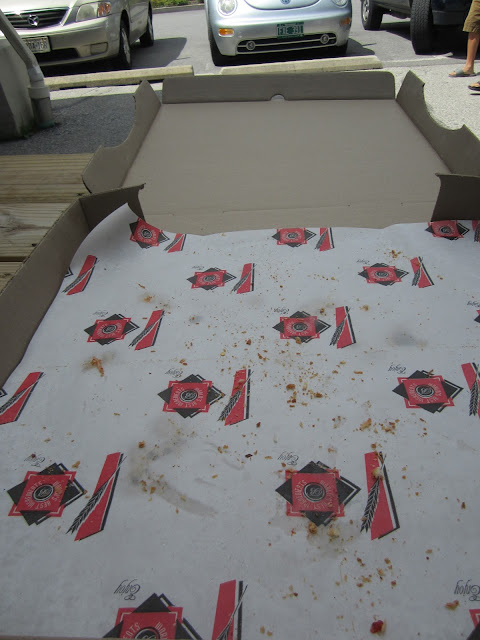


~Mandy


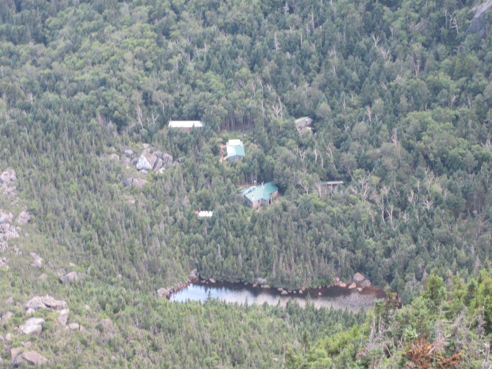


Subscribe to:
Posts (Atom)