Saturday, December 30, 2023

W7I/SI-193 Chester Hill

 Right after hiking and activating Rabbit Mountain I drove across Soda Springs to the end of North Main Street. There is a dirt lot at the very end of the street in which I parked. Next to the lot is a dirt recreation trail which travels around the base of the hill. Perfect for finding a good spot to head up. 

Looking back at the parking area.

I walked a short distance down the path before heading up the hill. There was a pullout in front of a fenced area, with open water behind the fence. Behind a concrete barrier with a "No Motorized Vehicles" sign was a use path heading up. I didn't see any tracks in the snow, but decided it was a good spot to head up.

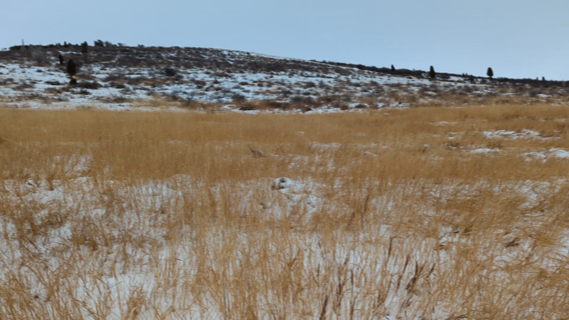
Where I left the bike path and headed up the trail.

The trail climbed up, but never at an objectionable steepness. At a fence with an open gate another trail joined, and a single trail continued up the mountain. The trail first goes to a lower false summit with a big stone cairn on top. This seems to be where most people stop, since I didn't see a well worn trail after that.

Large cairn on the false summit. Some sort of power plant belching steam or smoke in the background.

From the cairn I dropped down a short distance to a wide, brush filled col. There were tracks across the brush, either from humans or animals. But either way, it made crossing pretty easy. On the other side I started climbing up to the summit. The top is covered in an open forest. I had no problem picking my way through the trees, and I think with some careful planning you could avoid the forest altogether. 

Going up through the woods.

There was enough of a clearing at the high point to put up an antenna, but I had passed a clearing with a view a few feet lower, so I backtracked a little before setting up. There was great cell service the entire hike. On the air I did only 20m again, since it was chilly. And like on Rabbit Mountain, there was a big pileup. 

Looking down at Soda Springs. (Or should we call it SOTA Springs?)

I took the same path back to the car. Not really any good options for a loop on this hill. From the base it was about an hour drive back to Pocatello and a warm shower.


Trailhead: Dirt lot at the end of North Main Street.
Website: SOTA Site.
Route: Take the bike path around to where you want to go up the hill, then follow one of the trails to the false summit. Cross the col, and head up through the woods to the high point.
Red Tape: Not signed anywhere.
Video: Coming soon!

W7I/SI-185 Rabbit Mountain

 There are two SOTA peaks on either side of Soda Springs Idaho. This peak and Chester Hill. I drove out to these peaks for a double activation. First up was Rabbit Mountain. Following the advice of Bill N0DNF, I parked at the baseball fields in Kelly Park. At least I assume they were baseball fields, everything was covered in snow. Across the street I found a cross country trail, and started heading up. 

One of the signs. Skiing, disc golf, there was a lot going on there.

There is a small ridge that all the trails go around, to the right. I followed them around, then climbed up to the large water tank. The groomed and used section of ski trail seemed to end at the tank. After looking around a bit, I decided it would be easiest to just go straight up the hill, and that is what I did.

View from near the water tank.

The first part was through waist high grass. Where the hill got steeper, the grass ended and it was thigh high brush. Not hard to get through in the winter, but might be more of a challenge in the summer. The views did get better as I climbed towards a small wood at the top. It turns out the summit is through the woods and higher, but as you go up you can't see that.

View from the top. Low clouds the day I was there.

I was able to get through the woods without much trouble. There were a lot of deer tracks and other signs, so I just followed those where I could. Animals usually are good at finding the easiest way through. On the other side I found a road, and followed it to the towers.

I used one of the fences to hold up my pole, and got on the air. Since I didn't want to sit in the snow, I just kneeled in it. Not sure I stayed any warmer. With a big wire in the air I had a bigger pileup on 20m than I wanted, but I stayed long enough to work everyone. 

I retraced my steps back down the hill, more or less. In some places I thought I could find a shorter way down, but I don't think I saved any time. Back at the car I drove the five minutes across town to the trailhead for Chester Hill.

Trailhead: Baseball fields in Kelly Park. Near the end of Kelly Park Road.
Website: SOTA Site.
Route: Follow the cross country ski trails around the low ridge and up to the water tank. Then either go straight up the hill or follow old roads to the top.
Red Tape: Not signed anywhere.
Video: Coming soon!

Thursday, December 14, 2023

W7I/SI-177 Chinese Peak

 On the east side of Pocatello, a mountain with a flat top covered in towers looks over the city. This is Chinese Peak. The peak is on BLM land, and a nice hike. I drove to the end of Barton Road and parked. In the winter the road is gated next to a small lot. I'm told in the summer you can drive all the way up. 

Looking over at the Bannock Range across the freeway

To get to the top just follow the access road. It was obvious that lots of other people use this area for hiking and fun. The snow on the road was packed down, and there were even tire tracks that went all the way up. It is about three miles and 1700 vertical feet to the top from the parking lot. 
Out of the wind and snow making contacts.

The tire tracks ended just below the summit, so the last quarter mile was a bit harder. I walked around on top looking for somewhere where I wouldn't have to sit in too much snow to set up, then spied a utility box just below the summit. I walked over and set up on it. As a bonus it was out of the gentle breeze as well. 
As I started making contacts, everyone seemed very weak. I assumed it was because I was using the short whip, but realized that it was because the attenuator was turned on. It was much easier hearing people with it off.
Hazy in the early afternoon.

I didn't hang out on top too long, since I was getting cold. I took the same road back down. It appears there are some other trails in the BLM land, and you could approach from the north rather than the west. If you're looking for a longer or possibly more scenic hike, those trails could be a good option.


Trailhead: Parking lot at the Barton Road gate.
Website: SOTA Site.
Route: Walk up the road to the summit.
Red Tape: None.
Video: Coming soon!

Monday, December 4, 2023

W7I/SI-215 Howard Mountain

 West of Pocatello, at the north end of the Bannock Range, stands Howard Mountain. Many parts of town have a view of the summit and its many towers. It is a pleasant hike, and worth a walk up. I woke up on my first day in Pocatello and the temperature was a crisp 17 degrees Fahrenheit. I could see the summit across town from the hotel. After breakfast, and some time psyching myself up for the cold, I drove across town to the trailhead at the end of West Trail Creek Road. 

Peak on the right.

In the winter the road is gated about a mile below the saddle. There was plenty of space to park, despite the "No Parking" signs. It was cold, as I knew it would be. I was layered up, and wasted no time in heading up the trail. The first mile to the saddle is on a dirt road, and is obviously a popular spot for cross country skiing. There were a lot of tracks. In the summer you can drive up this part for an even shorter hike.
Looking back along the road.

At the col the nice, beaten down path ended as I made a right turn towards the summit. The snow wasn't deep, but it was much slower going as I had to make my own path. I thought about going straight up the hill to the high point, but decided it would be easier to take the graded road up. This worked out well until I got to the ridge, where the snow was thigh deep in places. Post-holing is not easy.
Making QSOs on the summit.

Eventually I got to the high point, which has a tower. I found a nice rock I could stand in front of and put up the wire. Having a KH1 would've made setup so much easier. It was much warmer on top than I was expecting. As the guy wires and tower warmed up in the morning sun, snow and ice would fall off making a racket. On the bands I had no trouble getting contacts. Since it was so warm, I chased a few summit to summit contacts before packing up. 
Views of Pocatello.

Since going down is easier, I just went straight down to the road. This was steeper and slipperier than I thought it would be, but I made it to the road without falling. From there it was an easy walk back to the saddle and down to the car. 


Trailhead: As far up West Trail Creek Road as you want to or can drive.
Website: SOTA Site.
Route: Walk up the road to the saddle, then turn right and follow the access road to the summit.
Red Tape: None.
Video: Coming soon!

Thursday, November 16, 2023

W6/ND-169 Red Mountain

This was the final peak I was able to do on my 2023 desert trip. The trailhead is in the aptly named town of Red Mountain, along 395. Turn north onto Trona Road, then an immediate right onto the dirt road with the big pullout. Google calls this Steamwells Road. I was only able to drive about a quarter mile down the road in a sedan, but real OHVs could get much farther.

Summit on the right.

The roads in this area all had signs. I followed road 108. This winds its way to the base of the mountain, then goes up to a col north of the peak. The road was pretty rough in places; no problem for someone on foot, but could require some skill to drive. The climb to the col seemed easier than I expected. At the col there is another road that heads south up to the crest of the ridge.
Ridge near the summit.

After a very steep climb, the road levels out and ends at a dry pond. It seemed like an area that people camp at for fun. I found bits of a trail that lead higher, but nothing formal. The ridge crest is fairly rocky, but it was not hard to find a way up the next steep section. On top was a wide, gently sloped part of the ridge. It was easy walking, and I enjoyed the views. After going over a sub-peak, you drop a short distance down, then climb up a rocky area to the summit. From a distance it looks like there are some cliffs, but they are not bad to traverse.
Desert views.

There was a lot of debris at the summit. I put up my antenna and got busy making contacts. Cell service was good on top. The bands cooperated, and I had no problem getting my contacts. There was a rock with some graffiti scratched in. One was dated 1907. I wonder if it was real, or just some prankster.
Really from 1907?

I retraced my steps to get down. The creosote really hid the car, so I had to pay attention at the bottom to make sure I ended up back where I wanted to. But I did it, and headed back to town for lunch.

Trailhead: Pullout on Trona Road, or as far up 108 as you can drive.
Website: SOTA Site.
Route: Follow road 108 up to the col, then the spur road to the dry pond bed. Cross country up to the summit along the ridge.
Red Tape: None.
Video: Coming Soon!

Tuesday, November 14, 2023

W6/SD-472

Ridgecrest is a strangely named city. The name implies it is on top of a hill, but it is actually in a basin, near a dry lake bed. Nowhere near the crest of a ridge. This peak, however, is on the crest of the ridge south of town. I drove up 395 to the starting point for this unnamed peak. Boundry Road heads off to the east from the highway. I only had a sedan, so I was able to drive about half a mile up the sandy road. With a jeep or similar you could drive to the summit.

Decisions....

The hike is pretty straightforward. Just follow Boundary Road until you get to the summit. As simple as this sounds, however, I still managed to make some wrong turns. Some of the junctions are not signed, and didn't appear on the map I had. I did walk past some benches and art set up in the middle of the desert. Not sure if this is a rest area or a campground or something like that. I didn't stop. 

Some benches at a campsite?

The relief is fairly low in this area, and there are a lot of small hills that look like they could be the summit. You have to walk past a few, and over the sides of some. The highest point is pretty rocky, and there is a turn around area for vehicles. Like most places in the desert, there is plenty of space. I found a nice rock to sit on off to the side of the road, and put up my antenna. 
Summit area with Ridgecrest below.

I had a nice view of Ridgecrest as I operated, and very good cell service. The bands were decent, and I had no problems getting my contacts. Not sure if there are many hams in Ridgecrest, but it would be a good place to get them on 2m. Once I was done, I packed up and retraced my steps back to the car. This time, however, I did a better job following Boundary Road, and had a slightly shorter hike back. 
Watch out for the cholla.


Trailhead: As far along Boundary Road as you want to or can drive.
Website: SOTA Site.
Route: Walk along Boundary Road until you get to the summit. There are plenty of other OHV trails if you want to make a loop or get some variety.
Red Tape: None. If driving, follow the signs about where you can and can't drive.
Video: Coming Soon!

Tuesday, November 7, 2023

W6/SD-152 Bell Mountain

This was the third peak of the Victorville Threesome I hiked. After Catholic Hill and Little Bell Mountain was Bell Mountain. This was the hardest of the three peaks. The trailhead for this peak is south of the summit. From Dale Evans Parkway head west on a dirt road. Google calls it Falchion Road, but I can't find this name on other maps. At the intersection with what Google calls Vega Road turn right and head north as far as you can. In a sedan I could get about a quarter mile down this final road. There was a nice place to turn around and park out of the way, so I decided to not risk getting stuck.

Bell Mountain from the trailhead.

I then walked up the road a bit to a sheltered area. In the satellite view I was able to see a trail, but I couldn't find it on the ground, so I just started going up the hill. It was steep. When I got to the ridge, I crossed the trail. It was a good place to find it, since above me on the ridge were some cliffs and the trail nicely routed around them. With the trail, it was easy to find my way up to the summit. There is a flagpole with a flag, and, appropriately, a bell. I signed the register and got on the air.
Its a steep hike to the summit.

There was good cell service, but no chasers. I called for a while on 20m, but didn't get anyone. Maybe it was too late in the day to get east coast people. Down on 40m I called, and barely got four contacts. Not the best activation, but it was successful. And I didn't get blown away in the strong wind.
On the way down I followed the trail all the way to the base. There were some nice switchbacks lower down, and it was much more pleasant.
Looking back at the two other summits I did.

Back at the car I headed back to the pavement for the long drive to Ridgecrest. Along 395 there was an accident, with multiple campers in pieces on the side of the road with a crane lifting one onto something. Glad I missed the big jam I'm sure that caused. Be careful driving!

Trailhead: South of the summit, at the corner of Vega and Falchion Roads. Or as far up as you can drive.
Website: SOTA Site.
Route: Find the trail, and follow it to the summit. It is not obvious from the OHV roads where the trail is.
Red Tape: None.
Video: Coming Soon!

W6/SD-181, Little Bell Mountain

The middle peak of the Victorville Threesome, Little Bell Mountain. After hiking Catholic Hill I drove a few minutes down the road to the base of this one. There is an access point for some OHV trails along Corwin Road, just across from Waalew Road. Since I only had a sedan, I pulled into the wide area just off the road and parked. A jeep or similar could get much closer. 
The peak is in the middle of the frame.

From here, a sub-peak is closer, then the peak. I followed the OHV roads to the base of the col between the two peaks. From here it looked a bit better to go up the ridge on the right (north) to the main ridge, but going up the reentrant would probably have been fine.
Plenty of interesting desert plants out there.

It did not take me too long to climb up to the ridge. From here I just had to follow it along until I got to the high point. There was a small false summit on the way. This peak was much better for playing radio than Catholic Hill. Much more space on top, and no ants to attack. I was still pining after the KH1, but not as badly. There were also more chasers, or maybe I just wasn't so impatient. Cell service was excellent on top.
Looking down my route up and down the hill.

I took the same route back down. At the base I had to be careful, since there were so many paths to take and the car was hidden in the big creosote bushes. But my trusty GPS watch led me back without problems. Now I had done two summits, it was time to get number three, Bell Mountain.

Trailhead: Across from Waalew Road, as far as you're willing to drive.
Website: SOTA Site.
Route: Find your way to below the col, then head up to the main ridge. Turn right and follow it to the summit.
Red Tape: None.
Video: Coming Soon!

W6/SD-186, Catholic Hill

This peak is one of three that I call the Victorville Threesome, three peaks along the same ridge, more or less. Catholic Hill was the first I did this day, and the easiest. I parked near the corner of Sylvan and Roanoke Roads in Apple Valley. There is a paved and gated road that leads up to a big water tank on the side of the hill.

At the start of the hike.

I walked up the pavement to the tank, then along the fence. On the other side there was a break in the small cliff that I could scramble up. From here, I just followed the ridge up to the summit. The terrain is covered in big rocks, so a bit of care is needed to find a way through, but it wasn't difficult.
Almost at the top.

There is a large cross on top, along with some solar garden lights. I suppose they like to have it lit up at night. Either way, it was a convenient support for my antenna pole. The radio gods must've heard my prayers, since I quickly got five contacts. I did, however, pick a bad place to sit. One crawling with red ants. After the first bite I hurried up a bit. It was also the day after Pacificon, where the Elecraft KH1 was announced, so I was really sad I didn't have one. It would've been the perfect summit for it.
Views of Apple Valley

I mostly took the same way down, but I cut down to the road at one of the small cols, before I got back to the water tank. This saved a little distance, but was a bit steep. Probably wouldn't have been fun to go up. Back I the car I headed a minute down the road to the base of Little Bell Mountain, the second of the threesome.

Trailhead: Apple Valley, corner of Sylvan and Roanoke Roads.
Website: SOTA Site.
Route: Walk up the paved road to the water tank, then follow the ridge to the summit.
Red Tape: None. Don't block the gate.
Video: Coming Soon!

Monday, November 6, 2023

W6/CT-241 Pedley Hills

This is not the most interesting summit I've done. It is, however, a short and easy hike. Drive up to the end of Lakeside Drive, and find a place to park in the neighborhood. At the end of the pavement, the dirt starts and it is a quarter mile up to the summit.

The summit is visible from the trailhead.

You can see where you want to go, so just walk on up. The eroded jeep trails are an easy walk, but would require some serios OHV capability to drive. The top is rocky, but it wouldn't be too hard to set up an HF antenna. I was short on time, so I did VHF only. It took about 15 minutes to get four contacts, and I was worried I'd have to leave before I got number four. 
Views of the Jurupa Hills, and the San Gabriel Mountains.

Talking with locals later, it sounds like that area is just not very good for VHF. Too low and far away from the chasers in LA, and not that many hams in the inland empire. Oh well, next time I'll leave more time for HF.
Back at the car it was a short drive over to the airport for my flight home. 

Trailhead: End of Lakeside Dr.
Website: SOTA Site.
Route: Walk up to the summit. You can see it from the end of the road.
Red Tape: None that I'm aware of.
Video: Coming Soon!

Thursday, November 2, 2023

W6/ND-232 El Paso Peaks

After driving up Government Peak, I headed north on 395 to get this peak. Motorcross road goes towards this summit. It heads west across from Searles Station Cutoff road. Motorcross Road is paved, I suppose. There is pavement, but there are also potholes big enough to swallow a small car. In the Jeep I had, it was easy enough to go around, but a sedan might have a bit of trouble navigating the poor road.

View of the peak from the parking spot.

The road doesn't really get rougher, but there is less asphalt as you get farther along. At the turnoff for Laurel Mountain there are lots of signs warning you not to get too close to the government stuff on top. Probably something to do with the base at China Lake just to the north, but I am curious what the golf ball is for. The rough road then climbs up to a sub-peak with a bunch of towers. This is where I parked, as the road gets significantly rougher past here. It was only three quarters of a mile or so to the summit from here.
El Paso Peaks

I walked along the road to the base of the peak. There is a relatively steep climb that looks like dirt bikes have driven up and down. Probably fun on one of those. Up on the summit ridge is was a quick walk over to the high point. The wind had died down a bit from earlier, so it was pleasant to sit on the summit and operate. The cell service was good. It was getting to be lunch time, so I didn't linger too long. Back at the car I drove down the hill to find some food in Ridgecrest.

Trailhead: Subpeak with all the towers.
Website: SOTA Site.
Route: From the towers, follow the road to below the summit, then follow the motorcycle trail to the summit ridge, then cross country to the top.
Red Tape: None.
Video: Coming Soon!

W6/ND-224 Government Peak

This desert peak south of Ridgecrest is either really easy or a long slog, depending on your vehicle. I had a Jeep, so it was really easy. Don't follow Google Maps, it tried to take me down closed roads, and didn't know about roads that were easy to drive on. Someone on peakbagger posted a GPS track of the route described here, https://peakbagger.com/climber/ascent.aspx?aid=1133044, if you like pictures more.

From the south end of the small town of Red Mountain, head west on Osdick Road. This curves to the south and becomes Butte Ave. A short distance down Butte, turn right onto Randsburg Mojave Road. All of these roads are dirt, but would be passable in a sedan. 

Next, turn right onto R20, which is also called R16. From here the roads get rougher, and sedans may not be able to make it. Finally, turn north onto R85 or R83, depending on the map or sign, and follow that to the col below the summit. I parked at the col to get some walking in, but you could drive all the way to the summit.

Looking over at Fremont Peak

It is less than half a mile to the summit. I set up just below the road, to get away from the towers a little. There was good cell service, and I quickly got plenty of HF contacts. The wind was blowing, but it was reasonably warm, so a light windbreaker was enough. I drove down the same way I went up. The tire tracks were fresh enough in the dirt I could follow those when I got to intersections. Back on the highway I drove a few miles down the road to get El Paso Peaks.

Trailhead: Col below the summit.
Website: SOTA Site.
Route: See post for driving description.
Red Tape: None.
Video: Coming Soon!

Tuesday, October 31, 2023

W6/ND-231 Fremont Peak

I had just climbed Frankish Peak, and the rental company had given me a Jeep, so I drove over to the desert to try it out on some dirt roads. My goal was Fremont Peak. This pointy mountain is easy to see as you drive 395, probably on your way to or from the Sierra. 

Looking up at the summit.

The peak is at the end of a long dirt road, aptly called Fremont Peak Road. The turnoff from 395 is not marked, so be careful not to miss it. The flat part of the road was in decent shape, and a sedan could likely drive a few miles in before the road got too rough. It was super easy in the jeep.

Looking at one of the many dry lake beds in the Mojave.

Eventually the road begins bearing right and going up the hill. It becomes much rougher here as well. I drove up, parked, and started to walk, then realized it wasn't so bad. So I got back in the car and drove up to the end of the road. There were some abandoned structures here, just below a col, and the path from here got much steeper. On a dirt bike you could get a lot farther up. Or maybe if you were a better off road driver than I am.
Summit area.

I followed the dirt bike trail up to its high point, about 200 feet below the summit. From here I just went straight up. It was steep and rocky, but I was able to easily find ways around any big rocks. No climbing required. The summit area is flat and open, and bigger than I expected. There was a small antenna and solar panel from some unknown organization, and a register. I signed it and put up my antenna. 
Enjoying desert views while I operate.

I had good cell service, so spotting wasn't a problem. Twenty meters was open to Europe. While I was on 40m, the UTC rollover happened, so I worked a bunch of chasers twice. Always nice to be able to give out extra points. I took the same route back down, more or less. I just picked what looked like the best way through the rocks until I got to the open desert slope below. From the path it was a quick jog back to the car. It seemed like a long drive back to 395, but I was just glad I didn't have to walk it.

Trailhead: As far up Fremont Peak Road as you can/will drive.
Website: SOTA Site.
Route: Follow the road/bike trail up as high as it goes, then go straight up to the summit.
Red Tape: None.
Video: Coming Soon!

W6/CT-151 Frankish Peak

 Frankish Peak is one of those peaks that doesn't look too bad on the map. Real life, however, is different. The trailhead for this peak is easily accessible, a large dirt pullout on N Mountain Ave. This is across the street from what appears to be a large dam. Probably to prevent floods when it rains and snows in the mountains. From here there is an unmaintained trail that heads up the hill.

Steep and dry.

The trail up to the ridge is steep. Very steep. Most of it is just regular steep hiking, but there were a few sections that were class 2 or even class 3. Not the most fun hike I've ever done, but I made it up.
Enjoying views of the San Gabriel Mountains.

The views do get better as you climb. There are a few short sections along jeep trails, but mostly it is narrow, overgrown single track. The final road section is just below the summit. On the summit ridge, the closer peak is a little lower, but the trail continues across to the high point. This is marked with a sign and a large open area covered in broken glass. I'd like to know how all that glass got up there.
QRV!

I did not have cell service on top, at least where I was sitting. I may have been able to find it by walking around, but RBNhole does a good job putting up spots, so I didn't try. I worked people on 20m, but surprisingly no one on 40m. On VHF I got a few people as I expected, looking down a such a large populated area.
The hike down was nearly as bad as the way up. Steep and loose in places. Badly defined trail. I nearly went down the wrong ridge, but caught myself before I got too far. That would've been bad, since hiking up in the dense chaparral would have been terrible. Back at the car I had a drink and headed across the mountains into the desert to my next goal, Fremont Peak.

Trailhead: Side of N Mountain Ave, across from the reservoir.
Website: SOTA Site.
Route: Take the extremely steep use trail up the ridge. Be careful, both of the steepness and of going the wrong way!
Red Tape: None, hike is in Angeles or San Bernardino NF.
Video: Coming Soon!

Saturday, October 28, 2023

W7I/SR-138

 This is a fairly easy peak near Mountain Home. From the freeway, drive north on US 20, uphill and into the foothills. A few miles up, turn left onto Anderson Dam Road. This road is paved. Drive down the road until you cross a cattle guard and the pavement ends. There is a large pullout here you can park in at the base of this mountain, on the dirt side of the road. 

Looking at the summit.

Since I didn't want to crawl under the barbed wire fence, I crossed the cattle grate and started up the hill. The route to the top was pretty easy to see, just follow the ridge up. There are some big embankments lower down, but they are easy to avoid. I wouldn't be surprised if people used this area for shooting.

Enjoying the beautiful day.

It was about a mile up to the summit, and it didn't take me too long. The first half is flatter, but much more brush to navigate around. After crossing what appears to be a power line access road, the steepness goes up. The views got better as I climbed which was nice, but the wind also picked up. It was, however, one of those beautiful fall days where everything is just perfect.

One of the embankments near the bottom.

On the summit there is the remnants of a fence. I used a conveniently located post to hold up my antenna pole, and was quickly on the air. I had good cell service for spotting, and the QSOs started rolling in. It was the Arizona 10 point madness day, but none of the AZ stations came to work me summit-to-summit. I was a little disappointed, but there were plenty of other S2S contacts.

One happy hiker.

Since I had to get back to Boise and the airport for my flight home, I couldn't spend too long on top. It was a pity, since it was so nice out. Oh well, there'll be nice days at home soon enough. I retraced my steps back to the car for the drive back to the capitol.


Trailhead: Where the pavement ends on Anderson Dam Road.
Website: SOTA Site.
Route: Cross the cattle guard to get around the fence, then follow the ridge up to the summit.
Red Tape: None.
Video: Coming soon!

Monday, October 16, 2023

W7I/CI-082 Celaya Benchmark

 It was a rainy day, but I was tired of sitting in my hotel room, so I headed out for an activation. I figured a peak with more driving than hiking would be a good choice for a day like this, so Celaya Benchmark was my choice. From Twin Falls I headed south on US93 to Rogerson. In town I turned west and drove down Three Creek Road. This crosses the Salmon Falls Dam, which is not suitable for large vehicles or trailers. Next, head south on Monument Springs Road. This dirt road was well graded, and the little sedan I had made it all the way to the trailhead.

Jeep trail hiking.

I found a wide area to park in, north of the summit at about (42.06432, -114.91910). There is a jeep trail that heads away from the main road here, and I followed it. A short distance down there is a gate. This one was a bit easier to get through since there was a chain you could use to get some mechanical advantage while shutting it.

MTR 3B on the summit.

From here the trail continues up onto the main ridge. I was pleasantly surprised to find it wasn't as windy on the ridge as I feared. Follow the road until you're near the summit. The road goes around the summit, so at some point you'll need to step off to get to the high point. I did this shortly before some higher brush.

Radiating that RF.

It was an open field sort of bushwhack to the summit. In the fog I just followed the sharp drop off to my left. The summit is broad and open, and since it was so cloudy I had to use the GPS to make sure I was at the high point. 

I wanted to try and get out of the wind, so I went a few feet down the east side of the summit, with the cliff. Turns out there are plenty of bushes to hold your pole here, and some nice shelter from the weather. It was quite pleasant sitting and making contacts. I had pretty good cell service on the summit.

Enjoying the outdoors.

I took the same route back down, but it was much less pleasant. The rain had started and the wind picked up. First, only the left side of my pants was wet, then all my legs were wet. But since it was a short hike, I wasn't too worried. At the car I got out of the rain and turned up the heat for the drive back to Twin Falls.


Trailhead: Along Monument Springs Road, at about (42.06432, -114.91910).
Website: SOTA Site.
Route: From the location above, follow the rough jeep trail to just below the summit, then bushwhack.
Red Tape: None, but watch for cattle on the open range.
Video: Coming soon!