Monday, May 30, 2022

W6/CT-165

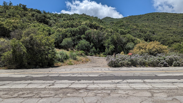
 After activating Burn Benchmark, I drove up the Sierra Highway to Mint Canyon Road. A short distance in, turn right onto Petersen Road. Under the power lines, across from where the PCT goes into the hills, there is a pullout big enough for one or two cars. I parked here, crossed the road, and started hiking north on the PCT.

PCT, and tower access road.

The PCT follows some fire roads here, that are probably also used to access the power pylons. After around half a mile, the PCT turns left and I turned right, to go up the ridge. There was a short distance more on the dirt road, then I turned onto what appears to be an old fire break.

The PCT climbs up that valley to Mt McDill.

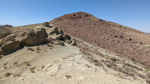
I followed the fire break all the way to the summit. Near the bottom it goes over a few bumps before climbing up. Near the top, it it nearly flat. I think most of the high area is in the activation zone, but I decided to go all the way to the high point at the far end of the ridge.

Cactus still blooming!

I had good cell service as I put up my antenna. The views down into the valley were nice, and there was a pleasant breeze to help keep me cool. It was close to lunch time, and I was getting hungry, so I only did 20m and 40m. Despite this, I got lots of contacts.

Linked end fed halfwave on the summit.

The hike down the fire break was quick. Back on the PCT, I passed a pair of thru hikers. I guess it is still the season for them to be passing through this area.

Trailhead: Across from the PCT on Petersen Road.
Website: SOTA Site.
Maps: AA6XA SOTA Hikes map.
Route: Take the PCT for 0.5mi. Turn right, then follow the road and firebreak up the ridge to the summit.
Red Tape: None. 
Video: ham_bitious YouTube

W6/CT-271 Burn Benchmark

 There are two Burn Benchmarks in this area of southern California, and this was the first that I did. Since I didn't have a car capable of serious off road driving, I looked for a route that was all on paved roads. I found a reasonable route starting from the Sierra Highway south of Sleepy Valley. There is a large pullout on the southbound side, just after you drive under some high voltage lines (34.48715, -118.38809). I parked here.

Looking up at the power lines.

From here it as a short but very steep climb up to the ridge, then a pleasant walk to the summit. My original plan was to go up the left side of the small canyon and follow the power line access road up to the summit, but that way appeared to have a lot of cliffs, so I went right.

On the ridge.

The first part of this climb was very steep. Very, very, very steep. I made it up though, and was glad to be on the ridge. I still thought I could go over to the road and take that, but the reentrant looked a bit steep and brushy, so I decided to just go straight up. As far as I can tell, the parking spot is on the border of the national forest land, and the entire hike is in the NF. Either way, there are no signs or fences.

Looking towards Palmdale.

The walk up the ridge was pleasant, with nice views. There is no difficult bushwhacking, any brush can simply be stepped over or around. The summit was clear, with a metal pole at the high point. I used this pole to hold up my fishing pole and antenna, and got on the air. There was excellent service on top. I made contacts on all four HF bands I had, but there were no takers on VHF.

QCXmini making contacts on 17m.

I packed up and took the same route down. The steep bit near the road was treacherous to get down, but I did it without falling. Definitely some class 2 slope there. Back at the car I found out my work for the evening had been cancelled, so I drove up the road a bit to the start for another summit.

Trailhead: Side of Sierra Highway (34.48715, -118.38809)
Website: SOTA Site.
Maps: AA6XA SOTA Hikes map.
Route: Scramble up the steep slope on the right of the small canyon, then follow the ridge to the summit.
Red Tape: None. 
Video: ham_bitious YouTube

W6/CT-030 Mt Lukens


 Back in SoCal meant more SOTA. This time I decided to start with Mt Lukens, the highest point in the City of Los Angeles. It appears the most common hiking route is to start at the Deukmejian Wilderness Park in Glendale, so I started there. Near the parking lot there is a maze of trails, but there are two that go all the way to the summit. I did the loop in the clockwise direction.

Near the parking lot. Still a long way to go up.

I was glad to have the maps on my phone, so I could use the GPS to verify I was on the correct trail. Once you get a short distance away from the trailhead, there are signs, but there are also lots of unsigned use trails. My route climbed over a small spur, dropped into a canyon, the started the long climb up.

Yucca plant with a view to the north.

The trail is well graded, with lots of switchbacks. Some local hiking club has sure put a lot of effort into building and maintaining the trail on such a steep hillside. There were sections that were starting to wash out, but everything seemed like it sees regular maintenance.

Looking over at the Verdugo Mountains.

As you climb, the views get better. After a few miles, the trail ends and joins a fire road. However, the relentless climb continues. It was warm and getting hotter, but some clouds blew over and at least blocked the direct sun. Eventually I made it up to the summit area. There are a million towers on top, so I found a spot with a nice view to set up. 

There was no cell service on top, so I had to rely on RBN. I started on 17m, but didn't get anyone. I thought that the band might be closed, so I switched to 40m where I only got one. This was concerning, but a call on 2m quickly resulted in a pileup. Nothing like VHF while overlooking a big city. Once I had gotten everyone, I asked one of the chasers to spot me on 30m, where I made a few more contacts.

Worn out flag on the way down.

By this point the sun had come out, I was hot, and beginning to worry about running out of water on the descent, so I packed up. I took the other trail down, and it was a long way down. About halfway down there is a flagpole that needs a new flag. I was surprised to pass a few people heading up at such a late time. I had forgotten my snacks at home, so I only had one clif bar. However, I found an unopened bar on the trail as I descended. It was ambrosia. Back at the car I cranked the AC and headed over to my hotel for the week.

Trailhead: Deukmejian Wilderness Park, Glendale.
Website: SOTA Site.
Maps: AA6XA SOTA Hikes map.
Route: I took Rim of the Valley Trail up and Crescenta View Trail down.
Red Tape: None. 
Video: ham_bitious YouTube
 

W6/CT-225 Flint Peak

I had time in the morning before going back to the airport, so I decided to head up to this peak. Many of you will recognize this peak as the favorite of N6AN, however, since it was a last minute decision to come up, I wasn't able to meet up with him.

Gate at the end of the road.

I parked at the end of Figueroa Street. There is plenty of space here. On the other side of the gate is a short but steep trail that leads up to the fire roads running along the ridge. Follow it towards the summit, passing under some high voltage lines. The power lines were really crackling when I passed.

The dirt road drops to a small col, where the road becomes paved.  Follow this up the rest of the way. The actual high point is inside the fence, but along the fence line are some big pine trees. I setup along the trees, to be in the shade. As you'd expect, there is great service on top.
QCXmini and MTR, ready for action. 


I put out a spot and was soon making contacts. I didn't make a huge number, but there were plenty of chasers out. Setting up the antenna so close to the fence might have affected it some. Once the calls stopped coming, I packed up and took the same route back, then headed for the airport and home.

Trailhead: End of Figueroa Street.
Website: SOTA Site.
Maps: AA6XA SOTA Hikes map.
Route: Follow the trail and fire roads up to the summit.
Red Tape: None. 
Video: Coming soon!

Monday, May 23, 2022

W6/CT-270

 This unnamed peak overlooks the city of Rosamond, just off of CA 14. One of its subpeaks has a cross on it and seems to be a popular hike for locals, but the main summit does not. I drove over from Willow Springs Butte. There are a few parking options. There is a rough dirt road you can drive up as far as you are able, or just park where it meets Felsite Street. Or, drive up through the neighborhood to the end of Sunset Ridge Drive, and find a parking spot there. That is what I did. 

The red summit is a false summit.

There is a network of trails and roads on the hill, so pick a way up. I turned left and followed a ridge up. This took me over a red peak, which is not the high point. I was a little disappointed when I found that out. On top there was a decent sized cairn with a tiny flag in it. The wind had died down, but there was still enough I dropped down to get out of it. 
Summit cairn. It needs a new flag.

Unlike on Willow Springs Butte, there were plenty of bushes to hold my pole, and I had no problem setting up. There was excellent cell service, as I expected. I made plenty of contacts, and had a nice chat on 70cm with a guy out for an afternoon walk near Lancaster. 
Looking at the San Gabriel Mountains. The "cross peak" is the low hill in the foreground.

Since there seemed to be so many trails, I took a different route down. This took me down into a small canyon with lots of graffiti and a water tank. It seemed no harder than the way I went up, so there are some nice options for getting to this peak. I made the mistake of taking the dirt road down. I would not recommend it since it was so rough, especially since there is a paved option next to it.

Trailhead: Top of Sunset Ridge Drive.
Website: SOTA Site.
Maps: AA6XA SOTA Hikes map.
Route: Pick a trail and make you way to the summit.
Red Tape: None. 
Video: ham_bitious YouTube

W6/ND-328 Willow Springs Butte

 This peak is a short drive away from the Rosamond Hills, which I had just climbed. I approached this peak from the south, driving up 80th Street as far as I was able. I ended up parking at the base of the tower. From here it is a straightforward walk up the hill.

Part way up.

It seems as though 80th Street just continues straight up. This makes following the trail simple, but also makes it incredibly steep. I could see that it would be steep, and it was. As I was going up, I also started to dread coming back down since it was so steep. I would stop occasionally and turn around to watch the cars driving around the race track. Not the best soundtrack for a hike. Eventually I made it up to the ridge, where there was a short walk over to the high point.
Road running along the ridge. 

After tagging the summit I dropped a little to get out of the wind. However, I ran into a problem that there were no bushes for holding up the pole. I picked the biggest one, then spent a few minutes building a small cairn to hold the base of the pole. It worked, but not very well. I didn't spend much time on HF, since the pole would fall over every few minutes. Bring stakes if you do this peak. I did have a nice QSO with a guy on 2m in Rosamond. We chatted until I started getting cold, when I packed up and headed down. 
The trip down was as bad as I thought it would be. Very unpleasant going down such a steep, slippery slope. I managed to get back to the car without falling, where I drove over to the final summit of the day.

Trailhead: From Rosamond Blvd, drive up 80th Street as far as you can.
Website: SOTA Site.
Maps: AA6XA SOTA Hikes map.
Route: Follow the road up to the ridge, turn left and take the road to the summit.
Red Tape: None.
Video: ham_bitious YouTube

W6/ND-326 Rosamond Hills

 After activating Castle Butte, I drove back down the highway towards Rosamond, where my goal was the Rosamond Hills high point. The trailhead I chose was between 58th and 60th streets, at the base of the butte on the north side. The road is dirt, but well maintained and passable in any car. 

Heading up the steep part.

From here there is a steep OHV road that goes up to the ridge. There were obvious tire tracks, so people must drive up it, but I wouldn't want to. I hiked up. The wind was still really moving, and it seemed a lot faster up on the ridge. Once on the ridge, I turned left and went cross country up to the high point.
I think these rocks were the high point.

As I was walking over, I could see another peak to the side that looked to be a similar height. However, the topo map said I was on the correct peak. Once I got to the high point, I found a sheltered place and put up the antenna. I was a bit worried about the pole in the wind, but it was ok. Cell service was good. 
The other peak, that isn't quite the summit, had a cross on top.

Once I was done, I retraced my steps back down. This went fine until I started heading down the wrong spur. I noticed before I got too far, and was able to cut across the side of the hill and get back to the right path. The road was steep going down, but the footing seemed good. Back at the car I drove out and around to Willow Springs Butte for another activation. 

Trailhead: Between 58th and 60th streets, base of the butte, north side. The dirt road does not have a name on any map I've found. 
Website: SOTA Site.
Maps: AA6XA SOTA Hikes map.
Route: Follow the OHV road up to the ridge, then go cross country to the summit.
Red Tape: None.
Video: ham_bitious YouTube

W6/ND-341 Castle Butte

 This easy peak is a bit east of California City in the middle of the Mojave Desert. There are a number of dirt roads of varying quality in the desert, and with enough clearance you can drive very close to the summit. I drove in via Tamarack Street, a dirt road. The first part of this road was good, passable by a sedan, but it got rougher as I got closer to the butte. This rougher part is labeled as 140th Street on maps.

Summit from the parking spot.

Since I had a jeep with some clearance, I was able to drive all the way to the col between Castle Butte and a lower peak. From here is was less than half a mile up to the top. The first part is steep sand, then it gets rocky. It was very windy, and a few times I had to put a hand down to keep my balance during a gust. 
Views of the high desert.

Since it was so windy, after I tagged the summit I found a spot on the lee side of the hill to set up. I managed to get my antenna up in a bush, and started on 17m. The highlight was working Slovenia, with good signals both ways. There was great cell service on top, so spotting was not an issue. 
California City was just around the rocks.

I didn't spend too long on top, since there were three more summits I wanted to get, starting with the Rosamond Hills. I took the same route back to the pavement, since I knew it was passible. There is one house along the road, and as I drove by a dog started running after the car. I wonder if it was curious or angry.

Trailhead: Col, just northwest of the peak.
Website: SOTA Site.
Maps: AA6XA SOTA Hikes map.
Route: Scramble up to the summit.
Red Tape: None.
Video: ham_bitious YouTube

Tuesday, May 17, 2022

W6/ND-334 Alpine Butte

 A short distance from Lovejoy Buttes is Alpine Butte. This is an easy peak. From Avenue O, drive north on 136 St East as far as your vehicle will let you. When you can drive no farther, get out and walk up to the summit. 

End of the road.

It is a bit steep, and there is no trail, but there are enough rocks and stuff that getting to the top was not hard. The wind was really blowing, so I had to find somewhere to setup out of the way so I wouldn't get blown away. 
Antenna on the summit.

There also seemed to be less brush, which made getting the pole up a bit harder. As expected, there was great cell service. By the time I was done operating, it was after lunchtime and I was getting hungry. I picked my way down the hill to the road and back to the car, where I returned to the hotel.
Gotta love those joshua trees.

Trailhead: End of 136 St East, south of the butte.
Website: SOTA Site.
Maps: AA6XA SOTA Hikes map.
Route: Head up to the end of the road, then straight up to the summit.
Red Tape: None.
Video: ham_bitious YouTube

W6/ND-323 Lovejoy Buttes

 Immediately after activating Black Butte, I drove over to the base of Lovejoy Buttes. This peak towers over the Lake Los Angeles community, and is a pleasant hike. I parked near the height of land on 145 St East. There seemed to be some OHV trails going into the desert here and it wasn't signed. I started hiking east towards the butte.

Joshua Trees on the way.

The desert is sandy on the flat part, and made walking a bit more difficult. There are myriad OHV trails, and I followed one to the base of the hill, then up to the crest. Once on the crest, follow one of the trails along to the high point.
Sandy climb up to the ridge.

Thankfully the ridge is hard rock and sand, and footing is good. Near where I came onto the ridge there is an abandoned boat. Start of the Lake Los Angeles Yacht Club?

Setup on the summit.

It was still breezy, but had warmed up some since Black Butte. I put up the antenna, and was quickly on the air. There was good cell service on top. Once I was done, I took the same route back to the car, where I headed over to Alpine Butte for one last activation.

Trailhead: Height of land, 145 St East
Website: SOTA Site.
Maps: AA6XA SOTA Hikes map.
Route: Follow one of the use trails to the ridge, then around to the summit.
Red Tape: None.
Video: ham_bitious Youtube

W6/ND-311 Black Butte

 It was forecast to be a cool day, so I decided to take advantage of it and do some desert peaks. First up was Black Butte. This peak is east of Palmdale, just south of Palmdale Blvd. Drive until you get to 235 St East, and go south. This road is dirt, but any car could drive it. At the south end of the butte there are some trails that a high clearance car can take to get closer, or just park and walk.

Base of Black Butte.

Since the rental company had given me a jeep, I drove to the base. It appears the area is used for shooting, but no one was there when I arrived. There is an easy to see path that leads up the hill. I took the path since it seemed like the easiest option. 
Path up the butte.

As you'd expect from looking at the mountain, the path up is steep and in some places, slippery with loose rocks and sand. Overall, it wasn't as bad a hike as I was expecting. After you get to the first plateau, the route gets much less steep. The road up fades out on the last climb, but there is a parallel one you can use, or just bushwhack. The creosote has large roots to keep other plants from getting too close, so off trail travel is easy. 
Setup on the summit.

On the top I put on a windbreaker to cut down the breeze a bit, and put up my antenna. There are enough bushes to make it easy to support a pole. There was great cell service, so no issue spotting. It was cool and breezy, but I stayed warmer than I expected. Once I was done operating, I packed up and retraced my steps back to the car, where I drove back towards Palmdale to get Lovejoy Buttes.

Trailhead: 235 St East, at the south end of the butte.
Website: SOTA Site.
Maps: AA6XA SOTA Hikes map.
Route: Follow one of the use trails to the base, then the trail up to the summit.
Red Tape: None.
Video: ham_bitious YouTube

Friday, May 13, 2022

W6/CT-263

 I had just finished hiking Whitaker Peak, and was back at the junction below the communications towers. I was a bit tired, but it seemed silly not to go the extra mile up to the peak for the activation, so up I went. 

Ruby Canyon

It is a bit over a mile, and about 350 vertical feet up to the summit. There is a picnic table on the other side of a fence, and just past this a fire break goes up to the summit. It would be nice if the table was in the activation zone, but it is definitely too low. I made good time up to the top, where I set up along the side of the road. There was no problem spotting, I had good cell service. 

Set up on the ridge.

I didn't spend too long making contacts since it was getting late, and I still needed to hike down and drive to the hotel. Getting down was easy, just follow the road all the way back to the car. Overall it was a great day of SOTA and peak bagging.

Trailhead: Golden State Highway at 6N53
Website: SOTA Site.
Maps: AA6XA SOTA Hikes map.
Route: Take Whitaker Peak Road, 6N53, to the junction, then turn right.
Red Tape: None. 
Video: ham_bitious YouTube

W6/SC-076 Whitaker Peak

 I was down in southern California for work, and before starting I decided to get some hiking in. It seemed like Whitaker and its nearby neighbor (CT-263) would make a nice hike. From the airport I drove up I-5 to the Golden State Highway, where I parked at forest road 6N53. Sadly, the gate was closed at the base, so I had to walk and extra few miles.

Start of Whitaker Peak Road.

The road is paved up to the junction with 6N53B, though it would be a rough drive in places. It is about two miles to the communications site where the road splits. From here, I took the left fork and descended to the col on the now dirt road. 
First view of Whitaker Peak.

The road then climbs at a steady grade. It was Mother's Day, so I was surprised to see other people out hiking, but I basically had the place to myself. The best way to get to the summit seems to be an approach from the north side. However, it is a challenge getting off the road, since there is an impassible embankment.

The annoying embankment.

I tried a few places to get up it, but it was too steep or slippery for me. I needed to walk past the peak, to the col with the towers peak to find a place low enough to scramble up. I then had to walk all the way back through the brush to the base of Whitaker proper.
Ready to go cross-country.

The bushwhacking wasn't particularly difficult. I could find open passages, or the places I needed to push were fairly thin. It seemed like the south side was slightly more open, but not enough to stay on it. At the summit I found a benchmark and register. After signing it, I set up the antenna. Somehow I managed to get the wire all knotted up as I was unwinding it, but the end-fed got in the air eventually. I had decent cell service on the summit.
Excellent views.

Once I was done operating I retraced my steps back to the road and down. It was nice getting back on the easy to follow road, and I made good time back to the road junction. Here I turned left again to go get the other peak.

Trailhead: Forest Road 6N53. If you're lucky, you can drive up to the communication site.
Website: SOTA Site.
Maps: AA6XA SOTA Hikes map.
Route: Follow paved 6N53 (Whitaker Peak Road) to the junction. Turn left, follow the dirt road to the north side of the peak, the bushwhack to the summit.
Red Tape: None.
Video: ham_bitious YouTube