Wednesday, January 19, 2022

2022 January VHF Contest on W6/NC-350 Loma Alta

 Like I have the past few years, I went up to Loma Alta in Marin for the January VHF contest. I took the same route, from Big Rock, up to the summit. 

A bit overcast at the start.

It is two miles to the summit, and it took about an hour with the giant load I was carrying. There was a good breeze at the top too, and I was worried I would get cold and have to pack up early.

Most of the gear, set up and ready.

I had 50, 144, 222, 432, 902, 1296, and 10368 with me this year, and I was hoping to make contacts on all those bands. I used the same setup as last year, the yagis on one "tower" and the wire antennas on the other.

144, 222, and 432 yagis.

Extended Double Zepps for 6m (inverted v) and 2m (vertical)

I had a few minutes before the contest, so I made a few QSOs on 10 and 15 in NAQP. I was disappointed that NAQP was moved, since normally I can do both. I did pretty well on Saturday, making lots. I was disheartened that I couldn't find anyone on 902 or 10GHz, but I thought that maybe on Sunday those people would come out.

A stunning sunset.

I managed to pack everything up before the light was totally gone, and enjoyed a spectacular sunset as I descended.

The next morning, I picked up KN6REU, and we drove back up to Big Rock. It seemed a little warmer, but it was still pretty chilly on top. For the second day, I only put up the wires and the 2m beam.

Very green this time of year.

I made some more contacts, and even got a few new mults. It was nice to get them. KN6REU only made a dozen contacts, but she was busy staying warm and making warm beverages.

Making 2m contacts.

Overall it was a great weekend, and we're looking forward to the next one!


Video: Youtube

Monday, January 3, 2022

W1/HA-076 Bly Hill

 After activating Bald Sunapee and Mt Sunapee, I drove up to this summit for an easy drive up activation. Bly Hill is at the top of High Meadow Road, off of Rollins Road. Your favorite mapping program can get you there. 

On the satellite view, it looked like there is a "T" at the end, and I could park there and operate out of the way. However, when I got up there, the "T" was full of construction vehicles building a new house there. So instead I parked on the side of the road. 

Using the winder as a snow stake.

As I was setting up, one of the workers drove by and stopped to see what I was doing. After giving a quick explanation, he drove off and let me be. I sat in front of the car on the side of the road. Not a very nice operating position, but I didn't have to worry about other cars hitting me. 

I only had about 30 minutes to operate before I had to head back south, but this was not a problem. I made lots of contacts on 20m, a few on 40m, and a surprising number on 17m, despite spending only five minutes on the band.

A very easy one point.

Once my fingers got cold, I took it as a sign to pack up. When I got home, however, I discovered I was missing one of my gloves. It hasn't turned up yet, so if anyone find a black liner type glove on the side of the road up there, its mine.


Trailhead: End of High Meadow Road, or anywhere in the activation zone you can park.
Website: SOTA Site.
Maps: AA6XA SOTA Hikes map.
Route: Find somewhere on the side of the road to operate from.
Red Tape: None.
Video: coming soon...

W1/HA-025 Mt Sunapee

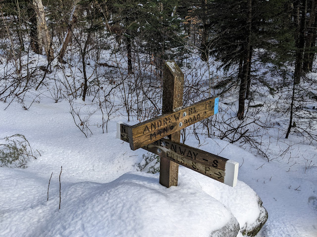
 This was the second peak on my end of 2021 three peak extravaganza. After getting the poorly named Bald Sunapee. I set off up the Andrew Brook Trail. This is not the shortest option, but I was already here for Bald Sunapee, and I didn't want to deal with the ski area parking for that trail. The beginning of this trail is fairly flat, and includes crossing one wide stream. There was some plastic tubing running through the woods, and I assume it was for maple syrup collection.

Getting ready for syrup season?

The blue blazed trail then stared climbing. It was a steady climb, and not unreasonably steep. I passed a couple who told me the summit was above the clouds, so I was looking forward to that. Parts of the trail were bare of snow. I tried to not walk on the rocks, since I was wearing spikes. At one point I stepped on some ice while crossing a stream, and broke through. I'm glad to report my winter boots are still nice and waterproof.

That's a smile, not a grimace.

At the top of the climb, it levels out a bit, and crosses a small rise. On the other side is Lake Solitude. The sun was out by this point, and it was simply beautiful. That would be an awesome camping spot, somewhere around the lake.

Joining the Monadnock-Sunapee Greenway.

At the junction at the end of the lake I joined the Monadnock-Sunapee Greenway, which I took the rest of the way to the summit. Sadly, it was warm enough up here that the trees were all dripping on me. Despite the nice sun, it felt like I was hiking in a rainstorm. I thought about going to look at the White Ledges viewpoint, but it seemed a bit foggy for a view. Along the ridge there are a few bumps and I made quick time. The trail comes out of the woods at a ski trail. This one was closed, but the next one that I followed to the summit was not. It is not super comfortable walking on a ski trail with lots of skiers.

Summit lodge and tower.

At the summit I looked around briefly before finding an open space without people. It was just past the summit lodge, where the trail from the ski area parking lot comes out of the woods. I set up off to the side. I was wet from sweat and the trees, and got cold quickly. It didn't help that the sun went away as I got to the top. 

I had good service for spotting and texting, and started making contacts. The highlight was a summit to summit with a Spanish station. He was pretty weak, but enough that we were able to complete the QSO. It'll be fun in a few years when that sort of DX is easier.

On Lake Solitude looking up at the ledges.

Sufficiently cold, I packed up and started down. The trail seemed even more slushy than on the way up. This time it was clearer, and I stopped by the ledges viewpoint. It is definitely worth the walk. The hike down was quick, though I re-entered the fog a little below the lake. Back at the car I cranked up the heat and drove over to Bly Hill for a quick activation before going home.


Trailhead: Andrew Brook Trailhead, Between the Mountains Road. There is only parking for about half a dozen cars here, and there are "No Parking" signs along parts of the road.
Website: SOTA Site. Mt Sunapee SP
Maps: AA6XA SOTA Hikes map.
Route: Take the Andrew Brook Trail to Lake Solitude, then the Monadnock-Sunapee Greenway north to the summit.
Red Tape: None.
Video: YouTube coming soon...

Sunday, January 2, 2022

W1/HA-137 Bald Sunapee

 It was the last day of 2021, and time to end the year with a bang. I had a three summit day planned, and first up was Bald Sunapee. This poorly named mountain is just east of Mt Sunapee. Based on some trip reports I found, it appeared the best place to start was west of the mountain on Between the Mountains Road. Google streetview showed some pullouts about a mile past the Andrew Brook Trailhead. However, with the snow I didn't see anywhere good to park. So I just parked at the public trailhead.

The road just looked like this.

From this small parking lot I walked about half a mile down the road. This seemed to be past the houses and directly below the summit. I didn't see any negative signage, so I stepped off the road and started up the hill. 

Foggy woods on the way up.

The climb is rather steep at the start. After about half of the elevation, I crossed a flatter area. There were some tracks in the snow, and since they were going the direction I wanted to, I followed them some. I soon saw they were human footprints. I didn't follow them the whole way, but I did follow generally the same route they did.

Operating at the summit.

The second half of the climb wasn't bad, but the forest seemed thicker higher up. There are some small cliff bands, but I missed them on the way up. If you find them, just go around. The summit seemed brighter, but it had also warmed up enough for the snow and ice to start melting off the trees, so it felt like I was getting rained on. 

I was a bit disappointed that the top was totally covered in trees despite having "Bald" in the name, not that there would have been a view with the fog. There was good cell service on the summit, and I found enough of a clearing to put up my antenna. I was glad to have the tuner for this one, since it was up against a few trees. On the air I quickly made contacts, including some Europeans. I didn't linger, since I needed to be back by four to pick up my dad from work and I knew Sunapee would be a bigger hike.

Happy despite no views.

I took the same route down, more or less. I manage to walk through some cliff bands, but I was able to find routes down or around withouth any climbing. It was fast going down, and the snow wasn't too slick. I came out on the road just past where I went in, and walked back to the car. I took a quick break in the lot before starting up the trail to get Mt Sunapee.


Trailhead: Andrew Brook Trailhead, Between the Mountains Road. This lot only has space for about half a dozen cars, and there were a number of "No Parking" signs around. In the summer you can probably park closer and avoid the road walk. Just watch the signs.
Website: SOTA Site.
Maps: AA6XA SOTA Hikes map.
Route: From the trailhead, walk about half a mile up the road, then go straight up to the summit.
Red Tape: None. I'm not sure who owns the land, but I didn't see any signs.
Video: YouTube

Saturday, January 1, 2022

W1/HA-091 Lovewell Mountain

 Lovewell Mountain is another SOTA peak on the Monadnock-Sunapee Greenway, this one in Washington, NH. There are a number of different approaches to the mountain, but I decided that the one from the south would be the best for me. 

Parking at the end of Washington Drive.

The trailhead I chose was at the very end of Washington Drive, on the east side of Island Pond. There is a big turn around with plenty of space to park. On the lake side is a sign for a private beach, and next to it a jeep trail that goes in to some woods owned by the Society for the Protection of NH Forests, which is open to the public.

Up one of the jeep trails.

Head up this trail, following the stream, until you climb up a short hill and reach another jeep trail. Turn left here and follow it to the next junction. At this well signed junction you join the Monadnock-Sunapee Greenway, which goes over the summit. It also appears that the land ownership changes, and you enter state land.

The greenway is only for hikers.

The route here becomes a single track, and starts climbing. The bottom part was somewhat wet, with lots of icy patches, or open water. Its probably wet and muddy in the summer. After about half of the climb, the terrain flattens out for a bit. The upper climb was not hard, and there is a short spur to a ledge near the summit. There was also a sign for a spring, but I didn't go to look.

Enjoying the only view.

The summit area has a clearing, with a large cairn on one side. It looked like there was a memorial plaque on it, but I couldn't really see through the snow.

Time for some field repairs!

As I was setting up my antenna, the radiating wire broke just past the crimp on connector. Luckily, I had a knife and was able to strip it enough to wrap it around the bolt. With the antenna up, I got on the air and didn't have any further problems. There was good cell service on top, and spotting was easy.

It was a winter wonderland.

Once I started getting chilly, I packed up and retraced my steps back to the car. It was a quick descent, and I was soon back an the road, the car right where I had left it.


Trailhead: End of Washington Drive, east side of Island Pond.
Website: SOTA Site. Google for Monadnock-Sunapee Greenway info.
Maps: AA6XA SOTA Hikes map.
Route: Head up into the forest, then turn left at the next jeep trail. Turn right onto the Monadnock-Sunapee Greenway, and follow it to the summit.
Red Tape: None. Don't park in the private parking lot.
Video: YouTube