Sunday, June 9, 2019

ON/ON-029 Terril Ste-Barde et Tonne

This summit is a small hill on the outskirts of Liege. The shortest trail to the top appears to be from the east side at the intersection of Rue Sergent Merx and Rue Naniot. I parked a block down Rue Sergent Merx at the park, then walked back up the road to the trail. ON7DQ has a great description of the route on his blog.
Heading up to the summit.
The hill is covered in lush, dense vegetation, and I quickly forgot I was in the middle of a city. There is not a lot of elevation to gain, and the trail takes its time, so it is not steep. The high point is different, however. I passed some use trails up to it, but they looked very steep, so I continued around. On the other side of the summit cone there is a trail that is less steep. I took this up to the top.
Watch your footing at the top.
The area at the top is fairly small, but there was no one else there when I was on top. I strung out my antenna and got on the air. I had a bit of time pressure since I didn't want to be late returning the car, but I got enough contacts without any trouble. I retraced my steps back to the car, and got on the freeway back to Brussels.
A few water bars would help prevent erosion.
Trailhead: Intersection of Rue Sergent Merx and Rue Naniot
Website: SOTA Site
Maps: AA6XA/P SOTA Map 
Route: Enter the woods on the trail and turn right. Follow the trail up to the summit. The backside is less steep to get to the high point.
Red Tape: None that I'm aware of.

PA/PA-003 Observant (Sint Pietersberg)

This peak is the higher of the two SOTA summits in the Netherlands. Like all the other Benelux summits, ON7DQ made a useful chart with the best parking locations for each summit. I tried following my GPS to the place for this one, but there were some signs that seemed to me to indicate I wasn't allowed to drive up that way. Luc says its ok to drive up that way, but as a visitor I decided to not take the chance. So instead I turned around and parked at the edge of the village and walked.
Walking up the road.
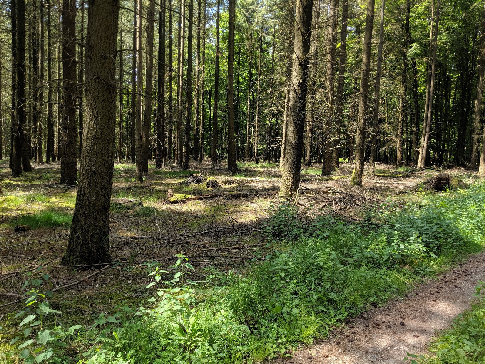
There is a cul-de-sac at the end of Guldendael road, and this is a good place to park. An overgrown, single-track trail leads from the left side to one of the dirt paths on the mountain. I got pretty wet on this trail since it had rained on the way over. On the wide, dirt path I turned right and headed up the hill.
Middle path to the summit.
I didn't have a good map, so I made some wrong turns, but eventually I found my way to the top. There is a star shaped stone structure on the summit, with a number of benches. It was mid-week on a rainy day, so there was no one else on top. I didn't feel bad setting up using the structure to hold up my antenna.
About to head down.
On the air I made contacts on the three bands I had. The clouds were dark, but it didn't rain while I was out. The walk back to the car was a lot easier since I knew where I was going. At the car I realized I had enough time for one more summit before I had to return the car in Brussels, so I drove to a suburb of Liege for my last one.

Trailhead: Cul-de-sac at the end of Guldendael
Website: SOTA Site
Maps: AA6XA/P SOTA Map 
Route: Take the single track to the wide dirt roads. Follow the roads up to the summit.
Red Tape: None that I'm aware of. Watch out for bikers.

ON/ON-026 Le Mont d'Henri-Chapelle

This peak was the final drive-up peak I did on this vacation. After getting Signal de Botrange, the Belgian high point, I drove over to the coordinates provided by ON7DQ. The location he recommends is at the end of a small road, with a picnic table and viewpoint. The sun was peeking through the clouds, so I thought it might not rain like it was forecasted to.
Not a lot of space to set up, but enough.
I used the trash can stand to hold up my pole, and got on the air. As I wash finishing up the third contact it started to rain. I quickly covered everything and put on my raincoat. Lucky for me, there was a fourth chaser waiting when I got back on. I made the contact, then called CQ once more to see if there was anyone else. Not getting any replies, I packed up.
The view over the valley is probably even nicer on a clear day.
This was probably the shortest activation I've ever done, but it was enough and I didn't get too wet. In the car I drove over to the Belgium-Germany-Netherlands triple point to tag the Netherlands high point before heading over to get a summit in the country.

Trailhead: 50.677059, 5.920479
Website: SOTA Site
Maps: AA6XA/P SOTA Map 
Route: Just set up there.
Red Tape: None that I'm aware of.

ON/ON-001 Signal de Botrange

Signal de Botrange is the highest point in Belgium. It is also an easy drive up summit. Any gps should be able to get there. It was the second summit of the day for me. I drove up and parked. There weren't many other cars or people there. The gift shop and restaurant were closed, as was the tower.
Here I am, the highest person in Belgium.
There is a mound behind the building with a staircase leading up it. I walked up and read the plaque on top. It turns out the peak is naturally only 694m, so they built the mound and platform to get up to 700m. People seem to like round numbers.
Mound and tower.
I walked around a little, then found a small clearing in the woods behind the parking lot to set up in. On the air I quickly got my contacts. I didn't linger, since the weather seemed like it might turn at any moment. This was the second country high point I've been to, after Kneiff in Luxembourg the previous day.

Trailhead: Signal de Botrange
Website: SOTA Site
Maps: AA6XA/P SOTA Map 
Route: Set up somewhere out of the way.
Red Tape: None that I'm aware of.

Saturday, June 8, 2019

ON/ON-025 Burteaumont

This is another easy peak near Stavelot, Belgium. After spending the night in town, I got up and drove over to the coordinates provided by ON7DQ. Turning off the main road where the GPS indicated, I saw a sign that seemed to indicate I wasn't allowed to drive up. My French is pretty terrible, so I decided not to take a chance, and just walked up.
The main road and where I parked are just on the other side of the house.
It was a quick walk. On the crest of the ridge I turned to go up to the high point, but noticed a red sign on the tree. Even with my poor French and Dutch I could see that it indicated no trespassing. So I turned around and set up on the side of the road I had just walked up.
Finally a peak with a view.
I used a fence post to hold my pole and strung out the antenna. I put out a spot and quickly got my contacts. The forecast was for rain in the afternoon, so I didn't linger since I had 4 more summits I wanted to get before returning the car.

Trailhead: 50.400523, 5.979388
Website: SOTA Site
Maps: AA6XA/P SOTA Map 
Route: Walk up the road to the intersection with the no trespassing sign. Set up there.
Red Tape: None that I'm aware of.
The high point is down that way.

Friday, June 7, 2019

ON/ON-024 Bois du Tour du Coo

This was my fifth summit of the day and the only one that required an actual hike. I parked in the small lot by the graveyard described by ON7DQ. The next challenge was finding the trailhead. There was an embankment across the street where it should have been, but I saw no obvious place. After wandering around for a while I eventually found it. It is up the hill from the cemetery.
Start of the trail.
The area had recently been logged, and the ground was covered by the slash left behind. I picked my way through it to the open trail. After traversing the top of the embankment, it turns and head up the hill.
Up the hill.
The trail goes straight up the hill along the ridge. It is not a lot of vertical distance, so the steepness is not bad. The single track becomes a jeep trail partway up. Like all the other summits in the area, the summit is broad. There is a trail junction at the high point. When I got to the junction I stopped and found a place to set up.
Operating location.
The trees were a bit thinner here, but there was so much understory that there was no view. It seemed like I got more contacts than on earlier summits. Maybe people were home from work by this point and able to chase. By the time I was done I was getting tired and hungry. I packed up and retraced my steps back to the car.
Cemetery gates at the parking lot.
A few steep sections had ropes strung up to help you down, but I didn't find that it was steep enough to require them.

Trailhead: 50.393306, 5.874168. This is a small parking lot in front of a cemetery.
Website: SOTA Site
Maps: AA6XA/P SOTA Map 
Route: Walk up the road to just before the house. Climb up the embankment then follow the trail back then up to the summit.
Red Tape: None that I'm aware of.

ON/ON-009 Iverst

This is an easy drive up summit on the Belgian-German border. It appears the high point is just on the Belgian side, hence the ON reference. There is a park with a large parking lot on the German side in the activation zone, but you have to pay to park there. Luckily for us, ON7DQ found a place on the Belgian side where you can park for free.
Looking back at the car through the woods.
I parked in the small pullout he found, then walked a short distance into the woods. I was looking for a small bush that I could use to support my pole, but I didn't see any good candidates. Instead I just found a good place to sit and strapped my pole to one of the big trees. It looked like rain, but the weather held the entire time I was on the summit.
The sun is trying to peek out.
I had no trouble getting the contacts I needed. It was a pleasant place to sit, in the middle of the open forest. When I got tired of calling CQ I packed up and drove to my hotel for the night. After checking in I went and got my fifth summit for the day.

Trailhead: 50.408333, 6.369756
Website: SOTA Site
Maps: AA6XA/P SOTA Map 
Route: Find somewhere nice to setup.
Red Tape: None that I'm aware of.
Looking up my pole.

Thursday, June 6, 2019

DM/RP-003 Schwarzer Mann

This peak is an easy drive up in Germany, and I only stopped by to get a new association. There is a small parking lot at the top that I parked at. It had two picnic tables which made the operating more pleasant.
Setup at one of the tables.
I got a nice little pileup on 40, and quickly got through them. I tried some other bands, but didn't get as many people as on 40. The sun had come out briefly, but by the time I was packing up it was threatening rain again.
The other picnic table.
There appear to be a number of hiking trail on the mountain, and if I ever come back I'll park at the bottom and hike up.

Trailhead: Trailhead parking lot at the summit.
Website: SOTA Site
Maps: AA6XA/P SOTA Map 
Route: Setup at one of the picnic tables.
Red Tape: None that I'm aware of.

LX/LX-001 Steekammchen

After activating Kiirchbesch I drove over to get the last summit in Luxembourg. Again, I used the coordinates from ON7DQ to find the best parking spot. Since I was coming from the southeast, the GPS took me up some dirt roads to get to the summit. I discovered on my way down that if you come up from the village on the north side the road is paved almost all the way to the top.
Some bushes blooming on the way to the top.
The parking spot may have been in the activation zone, but I got out and walked up a little more to get to the highest point to set up. I found a reasonably dry place to sit on the side of a path, and put up my antenna.
Calling CQ
The sun came out briefly while I was operating, which was nice. I had no trouble getting the contacts I needed. Since there were three more summits I wanted to do, I didn't hang out too long on top. Back at the car I made a small detour on my way to Schwarzer Mann to tag the high point of Luxembourg.
One of the only views I had that day.
Trailhead: 49.9712, 5.95437
Website: SOTA Site.
Maps: AA6XA/P SOTA Map 
Route: Follow the road up to the top. Go up at any intersections.
Red Tape: None that I'm aware of.

LX/LX-003 Kiirchbësch

After spending the day hiking part of the Mullerthal Trail, I went back to do some more SOTA. First up were the two remaining summits in Luxembourg. From the hotel I followed my GPS to the coordinates provided by ON7DQ in this post. The dirt road seemed a bit rough for my rental car, so I parked near the bottom of it and just walked up. While I was operating I did see a car drive by, so it is possible to drive up to the top.
Looking back down the road. I parked around the bend.
It was a short walk up to the top. Even without a map it was obvious how to get to the high point. This summit was much more defined that the other ones I had done so far. I walked past the cabin and found a spot off the road in the woods where I could set up.
Cabin in the woods. It seemed like this area is logged regularly.
I had five summits planned for the day, so I didn't linger. There was rain in the forecast too. Once I put out a spot I got my four contacts. After a few more CQs with no responses I decided to pack up and head over to the fourth and last summit in Luxembourg.

Trailhead: 49.89187, 6.22486
Website: SOTA Site.
Maps: AA6XA/P SOTA Map 
Route: Follow the road up to the top. Go up at any intersections.
Red Tape: None that I'm aware of.

Wednesday, June 5, 2019

LX/LX-004 Widderbierg

After getting my first Luxembourg summit I headed over to this one. Again I used this great chart to find the best parking spot. I parked at the crossroads just off the road. I figured it would be obvious how to get to the high point so I just set off into the woods along the path.
Dense forest on the way.
From an efficiency point of view, this was a big mistake. I ended up taking a rather roundabout route to the top, but I did enjoy the walk. Near the high point there is an old tower in the middle of the woods. I setup along the path near the tower. ON7DQ has a great write up with better direction for this summit.
At the tower.
I had no trouble getting my contacts. It got cloudy and windy while I was on the summit, so I packed up once I started getting cold. I took the more direct route back to the car, and was there in a few minutes. Back on the road I headed for my hotel in Echternach, where the plan was to hike part of the Mullerthal Trail the next day.

Trailhead: 49.648870, 6.319931
Website: SOTA Site.
Maps: AA6XA/P SOTA Map 
Route: Stay to the left at the first intersection and head up the hill.
Red Tape: None that I'm aware of.

LX/LX-002 Grengenwald

After spending the morning walking around Luxembourg City I headed back to the countryside to get some more summits. First up was Grengenwald. I parked where ON7DQ recommended in his super useful chart. I had trouble finding the turn off and drove past it and had to turn around. I parked off to the side, not blocking the dirt roads.
Walking up the path.
I started up the track. At the signed intersection I turned left. This section was very flat, and probably went over the highest point, but it is so flat it is hard to tell. I was in no hurry, so I kept walking around looking for a good place to operate from. I'm glad I did because I found a picnic table on the side of the path. It doesn't look like Luc found the table when he came here.
Table with my antenna pole.
I got set up and went to tune the antenna. Again, nothing happened. After trying a few things, I realized that the cable that connects the rig to the tuner had become intermittent. Luckily I had brought 2 feed lines because I had been having issues with one of mine. So I used one to replace the short connecting cable and got on the air.
Very peaceful in the woods.
The WPX contest was going on, so I started on 30. I quickly got a small pileup. After working through it I decided to try 40 since I had seen a number of other spots there. I was surprised that it was easy to find an open frequency. I worked the chasers there, then decided to pack up and head over to Widderbierg.

Trailhead: 49.670951, 6.206298
Website: SOTA Site.
Maps: AA6XA/P SOTA Map 
Route: Up the track to the right, then left at the signed intersection.
Red Tape: None that I'm aware of.

Tuesday, June 4, 2019

ON/ON-016 Les Aisances

After getting two summits in France I had time for one more. This peak was on the way, so I made a small detour to activate it. ON7DQ had posted an extremely helpful chart of all the Benelux summits with GPS coordinates for the best place to park and walking time. I simply plugged the location into my gps and followed it.
Looking down the path.
The parking spot was on a side road at a trailhead. I parked and walked around a bit to find the best place to set up. It was great not being right next to a busy road like I was on the French summits I had done just before.
On the way back to the car.
I managed to put the flaky cable on such that it worked the first time, but I still didn't get very many contacts. I wasn't too upset. It was my third summit and second new association of the day, and it was nice just sitting in the woods. When I got bored I packed up and headed back to the car to drive to my hotel in Luxembourg City.

Trailhead: 49.756654, 5.199489
Website: SOTA Site.
Maps: AA6XA/P SOTA Map 
Route: None, just setup.
Red Tape: None that I'm aware of.

FL/NO-006 Les Dames de Meuse

After activating Bois Bryas it was a short drive over to this summit. Since this peak also has a very large activation zone I decided to just park along the road inside it and operate from there.
Antenna along the road.
I put up my antenna and got set up. When I tried to tune it, though, the tuner didn't do anything. I wasn't sure what the problem was, so I check a few things then tried again. It worked this time. I put up a spot and started calling CQ, but didn't get many responses. Eventually I got six contacts. I discovered the next day that the cable connecting the radio to the tuner had become intermittent. It was not a very pleasant place to operate, with cars zooming past. I had had enough of France, so I decided to get a Belgian summit before heading to the hotel.

Trailhead: Pullout on the side of road D988.
Website: SOTA Site.
Maps: AA6XA/P SOTA Map 
Route: Find somewhere to park in the activation zone.
Red Tape: None that I'm aware of.

FL/NO-058 Bois Bryas

This peak was my first in France and first in continental Europe. I was visiting my sister in Brussels, and decided to take a few days to do some SOTA. After picking up a car, I drove down to this peak.
The car from where I operated.
This was my first time in this region, and it is beautiful. The rolling hills and all the green trees were a treat for someone used to California's climate.
I found a pullout along the D8051 road that was in the activation zone. The activation zone is fairly large, as is the case for most of the summits in the Ardennes region. There was some open woods behind it with a faint trail, and I setup along the trail. I was expecting a large pileup, but I only got a few contacts on 40 and 30, including a summit to summit. I discovered the next day in Luxembourg that the cable connecting the radio to the tuner had gone bad.
The view down the road from my parking spot.
There were a few other summits I wanted to do before going to Luxembourg City, so I didn't spend a long time on the top. After packing up I drove over to Les Dames de Meuse to get a second French summit.

Trailhead: Pullout on the side of road D8051.
Website: SOTA Site.
Maps: AA6XA/P SOTA Map 
Route: Find somewhere to park in the activation zone.
Red Tape: None that I'm aware of.