Showing posts with label NH Hikes. Show all posts

Monday, January 3, 2022

W1/HA-025 Mt Sunapee

 This was the second peak on my end of 2021 three peak extravaganza. After getting the poorly named Bald Sunapee. I set off up the Andrew Brook Trail. This is not the shortest option, but I was already here for Bald Sunapee, and I didn't want to deal with the ski area parking for that trail. The beginning of this trail is fairly flat, and includes crossing one wide stream. There was some plastic tubing running through the woods, and I assume it was for maple syrup collection.

Getting ready for syrup season?

The blue blazed trail then stared climbing. It was a steady climb, and not unreasonably steep. I passed a couple who told me the summit was above the clouds, so I was looking forward to that. Parts of the trail were bare of snow. I tried to not walk on the rocks, since I was wearing spikes. At one point I stepped on some ice while crossing a stream, and broke through. I'm glad to report my winter boots are still nice and waterproof.

That's a smile, not a grimace.

At the top of the climb, it levels out a bit, and crosses a small rise. On the other side is Lake Solitude. The sun was out by this point, and it was simply beautiful. That would be an awesome camping spot, somewhere around the lake.
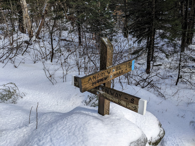
Joining the Monadnock-Sunapee Greenway.

At the junction at the end of the lake I joined the Monadnock-Sunapee Greenway, which I took the rest of the way to the summit. Sadly, it was warm enough up here that the trees were all dripping on me. Despite the nice sun, it felt like I was hiking in a rainstorm. I thought about going to look at the White Ledges viewpoint, but it seemed a bit foggy for a view. Along the ridge there are a few bumps and I made quick time. The trail comes out of the woods at a ski trail. This one was closed, but the next one that I followed to the summit was not. It is not super comfortable walking on a ski trail with lots of skiers.

Summit lodge and tower.

At the summit I looked around briefly before finding an open space without people. It was just past the summit lodge, where the trail from the ski area parking lot comes out of the woods. I set up off to the side. I was wet from sweat and the trees, and got cold quickly. It didn't help that the sun went away as I got to the top. 

I had good service for spotting and texting, and started making contacts. The highlight was a summit to summit with a Spanish station. He was pretty weak, but enough that we were able to complete the QSO. It'll be fun in a few years when that sort of DX is easier.

On Lake Solitude looking up at the ledges.

Sufficiently cold, I packed up and started down. The trail seemed even more slushy than on the way up. This time it was clearer, and I stopped by the ledges viewpoint. It is definitely worth the walk. The hike down was quick, though I re-entered the fog a little below the lake. Back at the car I cranked up the heat and drove over to Bly Hill for a quick activation before going home.


Trailhead: Andrew Brook Trailhead, Between the Mountains Road. There is only parking for about half a dozen cars here, and there are "No Parking" signs along parts of the road.
Website: SOTA Site. Mt Sunapee SP
Maps: AA6XA SOTA Hikes map.
Route: Take the Andrew Brook Trail to Lake Solitude, then the Monadnock-Sunapee Greenway north to the summit.
Red Tape: None.
Video: YouTube coming soon...

Sunday, January 2, 2022

W1/HA-137 Bald Sunapee

 It was the last day of 2021, and time to end the year with a bang. I had a three summit day planned, and first up was Bald Sunapee. This poorly named mountain is just east of Mt Sunapee. Based on some trip reports I found, it appeared the best place to start was west of the mountain on Between the Mountains Road. Google streetview showed some pullouts about a mile past the Andrew Brook Trailhead. However, with the snow I didn't see anywhere good to park. So I just parked at the public trailhead.

The road just looked like this.

From this small parking lot I walked about half a mile down the road. This seemed to be past the houses and directly below the summit. I didn't see any negative signage, so I stepped off the road and started up the hill. 

Foggy woods on the way up.

The climb is rather steep at the start. After about half of the elevation, I crossed a flatter area. There were some tracks in the snow, and since they were going the direction I wanted to, I followed them some. I soon saw they were human footprints. I didn't follow them the whole way, but I did follow generally the same route they did.

Operating at the summit.

The second half of the climb wasn't bad, but the forest seemed thicker higher up. There are some small cliff bands, but I missed them on the way up. If you find them, just go around. The summit seemed brighter, but it had also warmed up enough for the snow and ice to start melting off the trees, so it felt like I was getting rained on. 

I was a bit disappointed that the top was totally covered in trees despite having "Bald" in the name, not that there would have been a view with the fog. There was good cell service on the summit, and I found enough of a clearing to put up my antenna. I was glad to have the tuner for this one, since it was up against a few trees. On the air I quickly made contacts, including some Europeans. I didn't linger, since I needed to be back by four to pick up my dad from work and I knew Sunapee would be a bigger hike.

Happy despite no views.

I took the same route down, more or less. I manage to walk through some cliff bands, but I was able to find routes down or around withouth any climbing. It was fast going down, and the snow wasn't too slick. I came out on the road just past where I went in, and walked back to the car. I took a quick break in the lot before starting up the trail to get Mt Sunapee.


Trailhead: Andrew Brook Trailhead, Between the Mountains Road. This lot only has space for about half a dozen cars, and there were a number of "No Parking" signs around. In the summer you can probably park closer and avoid the road walk. Just watch the signs.
Website: SOTA Site.
Maps: AA6XA SOTA Hikes map.
Route: From the trailhead, walk about half a mile up the road, then go straight up to the summit.
Red Tape: None. I'm not sure who owns the land, but I didn't see any signs.
Video: YouTube

Saturday, January 1, 2022

W1/HA-091 Lovewell Mountain

 Lovewell Mountain is another SOTA peak on the Monadnock-Sunapee Greenway, this one in Washington, NH. There are a number of different approaches to the mountain, but I decided that the one from the south would be the best for me. 

Parking at the end of Washington Drive.

The trailhead I chose was at the very end of Washington Drive, on the east side of Island Pond. There is a big turn around with plenty of space to park. On the lake side is a sign for a private beach, and next to it a jeep trail that goes in to some woods owned by the Society for the Protection of NH Forests, which is open to the public.

Up one of the jeep trails.

Head up this trail, following the stream, until you climb up a short hill and reach another jeep trail. Turn left here and follow it to the next junction. At this well signed junction you join the Monadnock-Sunapee Greenway, which goes over the summit. It also appears that the land ownership changes, and you enter state land.

The greenway is only for hikers.

The route here becomes a single track, and starts climbing. The bottom part was somewhat wet, with lots of icy patches, or open water. Its probably wet and muddy in the summer. After about half of the climb, the terrain flattens out for a bit. The upper climb was not hard, and there is a short spur to a ledge near the summit. There was also a sign for a spring, but I didn't go to look.

Enjoying the only view.

The summit area has a clearing, with a large cairn on one side. It looked like there was a memorial plaque on it, but I couldn't really see through the snow.

Time for some field repairs!

As I was setting up my antenna, the radiating wire broke just past the crimp on connector. Luckily, I had a knife and was able to strip it enough to wrap it around the bolt. With the antenna up, I got on the air and didn't have any further problems. There was good cell service on top, and spotting was easy.

It was a winter wonderland.

Once I started getting chilly, I packed up and retraced my steps back to the car. It was a quick descent, and I was soon back an the road, the car right where I had left it.


Trailhead: End of Washington Drive, east side of Island Pond.
Website: SOTA Site. Google for Monadnock-Sunapee Greenway info.
Maps: AA6XA SOTA Hikes map.
Route: Head up into the forest, then turn left at the next jeep trail. Turn right onto the Monadnock-Sunapee Greenway, and follow it to the summit.
Red Tape: None. Don't park in the private parking lot.
Video: YouTube

Tuesday, December 28, 2021

W1/HA-010 Mt Kearsarge

 The forecast for Christmas eve was looking decent, certainly better than Christmas, so my family decided to go for a hike. Burn off a few of the calories we'd eat the next day, or something like that. We chose to go to Mt Kearsarge, a prominent peak in central NH.

Entrance to the state park.

We hiked in from the north side, which is Winslow State Park. The road to the parking lot is not plowed and gated in the winter, but parking is allowed on the road at the bottom. We parked here, put on our microspikes, and set off up the road.

Heading up the road.

The hike up the road is about a mile to the summer parking lot and trailhead. There were a lot of signs encouraging people to reserve a time, and I can see how the park could get very busy in the summer. We decided to go up the Winslow Trail. I went ahead so I could get set up and operate and not force everyone else to stand around in the cold.

Heading up.

The trail was very icy, and I'm not sure I could have gotten up without the spikes. It must be wet in the summer if there's that much ice. I passed a big group on the way up, with a dog who seemed bored by their slow pace.

A little below the summit.

Near the summit the forest opens up and the trees are all short conifers. The summit has a fire tower and communications tower, and is very open. I looked around and took some pictures, but there was a breeze and it had started snowing lightly, so I turned around to set up in the trees out of the wind.

Excellent views from the summit. In the fall, this must be beautiful.

I set up just above the trail junction below the summit. There was a clearing to the side that I could run my antenna out to and have it out of the way. I started on 20m, hoping to get some good DX, but only got two French stations. However, there was a good size pileup of Americans. Eventually I got cold, but people were still coming back, so I worked them. Before I froze to death, the calls stopped, and I packed up.

Sunny antenna on a gray day.

We took the other trail, the Barlow Trail, back to the parking lot. This trail seemed less steep going down, but still had some icy sections. The road walk back to the gate was much quicker going down. Back at the car we cranked up the heat for the drive back home, happy with our hike.

Trailhead: Winslow State Park. In the winter, park at the gate and walk up.
Website: SOTA Site. Winslow State Park.
Maps: AA6XA SOTA Hikes map.
Route: Take one of the two trails up to the summit.
Red Tape: None. Consider making a reservation in the spring/summer/fall if it is a busy day.
Video: No footage shot.


Sunday, December 26, 2021

W1/HA-212 Dakin Hill

 After activating nearby Osgood Hill, I drove over to the Monadnock-Sunapee Greenway parking lot on NH 9. This is a decent size dirt lot right next to a maintenance station. 

I was the only one on the trail.

Dakin Hill is on the north side of the highway, but luckily there's no need to dodge cars. The stream across the street from the lot flows under the highway in a culvert, and there is a walking path there. It took a minute for me to find the path down, since there were no tracks in the snow.

Walking under the highway.

Once I found the path and made the perilous icy crossing, it was easy to follow the trail. The greenway goes up Nye Road, then follows an old jeep trail from the end of the road. It seems to be on an easement, since both sides were liberally posted by the hunting club who owns the land.

Up the Monadnock-Sunapee Greenway.

I was getting worried as I hiked up that I wouldn't be able to get to the summit since there were so many "Posted" signs. However, they stopped below the summit. At the top of the climb the trail levels out and goes around the summit. I found a good place to step off the trail to bushwhack up to the high point. The forest was fairly open, and I didn't have to weave around too much.

Setup at the summit.

The summit is broad, and I found an open area in the sun to set up. It was pretty warm, which made it more pleasant to operate. I had good cell service on the summit, unlike at the trailhead. The bands were open across the country, and I made plenty of contacts. To get back to the trail, I just followed my footprints down. There were lots of deer tracks on the trail, and only my set of boot prints. This section of the greenway must not be very popular.

Trailhead: Monadnock-Sunapee Greenway parking. Just off Rt 9 on South St, before the maintenance station.
Website: SOTA Site. Monadnock-Sunapee Greenway maps and guides are easy to find online.
Maps: AA6XA SOTA Hikes map.
Route: Cross the highway in the underpass, then follow the white blazes along Nye Road and the jeep trail to the high point. Bushwhack to the summit.
Red Tape: None. Don't trespass.
Video: YouTube

W1/HA-080 Osgood Hill

 I was finally back in New Hampshire for the holidays with family, and one day I had access to the car, so I decided to go do some summits. My plan for the day was Osgood Hill and nearby Dakin Hill. 

Start of the trail. Parking area to the left.

There is a small parking area along Old Stoddard Road. Google marks this point as Kulish Ledges Trail. The road is unpaved, but the sedan made it up. The parking lot was unplowed, and I was a bit worried about getting out if I went in, but it turned out not to be a problem. There's a hornet on a tree marking the parking area and trail.

On the well marked trail.

The trail is flat and easy to follow past a pond to the first junction. I took the left trail here. The first half of the climb is a nice grade, pretty easy walking. The second half is steeper. The trail conditions were good, I didn't need any traction. Near the top of the climb are the Kulish Ledges. There are a few with decent views, and they're the only views on this hike.

Best of the ledge views.

On the summit plateau there is another junction. Follow the sign to the summit. At the summit there is another sign and a bench. The summit area was fairly open, and it was easy to put up and antenna and still sit on the bench.

At the summit!

I set up the radio and got on the air. I had good cell coverage on the summit, and the European stations soon started rolling in. It's always fun getting DX while you're QRP. After about 30 minutes operating I started to get cold, so I packed up and retraced my steps down. The sun had come out, and it was turning into an even nicer day.

Snowy woods.

Back at the car it was no problem getting out and back down to the paved roads, where I drove over to the trailhead for Dakin Hill.

Trailhead: Kulish Ledges Trail, Old Stoddard Road.
Website: SOTA Site.
Maps: AA6XA SOTA Hikes map. Partridge Woods - This site seems out of date, but I can't find any others.
Route: Take the Kulish Ledge Trail to the summit. There are some other trails to make a loop, if desired.
Red Tape: None. Dogs are allowed.
Video: ham_bitious on Youtube

Thursday, September 23, 2021

W1/HA-113 Cannon Mountain

 While visiting my parents, we decided to take the day and go up to Franconia Notch to see the sights. After a pleasant walk around the Flume, we drove to the tram and took it up.

Franconia Ridge.

The plan was to hike down to the ledges for lunch, then back up for the activation before heading down. We decided not to eat at the ledges since it was a bit warm in the sun, but found a shady clearing right off the trail for lunch.
Lunch in the Boreal Forest.

As we were eating, some A-10's flew over us heading south. Military jets are loud, I think most of the fuel goes into creating noise. After lunch we hiked back up to the summit, and climbed up to the observation tower. While we were up there, one of the A-10's flew through the notch below us. Pretty cool.
Operating on the summit.

After enjoying the view, we walked down to a clearing where I set up and made some contacts. Despite spotting myself, I didn't get many contacts. I didn't mind since it was such a nice day and I was having fun. Maybe I should've spotted for WWFF, but I didn't think of it at the time.
Old Man in the Mountain historic site.

Back at the tram building, we took it down. We stopped at the Old Man historic site on the way back home. 

Trailhead: Tramway building at the top.
Website: SOTA Site.
Maps: AA6XA SOTA Hikes map.
Route: Follow one of the trail up to the summit. Also plenty of trails up from the base.
Red Tape: None.

Tuesday, January 7, 2020

W1/HA-196 Gap Mountain

After activating Little Monadnock it was time for the last summit of 2019, Gap Mountain. I had seen a notice that the southern trailhead was closed for logging, so I drove around to the north trailhead, on Bullard Road. There is a good size parking lot on the left just before the road makes a sharp turn right.
Grand Monadnock through the trees.
Gap Mountain is just across a pass from Grand Monadnock, and I had views of it through the trees as I climbed up. The trail was well marked, and there were quite a few people out hiking, despite the Patriots game being on. After a relatively flat approach, the trail climbs up the face of the mountain. It was quite icy in places, and I was glad I had traction with me.
Looking north at Grand Monadnock again.
The route is totally in the forest until you reach the somewhat open area on top of the north peak. This area had the best views. It is well signed, to make it harder to descend the wrong side of the mountain once you're on top. The true summit of the mountain was looming just south.
Gap Mountain summit behind me.
My map showed a trail leading up to the peak, but I couldn't find it. So I decided to bushwhack, starting by heading straight towards the peak. I quickly reached a cliff, and had to walk along the top of it a short distance to find a place I could scramble down. It was not as easy as the open granite on higher mountains. After that it was an easy walk through the open forest. I found some human tracks that seemed to be heading up to the top, and followed them.
Summit cairn.
They led to a large cairn at the summit. I continued just past it to a relatively open area where I found a rock to sit on and put up my antenna. Since it was early afternoon, it was too late to get European stations, but there were plenty of North American chasers. I tried 17m again, and got many more contacts than I was expecting. I had to be back home in time for some dinner plans, so I didn't stay too long on top.
Sign on the way down. Despite what it says, that way is the best route to the summit.
Instead of trying to climb up the cliff on my way back, I headed to the left (west) some when I got to the col between the peaks. This was a much better option. I passed a sign saying the faint path I was on was not the trail to the summit, but the blazed trail doesn't get to the high point and going around the cliff is much safer than up and down it. A short distance past the sign I picked up the Metacomet-Monadnock Trail again, and followed it over the North Peak and back down to the car.
This was the best view at the true summit.
Back at the car I headed home, and made it in plenty of time for dinner.

Trailhead: Bullard Road, on the left just before the road turns right. There is a big sign.
Website: SOTA Site.
Maps: AA6XA SOTA Hikes map.
Route: Take the trail over, staying on the trail (not the road). At the north summit, continue down a short distance, then bushwhack past the "not a trail" sign and up to the summit.
Red Tape: None.

W1/HA-118 Little Monadnock

It was the last day of the year where I had both nice weather and access to a car, so I took advantage of it to get two more peaks. First up was Little Monadnock, the last of the peaks with "Monadnock" in their name. The best trailhead seemed to be Rhododendron State Park, so I drove over. The main parking lot was gated and unplowed, but there was plenty of space to park outside the gate.
One of the rhododendrons in the grove.
The trail passes through part of the grove before a well-signed junction turns off to the summit. The trail was well packed, and I had no trouble following it. The first part of the trail is fairly flat, winding through the woods. It then climbs up to the ridge, where it intersects with the Metacomet-Monadnock Trail. Turn left here, and continue up to the summit.
Well marked summit.
You'll know you're there when you get to the big summit sign. Since I hadn't seen anyone else, I just set up in the clearing, strapping my pole to the sign post. It was still early enough that I got some good EU DX on 20m. It was also much warmer sitting on top, so I spent more time than I had on other activations. I even tried 17m, where I worked some more Europeans.
Mt Monadnock in the distance.
The cell service was good on top. Once I started to get cold, I packed up and headed back down, retracing my steps. I passed a few people heading up, and was soon back at the car. There was plenty of daylight left, so I headed over to Gap Mountain.

Trailhead: Rhododendron State Park
Website: SOTA Site.
Maps: AA6XA SOTA Hikes map.
Route: Take the trail into the grove, then turn right onto the summit trail. Left on the Metacomet-Monadnock Trail once on the ridge.
Red Tape: None.
The woods feel so open in the winter.

Saturday, December 28, 2019

W1/HA-199 Davis Hill

After getting nearby Wantastiquet Mountain I drove a few minutes over to the Kilbun Pond Trailhead in Pisgah State Forest to get Davis Hill. Note that the marker on Google maps is a bit north of where the parking lot is. Once I found the lot, I had to find the trail. I assumed it was the road heading into the woods at the end of the lot, but the Davis Hill Trail is actually closer to the highway.
Trailhead. Parking is just out of sight behind the sign.

 Once I was on the correct trail, it was an easy hike up the hill. The intersections are all well signed, and it appears that the area is open to snowmobiles in the winter. I hiked up to the highest point on the trail, before it starts heading down again. This is past the town border sign.

I came out of the woods here on my way back.

 At the high point, I found a place that didn't look too bad and headed off into the woods. The forest was generally open, but there were some stands of mountain laurel I had to push through. Overall, it was an easy bushwhack up to the summit. There was no obvious highest point, so I walked around a little until I found a good place to put up my antenna.

Bushwhacking through the mountain laurel.

 There was good cell service on top, and I quickly had a pileup. Once I had worked everyone, including a few European stations, I packed up and headed back. I mostly followed my footprints, but lost them. Since I knew where the trail was, I just took a beeline to it, coming out of the woods at the town border sign.

Misty winter forest.

 Back at the car I headed for home. I thought about getting another peak, but it was still threatening rain, and all my jackets were damp, so I decided against it.

Trailhead: Kilburn Trailhead, Pisgah State Forest on NH 63.
Website: SOTA Site.
Maps: AA6XA SOTA Hikes map.
Route: Take the Davis Hill Trail to the high point, then bushwhack to the summit.
Red Tape: None.

W1/HA-146 Wantastiquet Mountain

The forecast was not super great, but I had access to a car and so decided to go out and get some more peaks. This time I would head west to near the Vermont border. First was Wantastiquet Mountain. There appear to be two trailheads. One hikes up from the Connecticut River, and is probably really nice on a clear day.
Trailhead kiosk.
The other route starts in the Madame Sherri Forest on Gulf Road, and this is the one I took. The parking lot was spacious and plowed. It was overcast, and had sprinkled a bit on my drive out, but no precipitation to start. The trail was well worn, and the microspikes were helpful.
On the way.
The junctions were all very well signed, and it was easy to pick the right direction. The trail appeared to be much less used after Indian Pond. Someone had already gone through, so it was easy for me to just follow the footprints. It started to rain, so I stopped to put on my raincoat. I was glad I did, because everything was wet after that short shower.
Icy pine needles.
The summit of the mountain is a fairly broad plateau. There are some small ups and downs on the way over to what my map said is the highest point. I stopped in a large clearing near some towers to set up my antenna. It seemed to be just below the high point. There was good cell service on the summit. It was a short time operating, since I was getting wet in the dripping snow and rain.
The tower on one side of the clearing.
After working the initial pileup I just packed up and went back. It wasn't fun sitting in the cold rain waiting for more people. The descent was quick, following the same trail as the way up. At the car I turned on the heat and headed over to Davis Hill.

Trailhead: Madame Sherri Forest, Gulf Road.
Website: SOTA Site.
Maps: AA6XA SOTA Hikes map.
Route: Follow the trail signs to Indian Pond then to the summit.
Red Tape: None.
On the way up.