Thursday, December 29, 2022

W6/CT-218 Temescal Ridge


 It was a warmer than expected day as I drove up Reseda Blvd. At the end is Topanga State Park, with Temescal Ridge my goal. At the end of the road there is paid parking, but if you're willing to walk a little farther you can park for free below. I was feeling cheap, so I used the free parking, then set off up the hill.

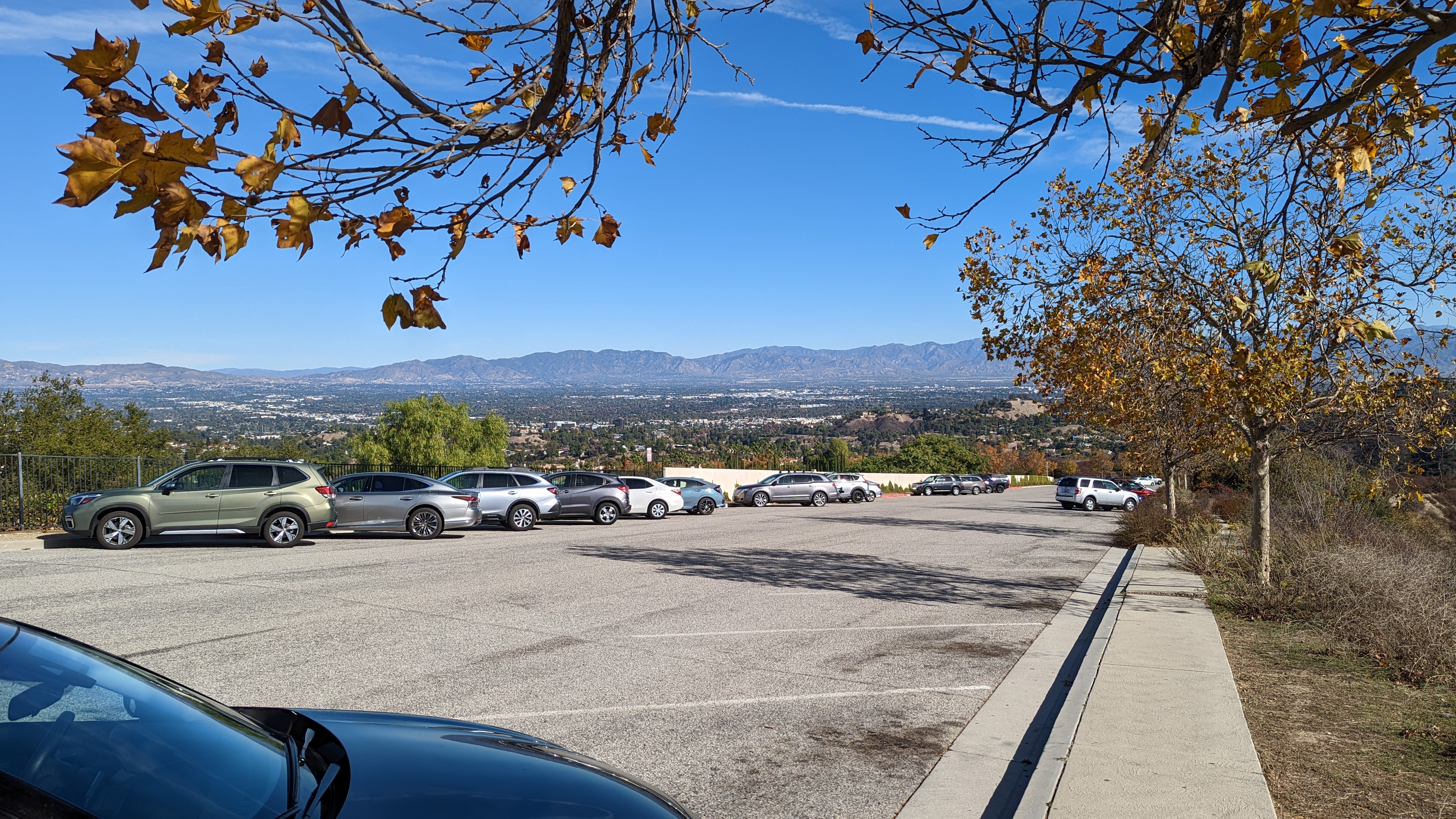
Top of the free parking lot.

There are a lot of trails in the park, so bring a map. I didn't see any paper ones available for taking at any of the kiosks. I took a fire road that seemed to be going in the right direction. It was, but it would've been more direct to take a single track trail at the start.

Looking back at Oat Mountain.

The fire road trail winds its way up nearly to the summit. About 3/4 of a mile before the summit the road reaches a col with a pit toilet and bench. After a quick pit stop I continued up to the top. Just before the summit a trail reaches the road. Take this single track up to the high point.

Pacific Ocean

The very top of the mountain is pretty small, so I went down a few feet to set up near some bushes. I didn't have cell service where I was sitting, but RBNhole spotted me no problem. Once I was done on HF I went to the top for some VHF and made a few more contacts.

Summit just behind my pole and antenna.

I took the same route down, mostly. I did take a little single track that went over one of the bumps. It added some variety, though there were some steep parts. Back at the car I put on some clean clothes before heading to the airport to go home.

Trailhead: End of Reseda Blvd. There is both free and paid parking.
Website: SOTA Site.
Maps: AA6XA SOTA Hikes map.
Route:  Take the fire road to just below the summit, then take the Backbone Trail up to the top.
Red Tape: None. 
Video: ham_bitious YouTube

Friday, December 2, 2022

W6/CT-032 Oat Mountain


 It was a windy day as I arrived at the trailhead in Michael D. Antonovich park. This park is at the end of Brows Canyon Road. The road has a number of "no trespassing" signs along the way, but it seems you are allowed to drive up, since there's the park entrance. I paid my $5 and drove to the upper dirt lot.

Parking area.

The entrance to the lot is a bit rough, but I was able to get in without bottoming out the sedan I had. The path to the top is a paved road. A short distance up it passes the site of a Nike Missile base, back when the missiles were needed to defend against Soviet bombers. There isn't much left but graffiti in the area.

Views of the destination.

The road continues up at a pretty good grade. There are some flatter sections, but the climb is fairly constant. Shortly below the summit there was a signed gate. I didn't want to go through it, so here I turned and went straight up the hill. It was rather steep, but I was quickly at the top.

Summit ahead!

I tagged the summit, then set up a little below it under some trees. It was out of the wind, which was nice. I had almost lost my hat a few times. I didn't have cell service where I was sitting, but I had had it for most of the hike up. I think if I had walked around a bit I would've found somewhere that had service.

Looking over at the Santa Monica Mountains.

I had limited time, so I only did 20m and 40m, with a few calls on 2m at the end. I didn't get a lot of contacts, but there was no problem activating the summit. Once I was done I took the road back down. I didn't feel like going down the steep grass, so I took it from the summit. It probably would've been smarter to go up that way.

Trailhead: End of Browns Canyon Road in Michael D Antonovich Park
Website: SOTA Site.
Maps: AA6XA SOTA Hikes map.
Route:  Follow the paved road to the summit.
Red Tape: None. 
Video: ham_bitious Youtube


Wednesday, November 30, 2022

W6/CT-163 Yerba Buena Ridge


 Yerba Buena Ridge is in Angeles National Forest, on the LA side. The trailhead is pretty easy to get to, on road 3N41 off of Little Tujunga Canyon Road. There is a parking lot with what looked like a toilet, but it was behind a locked gate. So I drove just up the road where there is a large pull out across from the trailhead. 

Trailhead parking was plentiful.

There are a number of switchbacks to climb up the steep part out of the canyon, then the trail starts a constant climb up to the ridge. It was a cool morning, and the hiking was quite pleasant. There seems to be some sort of private ranch below the trail. The Oak Spring Trail eventually reaches what is probably Oak Spring, where it drops a short distance into a forested area before resuming the climb.

Summit views.

Eventually you get to the ridge road, 3N30. There are some metal posts to keep vehicles off the single track trail. Turn left here and follow the road for about two miles up to the high point. There is a small cairn at the high point just off the road. I backtracked a little to a clearing with a covered cistern to set up.

MTR on the summit.

There are some bushes here to stick your pole in, but they're low enough you still have great views over to the rest of the San Gabriel mountains. I had enough cell service to send out some spots, so I sent one for SOTA and POTA. I was hoping I'd get a lot of contacts like on Bare Mountain, but since it was a weekday there just weren't as many chasers out. It was still a good activation.

Once I was done, I retraced my steps back to the car. It was a bit faster going down, as you'd expect. 

Trailhead: Road 3N41, just past the parking lot.
Website: SOTA Site.
Maps: AA6XA SOTA Hikes map.
Route:  Take the Oak Spring Trail up to the ridge road, then turn left and take it to the summit.
Red Tape: None. 
Video: ham_bitious YouTube


Thursday, November 24, 2022

W6/CT-082 Bare Mountain


 This mountain feels like it is deep in the San Gabriel Mountains even though it is fairly close to the desert. The trailhead is along road 5N04.4 south of the summit, near the Pinyon Flats shooting area. The day I went all the gates were open and I was able to drive right to the fire break, where I parked on the side of the road. Note that the dirt road section is somewhat rough, and you may not want to go down it in a regular sedan.

Heading up the fire break.

The fire break that you follow to the summit starts at a culvert. There was lots of evidence of shooting in the area, so be careful if you head there. I had passed one parked car on my drive in, so I wasn't worried. The fire break is generally wide and easy to follow. The climb up to the ridge isn't particularly steep, and I was soon enjoying the views.

Excellent Halloween views.

After you get to the ridge, there is a bit of a drop, then a steep climb up to a sub-peak. It was slow going, with loose sand and no switchbacks. However, like most hikes, if you persevere you'll get to the top. After the sub-peak there is a shallow col then the climb up to the summit. I found the firebreak became indistinct and hard to follow at the sub-peak, but there is not much brush, so it wasn't an issue.

Summit and register.

I found the summit register in a cairn on top. The notebook was wet, so I left it out to dry some while I was activating. It seemed drier when I packed it back up, and I tried to leave the opening at the bottom, so hopefully it won't be so wet for the next person. It was great at the summit, all I needed was a windbreaker while I operated.

Views to the Antelope Valley.

I had good service on top, and was able to spot for SOTA and WWFF/POTA. This resulted in a pretty good size pileup, and I got around 40 contacts total. Once I had worked everyone, I packed up and headed back down. The steep bits were a somewhat treacherous with my road running shoes, but I made it down without falling. Then it was just a long drive all the way back to the Angeles Crest Highway and back down to Palmdale.

Trailhead: Road 5N04.4 at the Pinyon Flats shooting area. The Forest Service map shows a trail here.
Website: SOTA Site.
Maps: AA6XA SOTA Hikes map.
Route:  Follow the fire break trail to the ridge and summit.
Red Tape: None. 
Video: ham_bitious YouTube

Saturday, November 12, 2022

W6/CT-169 Bee Benchmark


 This peak is in the hills near Bouquet Canyon Road. I parked at the Bouquet Crossing trailhead, which has some parking on both sides of the road. I then took forest road 6N19 up the hill.

Parking area.

This road seems fairly well graded, but it would probably be too rough for a regular sedan. If you had a bit more clearance though, you could probably drive up to the ridge without much issue. Since I had a sedan, I walked.

Heading up the road.

Eventually, you'll reach an intersection on the ridge. Turn right here. There are two decent paths, either will work. One sidehills around the little bumps, the other goes over them all. This area seemed to be a favorite place for dirt bikes and ATVs, and I saw some bikers while I was out.

Better views, so I must be getting close.

This road runs along the ridge, but doesn't go over the summit. At some point you'll see a well defined motorcycle trail that runs directly up the hill to the top. This is what you want to take. I thought I might have to bushwhack to it, but there were some easy paths over to it. This track is much steeper than the climb to the ridge, so be prepared. After a left turn, you're almost at the top.

Ready to go!

I signed the register, then set up off the side of the road. The cell service was somewhat marginal, but enough I was able to spot without too much issue. I thought I might get some people on 2m, but I only got one summit to summit contact. Since I had to get back to the airport I didn't linger too long on top. 

I took the same route back down, where I changed and drove the rest of the way through Bouquet Canyon to Santa Clarita and the airport.


Trailhead: Bouquet Crossing, Bouquet Canyon Road.
Website: SOTA Site.
Maps: AA6XA SOTA Hikes map.
Route:  Take road 6N19 to the ridge, then turn right. Follow one of the paths until you see the motorcycle trail to the summit, then follow that.
Red Tape: None. 
Video: ham_bitious YouTube


Monday, October 24, 2022

W6/SC-347


 After activating Ladyface I drove a few miles down the road to the Phantom Trailhead on Mulholland Highway. There is a good size parking area on the opposite side of the road here. I didn't notice the trailhead at first, and parked at the far end of the pullout. There was at least one other trailhead here, so I imagine the area can get busy on nice days. 

Start of the trail.

The trail is obviously well maintained, and the beginning is a few switchbacks to get up to the ridge. There were lots of footprints and bike tracks in the dirt, so it must get a lot of use. Compared to the steep climb up Ladyface I had just done, this trail seemed super easy. 
Flat, brushy area on top.

It is just under a mile to the summit, all easy hiking. On top I found a small clearing in the brush, and decided to sit there. I set up the antenna, sticking the pole in a bush, and was on the air. This summit had great cell service. The highlight of this activation was getting two Japanese stations on 20m. One of them was very weak, but I was able to pull him out enough to complete the contact.
Late afternoon in the Santa Monica Mountains.

It was getting late in the afternoon, and as the sun started to get low, the light became excellent. It was simply beautiful in the mountains. I could've spent hours enjoying the view, but I still had some driving to do, so I packed up and retraced my steps. 
Another view of the mountains.

I didn't pass anyone on this trail, to my surprise. Back at the car I took a few more pictures before heading up to the desert.

Trailhead: Google Maps calls it the Phantom Trailhead, on Mulholland Highway.
Website: SOTA Site.
Maps: AA6XA SOTA Hikes map.
Route:  Follow the trail to the summit. Easy hike.
Red Tape: None. 
Video: hamBitious YouTube

W6/SC-285 Ladyface


 This peak is in the Santa Monica Mountains, just south of Agoura Hills. From 101, go south on Kanan Road to the bend, and park in the pullout. The unsigned trail goes up the hill here.

Parking area.

The trail to the top of Ladyface is steep and sandy. The start is fairly wide, but it quickly becomes single track around the first flat spot. 
Heading up.

As you climb, the views of the area get better. In mid-October, the mountains were simply beautiful in the afternoon. The climb is somewhat spoiled by the road just below the hill and all the loud cars and motorcycles going up and down. 
False summit.

It appears that the summit is a blocky area with a flag, however as you get close it is easy to see that this is not the high point. The trail stays on the south side of the hill to skirt around the cliffs and rocky outcroppings. The trail joins the ridge before it reaches the high point.
Setup on the top.

The actual high point is a bit cramped and rocky, so I went back down the ridge a short way to a flat section with some bushes. This was the perfect spot to put up my antenna, and I was quickly on the air. I had decent cell service on top, so no issues spotting. HF seemed good, with the usual crowd of chasers. 
Since it was already mid-afternoon, I didn't spend to long on top. I took the same route back down. I was surprised to pass some people heading up, I figured the area wouldn't be that popular. At the car I drove over to my next peak of the day, Peak 1470.

Trailhead: Kanan Road, about 1mi south of US101. Pullout is on the inside of the first big curve, before the road starts going uphill.
Website: SOTA Site.
Maps: AA6XA SOTA Hikes map.
Route:  Follow the trail to the summit. Steep and sandy in places, but it does go around all the scary looking rock outcrops
Red Tape: None. 
Video: ham_bitious YouTube

Monday, October 17, 2022

W6/CT-274 Saddle Peak


 After activating Calabasas Peak I headed up to get Saddle Peak. The trailhead for this peak is at the top of Stunt Road. There is a very sharp turn at the end of the road, and to the left is a small parking area and view point. I parked here. The trail goes up between the roads. There is a steep embankment, then it is pretty pleasant.

Looking down at the parking area.

The trail to the summit is mostly the Backbone Trail, a long distance trail that crosses the Santa Monica Mountains. Follow it up to the paved water tank access road, then follow the road uphill past the left side of the tank, where it re-enters the woods. I found the signs in this area confusing and unhelpful.
Water tank with the summit.

There are a few more junctions below the summit, but it was obvious which way to go. I went up to the East Peak, since it looked nicer with fewer towers. There seems to be confusion to which peak is actually higher. Sources differ, but both seem to be in the activation zone.
Saddle Peak West.

I found that I only had cell service on the north side of the peak, so I set up there to make spotting easier. I made a few contacts on HF, then got out the HT. Two meters was hopping, and I made lots there. Even on that peak I put on the BPF, and I'm sure it helped cut down on the interference.
Heading back down.

It was starting to get late, so I packed up and headed back. At the car I braced myself for the long drive in traffic up to the desert. Overall, a great day in a new area!

Trailhead: Calabasas Peak Trailhead, south of the peak on Stunt Road.
Website: SOTA Site.
Maps: AA6XA SOTA Hikes map.
Route:  Follow the backbone trail to the summit.
Red Tape: None. 
Video: hambitious YouTube

W6/CT-214 Calabasas Peak


 Back in Southern California for work, I decided to head to a new mountain range to get some peaks. This time I chose the Santa Monica Mountains, west of Los Angeles. Most of this area is in the Santa Monica Mountains National Recreation Area, and counts for WWFF/POTA as well. My first summit was above the city of Calabasas and appropriately named Calabasas Peak.

Parking area on the side of Stunt Road.

I drove up Mulholland Highway, then turned onto Stunt Road. Google Maps has a point called "Calabasas Peak Trailhead", which is where I parked in a decent size pullout. There were some cars there already, and I passed a number of people on the trail. After crossing the road and going around a gate, the fire road begins a steady climb up to the summit. 
On the way up.

As you climb the views get better. Saddle Peak dominates the view to the south, but in the other directions there are great views of the mountain range. There was one intersection in a small col, but it was obvious which way to go. Around the high point of the road there is a use path that goes up to the high point. I went up to the very top and signed the log, then went down a little to a flat open area just below.
Summit. The log books were all full.

I had decent service on the summit. The trailhead did not have service. With my end fed in the air, I started calling CQ. 17m was open, and I got lots there. I also tried 20m and 40m, and made a few on those bands. I thought about trying VHF, but decided it would be better from the higher Saddle Peak.
Antenna in the brush. Looking north.

Having finished operating, I packed up and retraced my steps back to the car. It was a quick descent, with good footing on the road back down. Back at the car I drove up the hill to the Saddle Peak trailhead.

Trailhead: Calabasas Peak Trailhead, south of the peak on Stunt Road.
Website: SOTA Site.
Maps: AA6XA SOTA Hikes map.
Route: Take the fire road up to the top, then follow the use trail to the high point.
Red Tape: None. 
Video: ham_bitious YouTube

Friday, October 14, 2022

W7O/WV-096 Mt Sylvania


 We were up in Portland for a long weekend, and decided to do some SOTA wile exploring the area. We had a bit of time before lunch, so decided to grab an easy summit. This peak is in a residential neighborhood, with a small park around the high point. We drove up, and parked on the side of the road to the south of the summit. From there it was a quick walk up the path to the park on the summit. 

You could even sit on the bench for the activation!

We assumed that it would be an easy activation, and we were right. We only brought up the HT, and quickly got four contacts each on 2m, in less than 5 minutes. With the activation complete, we unscrewed the antenna, walked back to the car, and drove down to the city for a tasty lunch.

Easy to find people on 2m

Trailhead: Road in the activation zone.
Website: SOTA Site.
Maps: AA6XA SOTA Hikes map.
Route: Drive into the AZ, then walk up the path to the summit top park.
Red Tape: None.
Video: ham_bitious YouTube

Wednesday, October 12, 2022

W6/SS-293


 We had a campsite in Yosemite Valley, so went out for a long weekend of fun. After exploring the valley a bit on Friday, we drove up Tioga road on Saturday. Our goal was an unactivated peak, Peak 9222. KN6REU had never done a first activation, and this seemed like the perfect one for her to get first. 

Nice view of Half Dome on the drive into the valley.

We started from Old Tioga Road, which is just past White Wolf. The road was gated, but there was a large pullout that we parked in. From here we walked up to the top of the hill along the road, the stepped into the woods. 
Marker explaining some history of the area.

The first part of the climb was a bit steep, but we quickly got to the first sub-peak. Here there is a flat section as you walk over to the base of the next climb. It is typical open Sierra forest, with plenty of big rocks scattered around.
Heading through the rocks and forest.

The second climb is a bit longer, but not any harder. The rocks are spaced enough that it was easy to find routes up or around them. As the terrain levels out on the ridge, the forest opens to some large meadows.
Head up the ridge.

There is another peak that is nearly as high as the main peak, but the col is a bit too deep, so it isn't in the activation zone. We crossed it, and continued into the AZ. There isn't much interesting at the summit, just a rock that's a bit higher than the others. Slightly down from there we set up in a clearing. 
The cell service was very marginal. We got a few spots out, but I wouldn't count on it. KN6REU got on the air first with the HT and whip. After a few minutes of calling CQ, there were no answers, so we put up the EDZ. With this in the air, the contacts started rolling in.
Views of the Yosemite wilderness.

AA6XA tried to get some HF contacts, but the FT-817 didn't seem to be putting out any power. This was disappointing, since it meant there would be no CW, and now QRO POTA later, but he was able to get his four contacts on 2m. By this point it was close to lunch time, so we packed up and retraced our steps back to the car.
Back at the car, we continued driving up to Olmstead Point for lunch, then continued to Tenaya Lake to enjoy the beauty. Back in the valley that evening, we walked over for some Curry Village pizza, then back to the site for s'mores, a critical part of every camping trip.
Half Dome from Curry Village.

Trailhead: Old Tioga Road, big pullout before the gate.
Website: SOTA Site.
Maps: AA6XA SOTA Hikes map.
Route: Follow the ridge up to the summit.
Red Tape: None, just regular Yosemite rules.
Video: ham_bitious YouTube

W7O/NC-090


 On our way back from the beach we decided to stop and do an activation. This unnamed summit is a drive up in Tillamook State Forest near US26. From 26, turn north onto McGregor Road. This road is unpaved, but very well maintained. It was surprising how busy it was, so watch out for other vehicles.

Parked on the side of the road.

There are a few intersections to go through, so have a map or GPS to take the correct path. We went right, right, left. The roads get a bit rougher as you get closer to the top, but the rental sedan we were in had no trouble getting up. The high point of the road is in the activation zone. We parked at a wide spot, and set up along the road. AA6XA did HF while KN6REU did 2m. 

There was cell service for spotting, and AA6XA had no problem getting contacts on 20m and 40m. KN6REU on the HT, on the other hand, had a harder time. It took some time calling CQ to get enough contacts, but she did it, and even got a few summit to summit contacts. If we had been up earlier we probably would've had an easier time since there was a summit event going on.

Checking out 10m.

After we had all gotten our contacts, we packed up and drove back the way we came, and went back to Portland. Overall, this was a nice easy summit.
 

Trailhead: Road in the activation zone.
Website: SOTA Site.
Maps: AA6XA SOTA Hikes map.
Route: Drive into the AZ
Red Tape: None.
Video: ham_bitious YouTube

Monday, July 11, 2022

W6/CT-170 Kagel Mountain


 On my way back to the airport I stopped for some SOTA fun. This time Kagel Mountain was the destination. This peak is used as a take off spot for hang gliding and such. There is a road to the summit, but it is gated. The easiest trailhead seems to be at Dillon Divide on Little Tujunga Canyon Road. Across from the gate there was enough space for a few cars to park. The road to the summit was gated.

Gate at the start.

It was pretty warm out, but there was a nice breeze blowing. Luckily, the hike is not very hard. The road is well graded, if exposed. The first part loses a bit of elevation before a steady climb up to the ridge. 
Looking over at Fernando 2 Benchmark.

Up on the ridge I got some great views of the LA area. The ridge is fairly flat, and the activation zone is fairly long. However, it is worth going to the high point. 
Summit of Kagel Mountain.

On the summit there are picnic tables, perfect for operating from. I sat at the wooden one, thinking it might not be as hot after sitting in the sun. There were some bushes conveniently placed to hold up the pole. Since it was Field Day, I only did 17m and 30m. I got a handful of contacts on HF, then decided to see how VHF was.
Paraglider launch point.

This was a good decision. There were a lot of people on 2m and 70cm, and I filled up the log. It was actually easier on 70cm, since the frequency wasn't as jammed with people. After handing out some points, I packed up and headed back down. As I descended, two cars full of people drove up, to take off I assume. Back at the car I opened everything up to try and cool it down before driving to the airport.

Trailhead: Dillon Divide, Little Tujunga Canyon Road
Website: SOTA Site.
Maps: AA6XA SOTA Hikes map.
Route: Walk up the access road to the summit. Enjoy the picnic table for some comfortable operating
Red Tape: None.
Video: ham_bitious YouTube

Wednesday, July 6, 2022

W6/CT-086 Strawberry Peak


 After activating the nearby Peak 4140 I drove up the rest of the hill to get Strawberry Peak. This peak has a paved road to the top with an active fire lookout. The gates were open when I arrived, and I was able to drive to the summit. There is a small parking area on top. 

View from the fire lookout.

There were two volunteers in the fire lookout, and it was open to the public. I walked up and talked to the volunteers for a bit. If there weren't so many cell towers at the same height it would've been a great view. The tower was extremely similar to the one on Los Pinos Mountain down near San Diego. There was a picnic table at the base with space to put up an antenna, so I took advantage of it.
Set up on HF.

I did all three HF bands, and got more contacts than earlier on 4140. There was good cell service. I then went back up to the balcony of the tower to do 2m. I was glad to have the SOTABeams BPF so I wasn't deaf. It turns out one of the volunteers was a ham as well, so we chatted a bit about SOTA. 
Base of the tower, parking lot behind.

I could've stayed and chatted and enjoyed the view, but I still had a long drive to the desert, so reluctantly I packed up and drove down to the joshua trees. 

Trailhead: End of Strawberry Lookout Road.
Website: SOTA Site.
Maps: AA6XA SOTA Hikes map.
Route: Drive to the the summit.
Red Tape: None. I did VHF from the balcony of the tower. 
Video: ham_bitious YouTube