Tuesday, December 28, 2021

W1/HA-010 Mt Kearsarge

 The forecast for Christmas eve was looking decent, certainly better than Christmas, so my family decided to go for a hike. Burn off a few of the calories we'd eat the next day, or something like that. We chose to go to Mt Kearsarge, a prominent peak in central NH.

Entrance to the state park.

We hiked in from the north side, which is Winslow State Park. The road to the parking lot is not plowed and gated in the winter, but parking is allowed on the road at the bottom. We parked here, put on our microspikes, and set off up the road.

Heading up the road.

The hike up the road is about a mile to the summer parking lot and trailhead. There were a lot of signs encouraging people to reserve a time, and I can see how the park could get very busy in the summer. We decided to go up the Winslow Trail. I went ahead so I could get set up and operate and not force everyone else to stand around in the cold.

Heading up.

The trail was very icy, and I'm not sure I could have gotten up without the spikes. It must be wet in the summer if there's that much ice. I passed a big group on the way up, with a dog who seemed bored by their slow pace.

A little below the summit.

Near the summit the forest opens up and the trees are all short conifers. The summit has a fire tower and communications tower, and is very open. I looked around and took some pictures, but there was a breeze and it had started snowing lightly, so I turned around to set up in the trees out of the wind.

Excellent views from the summit. In the fall, this must be beautiful.

I set up just above the trail junction below the summit. There was a clearing to the side that I could run my antenna out to and have it out of the way. I started on 20m, hoping to get some good DX, but only got two French stations. However, there was a good size pileup of Americans. Eventually I got cold, but people were still coming back, so I worked them. Before I froze to death, the calls stopped, and I packed up.

Sunny antenna on a gray day.

We took the other trail, the Barlow Trail, back to the parking lot. This trail seemed less steep going down, but still had some icy sections. The road walk back to the gate was much quicker going down. Back at the car we cranked up the heat for the drive back home, happy with our hike.

Trailhead: Winslow State Park. In the winter, park at the gate and walk up.
Website: SOTA Site. Winslow State Park.
Maps: AA6XA SOTA Hikes map.
Route: Take one of the two trails up to the summit.
Red Tape: None. Consider making a reservation in the spring/summer/fall if it is a busy day.
Video: No footage shot.


Sunday, December 26, 2021

W1/HA-212 Dakin Hill

 After activating nearby Osgood Hill, I drove over to the Monadnock-Sunapee Greenway parking lot on NH 9. This is a decent size dirt lot right next to a maintenance station. 

I was the only one on the trail.

Dakin Hill is on the north side of the highway, but luckily there's no need to dodge cars. The stream across the street from the lot flows under the highway in a culvert, and there is a walking path there. It took a minute for me to find the path down, since there were no tracks in the snow.

Walking under the highway.

Once I found the path and made the perilous icy crossing, it was easy to follow the trail. The greenway goes up Nye Road, then follows an old jeep trail from the end of the road. It seems to be on an easement, since both sides were liberally posted by the hunting club who owns the land.

Up the Monadnock-Sunapee Greenway.

I was getting worried as I hiked up that I wouldn't be able to get to the summit since there were so many "Posted" signs. However, they stopped below the summit. At the top of the climb the trail levels out and goes around the summit. I found a good place to step off the trail to bushwhack up to the high point. The forest was fairly open, and I didn't have to weave around too much.

Setup at the summit.

The summit is broad, and I found an open area in the sun to set up. It was pretty warm, which made it more pleasant to operate. I had good cell service on the summit, unlike at the trailhead. The bands were open across the country, and I made plenty of contacts. To get back to the trail, I just followed my footprints down. There were lots of deer tracks on the trail, and only my set of boot prints. This section of the greenway must not be very popular.

Trailhead: Monadnock-Sunapee Greenway parking. Just off Rt 9 on South St, before the maintenance station.
Website: SOTA Site. Monadnock-Sunapee Greenway maps and guides are easy to find online.
Maps: AA6XA SOTA Hikes map.
Route: Cross the highway in the underpass, then follow the white blazes along Nye Road and the jeep trail to the high point. Bushwhack to the summit.
Red Tape: None. Don't trespass.
Video: YouTube

W1/HA-080 Osgood Hill

 I was finally back in New Hampshire for the holidays with family, and one day I had access to the car, so I decided to go do some summits. My plan for the day was Osgood Hill and nearby Dakin Hill. 

Start of the trail. Parking area to the left.

There is a small parking area along Old Stoddard Road. Google marks this point as Kulish Ledges Trail. The road is unpaved, but the sedan made it up. The parking lot was unplowed, and I was a bit worried about getting out if I went in, but it turned out not to be a problem. There's a hornet on a tree marking the parking area and trail.

On the well marked trail.

The trail is flat and easy to follow past a pond to the first junction. I took the left trail here. The first half of the climb is a nice grade, pretty easy walking. The second half is steeper. The trail conditions were good, I didn't need any traction. Near the top of the climb are the Kulish Ledges. There are a few with decent views, and they're the only views on this hike.

Best of the ledge views.

On the summit plateau there is another junction. Follow the sign to the summit. At the summit there is another sign and a bench. The summit area was fairly open, and it was easy to put up and antenna and still sit on the bench.

At the summit!

I set up the radio and got on the air. I had good cell coverage on the summit, and the European stations soon started rolling in. It's always fun getting DX while you're QRP. After about 30 minutes operating I started to get cold, so I packed up and retraced my steps down. The sun had come out, and it was turning into an even nicer day.

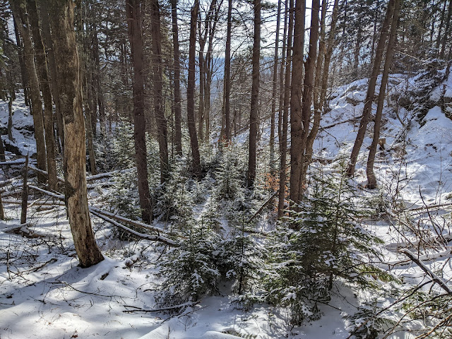
Snowy woods.

Back at the car it was no problem getting out and back down to the paved roads, where I drove over to the trailhead for Dakin Hill.

Trailhead: Kulish Ledges Trail, Old Stoddard Road.
Website: SOTA Site.
Maps: AA6XA SOTA Hikes map. Partridge Woods - This site seems out of date, but I can't find any others.
Route: Take the Kulish Ledge Trail to the summit. There are some other trails to make a loop, if desired.
Red Tape: None. Dogs are allowed.
Video: ham_bitious on Youtube

Wednesday, December 1, 2021

More Ways to Follow Me!

If this blog doesn't have enough ham radio content for you, you can also find me on Instagram. My radio account is @aa6xa.radio. It has more SOTA trip reports, as well as other radio related things I've been doing like building things and operating contests.

Since KN6REU got her license, we've stated another account with both our radio stuff, but mostly SOTA: @ham_bitious. She has mastered the art of the reel, and there are a bunch of fun videos up already, with more to come.

And even better, ham_bitious is on YouTube: youtube.com/@hambitious

So come follow for more radio fun!

Antenna setup at Brushy Peak.