Monday, August 27, 2018

W6/NC-542 Point Reyes

On my way from Point Reyes Hill to Point Reyes, I stopped at KPH, the old ship-to-shore commercial station. They are open Saturday afternoons, and give tours of the station. If you know code, they'll let you operated the ham station, K6KPH.
Running 1.5kW of CW.
I spent a few hours looking around and operating. It is a very neat place, and worth a visit if you are in the area. I'll probably go back at some point.
Cyprus Tunnel leading to the station.
Once I had had my fill of QRO, I walked back down the tunnel to my car, and drove to the end of the road at Point Reyes. There is a small parking lot here. Head up the road towards the lighthouse, then turn off to the left to get to the high point. It was very foggy here. I set up on a knoll a bit below the high point, and got on the air.
A very colorful slope down to the ocean.
SotaWatch had gone down, but there was enough cell service I could get on the Slack group and ask for contacts. Michael, KX6A was quick to respond, and both worked me and posted some alerts on other platforms. I quickly got the four contacts I needed. I then tuned around 20 for a while, and worked a few stations doing state QSO parties.
Looking north up the beach.
I heard some Hawaiian stations on 10, but they couldn't hear me. It was a short walk back to the car, then a long drive home through the North Bay traffic. Overall, a great radio-filled day on Point Reyes.

Trailhead: End of Drake Blvd.
Website: SOTA Site.
Maps: AA6XA SOTA Hikes map.
Route: Walk up the road, then up to the summit..
Red Tape: None.

W6/CC-071 Point Reyes Hill

This was the second summit of the day, right after Mt Wittenberg. The easiest way to the top is to drive up Mt Vision Road. This is a narrow, 1.5 lane road, with some nice views. Near the summit there is a chain across the road, with a very large dirt lot just before it. Park here, then walk up the road.
Looking back at the gate across the road.
The road is paved, and provides access for the FAA facility on top. At the top there is a trail that leaves on the right. I walked a short distance down this trail to find a place to setup. The trail is wide enough I could sit on the side and not block the trail.
The FAA installation, surrounded by fences with very strong warnings.
I did not have service on the top. I was able to send out a few texts, but just barely. Luckily, SotaWatch was still up, and RBNHole was able to spot me. I worked the normal bands, 30-20-40. As I was operating the fog started to lift, and it looked like the sun would come out. It did, briefly.
Squinting in the bright almost-sun.
After I was done, I went back to the car and drove down to KPH, the old ship-to-shore station.

Trailhead: Top of Mt Vision Road
Website: SOTA Site.
Maps: AA6XA SOTA Hikes map.
Route: Walk up the road.
Red Tape: None. Mt Vision road is narrow, be careful!

W6/NC-378 Mt Wittenberg

I had a full day of radio planned, three summits and a visit to KPH. The first stop of the day was Mt Wittenberg, the high point of the area. I started from the Sky Trailhead, near the top of Limantour Road. I chose this trailhead because it was the highest of the obvious routes to the summit.
Parking lot.
There is a reasonably sized dirt lot, and it appears that it is ok to park on the side of the road too. The Sky Trail is a dirt road, and appears to be driven every once in a while. I made good time up the hill, and it seemed like I had the place to myself. At the second junction I turned onto the Horse Trail, which contoured across the hill for half a mile.
Lots of fog.
Here I turned right onto the Z Ranch Trail, which climbed a bit more and traversed to the other side of the summit. At the other end is a big intersection in a field. Make a U-turn and head up the quarter mile spur to the summit. There are no views on top. It took me 45 minutes to get to the summit.
My antenna running across the summit.
I sat on one side of the summit clearing, and ran my antenna across it. If I was more ambitious, I could have gotten it higher using a tree branch. After hooking up my radio, I sent out a spot and started calling on 30 meters. I quickly started filling the log. After I got everyone on 30, I went up to 20, and got a similar number of calls.
Stopping for a selfie on the way up.
I finished up on 60, getting some of the locals. The cell service on top was generally ok, but there were some points where I lost it, or it could only do 3G. It was getting cool, and I had so much more to do, so I packed up and retraced my steps back to the car. As I was coming down the summit spur trail, two runners passed me going up. I said hi and stepped to the side to let them by. A short while later, while I was heading down the Z Ranch Trail, I saw the two runners coming towards me again. The seemed a bit lost, and after talking for a moment they decided they were heading the wrong way, and turned around. I was wondering if I'd see them again. Back at the car I drove down and over to Point Reyes Hill.

The trails were very well marked.


Trailhead: Sky Trailhead, Limantour Road.
Website: SOTA Site.
Maps: AA6XA SOTA Hikes map.
Route: Take the Sky Trail to the Horse Trail. Turn right onto the Z Ranch Trail, then follow the spur up to the summit.
Red Tape: None.

Friday, August 24, 2018

TF/SL-043 Hrafntinnusker

We spent our second night at Landmannalauger Hut, and slept well. In the morning we made our breakfast and got packed up. The sun was shining, though it was a bit breezy, overall good hiking weather. We headed up the Laugavegur Trail, through the lava field and then up past a geothermal vent. After inhaling some sulfur fumes, we continued our climb. The trail was steep in places, but it sees so much traffic it is easy to get up.
The first, and biggest, steam vent.
As we climbed up to the high area, the wind picked up and we had to stop a few times to layer up. The sun was out, so most people didn't mind the cold. As we got closer to the hut, we had to cross a few snowfields. The snow was fairly hard, so it wasn't too bad. At the hut we checked in, and had lunch inside to warm up a bit.
This vent was really belching out the steam.
Hrafntinnusker Peak is very close to the hut, so after we finished eating, I packed up my radios and warm clothes, and headed up to the summit with a few people. The trail leaves from the side of the hut, and is a dirt road for about half the distance up. A well marked trail turns off, and takes you right to the summit. If it's clear, it is obvious which way to go.
One of the snowfields close to the hut.
 It was very windy on top. I used the large cairn at the summit to hold up my pole, and set the antenna so it was with the wind. I found the least windy spot I could, and sat down. After a few CQs I got three contacts, and a few minutes of calling later, I got a fourth. I stayed on the air for a few more minutes, but I saw some nasty looking clouds getting closer, and decided to go back down to shelter. The people who had come up with me had left earlier, not wanting to wait in the cold. I don't blame them, it was chilly.
(Apparently no one took pictures of the summit of Hrafntinnusker, or the hut, or I'd add some)
Back at the hut I took it easy the rest of the afternoon, playing bananagrams with people. There are other summits nearby, but we had a few more days of hiking to do and I didn't want to wear out my legs too early.

Trailhead: Hrafntinnusker Hut.
Website: SOTA Site.
Maps: AA6XA/P SOTA Hikes map.
Route: From the hut, walk up the road and trail to the summit. Only about a kilometer hike up.
Red Tape: None that I know of.

Wednesday, August 22, 2018

TF/SL-079 Blahnukur

This was the second peak I did, after Haalda in the morning. I ate lunch with my family at the Landmannalauger Hut, then set out. Since they had climbed the peak earlier, I knew where to look for the bridge across the river. After crossing it, the next challenge was to find the trail up to the summit. A few minutes of looking, and the trail presented itself. The trail climbs up at a healthy grade, but not so steep to be unpleasant.
Looking down into Green Canyon.
There is a small false summit, then a final climb up to the top. The summit area is rather narrow, with steep scree slopes on either side. There was a group on the summit when I arrived, so I continued past the summit a few meters to a flat area just below the summit. There was enough space on the side of the trail here to set up off the trail and still be in the activation zone. I had to make a small pile of rocks to support my pole, but was on the air quickly.
After a few CQs on 20 I had a smaller pileup than earlier, but had no trouble working plenty of stations. I tried calling on 30, but didn't get any takers. Tuning around on 40 I heard a bunch of stations, and tried calling, but they couldn't hear me.
Haalda on the right, in the clouds.
I had to get back down in time for dinner, but I could have spent much longer on the peak. It was beautiful on the summit, with great views all around. To get down I continued around on the trail, heading down the backside of the peak. At the very bottom, just before the river, there was a short section that was very steep and eroded. It looked like most people were having trouble, but I trusted my boots and just went down. There was no good place to cross the river, but I eventually found somewhere where I crossed, only getting my toes wet.
The trail then crossed the edge of the lava field, then dropped back down to the camping area and hut. I made it back with plenty of time to spare before dinner, which I enjoyed on the porch with my family. The next day we planned to start hiking the Laugavegur trail, to Hrafntinussker Hut.

Trailhead: Landmannalauger Hut. Very rough road into the hut - take the bus or have a high clearance, 4wd car.
Website: SOTA Site.
Maps: AA6XA/P SOTA Hikes map.
Route: From the hut, walk past the campsite and the horse corrals, then head up the ridge to the summit. Trail is well worn and easy to follow.
Red Tape: None that I know of.

TF/SL-046 Haalda


Looking over the camping area from the hut. The building with the red flag is for the SAR team. The green buses had a small store inside.
The plan was for my family and I to hike the Laugavegur trail, but we had scheduled a zero day at the start to adjust to the new time zone. After spending the night in the Landmannalauger Hut we had a lazy breakfast, then split up to hike the peaks we wanted to. Haalda had never been activated before, and as far as I could tell from the maps, was not insanely difficult.
Haalda is the only peak still in the clouds. The trail up the spur is visible on the right.
From the hut I followed the Landmannalauger Trail for a kilometer or two through the lava field. It was still early enough that there weren't too many people on the trail. At the junction I turned right and took the trail that runs along the edge of the meadow. The trail ends at a stream crossing, and I had to pick my way across the rest, aiming for a spur that I could see had a trail running up it. I was able to get to the bottom of the spur without getting my boots wet, a big plus.
The climb up the spur wasn't as hard as I feared, and on top I found a well-trod trail. There were some signed trail junctions that made the navigation easy to the base of the final climb. There were a few steep switchbacks that climbed up the face of the mountain to the ridge. They were much steeper than the ones I am used to climbing out west, obviously graded for humans and not pack animals. There were a few more steep sections as I climbed the ridge and entered the clouds.
One view of the lava field, from the next morning.
I continued hiking until I reached a large cairn. I assumed that this was the summit, and in the glimpses I got through the fog I was able to confirm my assumption. I used the cairn to hold up my pole, and got set up. I had been concerned my QRP signal would have a hard time reaching chasers, but after a few CQs I soon had a large, unruly pileup. After I had worked all the chasers I could hear, a Swiss station started calling over me. I was starting to get cold, so I packed up rather than fight with him.
I retraced my steps to get down, passing a dozen or so hikers working their way up to the summit. I was surprised to see so many people, I had assumed it was not a popular summit. Back in the meadow I got across with dry feet again, then fought my way through the lava field crowds to get back to the hut. As I was eating a snack and deciding what to do next, my family walked in having finished their hike over Blahnukur, where I decided to go in the afternoon.

Trailhead: Landmannalauger Hut. Very rough road into the hut - take the bus or have a high clearance, 4wd car.
Website: SOTA Site.
Maps: AA6XA/P SOTA Hikes map.
Route: Take the Laugavegur Trail to the first junction. Go right across the meadow to the spur with the trail running up it. Follow the trails and signs up to the summit.
Red Tape: None that I know of.

Tuesday, August 7, 2018

W6/NS-306 Lowell Hill Ridge

This peak is an easy drive up. From CA 20 Turn onto Last Chance Mine Road, FS 20-16, and head up the hill. The dirt road is rough, but my little car was able to make it. There were a few sandy sections that had me worried, but I was able to get through them.
The walking part.
Just outside the activation zone the road veers left, and a rougher road continues straight. I had had enough driving, so I parked and proceeded on foot. If you had high clearance you could drive to the top. The summit area is very flat, and I tagged the summit then returned to nearer the car where I had seen some good places to set up. In a large pullout next to the road I strung up my EFHW.
On the air.
There is no view, so I enjoyed the solitude of the woods as I operated. HF got many of the usual chasers. I called on VHF but didn't get any response. It had been a long day, and I was getting tired, so I packed up and headed back to the car for the long drive home.


Trailhead: Last Chance Mine Road.
Website: SOTA Site.
Maps: AA6XA SOTA Hikes map.
Route: Drive into the AZ. Set up.
Red Tape: None.
Off trail, somewhere near the summit.

W6/NS-181 Donner Ridge

Donner Ridge is an easy peak on the outskirts of Truckee, just north of the highway. The best trailhead is the Glacier Peak TH. The lot was full when I arrived in the early afternoon, but there were still a few open spots.
Starting up the trail.
The trail is a fire road which appears to be used as a cross-country ski trail in the winter. It was wide and easy. Stay on the main trail until it turns to the left and starts going downhill. There is a less worn trail that leaves straight ahead. This goes up to the summit.
A young deer at the summit.
To get to the highest point, push through the brush to the clear area. The trail goes through the activation zone. At the top I looked around for a good place to set up, and found one with good views. It was still quite breezy, but the tree I strapped my pole to held up well.
Great views from the summit.
I worked the usual bands, but 20 was really noisy and I gave up on it after a few contacts. Other than that it was a great activation on a beautiful afternoon.

Clouds on the way back to the car.

Trailhead: Glacier Peak.
Website: SOTA Site.
Maps: AA6XA SOTA Hikes map.
Route: Go up the road. Where the trail turns left and down, go straight onto the new trail. Goes to the summit.
Red Tape: None. Might need a pass in the winter.
Set up on the summit.

Monday, August 6, 2018

W6/NS-076 Thimble Peak

This was the third peak Jamie, N6JFD, and I had done, after Round Top and Peak 9795. From the summit of Melissa Coray Peak, we descended to the col with Covered Wagon Peak. There was a marker here noting that this was the highest point of any of the pioneer wagon routes across the Sierra.
Historical Marker.
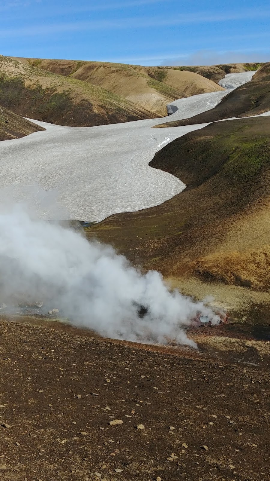
The next section was one of the hardest of the day. We followed a trail around the north side of Covered Wagon Peak, but the trail dropped down to Kirkwood. So instead we contoured across a steep scree/talus slope. With my hiking poles I made good time, but Jamie was slower, only having two feet. In the col we stopped for a breather, and noticed that it was getting much smokier.
Covered Wagon Peak, flanked by 9795 on the left and Melissa Cora on the right.
The slope up to the summit got steeper as we approached the top of the lift. Past the Ski Patrol hut it got even steeper, becoming class 2-3. There were some faint use trails, and in the end it wasn't as bad as I feared it might be.
Almost to the top. The summit is to the right of the cliff.
There was plenty of space in the activation zone to set up in, and we were able to get enough separation we could both do HF. I setup past the summit, using some krummholz to hold up my pole. Even better, there was a perfect rock for sitting nearby.
First view of Silver Lake as the smoke began to clear. Thunder Mountain on the right.
I started on 40, but only managed two contacts. After switching to 30 I got three more. The 222+ contest was still going on, but I only managed two more contacts with the same station as on 9795. After we had worked everyone, the smoke had cleared and we packed up. I scrambled up to the summit while Jamie finished. As we were leaving the summit, I turned around and saw the smoke from a new fire near Sonora Pass.
Lots of new smoke.
We then descended across the back of the ridge towards Thunder Mountain. After passing the second ski lift, we found the trail marked on the map and took it up towards the summit.
Looking back at Thimble Mountain.
Mokelumne Peak was very distinct in the distance.
I had wanted to tag the summit since it is the Amador County high point. We found a very distinct use trail and took it up to the top. There was no register, but we took some pictures and enjoyed being the highest people in the county.
The ridge we took down.
The sun was starting to set, so we hoofed it down. There was a bit of an uphill over a ridge, then the long descent to Carson Spur.
Kirkwood Lake hidden in the forest.
We stopped occasionally to take in the view, but didn't linger anywhere. The whole area is beautiful, and one could spend all day hiking one of these peaks.

Trailhead: Carson Pass
Website: SOTA Site.
Maps: AA6XA SOTA Hikes map.
Route: Take the PCT and other trails towards Round Top Lake. Continue around to the col with Fourth of July Peak. Climb over the peak, then up to the summit of 9795. Cross over to Melissa Coray Peak, then down and around Covered Wagon Peak. Up the ridge to the summit. A shorter route starts at Carson Spur.
Red Tape: None.
On the way up Thunder Peak is a cave in the rock.

W6/NS-378

This unnamed peak is northeast of Melissa Coray Peak, and just a little higher, making it the SOTA summit. Jamie, N6JFD, and I came here after climbing Round Top. From Round Top Lake, we took the trail around the Sisters to the col with Fourth of July Peak.
Taking a breather on the way up Fourth of July Peak, with Round Top and the Sisters watching.
Here we stepped off the trail, and quickly found a use trail that we took to the summit. We thought we might be able to contour around the summit, but the routes looked steep and difficult. So we just went over. On the summit we didn't find a register, so we dropped down to the next col. It was easy to see some routes up the side of the mountain to the ridge, then the summit.
Last push up to the ridge.
As we were heading up the face, we heard Rex, KE6MT, say that he was on his summit, Little Round Top across the valley. We let him know that we were almost at our summit, and pushed up to the top. After scrambling up to the high point, I found a comfortable area to sit, and got set up for HF. Jamie decided to do a VHF only activation.
What a great place to sit and play radio.
 I did not have any cell service where I was sitting, but RBN spotted me. The bands didn't seem to be in great shape, but I managed enough contacts on HF. I then got a summit-to-summit with Rex just before he hiked down. The 222+ contest was also going on, but I only got one contact on 222 and 446, with the same station.
The Nipple, with Jeff Davis just to the left.
As we were on the summit, it started to get smoky, but not as bad as it was the day before on Markleeville. We still had quite a bit of ridge to traverse, so we didn't linger. After packing up we crossed the shallow col to the summit of Melissa Coray Peak, where there is a marker and a weather station. The last peak of the day was Thimble Peak, a short distance away.

Thimble Peak, peak number 3.
Trailhead: Carson Pass
Website: SOTA Site.
Maps: AA6XA SOTA Hikes map.
Route: Take the PCT and other trails towards Round Top Lake. Continue around to the col with Fourth of July Peak. Climb over the peak, then up to the summit of 9795.
Red Tape: None.
Marker at the Summit of Melissa Coray Peak.

W6/NS-055 Round Top

Round Top was the first of three peaks I did on the Caples Lake Traverse with Jamie, N6JFD. After dropping off a car at the Thunder Mountain Trailhead at Carson Spur, we drove back up to Carson Pass. A few minutes after 7 we started down the PCT towards Winnemucca Lake.
Round Top, peeking through the trees.
The trail is easy and well traveled, and we made good time to Frog Lake. There was a thermal inversion which was holding the smoke in the valleys, so the views got clearer the higher we got.
Jamie pointing out all the peaks.
Another mile down the trail and we got to Winnemucca Lake. This area looks like it would be really nice to spend the night in. We paused for a few photos, then continued up to Round Top Lake.
Winnemucca Lake with Elephants Back on the left.
Just before we got to Round Top Lake we stepped off the trail and started ascending a ridge, up towards the peak. After climbing around some small trees, we found the use trail that leads to the summit. Looking back, we realized that if we had continued a few more yards down the trail we could have taken the use trail all the way up.
Getting closer.
The use trail took us up past a snowfield, then started going up some switchbacks to the steep part. The last few hundred feet are a class 2-3 scramble. It was very windy on top, so we took photos then found sheltered spots to set up.
Summit of Round Top.
We were able to set up far enough apart that we could both work HF at the same time. I started on 40, and quickly filled the log. I then called on 70, and got a contact. Jamie, in the meantime, had been on 2 meters, and handed off a contact to me. As I was trying to pack up, people kept calling me on 2.
Looking down at Caples Lake.
Eventually the callers stopped, and I was able to finish taking everything down. It was windy enough that I kept my raincoat on until we reached the lake at the bottom again.

One of the streams flowing into Round Top Lake.
Back at the lake we took the trail around towards Peak 9795, our next destination.


Trailhead: Carson Pass
Website: SOTA Site.
Maps: AA6XA SOTA Hikes map.
Route: Take the PCT and other trails towards Round Top Lake. There is a well-worn use trail that leads up to the summit. Class 2-3.
Red Tape: None. Camping in this area requires a special permit.
The Sisters.