Thursday, July 13, 2023

W7I/BC-079 Boise Peak

 Every resident of Boise has looked up at this peak at some point and wondered what the summit was like. Or at least I assume they all have, since its what I'd do. Since I had a nice rental SUV, I decided to find out. One can drive pretty close to the top if one has some clearance. The road up the hill is a continuation of 8th Street. It is paved until around the Hulls Gulch parking area, and in good shape some distance past there. As you drive up, however, the road gets rougher. I doubt a regular sedan could get very high.

View down to Boise

Around the elevation where the forest begins there is a road junction. I parked here since I wanted to get some walking in, but if you drove this far you could easily keep going. Go left at the junction, and continue up the hill. The road goes past some private homes. They don't seem very friendly.
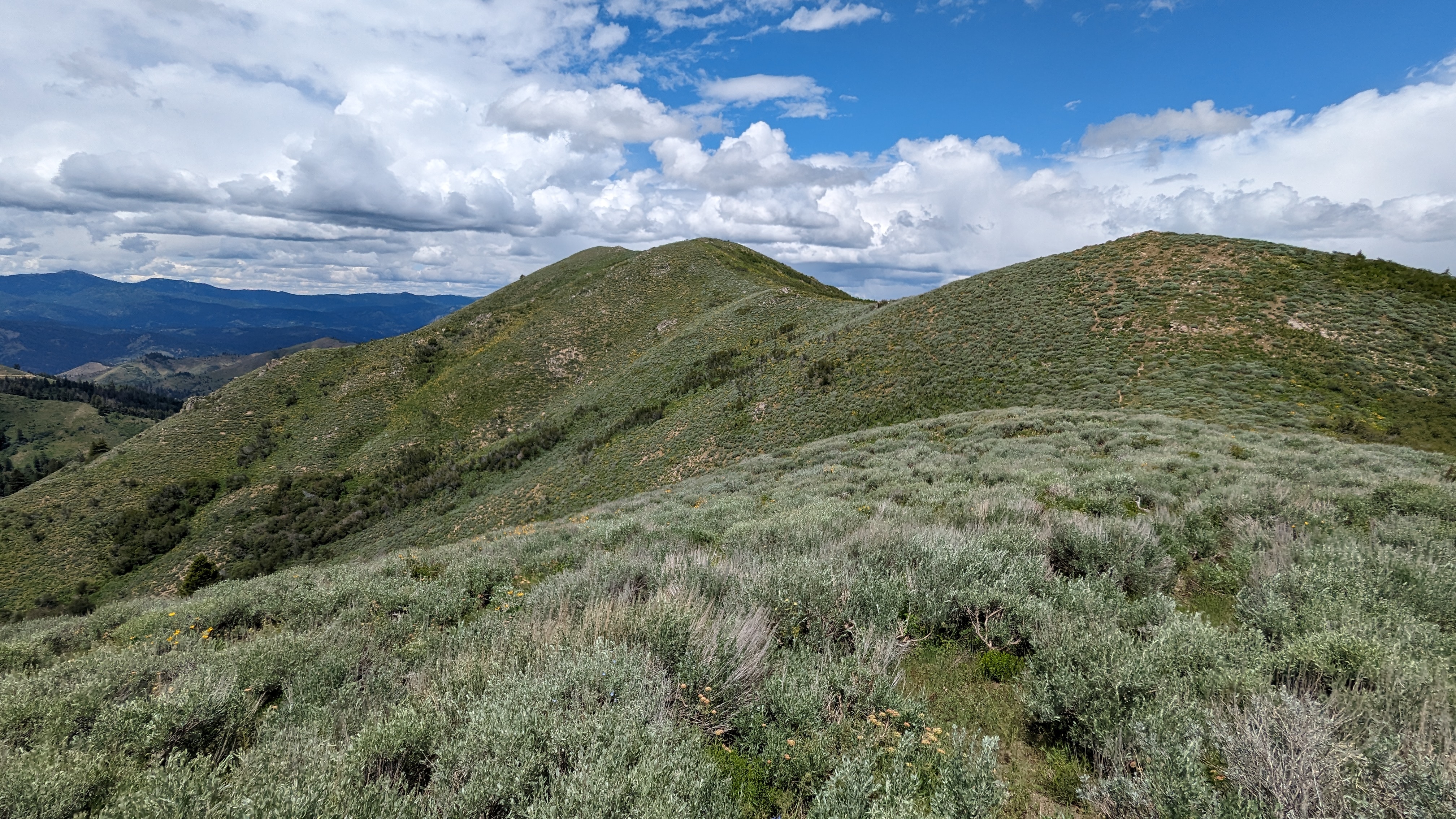
Looking over at Shafer Butte.

Below (southwest of) the summit the road turns to the right and starts to go around the peak. I took the left fork here, then decided to follow what seemed like a trail straight up the ridge. This was a mistake. The trail started off well, going around a pit to keep the vehicles out then up to a small outcropping. On the other side, however, was very dense forest. I pushed through, and eventually got to the open forest around the summit. It wasn't very fun, and I would not recommend this route. 
Setup on the summit.

I found a nice spot at the high point in the shade to sit, and put up the antenna. There was ok service (Verizon) on top, plenty to put out some spots. Since I wasn't in a rush, I did all the bands I had. 17m was good, but the DX was all on 20m. After the pileup and Europeans, 30m and 40m seemed a bit boring.
On the way up I had seen a road a little ways below the summit, and I decided that it would be a better route down. This road is not in the activation zone. It was, except I wasn't paying attention, tripped, and got some nice cuts on my hand and legs. Back on the road I followed it around and back to the main road. This one near the summit doesn't appear on any maps. 
Nice forest on the summit.

On the main road I headed back to the car, then had the long drive back to the pavement. There were a bunch of motorcycles and dirt bikes heading up. It seems like a popular area for OHV riding. It was nice to get off the washboarded and potholed road and on the pavement. 

Trailhead: Forest Road 231 or 263, as far as you can or want to drive.
Website: SOTA Site.
Route: Walk up the road to near the summit, then bushwhack. See map above.
Red Tape: None.  
Video: Coming Soon!

Wednesday, July 12, 2023

W7I/BC-083 Hoodoo Peak

 After activating Thorn Creek Butte, I headed over to Rabbit Creek Summit. This involved driving on some pretty narrow dirt roads. I was a bit apprehensive about the drive, but it turns out the roads were in decent condition. I mostly took roads 333 to 315. The SUV I had didn't have problems, but I wouldn't have wanted to be in a sedan or other low clearance car.

Nice views on the hike.

There was plenty of parking space at the col; there was even a family camping there. On the inside of the road bend a trail climbs up the steep embankment then heads up the ridge. This is obviously frequently used by motorcycles, but I didn't see any other people when I was out. It was a pleasant walk along the ridge, mostly in the shady forest. 
There are a few false summits you have to go around before you get to the high point. I was faked out by the first one and went a little out of my way. There is not much remarkable about this summit.
Looking back at Thorn Creek Butte.

I set up and got on the air. There was cell service. The bands were not in good shape, and I struggled to get my four contacts. Luckily I got five, then packed up. I feared the drive back to ID21 would be a long struggle like the drive up to Thorn Creek Butte, and it was getting to be dinner time. I was wrong. Road 327 was a joy to drive, smooth and wide. Soon I was back at the pavement for the drive back to Boise.

Trailhead: Rabbit Creek Summit, FS road 327
Website: SOTA Site.
Route: Take the bike trail along the ridge to the summit.
Red Tape: None.  
Video: Coming Soon!

Friday, July 7, 2023

W7I/BC-066 Thorn Creek Butte

 This peak has great views, but is not easy to get to. Just north of Idaho City, forest road 304 heads into the woods. Based on the map I had, I assumed it would be dirt but not too bad, passable in a sedan. This was a bad assumption. The first part wasn't so bad, but I was glad the rental company had given me an SUV with a bit of clearance. Four wheel drive wasn't necessary.

There were views near the summit.

The road was rough. I was glad to be going 10MPH on a lot of it. Eventually 304 winds its way up to the Bald Mountain campground. I was done with driving, so I just parked and walked the rest of the way. I definitely could have driven farther up. The mile or so up to the summit was pretty easy, just following the access road. Just keep an eye out for all the OHV users. Some of them seem a bit crazy.
Summit outhouse. Nice views.

There is a fire lookout on top. It was staffed, but the gate was closed and there were a bunch of signs warning you not to go up. This was surprising, usually people in fire lookouts are happy to see other humans; I think they get a bit lonely. But their coldness didn't stop me from enjoying the view and setting up. There was a bit of cell service, so I was able to put up some spots. I was also glad the temperatures were in the mid-70's, compared to ~100 in Boise. A good day to be in the mountains.
A rather faded sign letting you know you're at the summit.

Sadly, there was quite a bit of RF noise, and conditions weren't that great. I made a handful of contacts, but wish there had been more people out so I could've sat and enjoyed the view a while longer. The hike back to the car was quick, and I then navigated some more rough roads to get over to Rabbit Creek Summit for another peak

Trailhead: Bald Mountain Campground, or drive all the way to the summit.
Website: SOTA Site.
Route: Walk up the road to the top.
Red Tape: None.  
Video: Coming Soon!

Thursday, July 6, 2023

W7I/BC-082 Mt Heinen

 I arrived in Boise and immediately headed for the hills. It was a cool day, perfect for a longer hike. I headed north up ID 21 to Lucky Peak Reservoir, then started driving around the north shore. Near the end of the lake the pavement ends. Since the rental company had given me an SUV I wasn't worried, but it turns out the road was very well maintained and any sedan could've made it to the trailhead. On the dirt I drove up past the Arrowrock Dam and continued along the shoreline. The trailhead for Mt Heinen is at a small campground, Irish Point, quite a ways around; at least an hour drive from the airport.

Starting up the trail.

The trail is unmarked but easy to follow. There is a short flat section, then the uphill begins. The trail gains the first 1000 feet in about 0.75 miles. It is steep. So, so steep. But, you do start to get views pretty quickly. Some sections of the steep were quite sandy. I could tell it would be a chore coming down them.
Looking back at the reservoir and campground.

Thankfully, it was a cool day, and the sun was in and out of the clouds. This is not a peak you'd want to do on a hot day. On the first flat section on the ridge there are some trees. Eventually the climbing slows down, and you start traversing the ridge. There is still a fair bit of vertical, but it is a reasonable grade. 
Looking at the summit. Almost there!

I made it to the summit eventually. The benchmark was easy to find, and there was a register at the small summit cairn. There are a few bushes on the ridge, so it was easy to get my antenna up. I had ok cell service, enough to get out some spots. The bands, however, were dead. There was no one on 20m, and I barely got my four on 40m. I was a bit worried I had hiked all that way for zero points, but luckily there were a few chasers who were able to pull me out.
Set up on the summit.

There were rainstorms in the mountains in the distance, and I was really hoping they wouldn't come to me. I lucked out, and had a dry hike and activation. Since the hike up had taken me longer than I expected, I didn't linger too long on the summit. The hike back was long and steep.
Still a long way down to go.

The ridge traverse was pleasant, but the last two miles were just torture. Too steep to be pleasant or easy. But I made it down without slipping or my legs turning to jelly. The drive back seemed shorter, but it still wasn't quick. Back in Boise, dinner never tasted so good.

Trailhead: Google calls this the Mt Heinen Trailhead at Irish Point Campground
Website: SOTA Site.
Route: Follow the trail up to the summit. The trail isn't shown on any map I've seen, but it is definitely there.
Red Tape: None.  
Video: Coming Soon!