I climbed this peak a few years ago, but since I have a park pass, I decided to come back and try a different route. This time I would start on the east side of the park, at the Old Pinnacles Trailhead. When I got to the end of the road just before 8, there was still plenty of parking. The plan was to take the North Wilderness Trail to a canyon at the base of the peak, then follow a fence line up to the ridge, then the ridge around to the summit.
 |
| One of the easy stream crossings. |
The first mile or so of the hike is pretty pleasant along heavily used trails and with bridges across Chalone Creek. The junction with the North Wilderness Trail is signed, and the first few yards were nice. After this point I didn't see any other people until I got back.
Then the creek crossings started.
The first one wasn't bad. After hiking through some overgrown sections I reached the second. This one was a real pain to get across with mostly dry feet. The rest of the million crossings were varying degrees of bad. I really wished I had brought my poles, they would have helped a lot on some of the crossings. There were a fair number of blowdowns to go over, under, or around as well. The trail could use a maintenance crew coming by.
Overall, the North Wilderness Trail is not a good one to do after a wet winter. It's probably a really nice hike in the fall, before the rain comes. Or during a dry winter. At the northern part of the trail there is a canyon with a small stream that comes in from the north, on the other side of the creek from the trail. I found a down tree to cross Chalone Creek, then followed this canyon up to the fence line.
As you're following the small stream, stay to the left so you don't follow an even smaller tributary stream. I made the mistake of following the smaller stream, and had to do some extra bushwhacking. At the fence line, turn right and follow it up to the ridge. This was a pretty easy climb, the brush is clear from the fence. Cross the fence on the ridge, and start the ridge walk.
I had been expecting a pleasant ridge walk on fire breaks and jeep trails, and I was disappointed. There are some sections that are very overgrown and require pushing brush out of the way. It did seem like the brush was slightly less dense in places, so maybe there were breaks in it before that have become overgrown.
On the summit I used an old fence to hold up my antenna. I had LTE service on top. Most of the peaks in the park seem to have service but none of the canyons. It had been overcast all day, and I could see some rain in the distance. As I was operating, it started to sprinkle. I stood up to see if there was more rain coming, and it certainly appeared so, so I packed up.
Not too long after I left the summit the rain stopped. I retraced my steps back along the ridge to the fence, and down to the canyon. This time, though, I took the fence line to the main stream. This was a good decision, since the brush was much much less dense here. Back on the trail, it was a long slog with all the stream crossings back to the car. I was, however, able to avoid some of the nearby crossings by simply not crossing. Sadly, the map I had didn't have the accuracy for me to tell on the way in which crossings were superfluous.
 |
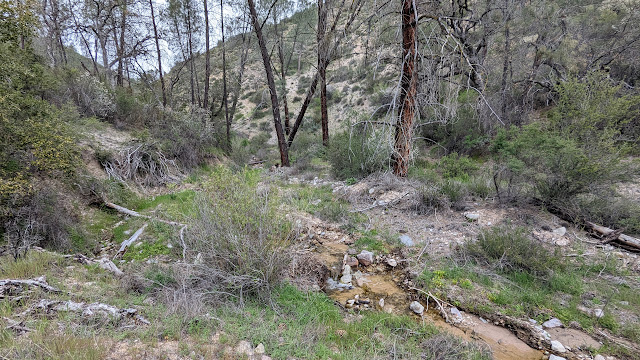
| The small tributary creek I followed up the canyon. |
The first one wasn't bad. After hiking through some overgrown sections I reached the second. This one was a real pain to get across with mostly dry feet. The rest of the million crossings were varying degrees of bad. I really wished I had brought my poles, they would have helped a lot on some of the crossings. There were a fair number of blowdowns to go over, under, or around as well. The trail could use a maintenance crew coming by.
 |
| Fence line at the steam bed. |
Overall, the North Wilderness Trail is not a good one to do after a wet winter. It's probably a really nice hike in the fall, before the rain comes. Or during a dry winter. At the northern part of the trail there is a canyon with a small stream that comes in from the north, on the other side of the creek from the trail. I found a down tree to cross Chalone Creek, then followed this canyon up to the fence line.
 |
| Made it to the ridge! North Chalone is the pointy one in the distance. |
As you're following the small stream, stay to the left so you don't follow an even smaller tributary stream. I made the mistake of following the smaller stream, and had to do some extra bushwhacking. At the fence line, turn right and follow it up to the ridge. This was a pretty easy climb, the brush is clear from the fence. Cross the fence on the ridge, and start the ridge walk.
 |
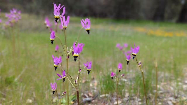
| Shooting Star flowers in a meadow. |
I had been expecting a pleasant ridge walk on fire breaks and jeep trails, and I was disappointed. There are some sections that are very overgrown and require pushing brush out of the way. It did seem like the brush was slightly less dense in places, so maybe there were breaks in it before that have become overgrown.
 |
| Poppy season. |
On the summit I used an old fence to hold up my antenna. I had LTE service on top. Most of the peaks in the park seem to have service but none of the canyons. It had been overcast all day, and I could see some rain in the distance. As I was operating, it started to sprinkle. I stood up to see if there was more rain coming, and it certainly appeared so, so I packed up.
 |
| Lupine flowers near the trailhead. |
Not too long after I left the summit the rain stopped. I retraced my steps back along the ridge to the fence, and down to the canyon. This time, though, I took the fence line to the main stream. This was a good decision, since the brush was much much less dense here. Back on the trail, it was a long slog with all the stream crossings back to the car. I was, however, able to avoid some of the nearby crossings by simply not crossing. Sadly, the map I had didn't have the accuracy for me to tell on the way in which crossings were superfluous.
Was this better than the other route I took? I'm not sure. It was certainly longer and the creek crossings were annoying, but not having to climb out of the Chalone Creek bed on the way out was nice. And the crossings wouldn't have been a problem if I had gone later in the season.
Trailhead: Old Pinnacles Trailhead.
Website: SOTA Site.
Maps: AA6XA SOTA Hikes map.
Route: Take the North Wilderness Trail to the canyon coming from the north near the summit. Follow the canyon to the fence, then the fence to the ridge. Traverse the ridge around to the summit.
Red Tape: None. Standard national park rules.
Video: Coming Soon!
No comments:
Post a Comment