I arrived in Boise and immediately headed for the hills. It was a cool day, perfect for a longer hike. I headed north up ID 21 to Lucky Peak Reservoir, then started driving around the north shore. Near the end of the lake the pavement ends. Since the rental company had given me an SUV I wasn't worried, but it turns out the road was very well maintained and any sedan could've made it to the trailhead. On the dirt I drove up past the Arrowrock Dam and continued along the shoreline. The trailhead for Mt Heinen is at a small campground, Irish Point, quite a ways around; at least an hour drive from the airport.
 |
| Starting up the trail. |
The trail is unmarked but easy to follow. There is a short flat section, then the uphill begins. The trail gains the first 1000 feet in about 0.75 miles. It is steep. So, so steep. But, you do start to get views pretty quickly. Some sections of the steep were quite sandy. I could tell it would be a chore coming down them.
 |
| Looking back at the reservoir and campground. |
Thankfully, it was a cool day, and the sun was in and out of the clouds. This is not a peak you'd want to do on a hot day. On the first flat section on the ridge there are some trees. Eventually the climbing slows down, and you start traversing the ridge. There is still a fair bit of vertical, but it is a reasonable grade.
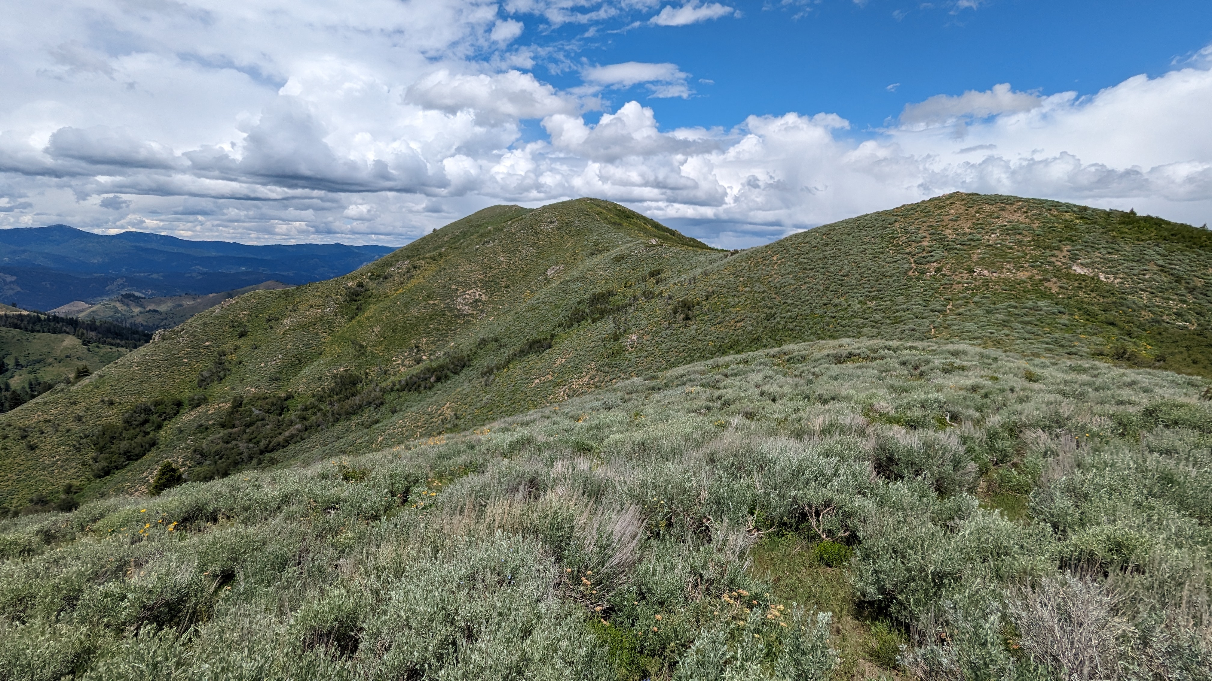 |
| Looking at the summit. Almost there! |
I made it to the summit eventually. The benchmark was easy to find, and there was a register at the small summit cairn. There are a few bushes on the ridge, so it was easy to get my antenna up. I had ok cell service, enough to get out some spots. The bands, however, were dead. There was no one on 20m, and I barely got my four on 40m. I was a bit worried I had hiked all that way for zero points, but luckily there were a few chasers who were able to pull me out.
 |
| Set up on the summit. |
There were rainstorms in the mountains in the distance, and I was really hoping they wouldn't come to me. I lucked out, and had a dry hike and activation. Since the hike up had taken me longer than I expected, I didn't linger too long on the summit. The hike back was long and steep.
 |
| Still a long way down to go. |
The ridge traverse was pleasant, but the last two miles were just torture. Too steep to be pleasant or easy. But I made it down without slipping or my legs turning to jelly. The drive back seemed shorter, but it still wasn't quick. Back in Boise, dinner never tasted so good.
Trailhead: Google calls this the Mt Heinen Trailhead at Irish Point Campground
Website: SOTA Site.
Maps: AA6XA SOTA Hikes map.
Route: Follow the trail up to the summit. The trail isn't shown on any map I've seen, but it is definitely there.
Red Tape: None.
Video: Coming Soon!
No comments:
Post a Comment