Monday, October 24, 2022

W6/SC-347


 After activating Ladyface I drove a few miles down the road to the Phantom Trailhead on Mulholland Highway. There is a good size parking area on the opposite side of the road here. I didn't notice the trailhead at first, and parked at the far end of the pullout. There was at least one other trailhead here, so I imagine the area can get busy on nice days. 

Start of the trail.

The trail is obviously well maintained, and the beginning is a few switchbacks to get up to the ridge. There were lots of footprints and bike tracks in the dirt, so it must get a lot of use. Compared to the steep climb up Ladyface I had just done, this trail seemed super easy. 
Flat, brushy area on top.

It is just under a mile to the summit, all easy hiking. On top I found a small clearing in the brush, and decided to sit there. I set up the antenna, sticking the pole in a bush, and was on the air. This summit had great cell service. The highlight of this activation was getting two Japanese stations on 20m. One of them was very weak, but I was able to pull him out enough to complete the contact.
Late afternoon in the Santa Monica Mountains.

It was getting late in the afternoon, and as the sun started to get low, the light became excellent. It was simply beautiful in the mountains. I could've spent hours enjoying the view, but I still had some driving to do, so I packed up and retraced my steps. 
Another view of the mountains.

I didn't pass anyone on this trail, to my surprise. Back at the car I took a few more pictures before heading up to the desert.

Trailhead: Google Maps calls it the Phantom Trailhead, on Mulholland Highway.
Website: SOTA Site.
Maps: AA6XA SOTA Hikes map.
Route:  Follow the trail to the summit. Easy hike.
Red Tape: None. 
Video: hamBitious YouTube

W6/SC-285 Ladyface


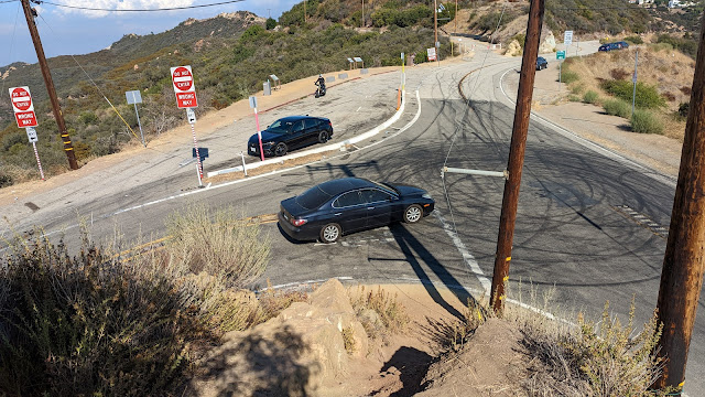
 This peak is in the Santa Monica Mountains, just south of Agoura Hills. From 101, go south on Kanan Road to the bend, and park in the pullout. The unsigned trail goes up the hill here.

Parking area.

The trail to the top of Ladyface is steep and sandy. The start is fairly wide, but it quickly becomes single track around the first flat spot. 
Heading up.

As you climb, the views of the area get better. In mid-October, the mountains were simply beautiful in the afternoon. The climb is somewhat spoiled by the road just below the hill and all the loud cars and motorcycles going up and down. 
False summit.

It appears that the summit is a blocky area with a flag, however as you get close it is easy to see that this is not the high point. The trail stays on the south side of the hill to skirt around the cliffs and rocky outcroppings. The trail joins the ridge before it reaches the high point.
Setup on the top.

The actual high point is a bit cramped and rocky, so I went back down the ridge a short way to a flat section with some bushes. This was the perfect spot to put up my antenna, and I was quickly on the air. I had decent cell service on top, so no issues spotting. HF seemed good, with the usual crowd of chasers. 
Since it was already mid-afternoon, I didn't spend to long on top. I took the same route back down. I was surprised to pass some people heading up, I figured the area wouldn't be that popular. At the car I drove over to my next peak of the day, Peak 1470.

Trailhead: Kanan Road, about 1mi south of US101. Pullout is on the inside of the first big curve, before the road starts going uphill.
Website: SOTA Site.
Maps: AA6XA SOTA Hikes map.
Route:  Follow the trail to the summit. Steep and sandy in places, but it does go around all the scary looking rock outcrops
Red Tape: None. 
Video: ham_bitious YouTube

Monday, October 17, 2022

W6/CT-274 Saddle Peak


 After activating Calabasas Peak I headed up to get Saddle Peak. The trailhead for this peak is at the top of Stunt Road. There is a very sharp turn at the end of the road, and to the left is a small parking area and view point. I parked here. The trail goes up between the roads. There is a steep embankment, then it is pretty pleasant.

Looking down at the parking area.

The trail to the summit is mostly the Backbone Trail, a long distance trail that crosses the Santa Monica Mountains. Follow it up to the paved water tank access road, then follow the road uphill past the left side of the tank, where it re-enters the woods. I found the signs in this area confusing and unhelpful.
Water tank with the summit.

There are a few more junctions below the summit, but it was obvious which way to go. I went up to the East Peak, since it looked nicer with fewer towers. There seems to be confusion to which peak is actually higher. Sources differ, but both seem to be in the activation zone.
Saddle Peak West.

I found that I only had cell service on the north side of the peak, so I set up there to make spotting easier. I made a few contacts on HF, then got out the HT. Two meters was hopping, and I made lots there. Even on that peak I put on the BPF, and I'm sure it helped cut down on the interference.
Heading back down.

It was starting to get late, so I packed up and headed back. At the car I braced myself for the long drive in traffic up to the desert. Overall, a great day in a new area!

Trailhead: Calabasas Peak Trailhead, south of the peak on Stunt Road.
Website: SOTA Site.
Maps: AA6XA SOTA Hikes map.
Route:  Follow the backbone trail to the summit.
Red Tape: None. 
Video: hambitious YouTube

W6/CT-214 Calabasas Peak


 Back in Southern California for work, I decided to head to a new mountain range to get some peaks. This time I chose the Santa Monica Mountains, west of Los Angeles. Most of this area is in the Santa Monica Mountains National Recreation Area, and counts for WWFF/POTA as well. My first summit was above the city of Calabasas and appropriately named Calabasas Peak.

Parking area on the side of Stunt Road.

I drove up Mulholland Highway, then turned onto Stunt Road. Google Maps has a point called "Calabasas Peak Trailhead", which is where I parked in a decent size pullout. There were some cars there already, and I passed a number of people on the trail. After crossing the road and going around a gate, the fire road begins a steady climb up to the summit. 
On the way up.

As you climb the views get better. Saddle Peak dominates the view to the south, but in the other directions there are great views of the mountain range. There was one intersection in a small col, but it was obvious which way to go. Around the high point of the road there is a use path that goes up to the high point. I went up to the very top and signed the log, then went down a little to a flat open area just below.
Summit. The log books were all full.

I had decent service on the summit. The trailhead did not have service. With my end fed in the air, I started calling CQ. 17m was open, and I got lots there. I also tried 20m and 40m, and made a few on those bands. I thought about trying VHF, but decided it would be better from the higher Saddle Peak.
Antenna in the brush. Looking north.

Having finished operating, I packed up and retraced my steps back to the car. It was a quick descent, with good footing on the road back down. Back at the car I drove up the hill to the Saddle Peak trailhead.

Trailhead: Calabasas Peak Trailhead, south of the peak on Stunt Road.
Website: SOTA Site.
Maps: AA6XA SOTA Hikes map.
Route: Take the fire road up to the top, then follow the use trail to the high point.
Red Tape: None. 
Video: ham_bitious YouTube

Friday, October 14, 2022

W7O/WV-096 Mt Sylvania


 We were up in Portland for a long weekend, and decided to do some SOTA wile exploring the area. We had a bit of time before lunch, so decided to grab an easy summit. This peak is in a residential neighborhood, with a small park around the high point. We drove up, and parked on the side of the road to the south of the summit. From there it was a quick walk up the path to the park on the summit. 

You could even sit on the bench for the activation!

We assumed that it would be an easy activation, and we were right. We only brought up the HT, and quickly got four contacts each on 2m, in less than 5 minutes. With the activation complete, we unscrewed the antenna, walked back to the car, and drove down to the city for a tasty lunch.

Easy to find people on 2m

Trailhead: Road in the activation zone.
Website: SOTA Site.
Maps: AA6XA SOTA Hikes map.
Route: Drive into the AZ, then walk up the path to the summit top park.
Red Tape: None.
Video: ham_bitious YouTube

Wednesday, October 12, 2022

W6/SS-293


 We had a campsite in Yosemite Valley, so went out for a long weekend of fun. After exploring the valley a bit on Friday, we drove up Tioga road on Saturday. Our goal was an unactivated peak, Peak 9222. KN6REU had never done a first activation, and this seemed like the perfect one for her to get first. 

Nice view of Half Dome on the drive into the valley.

We started from Old Tioga Road, which is just past White Wolf. The road was gated, but there was a large pullout that we parked in. From here we walked up to the top of the hill along the road, the stepped into the woods. 
Marker explaining some history of the area.

The first part of the climb was a bit steep, but we quickly got to the first sub-peak. Here there is a flat section as you walk over to the base of the next climb. It is typical open Sierra forest, with plenty of big rocks scattered around.
Heading through the rocks and forest.

The second climb is a bit longer, but not any harder. The rocks are spaced enough that it was easy to find routes up or around them. As the terrain levels out on the ridge, the forest opens to some large meadows.
Head up the ridge.

There is another peak that is nearly as high as the main peak, but the col is a bit too deep, so it isn't in the activation zone. We crossed it, and continued into the AZ. There isn't much interesting at the summit, just a rock that's a bit higher than the others. Slightly down from there we set up in a clearing. 
The cell service was very marginal. We got a few spots out, but I wouldn't count on it. KN6REU got on the air first with the HT and whip. After a few minutes of calling CQ, there were no answers, so we put up the EDZ. With this in the air, the contacts started rolling in.
Views of the Yosemite wilderness.

AA6XA tried to get some HF contacts, but the FT-817 didn't seem to be putting out any power. This was disappointing, since it meant there would be no CW, and now QRO POTA later, but he was able to get his four contacts on 2m. By this point it was close to lunch time, so we packed up and retraced our steps back to the car.
Back at the car, we continued driving up to Olmstead Point for lunch, then continued to Tenaya Lake to enjoy the beauty. Back in the valley that evening, we walked over for some Curry Village pizza, then back to the site for s'mores, a critical part of every camping trip.
Half Dome from Curry Village.

Trailhead: Old Tioga Road, big pullout before the gate.
Website: SOTA Site.
Maps: AA6XA SOTA Hikes map.
Route: Follow the ridge up to the summit.
Red Tape: None, just regular Yosemite rules.
Video: ham_bitious YouTube

W7O/NC-090


 On our way back from the beach we decided to stop and do an activation. This unnamed summit is a drive up in Tillamook State Forest near US26. From 26, turn north onto McGregor Road. This road is unpaved, but very well maintained. It was surprising how busy it was, so watch out for other vehicles.

Parked on the side of the road.

There are a few intersections to go through, so have a map or GPS to take the correct path. We went right, right, left. The roads get a bit rougher as you get closer to the top, but the rental sedan we were in had no trouble getting up. The high point of the road is in the activation zone. We parked at a wide spot, and set up along the road. AA6XA did HF while KN6REU did 2m. 

There was cell service for spotting, and AA6XA had no problem getting contacts on 20m and 40m. KN6REU on the HT, on the other hand, had a harder time. It took some time calling CQ to get enough contacts, but she did it, and even got a few summit to summit contacts. If we had been up earlier we probably would've had an easier time since there was a summit event going on.

Checking out 10m.

After we had all gotten our contacts, we packed up and drove back the way we came, and went back to Portland. Overall, this was a nice easy summit.
 

Trailhead: Road in the activation zone.
Website: SOTA Site.
Maps: AA6XA SOTA Hikes map.
Route: Drive into the AZ
Red Tape: None.
Video: ham_bitious YouTube