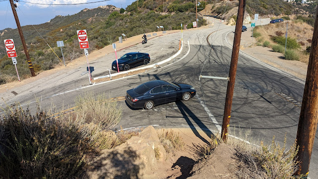
After activating Calabasas Peak I headed up to get Saddle Peak. The trailhead for this peak is at the top of Stunt Road. There is a very sharp turn at the end of the road, and to the left is a small parking area and view point. I parked here. The trail goes up between the roads. There is a steep embankment, then it is pretty pleasant.
 |
| Looking down at the parking area. |
The trail to the summit is mostly the Backbone Trail, a long distance trail that crosses the Santa Monica Mountains. Follow it up to the paved water tank access road, then follow the road uphill past the left side of the tank, where it re-enters the woods. I found the signs in this area confusing and unhelpful.
 |
| Water tank with the summit. |
There are a few more junctions below the summit, but it was obvious which way to go. I went up to the East Peak, since it looked nicer with fewer towers. There seems to be confusion to which peak is actually higher. Sources differ, but both seem to be in the activation zone.
 |
| Saddle Peak West. |
I found that I only had cell service on the north side of the peak, so I set up there to make spotting easier. I made a few contacts on HF, then got out the HT. Two meters was hopping, and I made lots there. Even on that peak I put on the BPF, and I'm sure it helped cut down on the interference.
 |
| Heading back down. |
It was starting to get late, so I packed up and headed back. At the car I braced myself for the long drive in traffic up to the desert. Overall, a great day in a new area!
Trailhead: Calabasas Peak Trailhead, south of the peak on Stunt Road.
Website: SOTA Site.
Maps: AA6XA SOTA Hikes map.
Route: Follow the backbone trail to the summit.
Red Tape: None.
Video: hambitious YouTube
No comments:
Post a Comment