Wednesday, September 30, 2020

Windy Hill

 I had a new pair of shoes, and what better way to break them in than a trip to Windy Hill? 

Pretty close to sunrise.

I headed to Portola Valley, where I got one of the last spots in the official parking lot. It seemed like it would be busy on the trails, but I was pleasantly surprised to be wrong. I made a loop of it, going up the Spring Ridge Trail and down the Lost and Razorback trails.

Looking up at the summit.

The way up was generally steeper and in the open. I was glad it was still early and hadn't warmed up too much or I would have been miserable in the heat. I got plenty of good views of the peak ahead of me and Portola Valley and the Bay Area behind. Definitely a trail that would be good in either direction!
Black Mountain was not very far away.

After a pleasant hike up the hill I made it to the summit. I had it to myself, and I took the opportunity to take some pictures. I still had plenty of miles left though, so I didn't spend too long. I stopped by the slightly lower summit, but there wasn't much interesting there either. 
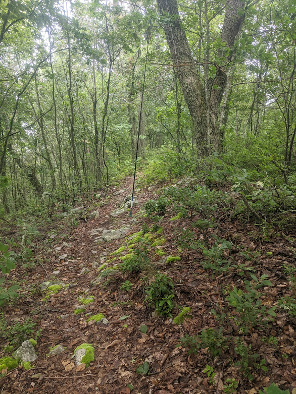
Down through the woods.

The descent was mostly in the forest, where it was cool and shady. I only passed a few people. My guess is that the more direct routes are more busy. There were plenty of switchbacks on the way down, which made for a pleasant run. Down near the bottom the trail ends and there are a few sections where you have to run on a paved road. It wasn't ideal, but at least it wasn't very long.
Nice stone bridge.

The flat section near the parking lot had lots of people. Back at the car I vacated my spot to let the next lucky person park in the lot.


Monday, September 28, 2020

Table Mountain

 It was time for my weekend run, and this nifty ninety peak looked like a good option. I got up early and drove up to Saratoga Gap, which was surprisingly busy. After warming up, I crossed the road and headed north along the trail towards the mountain.

Sun not quite over the ridge yet. Near Saratoga Gap.

It was a nice run along the ridge, with only a few bikers to watch out for. Eventually I got to the junction where I dropped down to the mountain.
Heading down to the peak.

It is a significant descent from Skyline Ridge down to Table Mountain. There are two trails, so at least you can make a loop of it. There are some views on the fire road trail.
The "summit" of Table Mountain

The summit is very underwhelming. I would only go here to check it off the list. There are nice mountains in the area. On the way back up I did manage to hit my head pretty hard on a tree that hadn't been trimmed quite enough. Back up on the ridge I crossed Skyline Drive and headed back on the other side.
Looking towards Big Basin.

There were some openings in the trees that allowed for views to the west. Little did I know a few weeks later that area would burn in the CZU fire.
Cool, shady forest.

I took a long way back, going down the Skyline to Sea trail a few miles before crossing the road and heading back up. One of the trails I took was extremely overgrown and appeared to be abandoned, but it wasn't hard to use, yet. I was also surprised how close it went to some people's yards. Maybe that's why it hasn't been maintained in a while.
Lots of cars in the woods along CA 35

Heading back I passed some of the many cars that have been sitting in the woods, presumable after tragic accidents. Back at the car I headed home to do some of the NAQP contest that was happening that afternoon.

Friday, September 25, 2020

W6/SN-038 Castle Peak

 As I was sitting in Lone Pine, bad news came. The Forest Service was closing all the national forests in southern California, including Inyo. This meant my permit was canceled for the next day, along with my campsite at Whitney Portal. After wallowing in pity for a while, I decided I didn't want to drive to the Bay Area at the end of a holiday weekend and so I started looking for somewhere to spend the night and get another peak in. I decided on Castle Peak, in the Truckee area.

The summit, not too far away, but very hazy.

I drove up that afternoon, getting to the trailhead after dark, where I camped. It was not a good place to camp, too close to the freeway. I did not sleep well, and at first light I was up and packing up. After eating breakfast in my car, to get out of the wind a little, I started up the road.
Where the trail leaves the road.

The approach is along a fire road that is open to cars. I saw a number of people camping along the road in campers and such. They were all still sleeping, since the sun hadn't risen enough to get over the ridges yet. Eventually, some singletrack breaks off, and you climb up to the PCT.
Sunrise above the ridge.

After taking the PCT the very short distance up to the pass, turn right and follow the trail up the ridge. It had been windy all night and morning, but once I got out of the trees on the ridge the full force of the wind hit me. I had to stop and layer up, even though I was hiking a good pace up the hill.
Very very hazy from wildfire smoke, but not as bad as it was down south.

The trail makes its way up the ridge. I had no problem following it, and it would be an easy hike even without a trail, just staying on the ridge. As I approached the top I heard some voices, and a head poked up from behind a scree wall. Turns out some people had camped at the summit.
One of the summit pinnacles. Or maybe it should be called a crenellation?

The highest peak is at the far end of the ridge, so I followed some use trails to it. I climbed up as much as I felt comfortable doing, then went down a little to set up my antenna. It was very windy, so I tried to find a place to sit out of the wind as much as I could.
My "why didn't I bring gloves?" face

I had good cell service, and no problem getting contacts, despite the early hour. I stayed warm enough, especially once the sun came around the point. Once the QSOs stopped coming, I packed up and headed down. It was still chilly, and I had a few hours of driving left to get home.
View through the summit.

A day or two after I got home, the Forest Service closed all the national forests in the state. I guess I lucked out and got some pre-Whitney hiking in at least.

Trailhead: Boreal Ridge Road. Take exit 176 and go to the north side of the freeway. Limited parking on the pavement.
Website: SOTA Site.
Maps: AA6XA SOTA Hikes map.
Route: Continue up the dirt road to the junction below the PCT. At the pass, follow the ridge up to the summit.
Red Tape: None.

Thursday, September 24, 2020

W6/SS-636 Alabama Hills High Point

 After hiking up another of the Alabama Hills, I continued driving down Movie Road to get the high point. Just down the hill from the col there is a large parking area. I parked here and walked back up the road to the base of the climb.

Welcome sign across the road from the parking.

The first part of the climb is an easy walk up the hill. However, the top is covered in large boulders.
Getting near the summit.

The final climb to the top is a class 3 scramble. I stayed on the west side and managed to find a route up. I came down farther east and the route was much easier. From the col north of the summit, I would recommend staying east.
Operating position.

I managed to find enough space to string out my antenna, and got on the air. I didn't spend as much time as the previous peak, but still got plenty of contacts.
Looking towards Whitney Portal. Parking area on the right.

After picking my way down from the top, I drove into Lone Pine to kill some time before heading up to Whitney Portal to spend the night before climbing the peak.

Trailhead: Movie Road.
Website: SOTA Site.
Maps: AA6XA SOTA Hikes map.
Route: Hike and climb up to the summit.
Red Tape: None.

W6/IN-048

 I had a smokey and fitful night at Horseshoe Meadows. My original plan was to hike up another peak that surrounds the meadow, but I was feeling like I needed an easy day. So instead I drove down to the Alabama Hills, praying it would get less smokey as I descended.

The summit.

There is a good dirt road that drives around the hills, with plenty of pullouts for parking and hiking. There is a small road at the base of the peak, but it looked a bit sketchy for my car, so I turned around and parked a quarter mile up the road at a large pullout. There were some people camping off to the side, so I tried to be quiet as I got ready.
Desert hiking.

I walked to the base of the hill, then realized I forgot my pole. After returning to get it, I started making my way up. I followed a small drainage up to the north shoulder of the peak. It was steep in places, but the footing was good and it wasn't a particularly difficult climb. On the ridge it was a quick walk up to the cairn at the summit.
Looking north towards the Alabama Hills high point.

I stuck my pole in the cairn, and got on the air. It was warm out, but a stiff breeze kept me comfortable. The bands seemed to be in good condition. I made many contacts on 17m and 20m especially. The highlight was two summit to summit contacts that were also completes for me. The first was to KE6MT up on Dry Creek Knoll a few miles north, that I had activated last year. The next was to WN3F on Waonaze Peak in Virginia, which I had been to a few weeks earlier.
So much smoke. At the base looking towards the car.

Once all the contacts had dried up, I packed up and headed down. The eerie sepia tone had returned in force, but all the sites I checked said the air quality was ok. The smoke must've been up high. It was still early, so I decided to drive a bit farther down the road and get the Alabama Hills high point.

Trailhead: Movie Road pullout.
Website: SOTA Site.
Maps: AA6XA SOTA Hikes map.
Route: Walk up to the summit.
Red Tape: None.

Wednesday, September 23, 2020

W6/SS-085 Cirque Peak

 I woke up early after camping at Horseshoe Meadows, and was glad to see most of the smoke from the previous evening had blown away. After a quick breakfast I set off since it was pretty chilly out.

One of the meadows at sunrise.

The trail starts off with a flat, sandy section as it works around the edge of one of the meadows. The trail gradually gets harder as it turns into packed dirt. After about two miles, you reach the base of the climb up to Cottonwood Pass. This is where the switchbacks start.
Brushy meadow on the way up to the pass.

It was still early and cool, so I made good time up to the pass. There were a few people heading out as I was going up. At the pass I got on the PCT and started going north.
The one lake you pass on the way.

This section is relatively easy, gently undulating trail. The PCT is very well worn and easy to follow. The PCT goes across the west flank of the mountain, getting lower the farther you go. I walked far enough to be sure to get around the cliffs at the south end of the ridge, then stepped off the trail and started heading up. I decided it would be easiest to side hill up to the summit rather than go straight up then across the ridge.
The summit slowly getting closer.

The off trail portion was not as difficult as I thought it might be. There was plenty of space between the rocks that it wasn't talus hopping. The elevation did make it relatively slow going though. Smoke started blowing in as I made my way to the summit, significantly reducing views.
Whitney and Langley.

When I first got to the summit I could see Mt Whitney a few miles to the north. By the time I left it was totally obscured by the smoke. A few other people stopped by while I was operating. The peak was much more popular than I would have expected. After a while, the altitude and smoke started giving me a headache, so I packed up and headed down. I took the same route down.
Smokey meadow in the afternoon. Hard to capture the post-apocalyptic red tone everything had.

Near the pass a couple passed me and asked how far it was to "the lakes". I told them there was one a little ways ahead. They then told me that there were a bunch of lakes, the Cottonwood Lakes. I had to tell them they went the wrong way back at the trailhead to get to those lakes, they were on the other side of the mountain. I'm always surprised how far unprepared people make it into the woods, and surprised the SAR teams aren't constantly getting them out.
There were quite a few people hiking around in the meadow, but many fewer people stayed to camp the night. They were probably smarter and went somewhere less smokey. 

Trailhead: Horseshoe Meadows
Website: SOTA Site.
Maps: AA6XA SOTA Hikes map.
Route: Take the trail to Cottonwood Pass, then the PCT north. Cross country to the summit. Could also go over New Army Pass and around the cirque.
Red Tape: Permits required for overnight trips.

Tuesday, September 22, 2020

W6/SS-066 Mt. Gould

 After spending the night near Sonora Pass, I packed up and started driving south on 395 down to the Onion Valley trailhead. My goal for the day was Mt Gould, just over 13,000 feet. The drive up to the trailhead was slow with many many switchbacks. The parking lot was also full, so I had to park about a quarter mile down the hill on the side of the road.

Entering the wilderness.

There were lots of people on the trail, but I made good time up the hill. There were some excellent views looking back to the Owens Valley, and views of the always impressive southern Sierra mountains.
Plenty of water in the stream.

Looking back towards the trailhead.

The crowds seemed to thin out some after I passed the first few lakes, perhaps people were just going up for a swim or some fishing. At Kearsarge Pass I sat down and had a break to enjoy the view some and have a snack. There were lots of backpackers that looked like they were about to head deeper into the wilderness.
Heart Lake.

From here I thought it would be talus and scree cross country to the top, and I was partially correct. I had guessed the ground cover, but I found lots of use paths winding their way up to the summit area. I followed them when they seemed to be going the right way, or picked my own, better way. There were also a fair number of other people hiking up to the top. 
Gould summit block.

At the summit I set up on the second, slightly lower summit. There was a group on the summit, so I didn't go up. I didn't have any problems getting contacts. I was tired, and I saw a cloud that didn't look very friendly, so I didn't linger too long. The return to the pass was very quick, with lots of slidey scree.
Looking west towards the Kearsarge Pinnacles.

After another break at the pass, I headed down the million switchbacks to the car. The parking lot was still overflowing when I got back. I grabbed another snack, then headed down towards Lone Pine, then back up to Horseshoe Meadows for the night.
Nice looking trees.

Trailhead: Onion Valley Trailhead
Website: SOTA Site.
Maps: AA6XA SOTA Hikes map.
Route: Head up the trail towards Kearsarge Pass. At the pass, turn right and go up the scree/talus to the summit.
Red Tape: Permits required for overnight trips.

W6/NS-173 Bell Mountain

 I had a permit to climb Mt Whitney in a few days, so I decided to take the week off and spend some time in the Sierra to acclimate before the big hike. First up was an easy hike for the first day, nothing too high yet. I drove up to Crabtree Trailhead, a popular starting point for hikes into the Emigrant Wilderness. After parking and having a bite of lunch I headed out.

Heading up the trail.

The trail is very well worn, and I passed quite a few people heading in for the holiday weekend. Just past the trail junction, the trees open up and there are some excellent views. The trail drops down into the valley here as well.
Looking across the valley, away from the mountain.

In the valley I took the next right and headed towards Mud Lake. This section is flat and was fast. It also seems like people don't go down there as much, I saw many fewer people.
Mud Lake meadow.
The map shows the trail ending at Mud Lake, but I found paths that started climbing the hill, which is what I wanted to do. So I followed them. After a while the started going in the wrong direction, so I stepped off the trail and started bushwhacking. The going wasn't bad, but there was a steep section with waist-high brush that was quite annoying. Once I had pushed through it, it was a simple walk up to the summit.
Meadow at the summit.

There is a big meadow on top, with some trees at the highest point. I set up here. As I was operating, some people on 4-wheelers drove up. Apparently there are OHV trails that lead to the summit. Since I don't have a good vehicle for that sort of thing, I think my route was probably better.
Looking back at the mountain.

I didn't spend too long on top, especially since the OHV people had started drinking. I retraced my steps back to the car and vacated my parking spot. I'm sure it didn't stay empty for long. After driving past the lake I headed up to Sonora Pass to camp for the night.

Trailhead: Crabtree Trailhead
Website: SOTA Site.
Maps: AA6XA SOTA Hikes map.
Route: Head up the trail towards Pine Valley and Mud Lake. From the lake, bushwhack up to the summit.
Red Tape: This entire route is outside the wilderness area, so go wild.

Thursday, September 3, 2020

W4V/HB-041 Meneka Peak

 I had one more afternoon off before coming back to California, so of course I went to the mountains for some hiking. I headed back to the Fort Valley, but this time stayed at the northern end to climb Meneka Peak. There is a large parking lot, signed for Signal Knob. Park on the right side, where the trail leaves from the end. 

Up the trail.
It was much sunnier today than on my last visit to the area, but this also meant it was much hotter and more humid. You just can't win. Again, I took the Massanutten Trail up the hill to the top of the ridge. This trail was very rocky, and reminded me of the AT in Pennsylvania.
One of the rocky sections.
It rained on me briefly as I was going up, but it was just a passing shower. I was slightly concerned about the weather, since the chances of rain went up as the day went on. 
The Fort Valley Overlook. Not that impressive.
Up on the ridge there is a junction where you need to turn left off the Massanutten Trail and onto the Tuscarora Trail for the last half mile up to the summit. It is well signed. I went that way and was soon on top. There are a number of campsites along the ridge and at the summit. They look nice, but I wouldn't enjoy carrying all my water up.
The summit.
I had some cell service, so I was able to spot myself once I put up the antenna. I made contacts on all three bands. Forty meters was pretty noisy, and once I realized it was from lightning I decided to pack up and head down. Don't want to be on a peak in an electrical storm.
Good viewpoint on the way down.
It got overcast as I went down, but the rain held off until I had got back to the hotel and was getting dinner. This was overall an easy hike and a fun day.

Trailhead: Signal Knob parking lot, VA678.
Website: SOTA Site.
Maps: AA6XA SOTA Hikes map.
Route: Take the Massanutten Trail up to the ridge, then turn right onto the Tuscarora Trail for the final climb to the summit.
Red Tape: None.

W4V/HB-030 Short Mountain

 Immediately after coming down from Waonaze Peak I continued up the gravel road for about half a mile to where the Massanutten Trail turns off. There is a small pullout with enough space for about two cars here if you don't like walking.

Big green trees.
The Massanutten trail is very well maintained here, and well graded. It was an easy walk up the hill to the top of the ridge, where it gets significantly flatter. There weren't as many spider webs here as on the other side, but I still walked through some big ones on the way up. 
Big spider web. Managed to avoid this one.
On the summit I set up my antenna along the trail. I put out a spot, but didn't get nearly as many contacts as I did on the earlier summit. It was still gray and overcast, and I was quite damp from sweating in the humidity. The slight breeze cooled me off very quickly, so I didn't stay too long on the summit. 
Summit of the mountain.
I ran down the hill, making it back to the road just as it started to rain. It was great timing.

Trailhead: OHV parking area, Edinburg Gap, VA 675
Website: SOTA Site.
Maps: AA6XA SOTA Hikes map.
Route: Head up the road to the Massanutten Trail, then follow the trail to the summit.
Red Tape: None.