Friday, August 6, 2021

W6/CT-226 Cerro Negro Benchmark

 I was finally done with work in SoCal, so I headed back to the airport. My flight was later, so I had some time to stop by a peak. I decided on an easy on, Cerro Negro Benchmark. For those who want to be lazy, like I did, the place to park is the top of Sugar Loaf Drive. Looking at a map, this last house may be inside the activation zone, and just inside the gate certainly is. So this peak could be even easier than it already is.

Standing behind the car, looking at the trailhead.

There are lots of signs forbidding overnight parking, but none seemed to ban day parking. So I parked under a tree in front of the last house on the street. From here it is a very short walk up to the summit.
Lots of RF on top.

On the summit I set up in the only shady spot I saw, under some trees right near the fence. On the radio, 20 and 40 were basically unusable from all the interference. However, 17 and 30 were ok, so I did make some HF contacts. My second was a summit-to-summit with Dave N6AN. He asked how long I'd be up, and said he might come over. 
Great views of the San Gabriel Mountains.

About an hour later, a guy with two poles in his pack appeared just below the summit. Dave had left his nearby summit, driven over, and hiked up jus to say hi. We talked for a while while I made a few VHF contacts. All good things must end, though, and I had to say goodbye so I could get to the airport on time. Next time maybe we'll be able to do some summits together.

Trailhead: Top of Sugar Loaf Dr. Don't block the gate.
Website: SOTA Site.
Maps: AA6XA SOTA Hikes map.
Route: Go up the trail, make a U-turn at the flat spot up to the summit.
Red Tape: None. Parking hours on Sugar Loaf Dr limited.

W6/SS-375

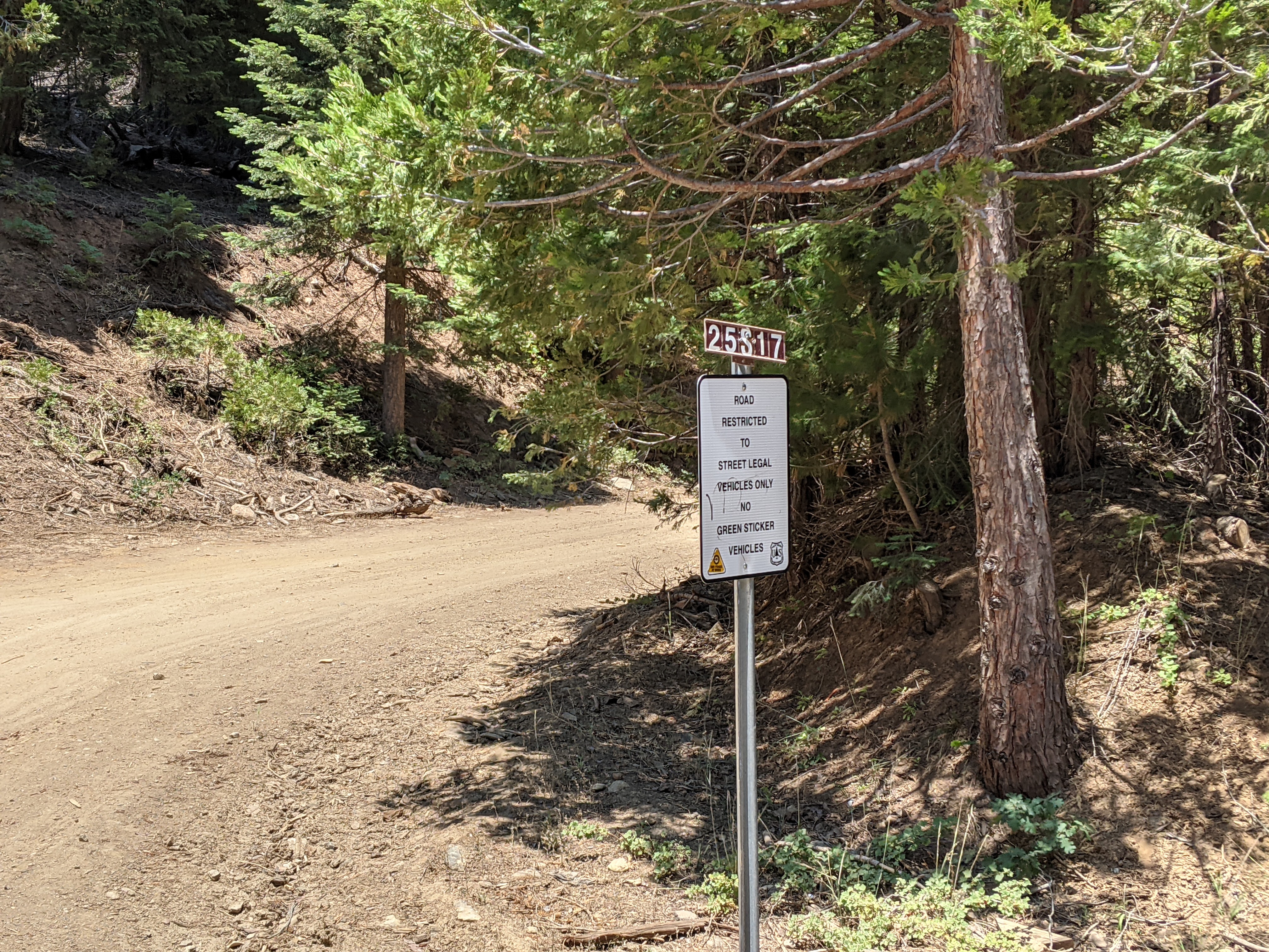
 I was looking for an easy peak in the area, and this one seemed like a good candidate. I had never been to Lake Isabella, so I was looking forward to seeing that too. For the peak, I parked in a very large pullout just past 25S17 on the paved 25S15, Rancheria Road.

Pullout to park in. Even got a shady spot!

I then walked down to the dirt 25S17 I had just driven by and started walking up the hill. I took the road to the first switchback, where I stepped off and went up.
Start of the dirt road.

It was a little steep going up, but the open forest was easy to navigate. There was not a lot of deadfall like NA6MG reported. It was typical easy Sierra bushwhacking.
Nice open forest on the way up.

Near the ridgeline I found an abandoned trail that seemed to run along the ridge. It was going the way I wanted to, so I followed it. There are a few small bumps along the ridge, but eventually you'll get to the highest, marked with a small cairn and ammo case register.
Summit of 7140.

I signed the register, then started setting up my antenna. There was a nice clearing right at the summit, so I was able to stake out my pole and string out the antenna without any issues. I decided to put up the linked EFHW so I could do 17-40. 
The only view from the summit.

There was decent cell service on top, and I was able to spot myself for all the portable activities, SOTA, WWFF, and POTA. This resulted in some pretty good pileups, and I spent about two hours on the summit operating. When I was done, I retraced my steps back to the car.
Bear! (In front of the orange netting)

As I was in my car, about to pull back into the road, I noticed something in the road above me. I stopped to look, and saw it was a bear! I tried to get some pics, but it started walking away from me. I was not in a rush to get back, so I turned and followed it up to the ski area. Here it went into the woods after looking at me for a few moments. It didn't seem like it was coming back, so I turned around and headed back down to the lake. This made the outing much more exciting, and I was glad I didn't run into it until I was in my car.

Trailhead: Pullout on Rancheria Road, between the ski area and 25S17
Website: SOTA Site.
Maps: AA6XA SOTA Hikes map.
Route: Go up dirt 25S17 to the first switchback, then go straight up to the ridge. Follow the ridge over to the summit.
Red Tape: None.

Thursday, August 5, 2021

W6/SS-621

 After activating Peak 8137 and attempting 8819, I returned to the col where I started, ready to get another peak. 

Backside of 7540, from the drainage to the north.

From the col it is a very steep hike up to the top, but class 2 all the way. I don't think there is any path that is particularly better than another. Go to the mountain and find your own way up. If it starts feeling too sketchy, stop and there's a better way nearby.
First visitor since Bob Burd placed a log!

On top I found a new register, that had been placed a few months ago by the famous Bob Burd. I was the first to sign it since then, not surprising seeing how this is not a particularly interesting peak.
On the air.

I put up the antenna, and was not surprised to find there was no cell service. RBN did its job however, and I mad plenty of contacts. There were enough rocks on the top that I had a pretty comfortable seat, and I could have spent a long time up there. It was getting warm however, so I packed up and headed back.
The town of Kennedy Meadows.

After carefully making my way back to the col, I discovered that there was a road that ended there. I guessed that this was the road I had parked at the bottom of, so I followed it down. I was right, and I could've had an easier walk up a few hours earlier if I had know. Oh well, part of the excitement of doing off-trail peaks. Back at the car I chugged some gatorade, and started back down to civilization.

Trailhead: Sacatar Trail road. See map. The road seemed a bit sketchy in the sedan I had, and might be impassable without clearance or 4WD if its wet.
Website: SOTA Site.
Maps: AA6XA SOTA Hikes map.
Route: Follow the road up to the col, then go up to the summit on the left.
Red Tape: None. Hike is entirely on BLM land.

W6/SS-620

 Another week in SoCal meant more summits in the southern Sierra. Today I had a few summits planned, none with names. First up was Peak 8137. I parked along Sacatar Trail in Kennedy Meadows. There is a road that goes up to the col between this peak and 7540, but I didn't see anywhere to stop at the base, so I parked a few yards to the west in a pullout.

Open forest on the way up.

I started up the road, but it seemed to be veering away from where I wanted to go, so I stopped taking it and just went cross country up to the col. This is a pleasant walk, not too steep. At the col I turned right and went down a little to the stream bed. This I followed to the reentrant I had decided would be a good route up to the summit.
Started getting views as I went up.

I took the reentrant, then stayed on the ridge to the left as best as I was able. At the top of this climb is a small flat area between three sub-peaks. One of them is on the main ridge, connected to the highest peak. I decided the best way would be to go around the left (north) side of this peak and up to the summit. Overall this was a decent route up.
My car is parked somewhere down there.

There was no cell service on top, as I expected. I put up the antenna, and was soon making contacts. I had good luck compared to the previous weekend when I was in the area. It didn't seem too hot, and I enjoyed taking in the views from the summit. My original plan was to go down to the north, and then climb up to Peak 8819. I started this, getting down to the col quickly. I then climbed up the first 200 feet, and realized I was tired and didn't have enough water to safely make it. So I turned around.
Starting up towards 8819.

Back at the col I decided the best route to Peak 7540 would be to follow the drainage to the northwest, then return to the first col, with the road. I did this and soon found myself at that col.

Trailhead: Sacatar Trail road. See map. The road seemed a bit sketchy in the sedan I had, and might be impassable without clearance or 4WD if its wet.
Website: SOTA Site.
Maps: AA6XA SOTA Hikes map.
Route: Follow the road up to the col. Drop down to the drainage on the other side, and follow it up. At a good point, head up to the summit.
Red Tape: None. Hike is entirely on BLM land.

Wednesday, August 4, 2021

W6/SS-623 Kennedy Mountain

 After coming down from Pine Mountain I was still feeling good, so decided to get one more peak. Kennedy Peak looks over the small town here, and didn't look like it would be too hard. I first tried driving in from the north, along the road that is at the base of the mountain. This road is gated and signed, so no access this way.

Kennedy Meadow.

The best place to park seems to be somewhere around the fire station, where the road turns left. From here follow the fence that encloses the old landfill across the field. It was not hard to find a path through the scrub, aiming towards the small building on the side of the hill. On the other side is the road that I tried to drive down. In this area it is not signed, so I followed it.
Up the road.

Turn left on the road, and head up the hill. There are some switchbacks, then the road will end. It may be better to leave the road at the top of the switchbacks, but I continued to the end of the ridge, where I turned and went cross country up to the summit. 
Excellent views on the way up.

Most of the off trail section is easy walking, but the summit area is extremely rocky. The first summit you get to is slightly lower, so I went around the very high point, then climbed up the slightly higher south summit. Although it looks like it might be hard scrambling, it is all class 2, maybe 3.
On the high point, looking back at the second peak.

At the high point I found the register. There weren't many entries since the last SOTA activators had come up. I took a pic to send to them, then put up my antenna. No cell service on the summit, so I relied on RBN again. It seemed to work better than on Pine Mountain, so I had no trouble getting my contacts. 
Summit selfie.

I mostly retraced my steps back, but cut straight down to the top of the switchbacks rather than following the ridge to the end. Going down, this was easy. Back at the car the clouds had fully dissipated, making the drive down Nine Mile Canyon pretty spectacular. 

Trailhead: Near the landfill, west end of Goman Ave.
Website: SOTA Site.
Maps: AA6XA SOTA Hikes map.
Route: Follow the fence past the landfill and across the field. Take the road up to the ridge, then follow the ridge to the summit.
Red Tape: None. Hike appears to be entirely on BLM land.