We spent our second night at Landmannalauger Hut, and slept well. In the morning we made our breakfast and got packed up. The sun was shining, though it was a bit breezy, overall good hiking weather. We headed up the Laugavegur Trail, through the lava field and then up past a geothermal vent. After inhaling some sulfur fumes, we continued our climb. The trail was steep in places, but it sees so much traffic it is easy to get up.
 |
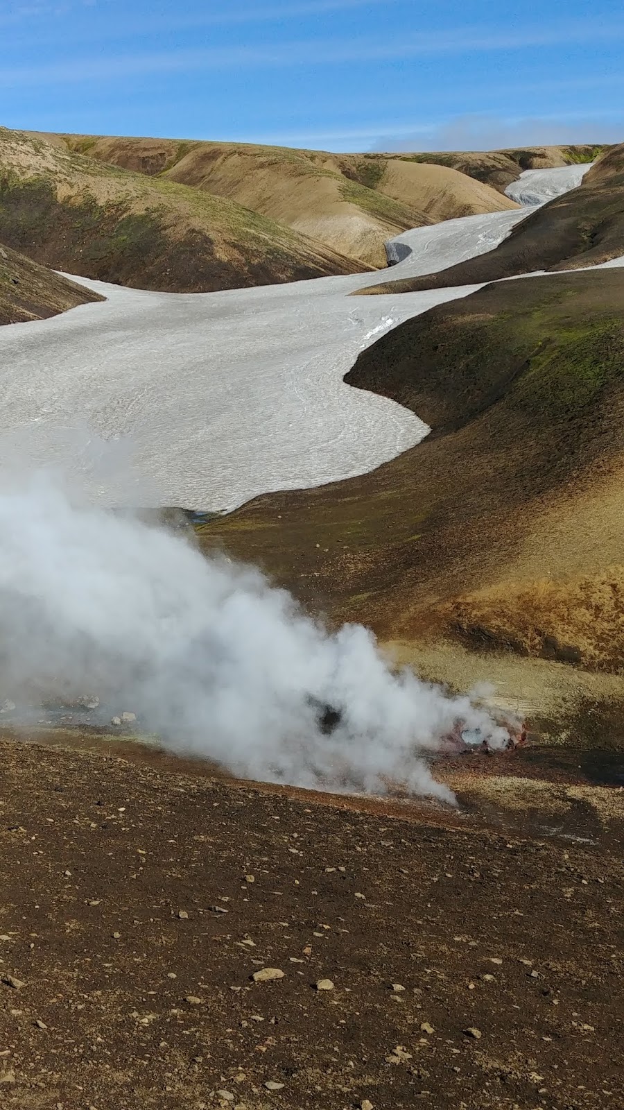
| The first, and biggest, steam vent. |
As we climbed up to the high area, the wind picked up and we had to stop a few times to layer up. The sun was out, so most people didn't mind the cold. As we got closer to the hut, we had to cross a few snowfields. The snow was fairly hard, so it wasn't too bad. At the hut we checked in, and had lunch inside to warm up a bit.
 |
| This vent was really belching out the steam. |
Hrafntinnusker Peak is very close to the hut, so after we finished eating, I packed up my radios and warm clothes, and headed up to the summit with a few people. The trail leaves from the side of the hut, and is a dirt road for about half the distance up. A well marked trail turns off, and takes you right to the summit. If it's clear, it is obvious which way to go.
 |
| One of the snowfields close to the hut. |
It was very windy on top. I used the large cairn at the summit to hold up my pole, and set the antenna so it was with the wind. I found the least windy spot I could, and sat down. After a few CQs I got three contacts, and a few minutes of calling later, I got a fourth. I stayed on the air for a few more minutes, but I saw some nasty looking clouds getting closer, and decided to go back down to shelter. The people who had come up with me had left earlier, not wanting to wait in the cold. I don't blame them, it was chilly.
(Apparently no one took pictures of the summit of Hrafntinnusker, or the hut, or I'd add some)
Back at the hut I took it easy the rest of the afternoon, playing bananagrams with people. There are other summits nearby, but we had a few more days of hiking to do and I didn't want to wear out my legs too early.
Trailhead: Hrafntinnusker Hut.
Website: SOTA Site.
Maps: AA6XA/P SOTA Hikes map.
Route: From the hut, walk up the road and trail to the summit. Only about a kilometer hike up.
Red Tape: None that I know of.


No comments:
Post a Comment