It was a warm day, but that didn't stop us from heading to the west side of Glacier to do some hiking and sightseeing. Going to the Sun Road was still closed, so we had to go the long way around. We reached the marked trailhead for Huckleberry Lookout a bit later than I would have liked, but the trail looked shady so I wasn't too worried.
 |
| An official NPS trailhead. |
The first part of the trail is flat, as it follows McGee Creek to the base of the climb. But once it starts going up it doesn't stop.
 |
| Pleasant flat hiking near the cars. |
The trail is well graded for its climb up, likely because it was used by pack animals when the lookout was actively staffed. It was pretty warm, but the was enough shade and breeze to make it bearable. And as we climbed higher, the views got better and better.
 |
| The trail goes up a canyon to the ridge. |
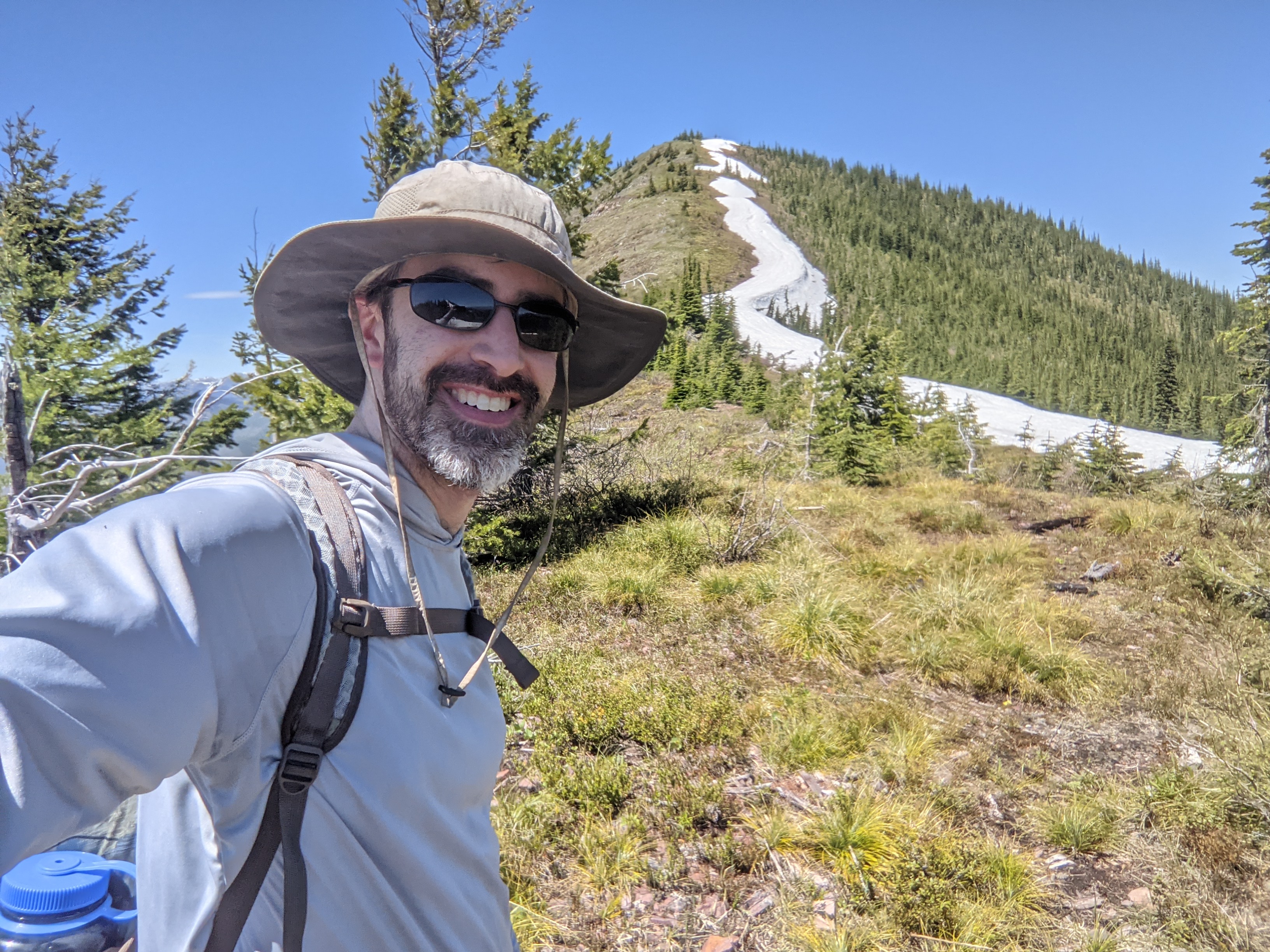
At about 6100 feet the trail stops climbing and turns right, and begins to sidehill below the ridge. From this area I was able to see the summit, and the ridge leading up to it.
 |
| The Apgar Mountains. |
My orginal plan had been to take the northeast ridge up to the summit, but from the vantage point I could see that the southeast ridge looked better, just as gentle and free from trees and brush. There was a line of snow, but it didn't look wide.
 |
| The summit from below. |
I took the trail around until I was more or less below the col, then stepped off. The short climb up to the ridge was very steep, but the brush wasn't very dense and it wasn't too hard.
 |
| The steep off trail section. |
Despite its short length, this climb was the hardest part of the hike. Up on the ridge, it was a pleasant walk up to the summit. On top I used one of the trees to hold my antenna pole and got on the air.
 |
| Almost at the top! |
I was surprised to have service on the summit. It wasn't the best, but it was enough to get out spots and texts. I even managed to get a bunch of summit to summit contacts, so everyone else must have been out that day.
 |
| Antenna on the summit. |
It was a beautiful day, and I didn't want to leave the ridge. However, my sister had skipped this summit and headed straight to the lookout. Not wanting to backtrack, I followed the ridge down towards the lookout. It seemed steep in places, but nothing bad. Near the trail, I saw some indications of an old trail or a use trail.
 |
| Looking down at the North Fork of the Flathead River. |
It was a quick climb up the trail to the lookout. This was another great view, and worth the trip over. We could have sat up there for a long time, but it was getting late.
 |
| Huckleberry Lookout. |
We took the trail all the way back to the car. There were some snowfields on the north-facing slopes, but nothing hard. It was warm enough that the snow was quite soft.
 |
| The high peaks of Glacier. Next time.... |
Back at the car we decided it was dinner time, and so we headed into town to find some food. We then went back into the park to see Avalanche Lake, then watch the sunset over Lake McDonald. It was a long, but very good day.
Trailhead: Huckleberry Lookout Trailhead
Website: SOTA Site.
Maps: AA6XA SOTA Hikes map.
Route: Take the trail up to the ridge. Either scramble up to the ridge and follow the southeast ridge to the summit, or take the trail around to the col and take the northwest ridge up.
Red Tape: None. The short way in may require a Going to the Sun Road permit, but you can drive around to the north to avoid that.
No comments:
Post a Comment