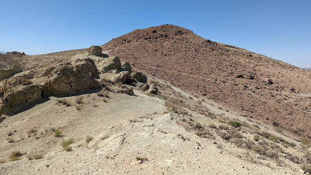
This unnamed peak overlooks the city of Rosamond, just off of CA 14. One of its subpeaks has a cross on it and seems to be a popular hike for locals, but the main summit does not. I drove over from Willow Springs Butte. There are a few parking options. There is a rough dirt road you can drive up as far as you are able, or just park where it meets Felsite Street. Or, drive up through the neighborhood to the end of Sunset Ridge Drive, and find a parking spot there. That is what I did.
 |
| The red summit is a false summit. |
There is a network of trails and roads on the hill, so pick a way up. I turned left and followed a ridge up. This took me over a red peak, which is not the high point. I was a little disappointed when I found that out. On top there was a decent sized cairn with a tiny flag in it. The wind had died down, but there was still enough I dropped down to get out of it.
 |
| Summit cairn. It needs a new flag. |
Unlike on Willow Springs Butte, there were plenty of bushes to hold my pole, and I had no problem setting up. There was excellent cell service, as I expected. I made plenty of contacts, and had a nice chat on 70cm with a guy out for an afternoon walk near Lancaster.
 |
| Looking at the San Gabriel Mountains. The "cross peak" is the low hill in the foreground. |
Since there seemed to be so many trails, I took a different route down. This took me down into a small canyon with lots of graffiti and a water tank. It seemed no harder than the way I went up, so there are some nice options for getting to this peak. I made the mistake of taking the dirt road down. I would not recommend it since it was so rough, especially since there is a paved option next to it.
Trailhead: Top of Sunset Ridge Drive.
Website: SOTA Site.
Maps: AA6XA SOTA Hikes map.
Route: Pick a trail and make you way to the summit.
Red Tape: None.
Video: ham_bitious YouTube
No comments:
Post a Comment